Astore Valley & Minimarg: A Complete Guide
The valley behind Nanga Parbat’s southern side, the written permission Minimarg actually requires, and what opens when.
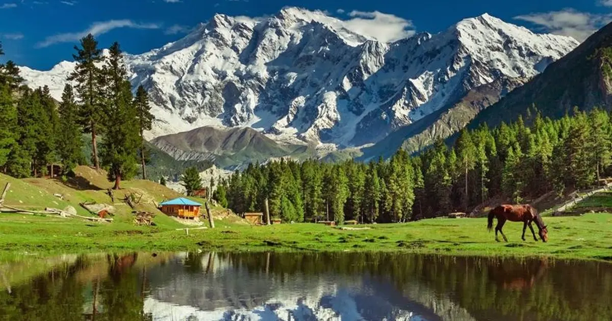
Astore is a valley in Gilgit-Baltistan running south-east off the Karakoram Highway near Jaglot, with a floor around 2,600 m. It is the way in to three separate things: the Rupal face of Nanga Parbat, the western entrance to Deosai, and Minimarg at 2,844 m near the Line of Control. Minimarg is the one that needs paperwork: a written permission naming every traveller, checked at the army post at Chilam. The road is open roughly late June to September.
Astore is the valley most people drive past. It opens off the Karakoram Highway a little south of Gilgit, and almost everyone continues north to Hunza instead. What they miss is that three of the best things in Gilgit-Baltistan are reached from this one side valley, and that one of them cannot be reached at all without a piece of paper.
This guide covers the valley as a whole and then Minimarg in detail, because Minimarg is where the questions are. If you only want the short version: Rama and the Rupal side are open to anyone, Deosai needs nothing more than a park fee, and Minimarg needs written permission obtained before you arrive.
The valley at a glance
| Place | Altitude | Permission | What it is |
|---|---|---|---|
| Astore town | ~2,400 m | None | The valley's main settlement and supply point |
| Rama meadow | 3,300 m | None | Pine and juniper bowl under Nanga Parbat |
| Rama Lake | 3,507 m | None | Short walk above the meadow |
| Tarashing | ~2,900 m | None | Trailhead for the Rupal face |
| Chilam Chowki | 3,869 m | Checkpost | Army post; the gate to Minimarg |
| Burzil Pass | 4,100 m | Permission | Historic Srinagar-Gilgit crossing |
| Minimarg | 2,844 m | Permission | Shina village 36 km south of Chilam |
Minimarg, and the permission you actually need
Almost every article about Minimarg says you need an NOC and leaves it there. That is not quite what happens on the ground, and the difference matters if you are planning a trip.
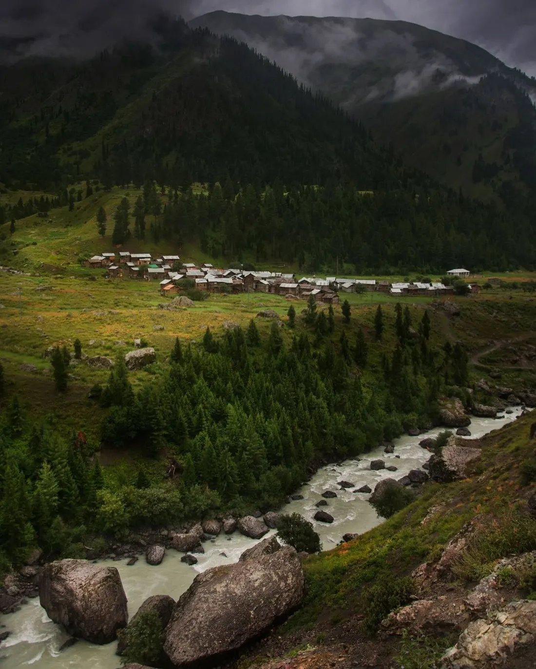
The document is a written permission issued by the Deputy Commissioner, Astore, granted with reference to the Commissioner of the Diamer-Astore Division. It is not a generic permit you carry around. It names each traveller individually, it lists the registration number of the vehicle you are travelling in, and it is granted for a specific date. Copies go to the army transit camps at Astore, at Chilam, and at Burzil Top above Minimarg.
That distribution list is the whole reason you cannot improvise this. The post at Chilam has your name before you arrive, or it does not. Turning up without the paperwork means turning around, after a long drive, at 3,869 m.
A few practical consequences:
- It has to be arranged in advance. This is not something you organise at the checkpost on the morning.
- Your vehicle is named on it. Changing cars after the permission is issued is a problem, which is one reason the jeep is usually hired as part of the arrangement.
- 4x4 only. Ordinary cars and motorbikes are not allowed past the post. Jeeps can be hired at Chilam.
- Pakistani nationals need their original CNIC. Photocopies are refused.
- Foreign visitors are a separate case. The blanket NOC that once applied to all foreigners in Gilgit-Baltistan was withdrawn several years ago, but ground close to the Line of Control was never included in that relaxation, and Minimarg sits behind a working checkpost regardless. In practice it is arranged for you, in advance, by an operator who does it regularly.
Rules on this ground change, and anyone who tells you otherwise has not tried recently. We confirm the current requirement before every departure rather than relying on what worked last season. If you want to go, tell us your dates and we will handle the permission, the jeep and the paperwork together.
What Minimarg is actually like
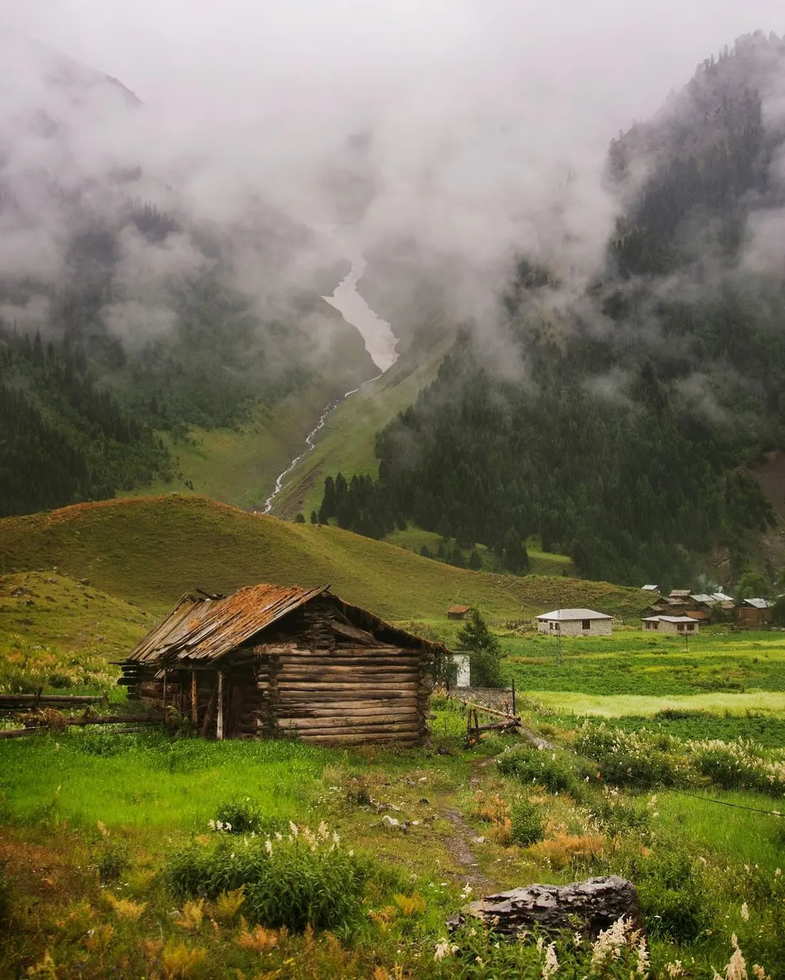
Minimarg sits at 2,844 m on the bank of the Burzil Nala, about 36 km south of the Chilam checkpost. It is a Shina-speaking village of wooden houses on a green shelf above a milky river, with pine forest climbing both walls of the valley and a good deal of weather moving through.
The numbers explain why so few people see it. July averages a mild 19.8 °C. January averages minus 26.3 °C. For most of the year the road is simply gone under snow, and the village lives at the end of a route that closes behind it.
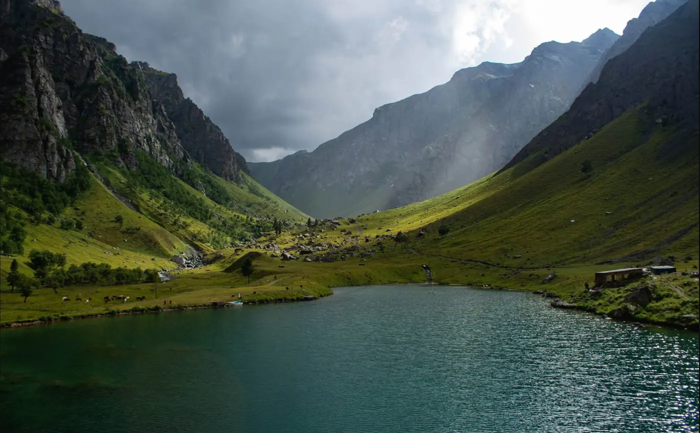
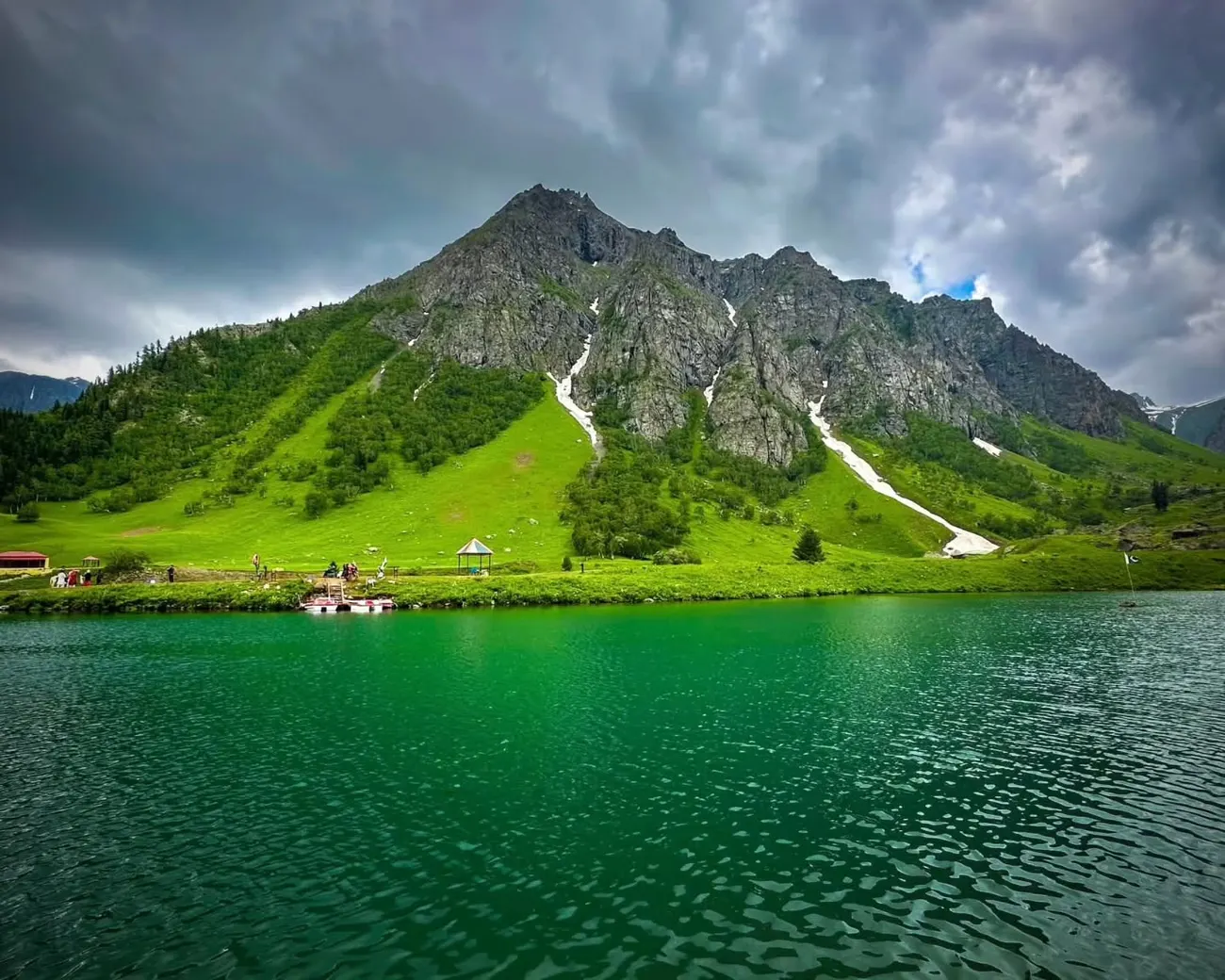
Nearby, Domel and the lake usually called Rainbow Lake are the standard day out from the village, and the reason many people come at all. The water is a strong green under cloud and turquoise in sun, ringed by grazing and a few buildings, with the valley walls rising steeply on both sides.
Burzil Pass, and the road to Srinagar that no longer runs
Above Minimarg the track climbs to the Burzil Pass at 4,100 m, roughly five kilometres north of the administrative line. This is the part of the story that gets left out of the travel pages, and it is the most interesting thing about the valley.
Burzil was a link on the historic caravan route between Srinagar and Gilgit. Travellers crossed it by horse for centuries. At the start of the twentieth century a hut stood on the crest of the pass where couriers handed over mail and messages carried from British India towards China. The Astore River itself rises on the pass's western slopes.
Until 1948 this was the road students and traders used to reach the Indian side. Then the line was drawn across it and the traffic stopped. Standing at the top now, you are looking at a road that used to go somewhere and no longer does, which is a strange and quiet thing to see.
Rama: the Astore that needs no paperwork
If the permission process sounds like more than you want, the valley has an answer. Rama meadow at 3,300 m is a wide bowl of grass and juniper a short drive above Astore town, with the snowfields on the northern side of Nanga Parbat filling the skyline. Rama Lake sits at 3,507 m, an easy walk further up.
No permit, no checkpost, no army camp on the distribution list. For many visitors Rama is the Astore they actually remember, and it makes a comfortable acclimatisation stop before anything higher.
Deosai from the western side
Most people reach the Deosai plateau from Skardu. The other way in is through Astore, climbing past Chilam Chowki at 3,869 m onto a plateau that sits above 4,000 m and is second in size only to the Tibetan. Coming from this side you arrive on the empty western edge rather than the busier Sadpara approach.
Our Deosai National Park guide covers the plateau itself, the brown bears and the season, and our Deosai trips can be run from either side depending on where the rest of your route sits.
The Rupal face
Astore is also the way to the south side of Nanga Parbat. From Tarashing the trail climbs the Rupal valley to a base camp at roughly 3,500 to 3,600 m beneath the highest mountain face on earth, some 4,600 m of rock and ice from the valley floor to the 8,126 m summit. The walking is moderate and non-technical; the difficulty is the remoteness rather than the ground.
We run it as a proper trip rather than a detour: see the Nanga Parbat Rupal face trek, or read our Nanga Parbat guide for how the mountain's two sides differ.
When to go
The honest window for Minimarg is late June to September, and it is set by snow rather than preference. Burzil holds snow into early summer, and the road over it opens late and closes early. July and August are the reliable months. September is beautiful and colder, and the risk of an early closure starts to matter.
Rama and Tarashing have a longer season, roughly May to October, because they sit lower and need no pass. Deosai runs mid-June to mid-September on the same logic as Minimarg.
Practicalities
- Getting there: the Astore turning is off the Karakoram Highway near Jaglot, south of Gilgit. Astore town is a few hours from Gilgit; Minimarg is a long day beyond it with the checkpost in between.
- Vehicle: a normal car reaches Astore and Rama. Everything past Chilam needs a 4x4.
- Staying: Astore town has simple hotels. At Minimarg the options are limited and include army-run accommodation, which is part of why the village feels the way it does.
- Cash and signal: draw money in Gilgit. Coverage past Astore is thin and past Chilam close to absent.
- Photography: be sensible near military installations and checkposts. Ask before you point a camera at anything official.
Frequently asked questions
Do you need a permit for Minimarg?
Yes. You need a written permission issued by the Deputy Commissioner, Astore, granted with reference to the Commissioner of the Diamer-Astore Division. It names each traveller individually, lists the registration number of your vehicle and applies to a specific date. Copies go to the army transit camps at Astore, Chilam and Burzil Top, so the checkpost at Chilam has your details before you arrive. That is why it must be arranged in advance: it cannot be sorted out at the post on the morning, and turning up without it means turning around at 3,869 m after a long drive. Because the vehicle is named, changing cars after the permission is issued causes problems. Pakistani nationals must carry their original CNIC, as photocopies are refused. We confirm the current requirement before every departure and handle the permission, the jeep and the paperwork together once you send us your dates.
Can foreigners visit Minimarg?
Yes, but only with permission arranged in advance, usually through an operator. The blanket NOC that once applied to all foreign visitors in Gilgit-Baltistan was withdrawn several years ago, but ground near the Line of Control was never part of that relaxation, and Minimarg sits behind a working army checkpost at Chilam. The written permission names each traveller, lists the vehicle and is granted for a set date, with copies sent ahead to the army camps at Astore, Chilam and Burzil Top. You cannot improvise it at the gate. Requirements change, so confirm them close to your travel dates rather than relying on an older account. We check the current rules before every departure and arrange the permission and the 4x4 together. If the paperwork does not come through, the rest of the valley still works: Rama meadow, Rama Lake and the Rupal side of Nanga Parbat need no permission at all.
How high is Minimarg?
About 2,844 m (9,331 ft). Minimarg sits on the bank of the Burzil Nala roughly 36 km south of the Chilam Chowki checkpost. That is lower than Chilam itself at 3,869 m, so the road climbs to the post and then drops to the village. The Burzil Pass above Minimarg reaches 4,100 m, and Astore town lower down the valley is around 2,400 m. At 2,844 m the height itself is rarely a problem, but crossing the high ground at Chilam on the way in is the bigger jump. Rama meadow at 3,300 m, a short drive above Astore town, makes a comfortable acclimatisation stop before anything higher. The altitude also explains the weather. July averages a mild 19.8 °C, while January averages minus 26.3 °C, and for most of the year the road is under snow. Minimarg is a Shina-speaking village of wooden houses on a green shelf above the river.
When is the Minimarg road open?
Roughly late June to September, with July and August the most reliable months. The window is set by snow rather than preference. Burzil Pass holds snow into early summer, and the road over it opens late and closes early. September is beautiful but colder, and the risk of an early closure starts to matter, so leave some slack in your dates if you go then. January in Minimarg averages about minus 26 °C, which is why the route stays closed for most of the year. Your written permission is issued for a specific date, so the road window and the paperwork have to line up, which is one reason to plan ahead. Elsewhere in the valley the season is longer. Rama and Tarashing sit lower and need no pass, so they open roughly May to October. Deosai from the Astore side runs mid-June to mid-September, on the same logic as Minimarg.
Can you drive an ordinary car to Minimarg?
No. Only 4x4 vehicles are allowed past the Chilam checkpost, and motorbikes are not permitted either. Jeeps can be hired at Chilam. Because your vehicle registration appears on the written permission, the jeep is usually arranged as part of the same booking, so the car you arrive in at the post has to match the paperwork. A normal car is fine as far as Astore town and Rama meadow, so you only need the 4x4 for the stretch beyond the checkpost. The Astore turning leaves the Karakoram Highway near Jaglot, south of Gilgit. Astore town is a few hours from Gilgit, and Minimarg is a long day beyond it, with the checkpost in between. Draw cash in Gilgit before you set off, because signal past Astore is thin and past Chilam close to absent. When we arrange a Minimarg trip, the jeep, the permission and the paperwork are handled together.
What is Rainbow Lake and where is it?
Rainbow Lake is the name usually given to the lake at Domel, a short distance from Minimarg village, and it is the standard day trip from there. For many people it is the main reason to make the journey at all. The water is a strong green under cloud and turquoise in sun, ringed by grazing and a few buildings, with the valley walls rising steeply on both sides, and it is almost always empty. The lake is inside the permitted area, so the same written permission from the Deputy Commissioner, Astore, covers it, and nothing on that side of Chilam is reachable without it. You will also need the 4x4 that is named on the permission. Plan it for the open season, roughly late June to September, when the road over Burzil is passable. Accommodation near Minimarg is limited and includes army-run options, so most people treat the lake as an outing from their base.
Do you need a permit for Rama Lake or Deosai?
No. Rama meadow and Rama Lake are freely accessible above Astore town, with no permit, no checkpost and no army camp on a distribution list. Rama meadow sits at 3,300 m, a wide bowl of grass and juniper a short drive above Astore, and Rama Lake is an easy walk further up at 3,507 m. Deosai needs only the national park entry fee. From this side you climb past Chilam Chowki at 3,869 m onto the empty western edge of the plateau, rather than the busier Sadpara approach from Skardu. The Rupal side of Nanga Parbat, reached from Tarashing, needs no permission either. The written permission applies to Minimarg and the Burzil side, not to the rest of the valley. Seasons differ, though: Rama and Tarashing open roughly May to October, while Deosai runs from mid-June to mid-September. A normal car will get you to Rama.
Ready for Your Next Adventure?
Join our community of explorers and discover the journey of a lifetime. Our expert team is ready to help you plan your perfect expedition.