Kutwal Lake Trek
Haramosh Valley, Gilgit, Gilgit-Baltistan
Last updated: · Reviewed by Javeed Iqbal, Founder
Elevation
3,300m
Difficulty
Moderate
Duration
4 Days
Best Season
Jun-Sep
Kutwal Lake Trek: a short walk under a rarely climbed 7,409er
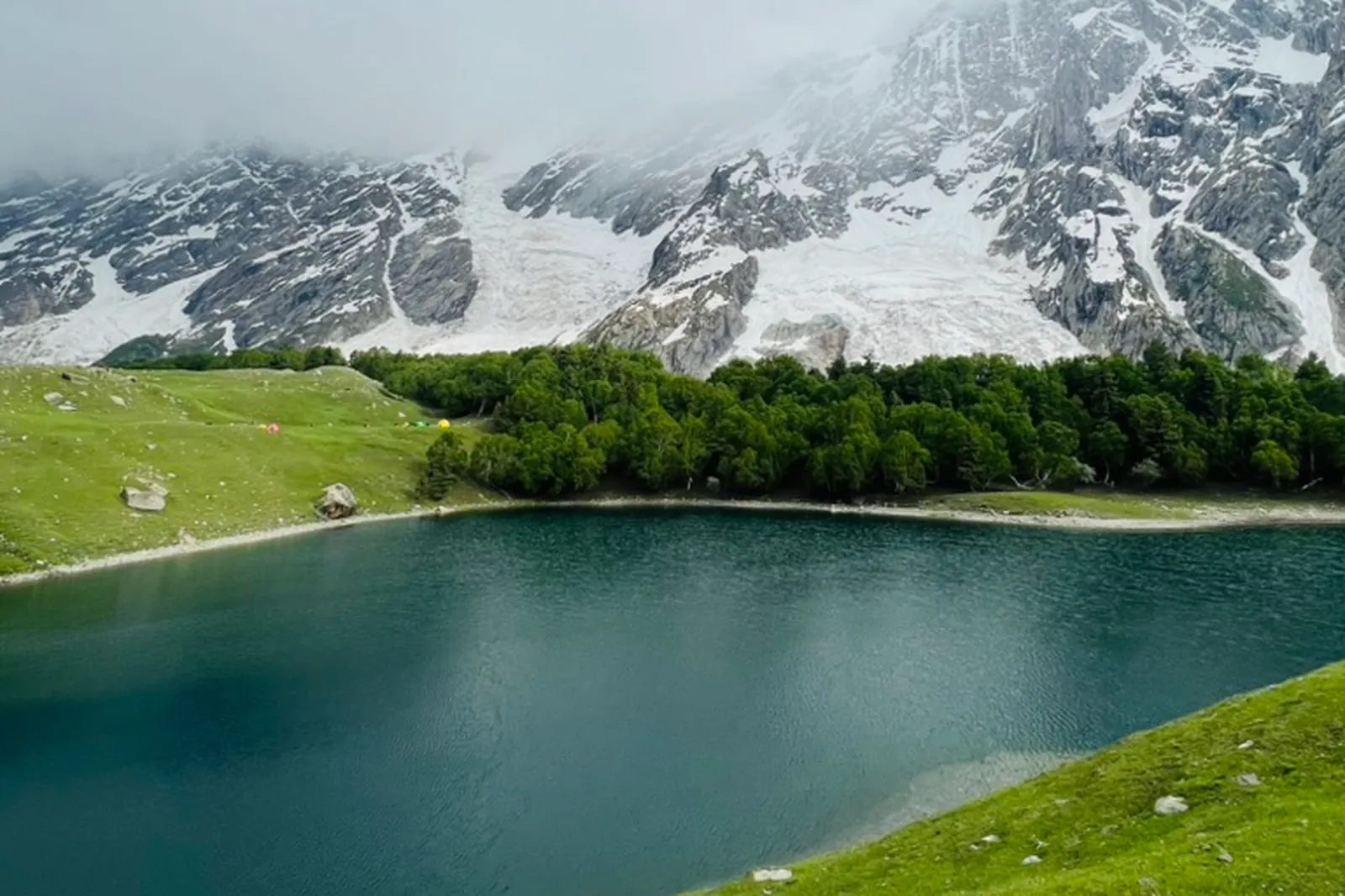
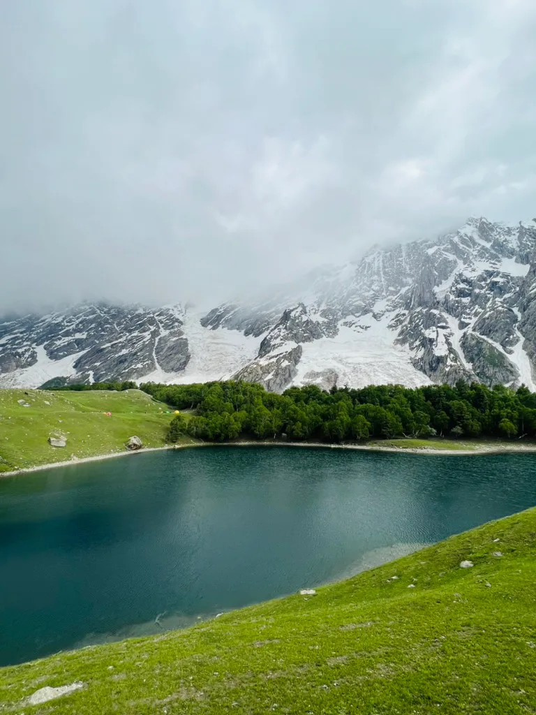
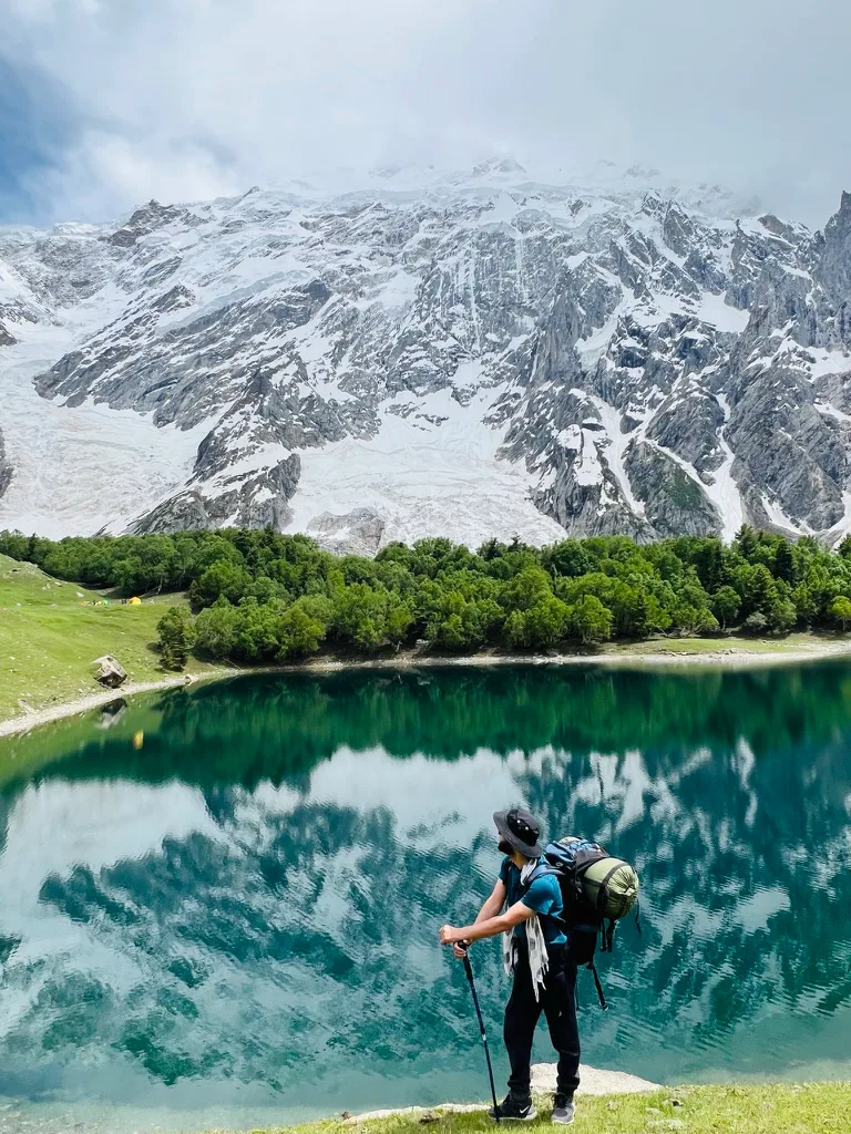
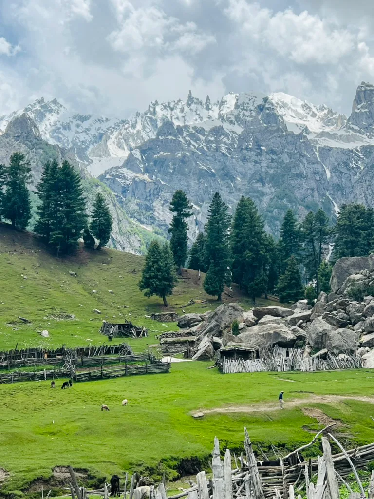
Kutwal is a turquoise lake at about 3,300 m in the Haramosh Valley, sitting directly under the north side of Haramosh Peak. It is one of the most accessible serious mountain settings in Gilgit-Baltistan: the turn-off is barely two hours from Gilgit, there is no permit to arrange, and the walking is measured in days rather than weeks.
Where the trek goes
The valley runs south off the Indus, roughly 65 km east of Gilgit. You leave the Gilgit-Skardu road at Sassi, about 53 km out, and swap to a jeep for the track that climbs through pine forest and side streams. From wherever the jeep can reach, you walk up to the summer settlement and the lake beside it, then back the same way.
The mountain above the lake
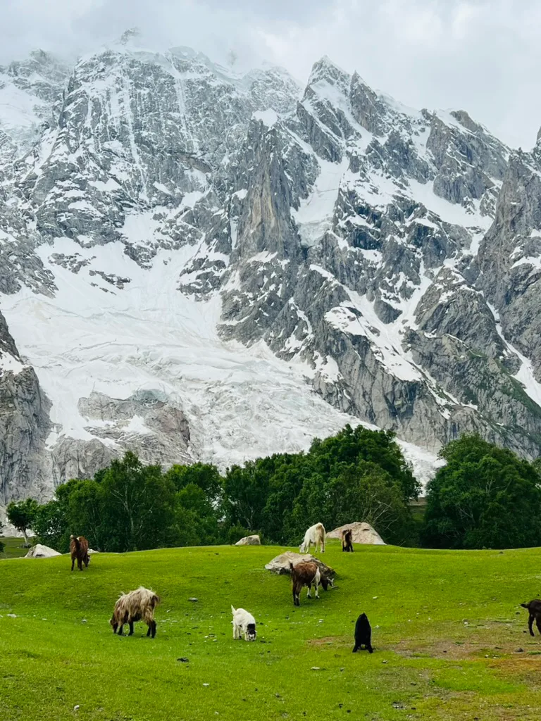
Haramosh Peak is 7,409 m, the high point of the Rakaposhi-Haramosh subrange, with 2,277 m of prominence. From the meadow you are looking straight at its northern flank. Dobani closes the valley to the west, and a peak called Laila rises above the lake. It is not the famous Laila Peak, which is in the Hushe Valley near Masherbrum; the two get confused constantly.
Haramosh has been summited only a handful of times. It is better known for 1957, when an Oxford party was caught below the Haramosh La and two climbers died. Ralph Barker's account, The Last Blue Mountain, is still widely read. The Austrians Heinrich Roiss, Stefan Pauer and Franz Mandl made the first ascent on 4 August 1958.
No permit required
The valley is open. There is no No Objection Certificate to obtain and no trekking permit, which is a real difference from the Baltoro side where K2 Base Camp and Concordia need both plus a per-person fee. We need your passport details for the checkposts along the Gilgit-Skardu road and enough notice to arrange guides, porters and the jeep.
Who this suits
Fit walkers, including first-timers in the Karakoram. There is no technical ground, no glacier travel and no dangerous altitude. The honest caveat is the climb out of the valley floor: it is steep and sustained, on loose trail, often hot lower down. If you are comfortable on a two-day Hunza trek, this is within reach.
When to go
Late June to mid-September, with July and August the most reliable. Before June there is snow on the upper approach and the side streams run high with meltwater. By late September the herders bring their stock down and the nights turn hard.
Combining Kutwal with the rest of the north
Kutwal fits neatly either side of a Skardu trip, since the trailhead is on the way. It also works as an acclimatisation leg. For the full background on the valley, see our Kutwal Lake and Haramosh Valley guide, or pair it with a few days in the Rakaposhi-Haramosh area.
Trek Itinerary: 4 Days
Day 1
Gilgit to Sassi and up the valley by jeep
Gilgit to Sassi and up the valley by jeep
Drive from Gilgit along the Gilgit-Skardu road to Sassi, about 53 km and two hours. Swap to a jeep for the track into the Haramosh Valley, climbing through pine forest and side streams as far as the road is open that season. Camp at the roadhead.
Day 2
Up to Kutwal Lake (3,300 m)
Up to Kutwal Lake (3,300 m)
Walk up the valley to the summer settlement and the lake beside it. How long this takes depends entirely on where the jeep stopped, so we plan a full day and treat an early arrival as a bonus. Camp on the meadow under the north face of Haramosh.
Day 3
A day at the lake
A day at the lake
A spare day to use on the lake, the grazing meadows and the higher ground behind the settlement, with Haramosh, Dobani and Laila around you. This is also the weather margin: if Day 2 ran long, this is the day that absorbs it.
Day 4
Down to Sassi and back to Gilgit
Down to Sassi and back to Gilgit
Descend the valley to the roadhead, jeep out to Sassi, and drive back along the Indus to Gilgit. Onward transfers toward Skardu can be arranged from the same junction.
What's Included
Not Included
Frequently Asked Questions About the Kutwal Lake Trek
Do I need a permit for the Kutwal Lake trek?
Do I need a permit for the Kutwal Lake trek?
No. The Haramosh Valley is open, so there is no No Objection Certificate and no trekking permit. We need your passport details for the checkposts on the Gilgit-Skardu road, and enough notice to arrange guides, porters and the jeep. That is a real difference from the Baltoro side, where K2 Base Camp and Concordia need both an NOC and a permit plus a per-person fee. Here the checkpost paperwork and valley fees are handled by us and included in the price. The trek starts from Sassi, about 53 km from Gilgit on the Gilgit-Skardu road, and the checkposts are along that road, so keep your passport and visa to hand on the drive. Kutwal Lake sits at about 3,300 m with Haramosh Peak above it, but you are only walking to the lake and meadows, so no peak rules come into it.
How long is the Kutwal Lake trek?
How long is the Kutwal Lake trek?
We run it as four days from Gilgit: in by road and jeep, a day walking up to the lake, a spare day at 3,300 m, and out. Walking time depends on how far the jeep can get that season. Day one is the two-hour drive to Sassi, about 53 km along the Gilgit-Skardu road, then a jeep up the Haramosh Valley through pine forest to wherever the track is open, where we camp. Day two is the walk to the summer settlement and the lake. We plan it as a full day and treat an early arrival as a bonus. Day three is spent at the lake with Haramosh, Dobani and Laila around you, and it doubles as the weather margin if day two ran long. Day four goes back down to the roadhead and out to Gilgit, with onward transfers towards Skardu possible from Sassi.
How difficult is it?
How difficult is it?
Moderate. No technical ground, no glacier and no dangerous altitude, but the climb out of the valley floor is steep and sustained on loose trail, and it is often hot lower down. Anyone comfortable on a two-day Hunza trek will manage it. The high point is the lake at about 3,300 m, well below the heights reached on the big Baltistan treks. How long you walk depends on where the jeep stops, which changes from season to season, so the day up to the lake can be shorter or longer than expected. We keep a spare day at the lake so a long walk in never has to be rushed. Porters carry the camp equipment and food, so you walk with a daypack. The trek suits fit walkers, including people who are new to the Karakoram. Boots with good grip help on the loose sections.
How high is Kutwal Lake, and Haramosh Peak?
How high is Kutwal Lake, and Haramosh Peak?
The lake sits at about 3,300 m; published figures range from 3,260 to 3,310 m. Haramosh Peak above it is 7,409 m, first climbed on 4 August 1958 by the Austrians Heinrich Roiss, Stefan Pauer and Franz Mandl. It is the high point of the Rakaposhi-Haramosh subrange, with 2,277 m of prominence, and from the meadow at Kutwal you look straight at its northern flank. The mountain has been summited only a handful of times. It is better known for 1957, when an Oxford party was caught below the Haramosh La and two climbers died, a story Ralph Barker told in The Last Blue Mountain. Around the lake, Dobani closes the valley to the west and a separate peak called Laila rises above the water. More than 4,000 m of height separates lake and summit, which is what makes the setting so striking from a camp you can reach in a day.
When is the best time to go?
When is the best time to go?
Late June to mid-September, with July and August the most reliable. Before June there is snow on the upper approach and the streams run high with meltwater, which makes the side-stream crossings harder. In July and August the path is clear and the summer settlement by the lake is in use. By late September the herders bring their stock down and the nights turn hard. How far the jeep can get also varies with the season, and that decides how long the walk up to the lake takes. Whenever you go, we keep a spare day at the lake to absorb bad weather or a long walk in. The drive from Gilgit to the Sassi turn-off is only about two hours, so Kutwal can slot in before or after a Skardu trip in the same window, since the trailhead is on the way.
Is the Laila Peak here the famous one?
Is the Laila Peak here the famous one?
No. The famous Laila Peak is in the Hushe Valley near Masherbrum. Haramosh has a separate peak of the same name above Kutwal Lake, and the two get confused constantly. The Hushe Laila is the one most people mean when they talk about Laila Peak, and it sits on the Ghanche side of Baltistan, reached through Khaplu. The Laila above Kutwal is part of the skyline you see from the lake and the meadows, alongside Haramosh Peak at 7,409 m and Dobani, which closes the valley to the west. On this trek we don't climb any of these peaks. You walk to the lake at about 3,300 m, spend a spare day on the meadows and the higher ground behind the summer settlement, and look up at them. If it is the Hushe Laila you are after, tell us and we will plan a separate trip into the Hushe Valley from Skardu.
Related Reading
Ready for Your Next Adventure?
Join our community of explorers and discover the journey of a lifetime. Our expert team is ready to help you plan your perfect expedition.