Gilgit to Chitral via Shandur Pass Road Trip | Go With Guide
Home
All Tours Cultural Tours Family Holidays Luxury Tours Camping Road Trips
K2 Treks Trending Treks High Passes Trekking Holidays All Treks
8000m Peaks 7000m Peaks 6000m Peaks High Passes
Cycle Touring Eco Tourism Motorcycle Touring Mountain Passes Festivals of Pakistan Ibex Hunting Snow Leopard International Travelers
About Us Vehicles Contact FAQs Blog
Plan Your Trip
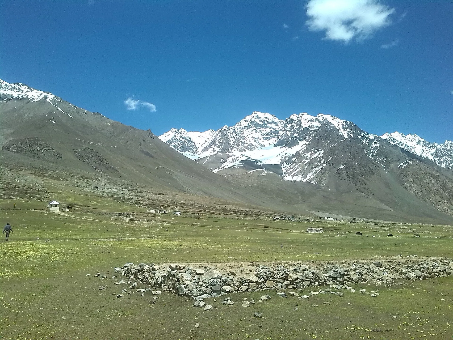
The green Shandur plateau below snow-capped peaks between Chitral and Gilgit
Back to Tours
Road Trip Chitral

Shandur Pass Road Trip

Gilgit to Chitral over Shandur Top at 3,700 m, the world's highest polo ground
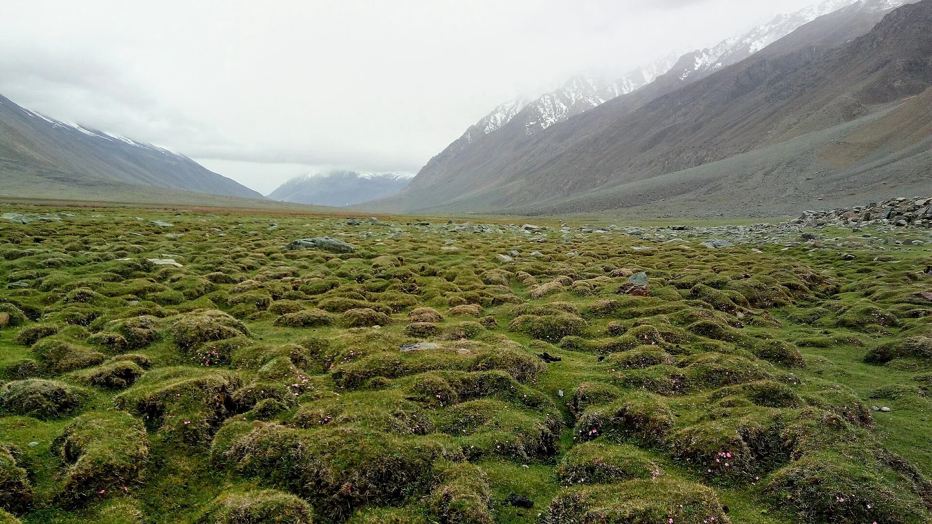
The green Shandur plateau below snow-capped peaks between Chitral and Gilgit
The broad green Shandur valley on the road between Chitral and Gilgit
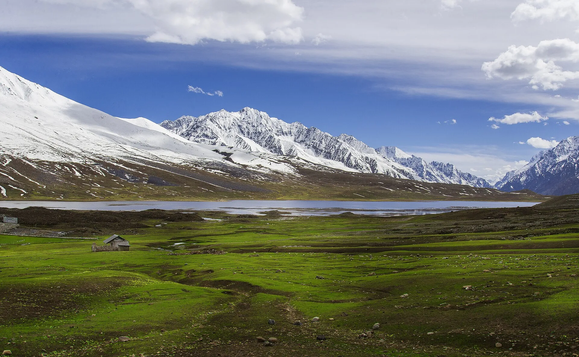
Shandur Lake on the high plateau of Shandur Pass
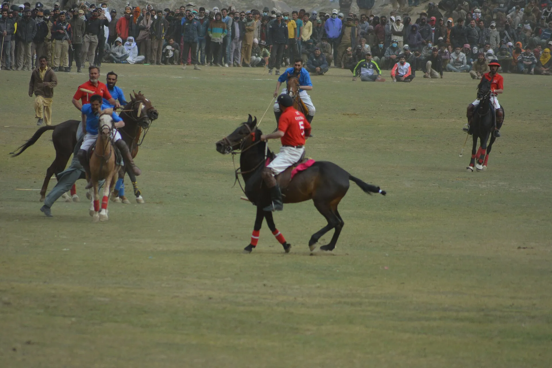
A polo match at the Shandur Polo Festival, the world's highest polo ground
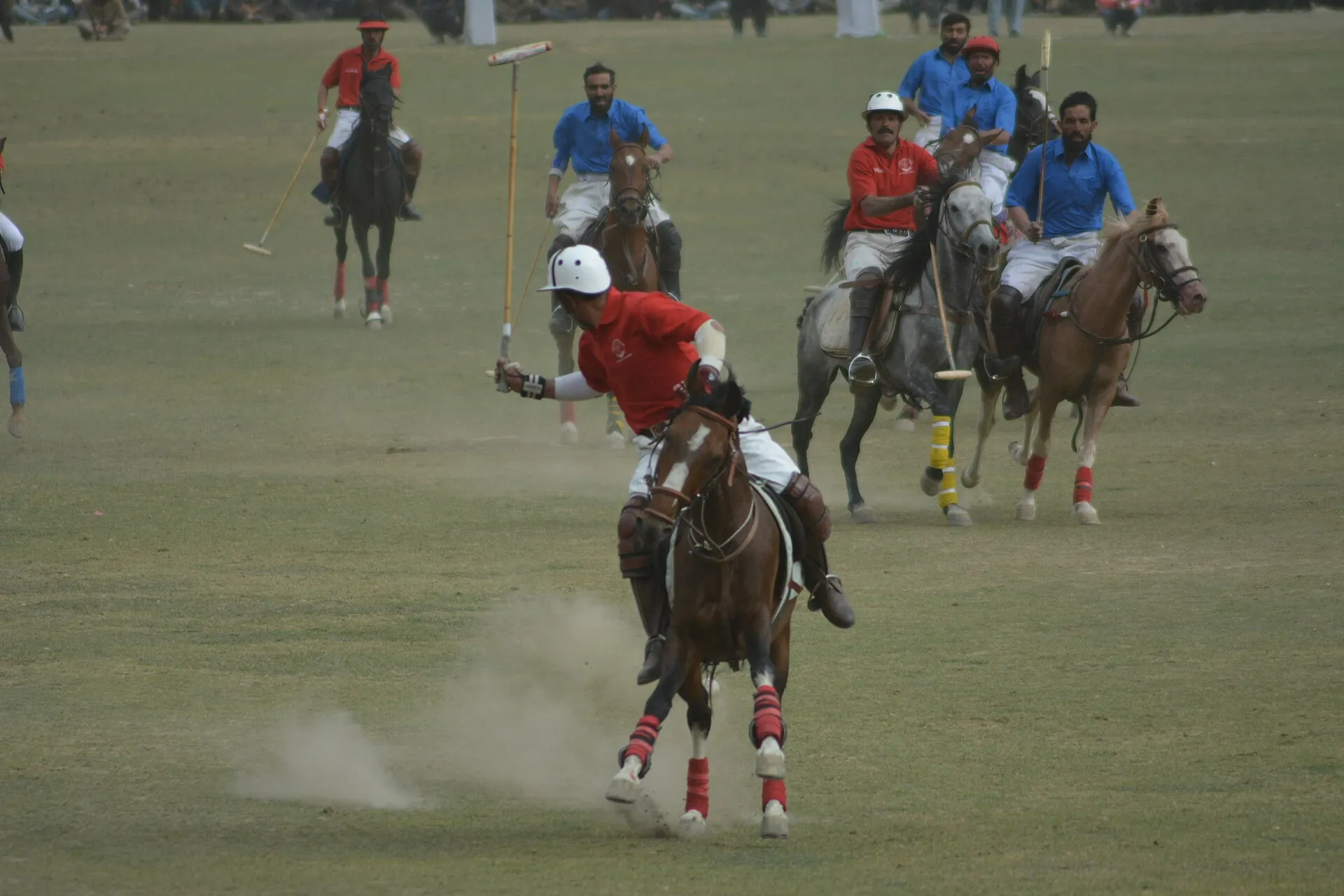
Fast polo action at the Shandur Polo Festival
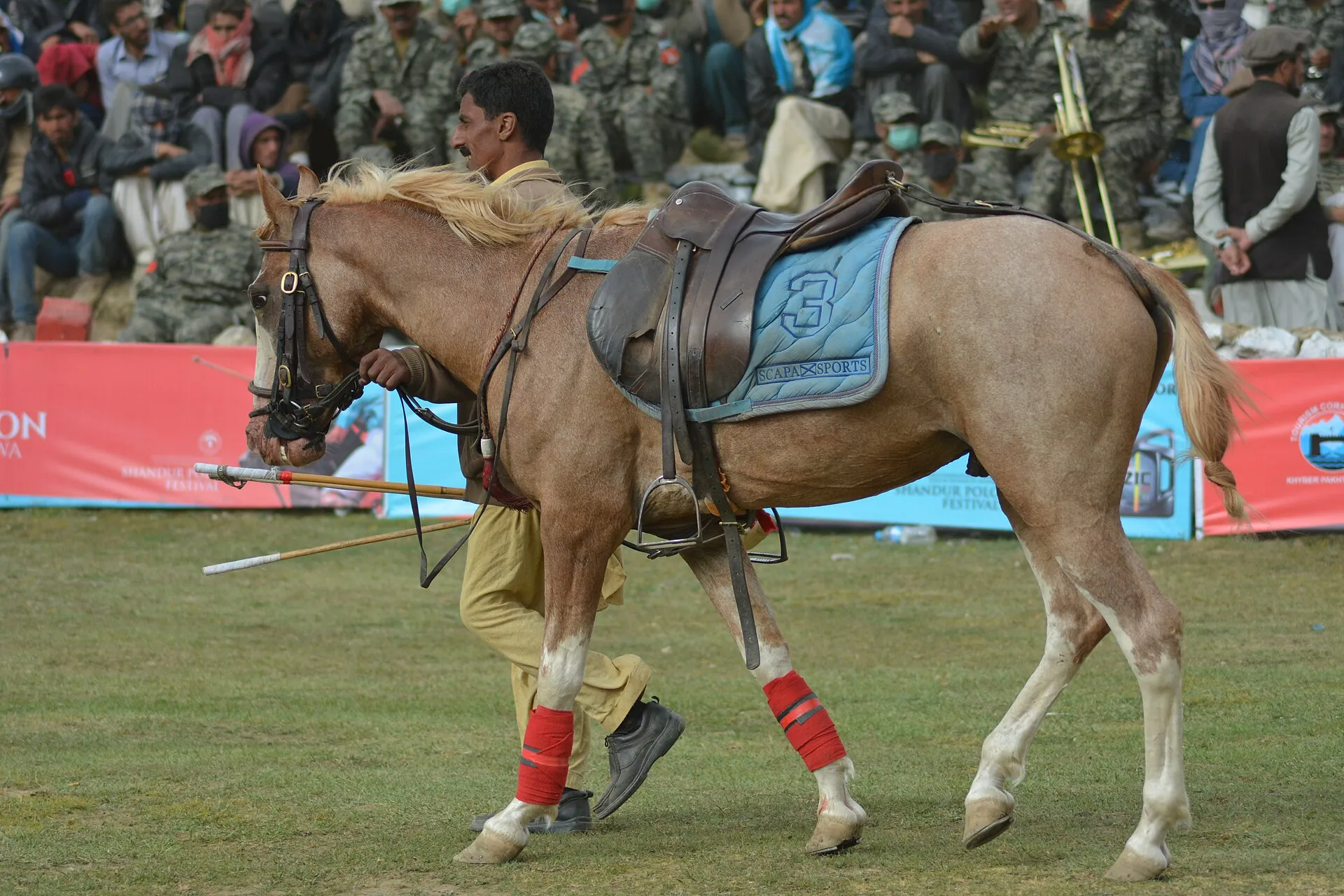
A mounted polo player at the Shandur Polo Festival

Last updated: · Reviewed by Javeed Iqbal, Founder

Duration

5-7 Days

Difficulty

Moderate

Group Size

2-8 people

Best Season

Jun-Oct

About This Tour

Shandur is the green pass between Gilgit-Baltistan and Chitral, and at 3,700 m the polo ground on its flat top is the highest in the world. This is the classic road trip across it: Gilgit to Gupis, up the Ghizer Valley to Phander Lake, over Shandur Top, then down the Mastuj and Chitral side. It is gravel jeep country for long stretches, so we run it in a 4x4 and take it in stages.

From Gilgit the road follows the Ghizer River west through Gupis and on to Phander, at about 3,000 m, where a long green lake sits below the willows and the road turns rougher. Past Gupis the surface breaks up and a 4x4 earns its keep. The climb to Shandur Top opens onto a wide grass plateau, the polo ground in the middle of it, herders' summer shelters dotted across the slopes. The descent on the far side drops you toward Mastuj and the Chitral River.

Shandur's draw is its colour. Where most of these mountains are brown gorge and grey glacier, the plateau and the Ghizer flats run green through the summer, fed by snowmelt. The road is open roughly May to October; outside that window snow seals the pass and the Gilgit-to-Chitral crossing shuts down for the winter. The Ghizer villages are mostly Ismaili and known for feeding travellers well.

Our tour runs the full Gilgit-to-Chitral line over 5 to 7 days, with nights at Phander and on the plateau so you are not rushing the best parts. It pairs naturally with the festival: if your dates land in festival week (held in June in recent years), see our Shandur Polo Festival tour, which uses this same road to reach the games. This page is the road trip on its own, any time the pass is open.

The Route: Gilgit to Chitral Over Shandur

From Gilgit the road heads west along the Ghizer River through Gahkuch and Gupis. It is about 165 km to Phander and a solid 6 to 7 hours, longer if the surface is rough, which after Gupis it usually is. Phander Lake at around 3,000 m is the stop most people remember: a stretch of deep-green water in a wide valley, good for an evening walk and a night before the climb.

From Phander the track winds up to Shandur Top at 3,700 m. You cross the polo ground, the flat grass plain that gives the pass its fame, then start down the western side toward Laspur and Mastuj. The Chitral side runs along the Chitral River past old watchtowers and apricot orchards into Chitral town. Shandur Top is roughly 45 to 50 km beyond Phander, about 210 km from Gilgit in all; we break the whole journey across several days rather than push it in one.

Stage-by-stage plan for the Gilgit to Chitral drive over Shandur, with distances, driving times and altitudes.
DayStageDistance and timeAltitude
Day 1Islamabad to GilgitShort flight or KKH1,500 m
Day 2Gilgit to Phander via GupisAbout 165 km, 6 to 7 hrs3,000 m
Day 3Phander to Shandur TopGravel climb, jeep3,700 m
Day 4Shandur to Laspur and MastujDescent, jeepChitral side
Day 5Mastuj to Chitral townChitral River valley1,497 m
Day 6Chitral, Bumburet or Mastuj FortOptional day tripChitral
Day 7Chitral to IslamabadFlight or Lowari TunnelDeparture

Day-by-Day Itinerary

1

Islamabad to Gilgit

Fly Islamabad to Gilgit at about 1,500 m, or come overland on the Karakoram Highway. Night in Gilgit with a route briefing for the days ahead.
2

Gilgit to Phander up the Ghizer Valley

Drive about 165 km west along the Ghizer River through Gahkuch and Gupis, 6 to 7 hours with the rough patches after Gupis. Arrive Phander at around 3,000 m for an evening walk along the lake. Guesthouse night.
3

Phander to Shandur Top

Climb the winding gravel road to Shandur Top at 3,700 m, the world's highest polo ground on its flat grass plateau. Time on the plateau and at Shandur Lake before camping or resting in the rest house.
4

Shandur to Laspur and Mastuj

Descend the western slope into the Laspur Valley, passing watchtowers, apricot orchards and Kho villages. Continue toward Mastuj on the Chitral side. Guesthouse night.
5

Mastuj to Chitral

Drive down the Chitral River valley through Mastuj to Chitral town at about 1,497 m. Time to visit Chitral Fort and the Shahi Mosque on arrival.
6

Chitral Cultural Day

Optional day trip to the Kalash valley of Bumburet, or a visit to Mastuj Fort. A flexible day to absorb Chitral before the journey out.
7

Departure from Chitral

Fly Chitral to Islamabad or drive out via the Lowari Tunnel. Departure.

Best Time to Drive the Shandur Road

The road is open roughly May to October. Snow closes the Shandur Pass and the wider Gilgit-to-Chitral crossing from about November to May, so this is a summer trip only. Midsummer brings the greenest plateau and the most reliable surface; the shoulder months of May and October are quieter but carry more weather risk up high.

If you want the polo festival, it has been held in June in recent years (11 to 13 June in 2026), but the dates are announced each year, so check our festival page rather than assume. Outside festival week the road is calmer and you have Phander and the plateau largely to yourselves.

Getting There and Road Condition

Most trips start in Gilgit, reached by the short flight from Islamabad or overland on the Karakoram Highway. If you are arriving on the KKH, this trip connects straight onto it: see the full corridor on our complete Karakoram Highway tour. From Gilgit the Shandur road is your route west to Chitral.

Expect gravel. The Ghizer Valley road is reasonable to Gupis, then breaks into rough patches and stays that way over the pass, which is why we use a 4x4 jeep with a local driver throughout. A private jeep with driver runs in the region of PKR 4,000 a day. River crossings and washouts can slow a day, so our schedule keeps some slack.

Who This Road Trip Is For

This suits travellers who like the journey as much as the destination and do not mind long days on rough gravel. There is no trekking required: the highlights, Phander Lake and Shandur Top, are reached by jeep, with short walks at each. The reward is remote country, green valleys and a crossing few outsiders make.

It is moderate mainly because of the distances, the road surface and the altitude on the plateau, not because of physical effort. If a bumpy 6 to 7 hour jeep day sounds like part of the fun rather than a chore, this is your trip.

Where Is the Shandur Pass and How High Is It?

The Shandur Pass crosses a broad grassy plateau at about 3,700 metres, linking the Ghizer district of Gilgit-Baltistan with the Chitral district of Khyber Pakhtunkhwa. Unlike the sharp rock passes of the Karakoram, Shandur is a wide, gently rolling upland, sometimes called the Roof of the World, with the shallow Shandur Lake and the famous high polo ground laid out on top. It is not on a paved highway: the crossing is a rough jeep track open only in the warmer months, reached from the Gilgit side by driving up the Ghizer valley through Gupis and Phander, and from the Chitral side up from Mastuj. That remoteness is exactly what makes the drive an adventure rather than a shortcut.

The Drive: Phander, Ghizer and the Roof of the World

The road to Shandur is the reason to come, not just the pass itself. From Gilgit the route climbs the Ghizer valley through a string of villages and river bends, with the turquoise Phander Lake and the trout streams around Gupis among the most photographed stops in the north. Higher up, the landscape opens into the wide Shandur plateau, grazed by yaks and marmots and ringed by rolling hills rather than jagged peaks, before dropping down the Chitral side to Mastuj and on toward Chitral town. Along the way you pass Khowar and Wakhi villages, old wooden mosques and polo grounds in almost every settlement, so the drive is a slow immersion in the culture that produces the Shandur festival.

Why Book With Us

We drive the Shandur road every season and we know where it bites: the rough run after Gupis, the river crossings that shift year to year, the days the pass is slow to dry out. Our jeeps and drivers are local to Ghizer and Chitral, our schedule carries slack for washouts and weather, and we book Phander and plateau nights ahead so you are not scrambling for a bed in remote country. Small groups, honest day plans, and a route we adjust on the ground when the surface or the sky changes.

What's Included

Islamabad-Gilgit flight and Chitral-Islamabad flight
All ground transport in 4WD jeep on mountain roads
5 nights accommodation (guesthouses in Phander, Shandur, Laspur, Chitral)
All meals throughout
English-speaking guide and local driver
Camping equipment at Shandur Pass (if camping option chosen)

Not Included

International flights
Travel insurance
Personal expenses and tips

Frequently Asked Questions

Is the Shandur road trip safe?

Yes. With a local driver and a 4x4 it is a safe summer journey, and the real hazards are the road surface, river crossings and weather rather than security. The Ghizer road is reasonable as far as Gupis, then it breaks into rough gravel that stays with you over the pass, so we use a 4x4 jeep with a driver who is local to Ghizer or Chitral for the whole route. River crossings shift from year to year and washouts can slow a day, which is why our schedule carries slack and we only cross Shandur Top when conditions are clear. The plateau sits at 3,700 m, so nights fall close to freezing and the wind is sharp on the open top; bring warm layers even in midsummer. There is no trekking involved. We book the Phander and plateau nights ahead, so you are never hunting for a bed late in the day in remote country.

When is the Shandur Pass road open?

The road is open roughly May to October. From about November to May snow closes the Shandur Pass and the whole Gilgit-to-Chitral crossing, so this is a summer-only trip. Midsummer is the best window: the plateau and the Ghizer flats are at their greenest, fed by snowmelt, and the road surface is at its steadiest. May and October are quieter but carry more weather risk up high, and some years the pass is slow to dry out early in the season. Our tour card lists Jun-Oct as the best season for that reason. Even in summer, expect mild sunny days on the plateau and nights close to freezing. If you want the polo festival, it has been held in June in recent years (20 to 22 June 2025, 11 to 13 June 2026), with the dates announced each year. Outside festival week the road is calmer and you will have Phander Lake and Shandur Top largely to yourselves, which many travellers prefer.

How high is Shandur?

Shandur Top sits at about 3,700 m, and the highest point on our route reaches 3,734 m, so the polo ground on the plateau is the highest in the world. It is the high point of the Gilgit-to-Chitral road. You gain the height in stages rather than all at once: Gilgit is at about 1,500 m, Phander Lake at around 3,000 m, and we spend a night at Phander before driving up to the plateau on day three. Chitral town, where the trip ends, is lower again at about 1,497 m. You will notice the height mostly at night. Even in midsummer, nights on top fall close to freezing and the wind is sharp across the open grass, so bring warm layers. There is no trekking involved and the walks at Phander and on the plateau are short, but take things slowly on top and stay warm if you camp.

How long does the drive take and how far is it?

Gilgit to Phander is about 165 km and 6 to 7 hours, and Shandur Top is roughly 45 to 50 km further, about 210 km from Gilgit in all. Those times stretch when the surface is rough, which after Gupis it usually is. We never push the crossing in one go. The tour runs 5 to 7 days: fly or drive to Gilgit on day one, drive the Ghizer Valley to Phander on day two, climb to Shandur Top on day three, descend through the Laspur Valley to Mastuj on day four and reach Chitral town on day five. Days six and seven cover an optional Kalash valley trip to Bumburet or a visit to Mastuj Fort, then the flight from Chitral to Islamabad or the drive out through the Lowari Tunnel. Splitting it this way gives you a night at Phander and time on the plateau instead of seeing the best parts through a jeep window.

Do I need a 4x4 jeep?

Yes. A 4x4 with a local driver is essential on this route, and we provide both for the whole journey. The Ghizer Valley road from Gilgit is reasonable as far as Gupis, then it breaks into rough gravel and stays that way over Shandur Top and down the Chitral side toward Laspur and Mastuj. Shandur is crossed by a jeep track, not a paved highway, and river crossings and washouts are part of a normal season. Our jeeps and drivers are local to Ghizer and Chitral and know where the road bites. If you are arranging transport yourself, a private jeep with driver in the region runs about PKR 4,000 a day. On our tour, all ground transport in a 4WD jeep is included in the price, along with the Islamabad-Gilgit and Chitral-Islamabad flights, meals, guesthouse nights and an English-speaking guide, from $900 per person.

Is there any trekking on this tour?

No trekking is required. Phander Lake and Shandur Top are both reached by jeep, with short walks at each stop, so this is a driving trip rather than a hiking one. We grade it moderate because of the distances, the road surface and the altitude, not physical effort. Expect long days on gravel: the drive from Gilgit to Phander is about 165 km and 6 to 7 hours with rough patches after Gupis. Phander sits at around 3,000 m and Shandur Top at 3,700 m, so take the climb easy and stay warm on the plateau at night. The walking you do is optional and gentle, such as an evening stroll along Phander Lake or time on the polo ground and at Shandur Lake. In Chitral you can visit the fort and the Shahi Mosque, or take the optional trip to Bumburet. If a bumpy jeep day sounds like part of the fun, you will enjoy this route.

Can I see the polo festival on this trip?

Not on this departure, but you can plan for it. The Shandur Polo Festival used to fall in early July, but recent editions were held on 20 to 22 June 2025 and 11 to 13 June 2026, and the dates are announced each year, so we keep this road trip separate and run it any time the pass is open, roughly May to October. If your dates land in festival week, book our Shandur Polo Festival tour instead. It uses this same road from Gilgit up the Ghizer Valley through Gupis and Phander to Shandur Top, and we confirm the festival dates before departure rather than assume them. Outside festival week the road is calmer and you will have Phander Lake and the plateau largely to yourselves, which many travellers prefer. The polo culture is visible on the ordinary road trip too: there are polo grounds in almost every settlement along the way, and you still cross the world's highest polo ground on the flat top of the pass.

Where does the road come out on the Chitral side?

From Shandur Top the road descends the western slope into the Laspur Valley, continues to Mastuj and then follows the Chitral River down to Chitral town at about 1,497 m. On our itinerary that is day four, Shandur to Laspur and Mastuj with a guesthouse night, and day five, Mastuj to Chitral. The descent passes old watchtowers, apricot orchards and Kho villages. The surface stays rough gravel from the pass down toward Laspur and Mastuj, so the 4x4 and local driver stay with you. In Chitral there is time to visit Chitral Fort and the Shahi Mosque on arrival. Day six is flexible, with an optional trip to the Kalash valley of Bumburet or a visit to Mastuj Fort. From Chitral you either take the Chitral-Islamabad flight, which is included in the tour, or drive out through the Lowari Tunnel.

Where is the Shandur Pass?

The Shandur Pass is a broad grassy plateau at about 3,700 metres linking the Ghizer district of Gilgit-Baltistan with the Chitral district of Khyber Pakhtunkhwa. On the Gilgit side it sits above Phander, and on the Chitral side above Laspur and Mastuj. From Gilgit the road runs west along the Ghizer River through Gahkuch and Gupis, about 165 km to Phander, then roughly 45 to 50 km more to Shandur Top, about 210 km from Gilgit in all. Unlike the sharp rock passes of the Karakoram, Shandur is a wide, gently rolling upland, sometimes called the Roof of the World, with the shallow Shandur Lake and the world's highest polo ground on top. It is not on a paved highway. The crossing is a rough jeep track open roughly May to October, which is why we run it in a 4x4 over several days.

What is there to see at Shandur?

The main sight is the world's highest polo ground, a flat grass plain in the middle of the plateau, with the shallow Shandur Lake nearby and herders' summer shelters dotted across the slopes. The plateau itself is wide and green through the summer, grazed by yaks and marmots and ringed by rolling hills rather than jagged peaks. Much of what makes the trip is on the road up. Phander Lake, at around 3,000 m, is a stretch of deep-green water below the willows and the stop most people remember, and the trout streams around Gupis are among the most photographed spots in the north. You also pass Khowar and Wakhi villages, old wooden mosques and polo grounds in almost every settlement. On the Chitral side come watchtowers, apricot orchards, Chitral Fort and the Shahi Mosque. Outside festival week the plateau is quiet and empty, which many travellers prefer.

What is the weather like at the Shandur Pass?

Cool by day and cold at night, even in midsummer, because the plateau sits at about 3,700 metres. Summer days on top are usually mild and often sunny, but nights fall close to freezing and the wind is sharp across the open grass, so bring warm layers whatever the month. The road is open roughly May to October, and our tour card lists Jun-Oct as the best season. Midsummer brings the greenest plateau, fed by snowmelt, and the steadiest road surface. May and October are quieter but carry more weather risk up high, and some years the pass is slow to dry out early in the season. From about November to May snow closes the Shandur Pass and the whole Gilgit-to-Chitral crossing, so this is a summer trip only. Lower down it is milder: Phander sits at around 3,000 m and Chitral town at about 1,497 m.

Can you drive over the Shandur Pass?

Yes, between roughly May and October, once the snow has cleared. Shandur is crossed by a rough jeep track, not a paved highway. The Ghizer Valley road from Gilgit is reasonable as far as Gupis, then it breaks into gravel that stays with you over Shandur Top and down toward Laspur and Mastuj. River crossings shift from year to year and washouts can slow a day, so we run the whole route in a 4x4 jeep with a driver who is local to Ghizer or Chitral. If you are arranging transport yourself, a private jeep with driver in the region runs about PKR 4,000 a day. The distances are manageable but slow: Gilgit to Phander is about 165 km and 6 to 7 hours, and Shandur Top is roughly 45 to 50 km further. We split the crossing over several days, with nights at Phander and on the plateau, rather than push it in one.

From

$900

per person

* Prices may vary. Contact us for accurate, customized pricing.

Duration5-7 Days
DifficultyModerate
Group Size2-8 people
Best SeasonJun-Oct
Max Altitude3,734 m
Book This Tour Ask a Question

Free cancellation up to 30 days before departure

Ready for Your Next Adventure?

Join our community of explorers and discover the journey of a lifetime. Our expert team is ready to help you plan your perfect expedition.