Kacheli Lake Trek
Three days from Minapin to a glacial lake at 3,970 m on the shelf above Rakaposhi Base Camp, Nagar Valley
Last updated: · Reviewed by Javeed Iqbal, Founder
Elevation
~3,970m
Difficulty
Moderate
Duration
3 Days
Best Season
May-Oct
Kacheli Lake Trek: the half day above base camp that almost nobody walks
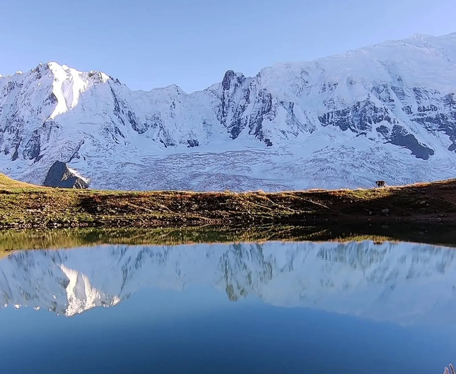
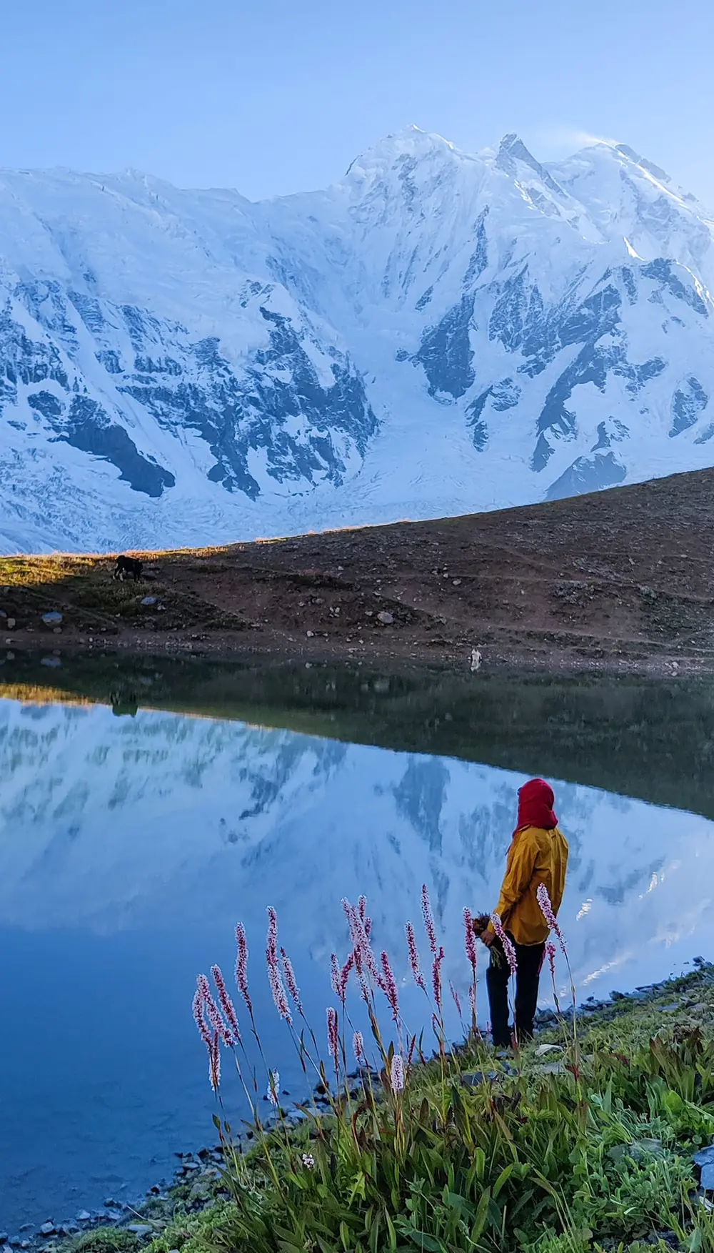
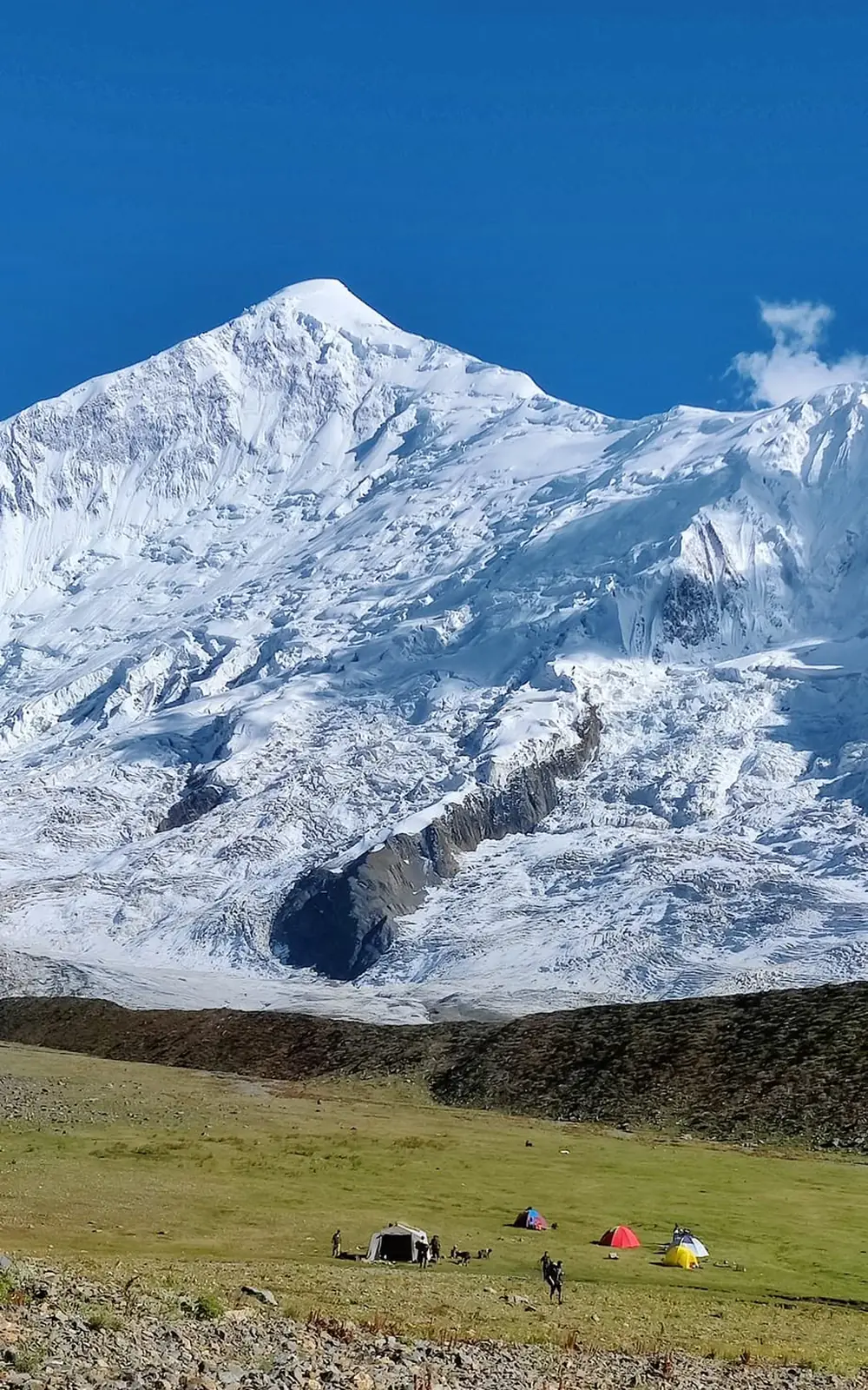
Every summer, groups walk up from Minapin to the meadow at Tagaphari, stand under Rakaposhi, sleep a night and walk back down. Kacheli Lake sits about 470 metres above that meadow, roughly two hours up a steep shoulder on the Diran side, and most of them never hear about it. This trip is built around going up there on a clear morning.
Where the trek goes
The route starts at Minapin village in the Nagar Valley, just off the Karakoram Highway about 75 to 80 kilometres from Gilgit. From roughly 2,000 metres the trail climbs through pine and birch forest past the shepherd huts at Hapakun, around 2,800 metres, then eases onto open pasture and moraine to reach Tagaphari at about 3,300 to 3,500 metres. That meadow is the standard Rakaposhi Base Camp, with the Minapin Glacier below it and Diran Peak across the ice.
The lake, and how high it sits
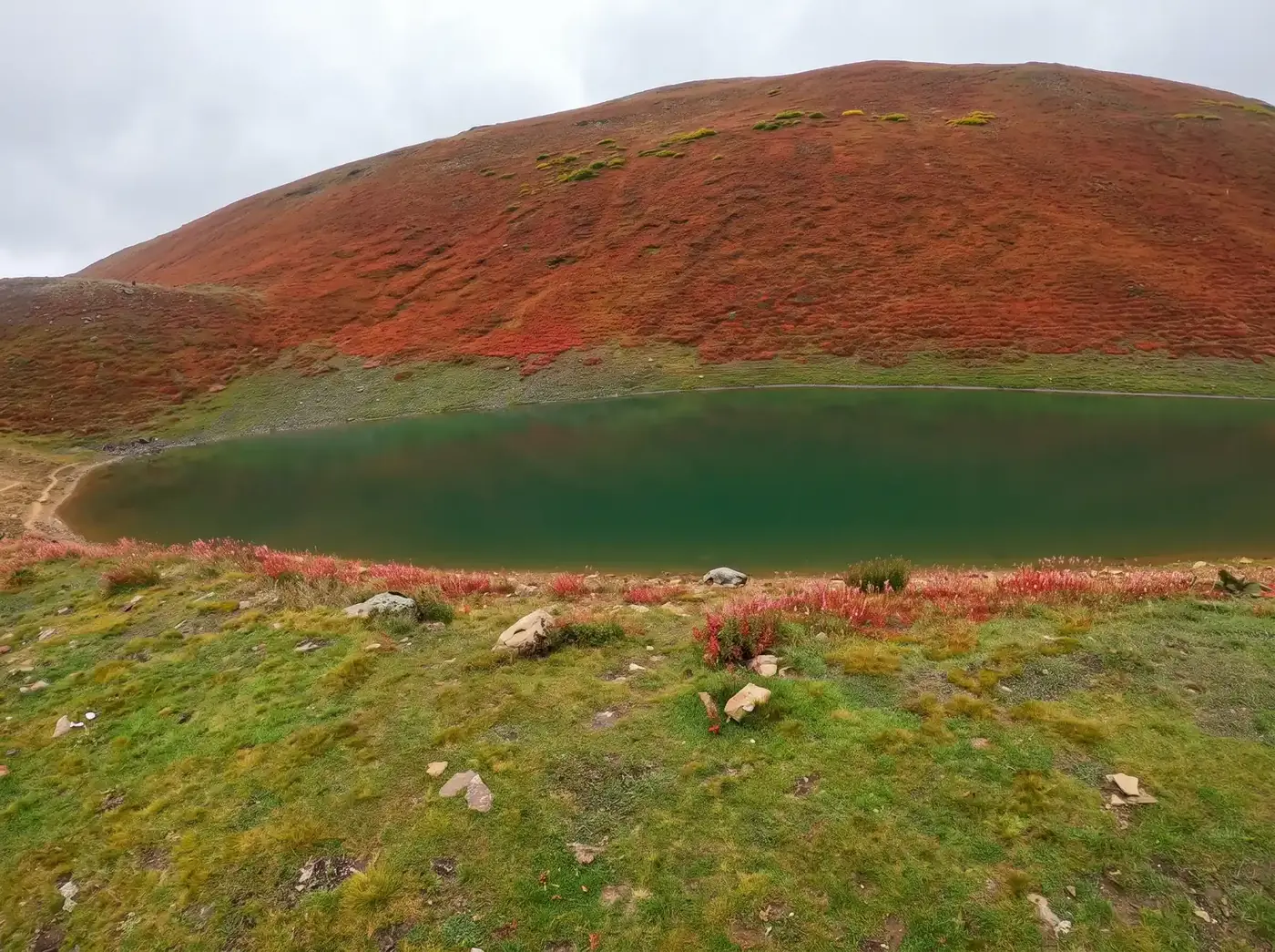
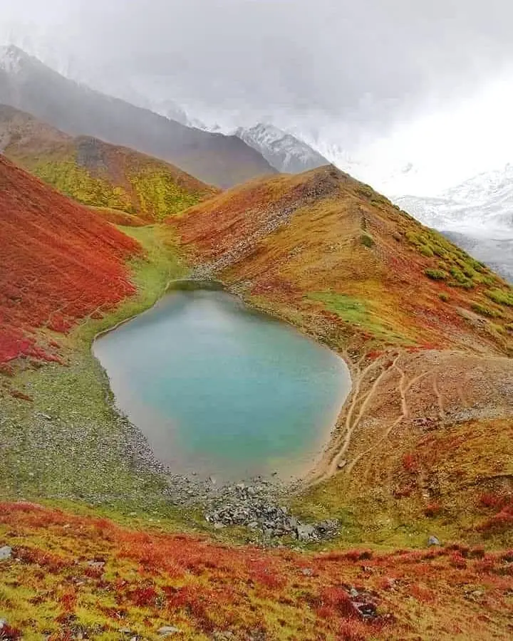
Kacheli lies in Kacheli Meadows on the Miacher side of the valley, with a recorded surface elevation of 3,970 metres. Some trek listings quote 3,800 metres, which appears to describe the surrounding meadow rather than the water. The climb from base camp gains about 470 metres and takes one and a half to two hours, with the descent roughly half that.
No permit required
Nagar and the Minapin valley are open zone. A standard Pakistani tourist visa is enough, with no No Objection Certificate and no trekking permit to arrange in advance.
Who this suits
Trekkers who can climb for five or six hours with a daypack and then get up and do it again the next morning. There is no technical ground, no rope work and no glacier crossing on the way to the lake. Porters carry the camp and the food. The first day out of Minapin is the hard part: sustained, hot, and about 1,300 to 1,500 metres of ascent.
When to go
May to October, with July and August the most settled. Late June and July bring wildflowers to Hapakun and Tagaphari, while September gives the clearest views of Rakaposhi and Diran and the coldest nights. Nights at base camp drop close to freezing even in midsummer, and the lake sits higher again.
Combining Kacheli with the rest of Nagar
The trek shares its whole approach with the Rakaposhi Base Camp trek, so the two combine without adding travel days. Rush Lake, higher and longer, sits in the same district if you want a bigger objective on the same trip.
Trek Itinerary: 3 Days
Day 1
Minapin to Rakaposhi Base Camp at Tagaphari
Minapin to Rakaposhi Base Camp at Tagaphari
Start at Minapin village, about 2,000 m. The trail leaves the last houses and climbs steadily through pine and birch forest, passing the shepherd huts at Hapakun around 2,800 m for a rest and a brew. Above Hapakun the gradient eases across open pasture and moraine to Tagaphari, the base camp meadow at roughly 3,300 to 3,500 m. A gain of about 1,300 to 1,500 m and a long day. Camp with Rakaposhi ahead and the Minapin Glacier below.
Day 2
Tagaphari to Kacheli Lake (3,970 m) and back to camp
Tagaphari to Kacheli Lake (3,970 m) and back to camp
An early start for the climb the standard Rakaposhi itinerary leaves out. The route goes steeply up the shoulder on the Diran side, gaining about 470 m to the lake at 3,970 m in one and a half to two hours. Time at the water, then back down to camp in roughly half that. Afternoon free to walk the moraine toward Diran Base Camp or rest at Tagaphari for sunset on the peaks.
Day 3
Tagaphari down to Minapin
Tagaphari down to Minapin
Back down the way you came, through moraine and pasture to Hapakun and on through the forest to Minapin. Mostly downhill and far quicker than the climb. Transfer onward to Karimabad or Gilgit.
What's Included
Not Included
Frequently Asked Questions About the Kacheli Lake Trek
Do I need a permit for the Kacheli Lake trek?
Do I need a permit for the Kacheli Lake trek?
No. Nagar and the Minapin valley are open zone, so a standard Pakistani tourist visa covers it. There is no No Objection Certificate and no trekking permit to arrange. That makes Kacheli simpler than the big Baltistan treks such as K2 Base Camp, which sit in the restricted zone and need a permit. The route starts at Minapin village, just off the Karakoram Highway about 75 to 80 kilometres from Gilgit, and the whole trek stays inside the valley. Camping and local fees along the way are included in our price, along with transport to and from the Minapin trailhead, a local guide from the Nagar Valley and a porter team for the camp. All we need from you is your passport and visa details and enough notice to book the guide and porters for your dates. The season runs from May to October.
How high is Kacheli Lake?
How high is Kacheli Lake?
3,970 metres, about 13,020 feet, in Kacheli Meadows on the Miacher side of the Minapin valley. Figures around 3,800 m on some listings describe the meadow rather than the lake itself. The lake sits about 470 metres above Tagaphari, the Rakaposhi Base Camp meadow at roughly 3,300 to 3,500 metres, on a steep shoulder on the Diran side. From camp the climb takes one and a half to two hours, and the descent roughly half that. The trek begins much lower, at Minapin village at about 2,000 metres, which is why the first day is the hard one, with 1,300 to 1,500 metres of ascent through forest and past the shepherd huts at Hapakun, around 2,800 metres. Nights are cold at this height. Even in midsummer base camp drops close to freezing, and the lake is higher again.
Can I do Kacheli Lake and Rakaposhi Base Camp on the same trip?
Can I do Kacheli Lake and Rakaposhi Base Camp on the same trip?
Yes, and that is how this trek is built. Kacheli is a steep out and back from the same base camp meadow at Tagaphari, so it adds about half a day to the standard Rakaposhi route rather than needing a separate trip. Day one climbs from Minapin to Tagaphari. On day two we start early, gain about 470 metres to the lake in one and a half to two hours, spend time at the water and come back to camp in roughly half that. The afternoon is free to walk the moraine towards Diran Base Camp or watch sunset on the peaks from Tagaphari. Day three is the descent to Minapin and a transfer on to Karimabad or Gilgit. Most groups that walk to Rakaposhi Base Camp never hear about the lake. If you want a bigger objective in the same district, Rush Lake is higher and longer.
How fit do I need to be?
How fit do I need to be?
Fit enough for five or six hours of uphill walking with a daypack on consecutive days. The first day gains about 1,300 to 1,500 m from Minapin, which is the real test. It is sustained and often hot, climbing through pine and birch forest past Hapakun before easing onto pasture and moraine at Tagaphari. Day two is shorter but steep, gaining about 470 m to the lake in one and a half to two hours. Nothing on the route is technical. There is no rope work and no glacier crossing on the way to the lake, and porters carry the camp and food, so you only carry what you need for the day. The descent on day three is mostly downhill and much quicker than the climb, though it is hard on the knees after two big days. If you regularly walk steep hills for most of a day, you will manage it.
Is there mobile signal on the trek?
Is there mobile signal on the trek?
Patchy around Minapin and Hapakun, and effectively none at Tagaphari or the lake. Plan to be out of contact for most of the trek, from the first day's climb until you come back down on day three. Bring a power bank, because you are camping for two nights with nowhere to plug in, and cold nights at base camp drain batteries faster. Download offline maps and anything you want to read before leaving Minapin. Leave your itinerary with someone before you start walking, including the date you expect to be back in signal. Our guide from the Nagar Valley knows the route and stays with the group, so you are not relying on your phone for navigation. If you need to send a message during the trip, the best chance is on the way back through Hapakun, or once you reach Minapin and the Karakoram Highway.
Ready for Your Next Adventure?
Join our community of explorers and discover the journey of a lifetime. Our expert team is ready to help you plan your perfect expedition.