Khunjerab Pass Weather, Opening Dates & Tour | Go With Guide
Home
All Tours Cultural Tours Family Holidays Luxury Tours Camping Road Trips
K2 Treks Trending Treks High Passes Trekking Holidays All Treks
8000m Peaks 7000m Peaks 6000m Peaks High Passes
Cycle Touring Eco Tourism Motorcycle Touring Mountain Passes Festivals of Pakistan Ibex Hunting Snow Leopard International Travelers
About Us Vehicles Contact FAQs Blog
Plan Your Trip
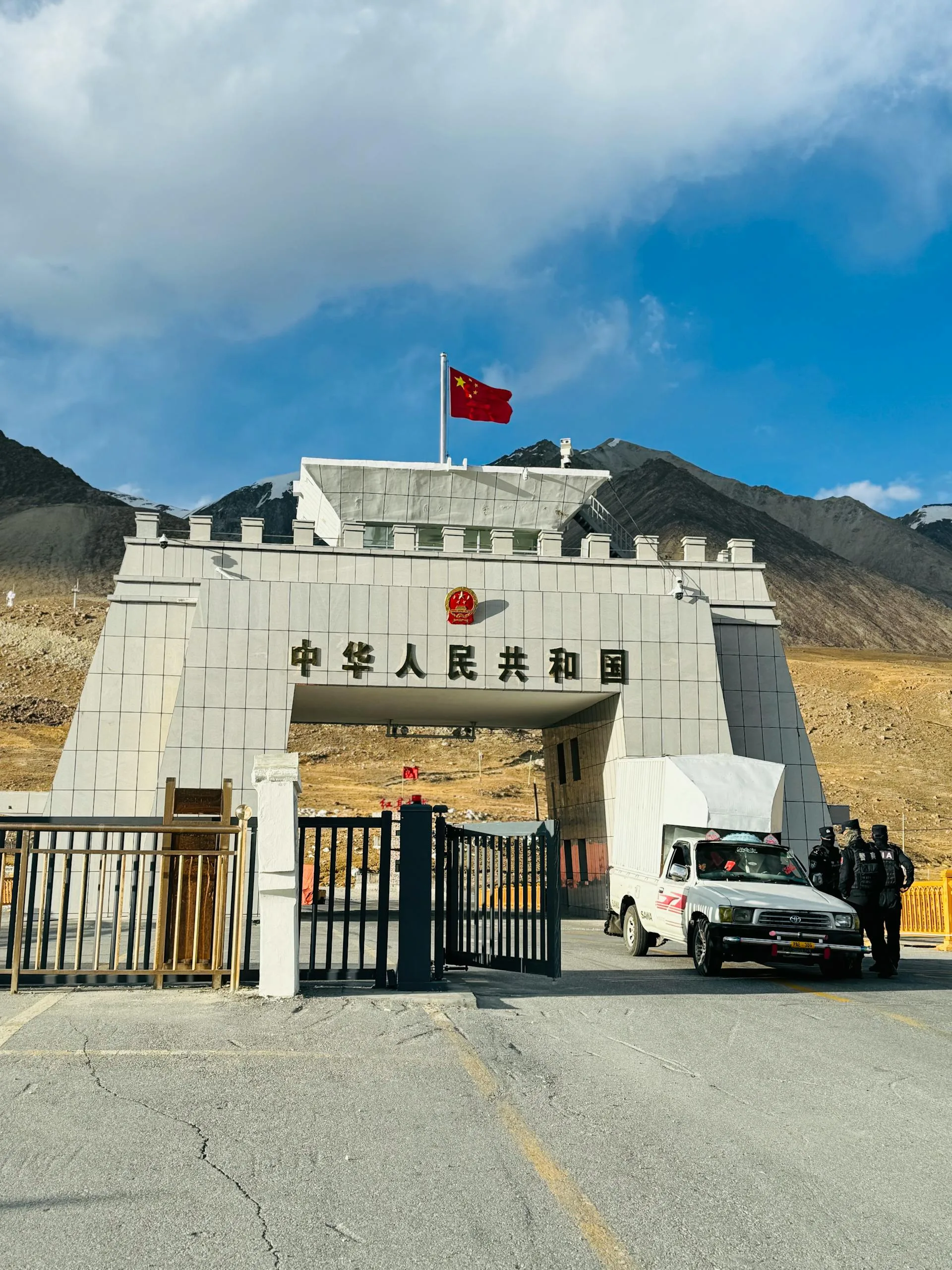
The border gate at 4,693 m Khunjerab Pass, the world's highest paved border crossing
Back to Tours
Road Trip Gilgit-Baltistan

Khunjerab Pass Explorer

A pass-led express to 4,693 m and the China gate, in seven days
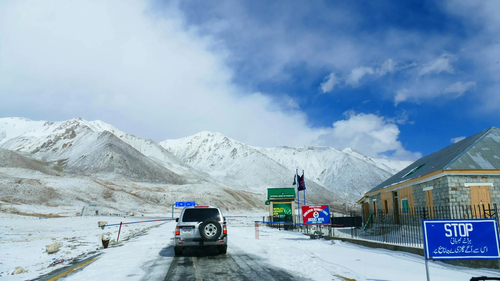
Snow-covered Karakoram peaks at the Pakistan-China border above Khunjerab Pass
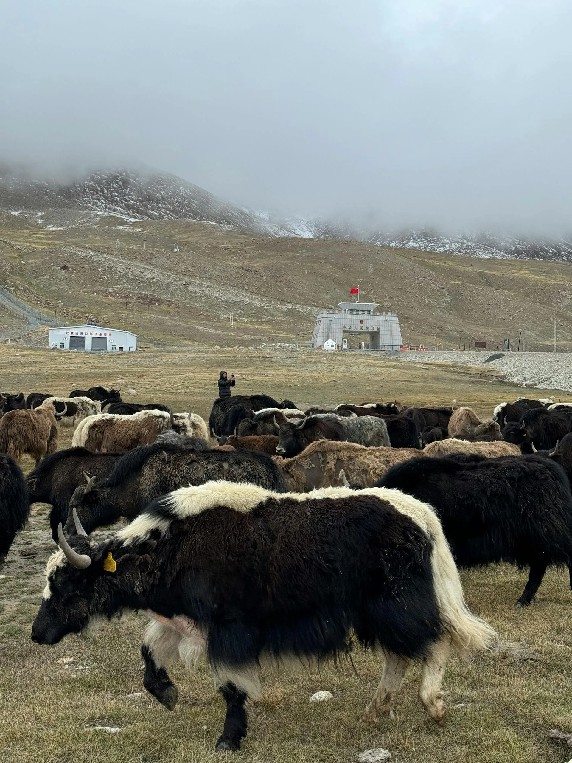
A yak grazing the high plateau near the Khunjerab Pass border marker
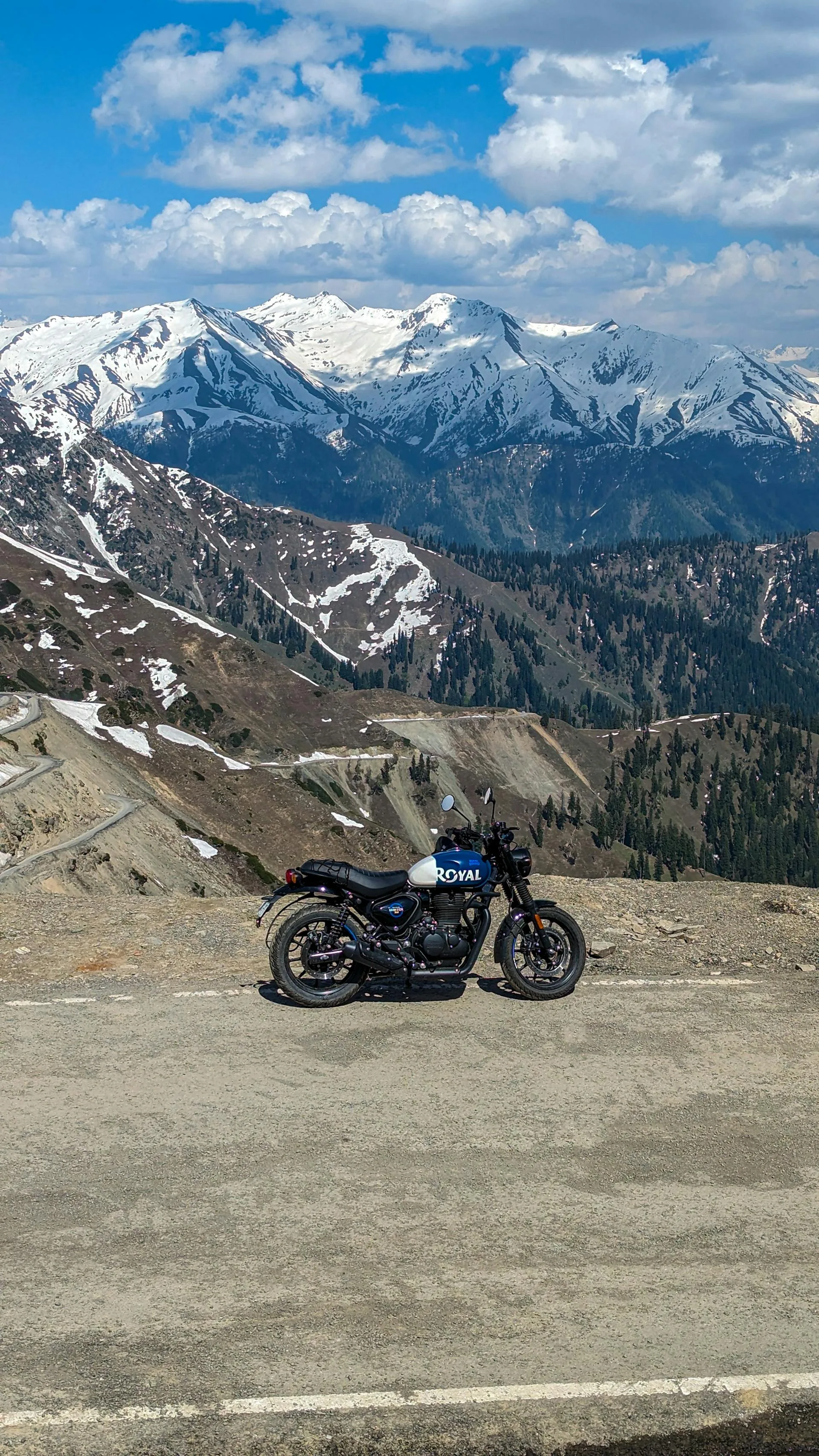
A motorcyclist on the Karakoram Highway climbing toward Khunjerab Pass
Snow-covered high peaks of Khunjerab National Park on the climb to the pass
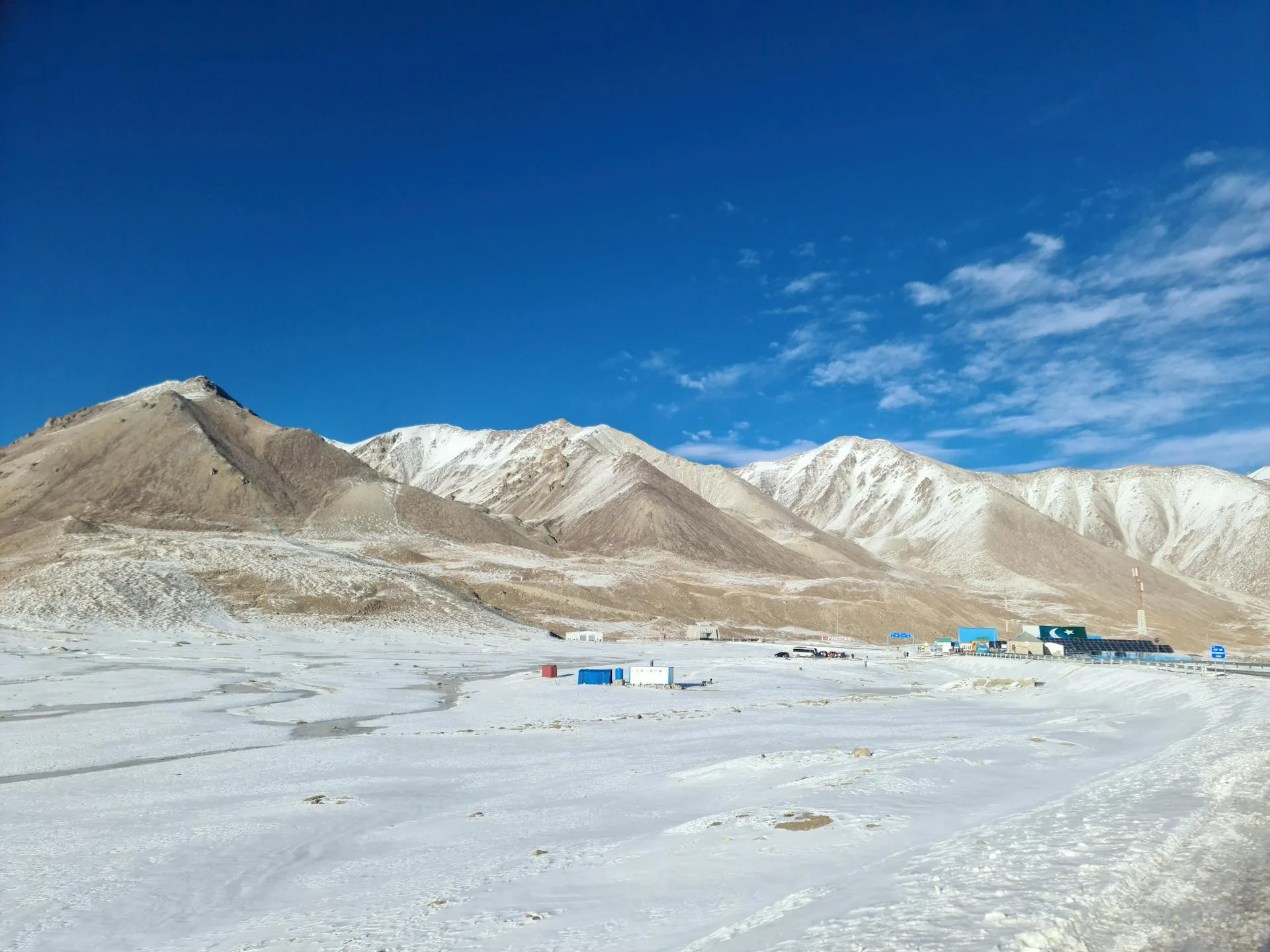
The bare high-alpine tundra of the Khunjerab plateau near the China border

Last updated: · Reviewed by Javeed Iqbal, Founder

Duration

5-7 Days

Difficulty

Moderate

Group Size

2-10 people

Best Season

Jun-Oct

About This Tour

This 7-day tour puts Khunjerab Pass front and centre. At 4,693 m on the Pakistan-China border, it is the highest paved international border crossing in the world, and reaching the gate, photographing it and standing on the line is the headline of the trip. We run it as a tighter, pass-led itinerary: Gilgit in and out, the Hunza landmarks taken in on the way up, and one big day built around the border itself.

The journey is the build-up to the pass. From Gilgit the Karakoram Highway climbs north past the Rakaposhi viewpoint near Nagar, the turquoise Attabad Lake formed by the 2010 landslide, and the saw-tooth Passu Cones, gaining altitude in stages so the body has time to adjust before the high day. Sost, the last Pakistani town with its customs post, sits about 75 km and two hours below the top, where the road enters Khunjerab National Park for the final climb.

Khunjerab National Park is the wild frame around the pass. This high-alpine reserve protects snow leopard, Marco Polo sheep, Himalayan ibex, blue sheep and golden marmot, with golden eagles overhead. As the road climbs above 4,000 m the vegetation thins to tundra, yaks graze the plateau, and marmots and ibex are the realistic sightings while your guide works the ridgelines with binoculars. The top is bare and windswept, with the border gate and the world's highest ATM.

The pass day is framed as a high-altitude day-trip: a fast climb to 4,693 m and back, which we manage with acclimatisation lower down, a short stay at the top and plenty of fluids. The grading is moderate, group size runs 2 to 10, and the price is $950. We sell the pass for the snow-free window only.

The Khunjerab Pass Day

The pass day is the reason for the trip and we give it the room it needs. From the upper valley the road runs to Sost, the last Pakistani town and its customs and immigration post, about 75 km and two hours below the top. Above Sost it enters Khunjerab National Park and climbs hard, past the park checkpoint, until the orchards are long gone and the landscape is tundra and rock.

At the top you have time at the border marker for photographs at the China gate, a look at the world's highest ATM, and wildlife spotting with binoculars across the plateau. The realistic sightings on the climb are golden marmots and Himalayan ibex, with yaks grazing near the summit and golden eagles working the thermals; snow leopard and Marco Polo sheep live in the park but are very rarely seen. We keep the stay at the top short, both for the weather and for the altitude, then descend to a lower night.

Key stops on the road from Gilgit to the Khunjerab border, with height or distance and what each one does on the trip.
PlaceHeight or distanceRole on the trip
Gilgit~270 km south of the passStart and finish, first acclimatisation night
Karimabad~2,438 mNights 2 and 5, Baltit Fort, Eagle's Nest
Borith Lake~2,600 mGentle walk on day 5, after the pass
Sost~75 km, ~2 hr below the topLast Pakistani town, customs post
Khunjerab Pass border4,693 m (15,397 ft)Day 4 high point, China gate
Road high point4,714 mHighest road elevation near the marker

Day-by-Day Itinerary

1

Islamabad to Gilgit

Fly to Gilgit, weather permitting, or drive the KKH. A first acclimatisation night, with an easy afternoon city walk and the Kargah Buddha rock carving nearby.
2

Gilgit to Karimabad

Drive north up the Karakoram Highway to Karimabad (~2,438 m), past the Rakaposhi roadside viewpoint near Nagar. Visit Baltit Fort and head up to the Eagle's Nest viewpoint for sunset over the peaks.
3

Karimabad to Passu

Drive north with an Attabad Lake boat trip on the way, then on to Passu. An afternoon acclimatisation walk and the Passu Cones at dusk, banking altitude before the pass day.
4

Passu to Khunjerab Pass

The big day: through Sost (~75 km, ~2 hr below the top) and into Khunjerab National Park, climbing to the border at 4,693 m. Marmots, ibex and yaks on the way up, photographs at the China gate, then return to Sost or Passu for the night.
5

Return via Gulmit and Borith Lake

A gentler day after the altitude: a stop at Gulmit village and a walk to Borith Lake (~2,600 m), with a view of the Passu Glacier tongue. Drive back down to Karimabad.
6

Karimabad to Gilgit

A morning in Karimabad bazaar, then the drive south to Gilgit. An optional excursion to the Naltar Valley and its coloured lakes is possible for those with energy to spare.
7

Gilgit Departure

Fly Gilgit to Islamabad. Tour ends.

Best Time to Go to Khunjerab Pass and When It Opens

For tourists, the workable window is May to October, and it is snow-dependent. Snowfall controls the top of the road, so the exact start and end shift each year, and we will not promise the pass in April or November. The early and late departures carry the most weather risk; we keep the pass day flexible so we can put it on the clearest morning we get.

Looser online sources quote April to November, but that reflects the China-side trade calendar, not a guarantee that tourists can drive to the marker. Compared with Babusar Pass (4,173 m), which is a seasonal shortcut on a different route, Khunjerab is higher, paved to the top and an international border, which is why it carries a stricter snow-dependent season.

Can Tourists Visit Khunjerab Pass?

Yes. Tourists can drive to the pass and stand at the border marker; it is a popular day-trip target from Hunza and the upper valley in season. What tourists generally cannot do here is cross into China: the gate is the formal border, and actually entering China needs the right Chinese visa and separate arrangements. For nearly all our guests, Khunjerab is a there-and-back day to the top, not a crossing.

You will need Khunjerab National Park entry fees for the pass day, which we arrange as part of the package. There is no separate trekking permit for this road itinerary.

How Hard Is It?

The difficulty is altitude, not walking. You drive almost the whole way, but the pass day is a fast climb to 4,693 m and back, so we treat it as a genuine high-altitude day-trip. We acclimatise in stages on the way up the valley, keep the time at the top short, push fluids, and watch for the headache, breathlessness or nausea of mild altitude sickness.

Because this is a tighter 7-day trip, the acclimatisation runway is shorter than on our longer Hunza-first tour, so the grading here is moderate rather than easy. It is not suitable for guests with serious heart or lung conditions. If you would rather acclimatise over more nights and spend longer in the valley before the pass, our 8-day Hunza to Khunjerab tour gives you that, and travellers who only want the valley itself can look at the Hunza Valley Explorer.

Where Is Khunjerab Pass and How High Is It?

Khunjerab Pass sits at 4,693 metres (15,397 feet) on the Pakistan-China border, high in the Karakoram at the northern tip of Gilgit-Baltistan. It is the highest paved international border crossing in the world, marking the frontier between Pakistan's Gojal (upper Hunza) region and China's Xinjiang. The pass is the highest point on the Karakoram Highway; a 4,714 m figure sometimes quoted nearby is the road's maximum elevation close to the marker, not the border itself. From Gilgit it is roughly 270 kilometres north up the KKH, and from Sost, the last Pakistani town, about 75 kilometres and two hours of climbing. The whole approach runs through Khunjerab National Park, a high-alpine reserve for snow leopard, Marco Polo sheep, Himalayan ibex and golden marmot.

Khunjerab Pass Weather and Temperature

The weather at Khunjerab is high-alpine and cold all year, and it drives everything about a visit. Even in July and August, daytime temperatures at the top usually sit around 5 to 15°C and can fall to near or below freezing when cloud rolls in, with a wind that bites at 4,693 metres; nights are below freezing for much of the year. Snow can fall in any month and lies deep on the pass through winter, which is why the road over the top is effectively closed to tourists from about late December until April and reliably open only from May to October. Come with proper warm layers, a windproof jacket, hat and gloves even in midsummer, and treat the thin air seriously. The clearest mornings usually come in June, September and early October.

Why Book With Us

We are a Gilgit-Baltistan operator and have run the Khunjerab road since 2015, so we know how to deliver the pass on a tight seven days: stage the altitude on the way up, keep the time at the top short, and build the pass day to land on a clear morning. Our guides double as wildlife spotters in the national park and know where the marmots and ibex sit. We are honest that the top is snow-dependent and that this is a real altitude day on a shorter acclimatisation runway, and we plan the trip so the journey up still rewards you even if fresh snow shuts the marker.

What's Included

Gilgit-Islamabad flights (both directions)
All transport on KKH including jeep to Khunjerab
6 nights accommodation (guesthouses in Karimabad, Passu, Sost, Gilgit)
All meals throughout
English-speaking guide and wildlife spotter
Khunjerab National Park entry fees

Not Included

International flights
Travel insurance
Personal expenses and tips

Frequently Asked Questions

How high is Khunjerab Pass?

Khunjerab Pass is 4,693 metres (15,397 ft) above sea level, the world's highest paved international border crossing and the highest point on the Karakoram Highway. You may also see 4,714 m quoted; that is the road's maximum elevation close to the pass, not the border marker. The pass sits on the Pakistan-China border at the northern tip of Gilgit-Baltistan, roughly 270 km north of Gilgit and about 75 km and two hours of climbing above Sost, the last Pakistani town. Because you drive almost the whole way, the height arrives fast, so we treat the pass day as a genuine high-altitude day-trip. We stage the altitude on the way up, with nights in Gilgit, Karimabad at about 2,438 m and Passu, then keep the stay at the top short and push fluids. Watch for headache, breathlessness or nausea. The trip is not suitable for guests with serious heart or lung conditions.

Can tourists visit Khunjerab Pass?

Yes. In season, tourists can drive up to Khunjerab Pass and stand at the border marker, and it is a popular day-trip from Hunza and the upper valley. What you generally cannot do on a tour like ours is cross into China. The gate is the formal border between Pakistan and Xinjiang, and entering China needs the right Chinese visa and separate arrangements, so for almost every guest this is a there-and-back day to the top. On the way you pass Sost, the last Pakistani town with its customs and immigration post, and then the Khunjerab National Park checkpoint. You need park entry fees for the pass day, and we arrange those as part of the package. There is no separate trekking permit for this road itinerary. At the top you get time for photographs at the China gate, a look at the world's highest ATM and some wildlife spotting before we head back down.

Is Khunjerab Pass worth visiting?

Yes, if standing at the world's highest paved international border, at 4,693 m with the Karakoram all around you, appeals to you. The top itself is bare and windswept, with the China gate for photographs and the world's highest ATM, so much of the value is in the journey up. The road from Gilgit passes the Rakaposhi viewpoint near Nagar, Attabad Lake and the Passu Cones, then climbs through Khunjerab National Park, where marmots, ibex and grazing yaks are the realistic sightings. Our 7-day tour at $950 per person builds the trip around one pass day, with Baltit Fort, the Eagle's Nest and Borith Lake around it. Be clear on the limits before you book: you cannot cross into China on this tour, the top is snow-dependent, and it is a real altitude day. If fresh snow shuts the marker, the Hunza stops still make the week worthwhile.

When is the best time to go to Khunjerab?

Go between June and October, which is the season we sell this tour for. Snowfall controls the top of the road, so the exact opening and closing shift from year to year, and heavy snow shuts the pass to tourists from about late December until April. We will not promise the border marker in April or November. You will see April to November quoted online, but that is the China-side trade calendar, not a guarantee that you can drive up to the gate. The clearest mornings usually come in June, September and early October. Even in July and August the top sits at around 5 to 15°C and can drop to freezing when cloud comes in, so bring warm layers, a windproof jacket, hat and gloves. The early and late departures carry the most weather risk, so we keep the pass day flexible and put it on the clearest morning we get.

How far is Khunjerab Pass from Gilgit and Sost?

Khunjerab Pass is roughly 270 km north of Gilgit on the Karakoram Highway, and about 75 km and two hours of climbing above Sost, the last Pakistani town. Nobody should do Gilgit to the pass in one push, so we split the road into stages. Day 2 takes you from Gilgit to Karimabad past the Rakaposhi viewpoint near Nagar. Day 3 continues to Passu with a boat trip on Attabad Lake, the lake formed by the 2010 landslide. Day 4 is the pass day: through Sost, into Khunjerab National Park, up to the border at 4,693 m, then back to Sost or Passu for the night. Most guests fly Islamabad to Gilgit to start, weather permitting, or drive the KKH if flights are cancelled. The return runs through Gulmit, Borith Lake and Karimabad, and you fly Gilgit to Islamabad on day 7.

Will I get altitude sickness at Khunjerab?

You might feel it, because the pass day is a fast climb to 4,693 m (15,397 ft) and back, and this is a genuine high-altitude day-trip even though you drive almost the whole way. The difficulty is the thin air, not the walking. We manage it by gaining height in stages: a first night in Gilgit, then Karimabad at about 2,438 m, then Passu with an afternoon acclimatisation walk before the big day. At the top we keep the stay short, push fluids, and watch for headache, breathlessness or nausea, then descend to Sost or Passu for the night. Because this is a tighter 7-day trip with a shorter acclimatisation runway, we grade it moderate rather than easy. It is not suitable for guests with serious heart or lung conditions. If you want more nights in the valley before the pass, our 8-day Hunza to Khunjerab tour gives you that extra time.

What wildlife lives in Khunjerab National Park?

Khunjerab National Park protects snow leopard, Marco Polo sheep, Himalayan ibex, blue sheep and golden marmot, with golden eagles overhead, but what you are likely to see is a shorter list. The realistic sightings on the climb are golden marmots and Himalayan ibex, with yaks grazing the plateau near the summit and golden eagles working the thermals. Snow leopard and Marco Polo sheep live in the park but are very rarely seen, so do not book this trip expecting them. The park begins above Sost, and as the road climbs above 4,000 m the vegetation thins to tundra and rock. Our English-speaking guide doubles as a wildlife spotter, knows where the marmots and ibex sit, and works the ridgelines with binoculars on the way up. Bring your own binoculars if you have a pair. The park entry fees for the pass day are included in the tour price, so there is nothing extra to pay at the checkpoint.

How much does the Khunjerab Pass tour cost?

The 7-day Khunjerab Pass Explorer is priced from $950 per person. That figure covers the Gilgit-Islamabad flights in both directions, all transport on the Karakoram Highway including the jeep up to Khunjerab, 6 nights in guesthouses in Karimabad, Passu, Sost and Gilgit, all meals, an English-speaking guide who also works as your wildlife spotter, and the Khunjerab National Park entry fees for the pass day. What you pay for separately is your international flight into Pakistan, travel insurance, and personal spending and tips. Group size runs from 2 to 10 people, and the final price can shift with group size, dates and any changes you ask for, so contact us for an exact quote before you book. You can cancel for free up to 30 days before departure. There is no separate trekking permit to buy for this road itinerary.

What is the weather like at Khunjerab Pass?

The weather at Khunjerab is high-alpine and cold all year, and it shapes every part of a visit. Even in July and August, daytime temperatures at the top usually sit around 5 to 15°C and can fall to near or below freezing when cloud rolls in, with a biting wind at 4,693 m. Nights are below freezing for much of the year, and snow can fall in any month. Heavy snow closes the top of the road to tourists from about late December until April, and we sell this tour from June to October. The clearest mornings usually come in June, September and early October. The early and late departures carry the most weather risk, so we keep the pass day flexible and put it on the clearest morning we get. Bring warm layers, a windproof jacket, hat and gloves even in midsummer, and treat the thin air seriously when you are out of the vehicle.

How cold does Khunjerab Pass get?

Summer days at the top hover around 5 to 15°C and nights fall below freezing; in deep winter temperatures on the pass drop far below zero and the road is buried in snow. Because the pass sits at 4,693 m, it feels much colder than the valley below even on a sunny day, so dress for winter conditions whatever the month.

Which country is Khunjerab Pass in?

The pass is the border itself: it marks the frontier between Pakistan and China. The Pakistani side is in Gojal, upper Hunza, in Gilgit-Baltistan, and the Chinese side is in the Xinjiang region. Our tour visits the Pakistani side and the border marker; it does not cross into China.

Is Khunjerab Pass open in winter?

No. Heavy snow closes the top of the road to tourists from about late December until April. It is reliably open only from May to October, and even then the final stretch is snow-dependent. We plan pass days inside that window and never promise the marker in the shoulder months.

From

$950

per person

* Prices may vary. Contact us for accurate, customized pricing.

Duration5-7 Days
DifficultyModerate
Group Size2-10 people
Best SeasonJun-Oct
Max Altitude4,693 m
Book This Tour Ask a Question

Free cancellation up to 30 days before departure

Ready for Your Next Adventure?

Join our community of explorers and discover the journey of a lifetime. Our expert team is ready to help you plan your perfect expedition.