Diran Peak
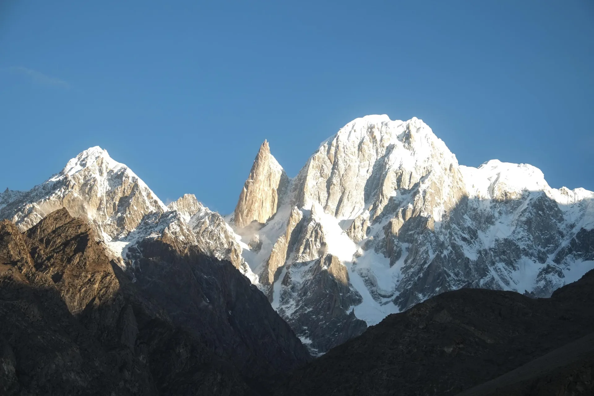
The ice pyramid above Rakaposhi
Last updated: · Reviewed by Javeed Iqbal, Founder
Elevation
7,266m
Difficulty
Extreme
Duration
25 to 35 Days
Best Season
Jun to Aug
Diran Peak expedition: climbing the pyramid above Minapin (7,266m)
Diran is a 7,266-metre (23,839-foot) snow pyramid in the Karakoram of Gilgit-Baltistan, rising directly east of Rakaposhi above the Minapin valley in Nagar. From the meadows of Tagaphari it looks like the friendliest big mountain in Pakistan: a clean, even-angled cone of snow with no obvious difficulty. That appearance is a trap. Diran has turned back strong expeditions and killed experienced climbers, and its gentle slopes hide crevasses, deep unstable snow and real avalanche danger. A Diran expedition is a serious 25-to-35-day undertaking that rewards glacier skill and judgement far more than raw technical climbing.
Where is Diran?
Diran stands in the Rakaposhi-Diran massif of the western Karakoram, in the Nagar district of Gilgit-Baltistan, just east of Rakaposhi (7,788m) and between the Minapin and Bagrot valleys. It is among the most photographed peaks in Pakistan because it shares its northern approach with Rakaposhi: trekkers who walk up to the Rakaposhi Base Camp viewpoint at Tagaphari are looking straight across the Minapin Glacier at Diran. At 7,266 metres it is a true seven-thousander, ranked around 93rd in the world, even though its symmetrical shape can make it look smaller and simpler than it really is.
The deception: why Diran is more serious than it looks
Diran's reputation rests on a contradiction. The standard route follows moderately angled snow slopes, nothing like the steep ice or rock of the harder Karakoram peaks, and yet the mountain has a long history of accidents. The reason is objective hazard, not technical difficulty. The snow on Diran is often deep and slow, swallowing climbers to the waist and hiding crevasses that can open without warning. The same slopes that look so inviting load up for avalanche after the frequent Karakoram snowfalls, and parties have been caught out high on the mountain when conditions turned. Diran is not a peak to underestimate, and a good expedition treats it with the respect usually reserved for a harder-looking objective.
The South Ridge: Diran's standard route
The normal route is the South Ridge, reached across the Minapin Glacier, the line of the 1968 first ascent. From Base Camp the climb works up onto the glacier and then up broad snow slopes and the ridge toward the summit, with a series of camps placed as the team acclimatises. The angle is forgiving by Karakoram standards, but breaking trail through deep snow is exhausting and the route demands constant attention to crevasses and slope stability. The summit pyramid is a straightforward but airy snow climb. Fixed ropes are placed where needed, and the descent follows the same line.
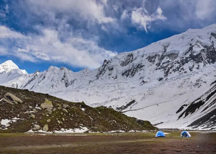
The approach: Minapin, Hapakun and the Diran Glacier
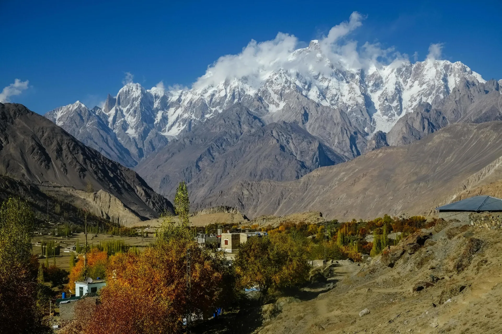
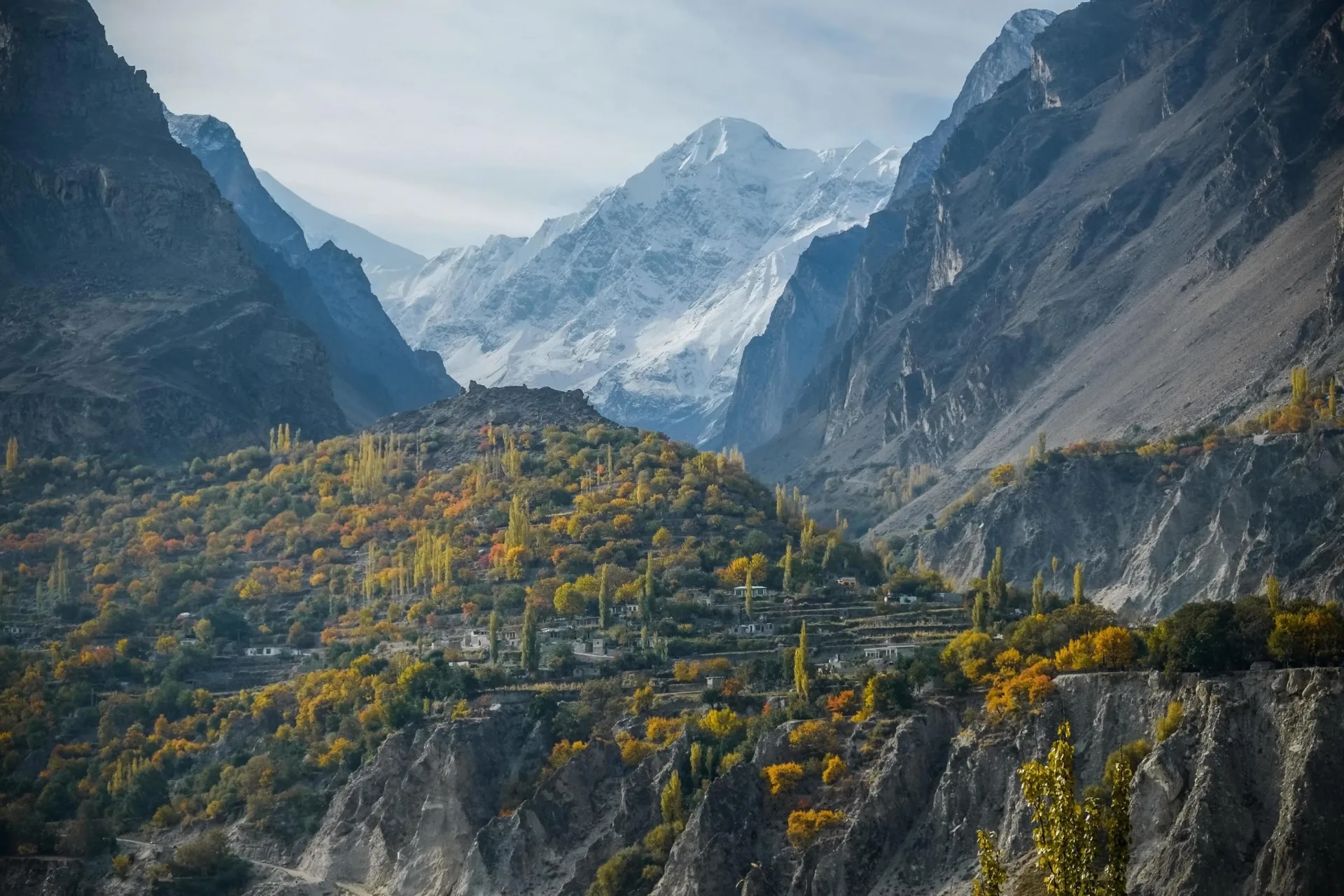
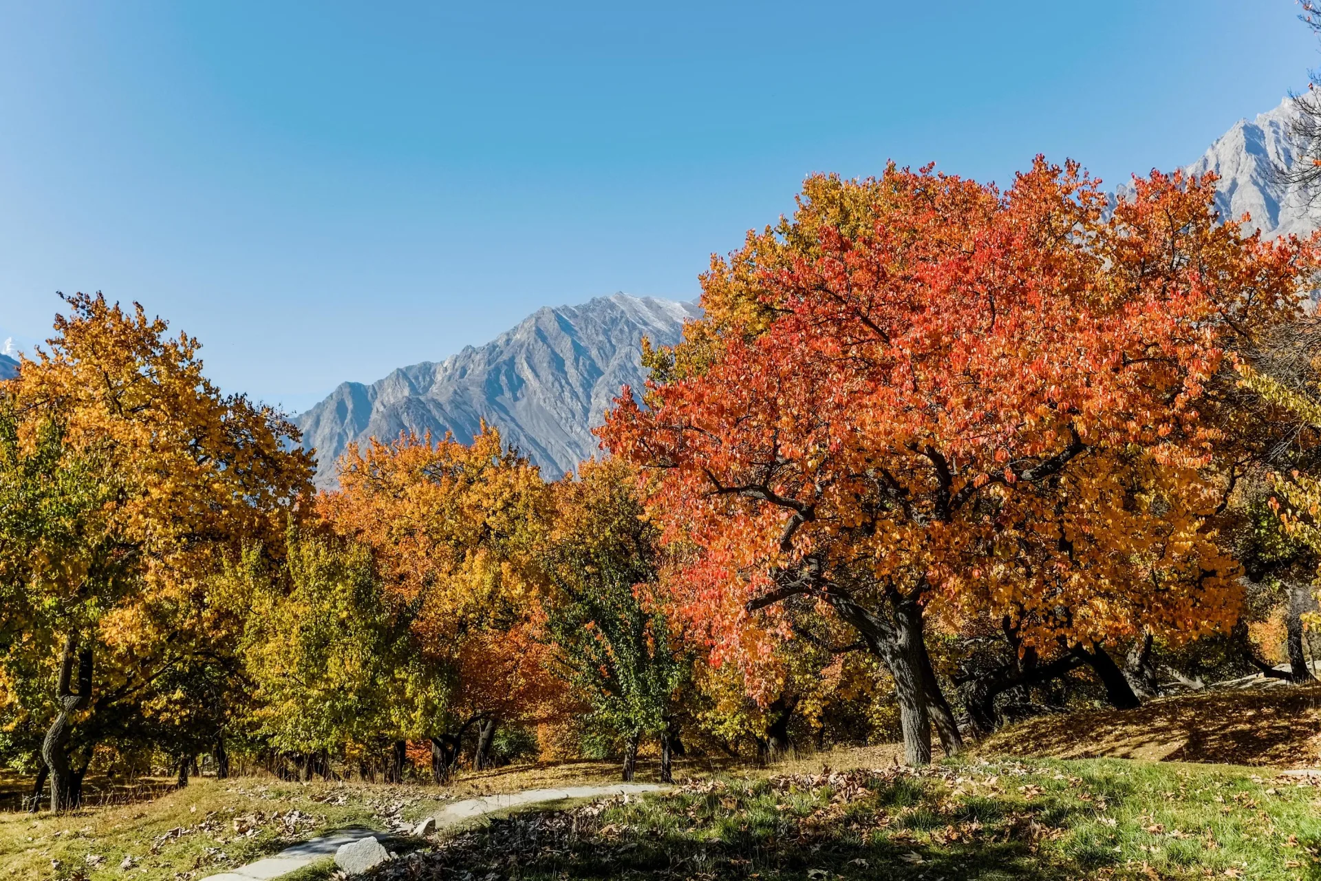
Diran shares its approach with the Rakaposhi Base Camp trek, one of the finest short treks in Pakistan. From Gilgit it is a two-to-three-hour drive into the Nagar valley to the village of Minapin at around 2,000 metres, the jumping-off point for the whole Rakaposhi-Diran massif. The trail climbs behind the village to Hapakun at about 2,800 metres and then to the Tagaphari meadow, the famous Rakaposhi viewpoint. From there the route crosses the Minapin Glacier to reach Diran Base Camp at roughly 3,700 metres, at the foot of the mountain. The walk in is short by Karakoram standards and spectacular, with Rakaposhi filling the sky behind you and Diran ahead.
How hard is Diran, and is it a good first seven-thousander?
Diran is often suggested as an accessible seven-thousander, and in terms of pure climbing difficulty that is fair: there is no sustained steep ice, no rock crux, no death-zone altitude. But accessible does not mean safe. The deep snow and crevasse hazard make Diran a poor choice for anyone without solid glacier-travel experience, and its accident record is a warning rather than a footnote. We treat Diran as a serious expedition for climbers who already move confidently on glaciated terrain, manage avalanche risk, and have the fitness for long days of trail-breaking at altitude. For the right climber it is a wonderful and attainable summit; for the unprepared it has proven deadly.
Best time to climb Diran
The season runs from June to August, the Karakoram summer, when the weather is most settled, with July usually the most reliable month. Conditions on Diran are very snow-dependent. Too early in the season and the slopes carry dangerous quantities of fresh snow; a good spell of stable weather is needed to consolidate the route and reduce the avalanche risk. A full expedition of 25 to 35 days allows for the approach, acclimatisation rotations, and the patience to wait for the snowpack and the weather to come right before a summit push.
Acclimatisation, camps and rotations
Like any high peak, Diran is climbed in stages. After establishing Base Camp, the team makes rotations up the route, carrying loads to higher camps, sleeping high, and returning to rest before the summit bid. Diran sits below the altitude where supplemental oxygen becomes necessary and is almost always climbed without it, though a well-run expedition carries emergency oxygen and a strong support team. Confident cramponing, roped glacier travel and crevasse-rescue skills matter here in a way they do not on more technical but less crevassed peaks.
The dangers: crevasses, soft snow and avalanche
Diran's hazards reward caution and punish complacency. The Minapin Glacier and the slopes above are heavily crevassed, and many of the crevasses are bridged by snow that hides them completely. Deep, soft snow makes for brutally slow progress and raises the avalanche risk, especially after storms and in the warmth of the day. Most serious incidents on Diran have come down to these objective dangers rather than to hard climbing. The defence is the usual one on big mountains: careful timing, conservative decisions, roped travel on the glacier, and the discipline to turn back when the snow or weather is not safe.
Permits, royalty and cost
Diran requires a Pakistan mountaineering permit and a peak royalty paid to Gilgit-Baltistan, with a liaison officer assigned to the expedition. As a peak in the 7,000-metre band, its royalty is modest compared with the 8,000-metre giants, and the short approach keeps logistics simpler than on the Baltoro peaks. A fully supported expedition, covering permit and liaison, transport from Gilgit, the Minapin approach, fixed camps, climbing staff and base-camp services, typically starts from around $14,000 per climber. Pricing here is indicative; we quote each expedition individually.
What it takes to climb Diran
Diran rewards mountain sense over technical wizardry. We expect climbers to be comfortable on glaciated terrain, competent with crampons, ice axe and ropework, and trained in crevasse rescue, with the fitness for long days breaking trail through deep snow at altitude. Previous experience at 5,000 to 6,000 metres is the usual minimum. Just as important is the temperament to respect a mountain that looks easy: the willingness to wait for safe conditions and to turn around when they do not arrive. Those qualities are what keep Diran the rewarding climb it can be rather than the dangerous one it has sometimes been.
Climb Diran with Rakaposhi: the twin peaks of Minapin
Because Diran and Rakaposhi share the Minapin approach, the two make a natural pair. Climbers come to the Rakaposhi-Diran massif for Diran as a serious but attainable seven-thousander, while trekkers walk the same trail to the Rakaposhi Base Camp viewpoint at Tagaphari for the views alone. If you are drawn to this corner of the Karakoram, ask us about combining a Diran expedition with the Rakaposhi Base Camp trek, or about Rakaposhi itself for those after a bigger objective.
Go With Guide Pakistan runs fully supported Diran expeditions with experienced Pakistani high-altitude guides, transport and logistics from Gilgit, the Minapin approach, fixed camps, and full base-camp support. Whether Diran is your first seven-thousander or a step toward the bigger peaks of the range, our team will help you climb it safely.
Climbing History
1958
Early Attempts
Early Attempts
British (1958), German (1959) and Austrian (1964) expeditions all attempted Diran and were turned back by bad weather, deep snow and avalanches, an early warning of the mountain's deceptive danger.
1968
First Ascent
First Ascent
Austrians Rainer Goeschl, Rudolf Pischinger and Hanns Schell made the first ascent in alpine style, climbing from the Minapin Glacier by the south ridge, the line that remains the standard route today.
1980s
A Mountain That Deceives
A Mountain That Deceives
Drawn by its gentle angle and beautiful shape, more parties came to Diran, but a steady toll of accidents from hidden crevasses and avalanches earned it a reputation as one of the more dangerous seven-thousanders for its grade.
Present
A Sought-After Seven-Thousander
A Sought-After Seven-Thousander
Today Diran is a popular guided objective for climbers seeking an attainable but genuine 7,000-metre summit, usually combined with the Minapin approach shared with the Rakaposhi Base Camp trek.
Recommended Reading
High Asia: An Illustrated History of the 7,000 Metre Peaks
by Jill Neate (1989)
High Asia: An Illustrated History of the 7,000 Metre Peaks
by Jill Neate (1989)
Himalaya Alpine Style
by Andy Fanshawe & Stephen Venables (1996)
Himalaya Alpine Style
by Andy Fanshawe & Stephen Venables (1996)
Frequently Asked Questions About the Diran Peak Expedition
How tall is Diran and where is it?
How tall is Diran and where is it?
Diran is 7,266 metres (23,839 feet) high, a true seven-thousander in the Karakoram of Gilgit-Baltistan, Pakistan. It rises east of Rakaposhi in the Nagar district, between the Minapin and Bagrot valleys, and is climbed from the village of Minapin.
Is Diran a good beginner 7,000m peak?
Is Diran a good beginner 7,000m peak?
Diran is accessible in terms of climbing difficulty, with no steep ice or rock crux, but it is not a safe choice for beginners. Deep snow, hidden crevasses and avalanche danger have made it one of the more dangerous seven-thousanders for its grade. It suits climbers who already have solid glacier-travel and crevasse-rescue skills.
What is the standard route up Diran?
What is the standard route up Diran?
The standard route is the South Ridge, reached across the Minapin Glacier, the line of the 1968 Austrian first ascent. It follows moderately angled but heavily crevassed and snow-loaded slopes from Diran Base Camp at about 3,700 metres to the summit pyramid.
How long does a Diran expedition take, and when is the best time?
How long does a Diran expedition take, and when is the best time?
A full Diran expedition runs about 25 to 35 days, including the short Minapin approach, acclimatisation rotations and waiting for safe snow and a summit weather window. The best season is June to August, with July usually the most settled month.
Can I combine Diran with the Rakaposhi Base Camp trek?
Can I combine Diran with the Rakaposhi Base Camp trek?
Yes. Diran and Rakaposhi share the same Minapin trailhead, and Diran Base Camp lies just across the Minapin Glacier from the Tagaphari viewpoint used by the Rakaposhi Base Camp trek. We can build an itinerary that pairs the climb with the trek, or with a wider Hunza and Nagar programme.
How much does a Diran expedition cost?
How much does a Diran expedition cost?
A fully supported Diran expedition typically starts from around $14,000 per climber, covering permit and liaison, transport from Gilgit, the Minapin approach, fixed camps, high-altitude support and base-camp services. We quote each expedition individually.
What's Included
Not Included
Ready for Your Next Adventure?
Join our community of explorers and discover the journey of a lifetime. Our expert team is ready to help you plan your perfect expedition.