
Gondogoro La
Panoramic views of four eight-thousanders

Last updated: · Reviewed by Javeed Iqbal, Founder
Elevation
5,585m
Difficulty
Challenging
Duration
16 to 20 Days
Best Season
Jun to Aug
Gondogoro La (5,585m): the high pass with four 8000ers in one view
Gondogoro La is the famous high pass that turns the K2 Base Camp trek into a one-way traverse of the central Karakoram, and it is the single best viewpoint in the range. At 5,585 metres it is not a summit but a glaciated col, reached on fixed ropes, where four of the world's fourteen 8,000-metre peaks stand in a row across the sky: K2, Broad Peak, Gasherbrum I and Gasherbrum II. Crossing it links the Baltoro glacier and Concordia with the Hushe valley, and it is the grand finale of what many people call the greatest trek on earth. This guide covers where it is, what the crossing involves, and how to prepare for it.
Where is Gondogoro La?
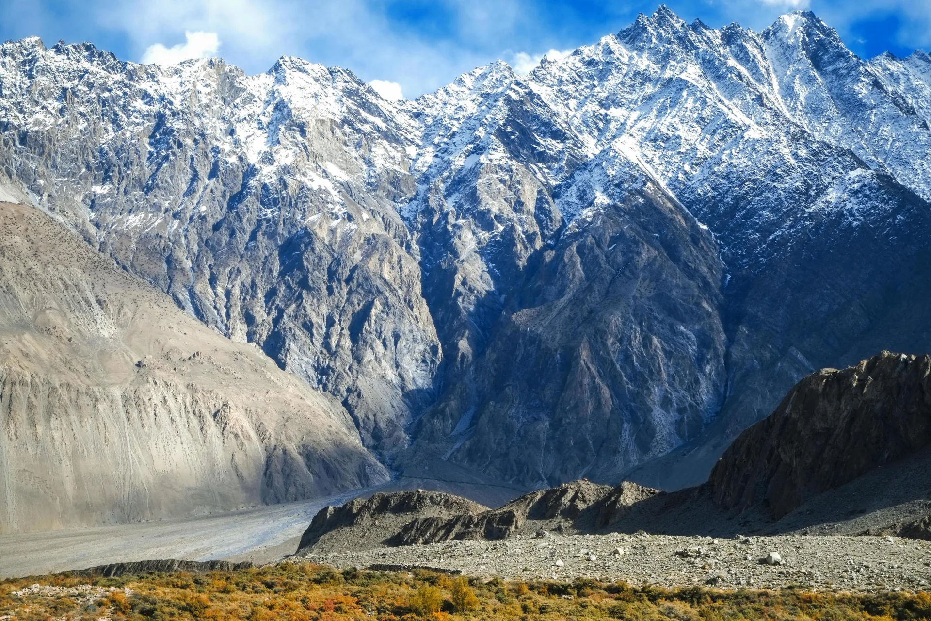
Gondogoro La lies in the central Karakoram of Gilgit-Baltistan, about 25 kilometres south of K2, inside Central Karakoram National Park. It connects the Vigne glacier, a branch of the Baltoro, on the north with the Gondogoro glacier and the Hushe valley to the south. Most parties cross from north to south: in along the Baltoro to Concordia and K2 Base Camp, then over the pass and down to Hushe. The col itself is a snow-and-ice saddle rather than any marked point, and it is only passable in summer, when the route is in condition and the ropes are fixed.
Four 8000ers from one pass
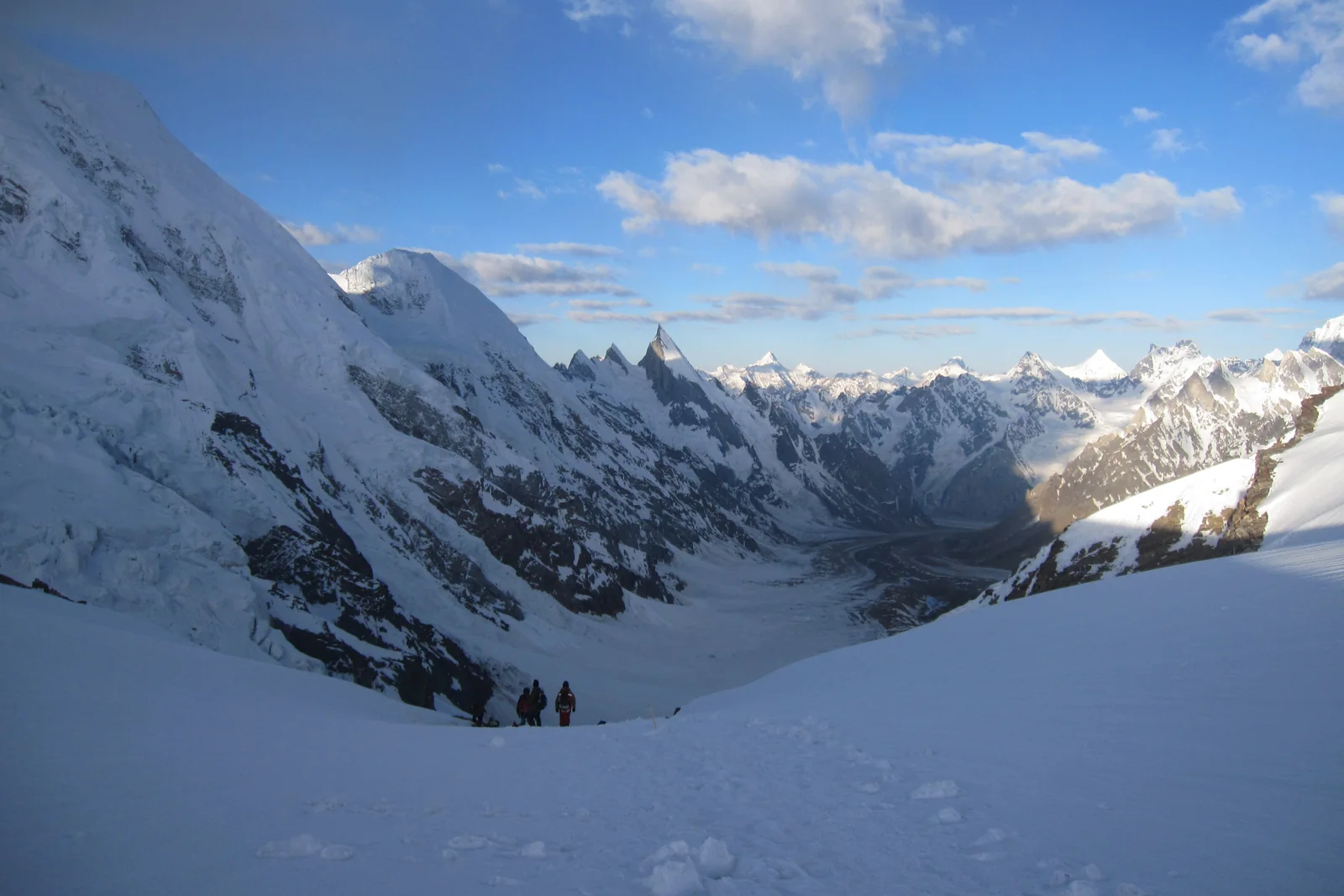
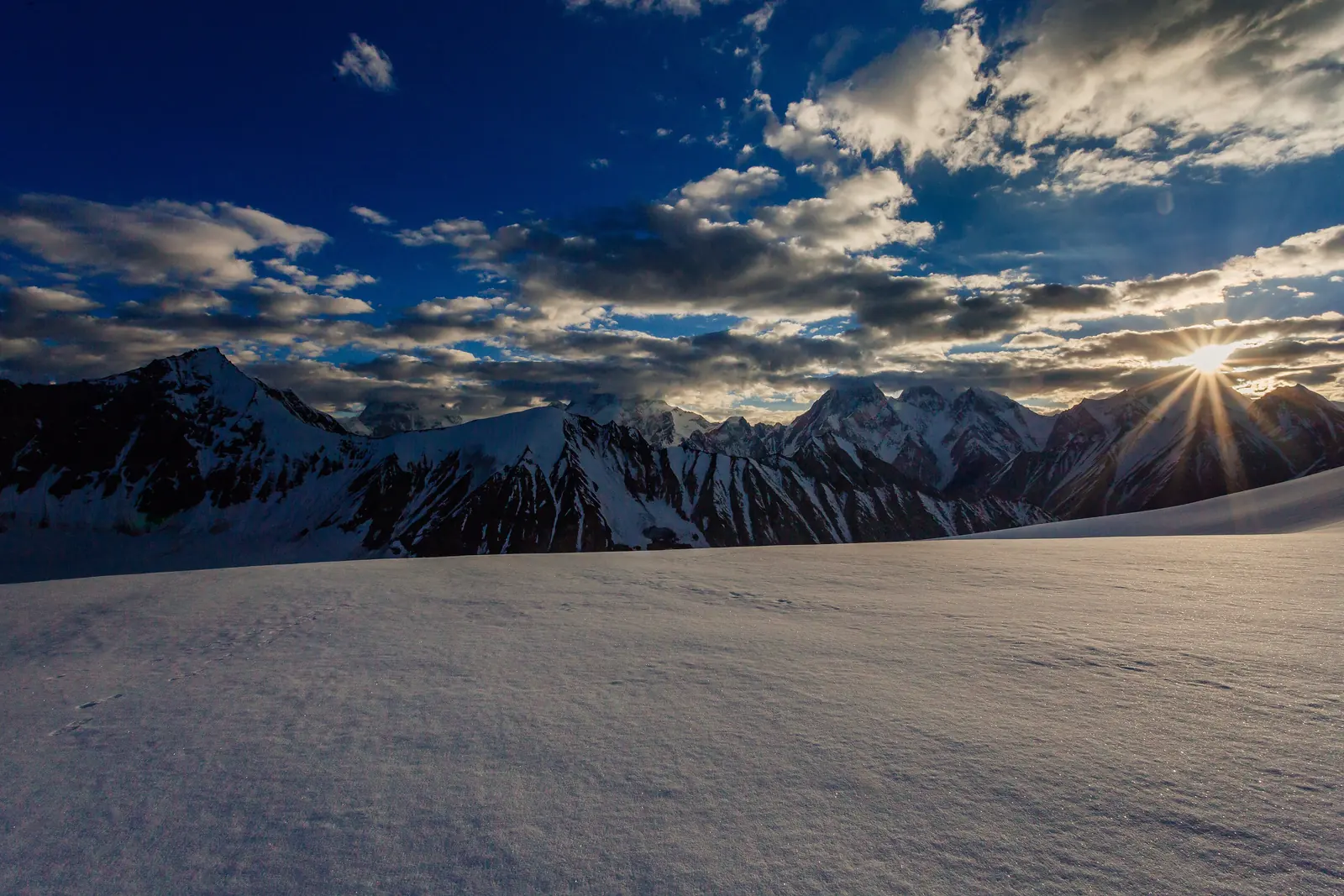
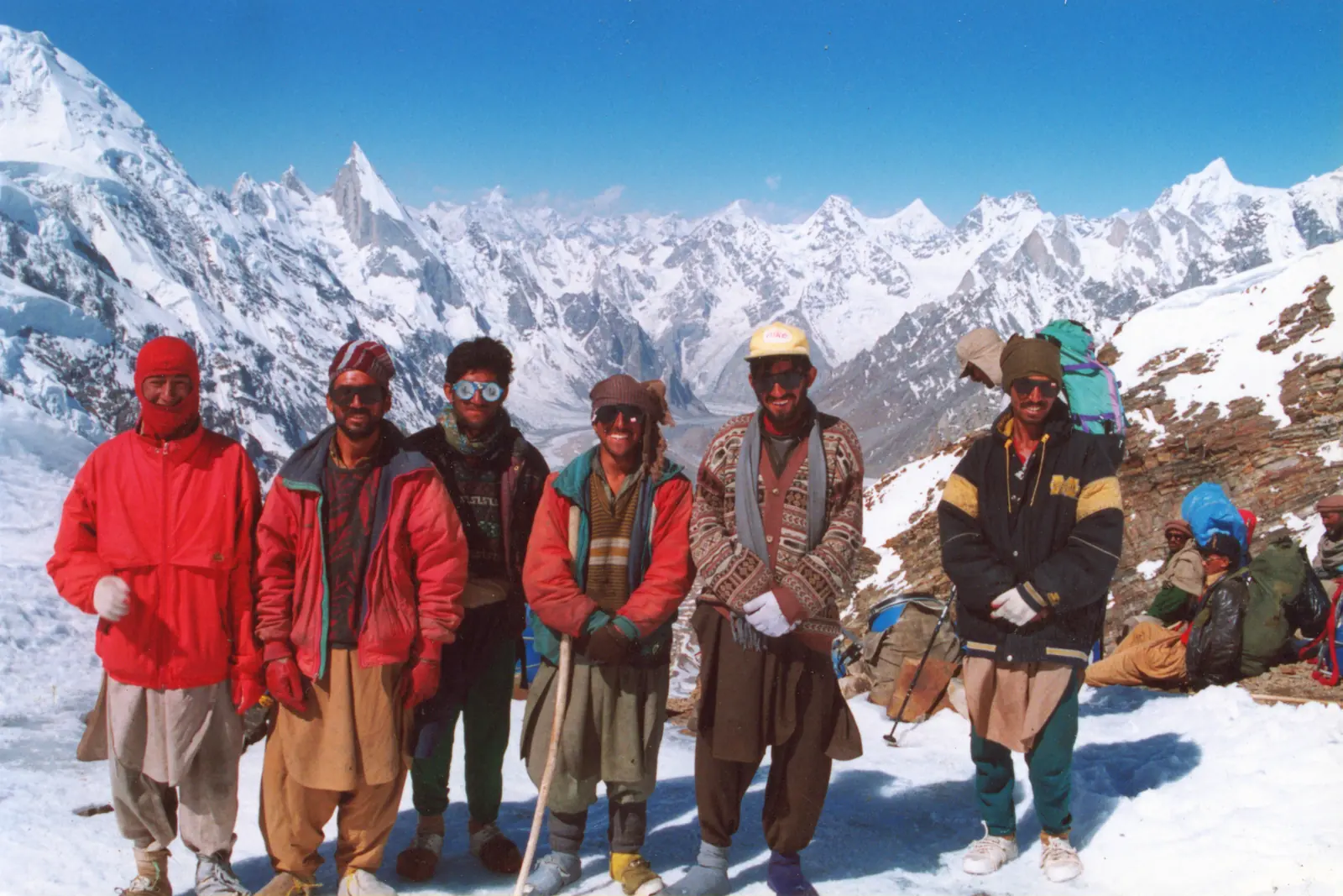
There is nowhere else on earth where you can stand on a single pass and see four 8,000-metre peaks at once. From the top of Gondogoro La the skyline holds K2 (8,611m), Broad Peak (8,051m), Gasherbrum I (8,080m) and Gasherbrum II (8,035m), with Gasherbrum IV, Chogolisa and Masherbrum filling the gaps and the spear of Laila Peak (6,096m) rising across the Gondogoro valley to the south. Crossings are timed to reach the col at first light, when the peaks catch the sunrise and the snow is still firm underfoot.
Is it a pass or a peak?
Gondogoro La is a pass, not a summit, and the distinction matters. The 5,585-metre figure is the height of the col, not of a climbed peak. The objective everyone comes for is the crossing itself, graded as a technical trekking pass rather than an expedition. There is no summit push, but there is a steep, roped glacier headwall on the north side and an exposed descent on the south that both demand real care. If you want an actual first-6000er to climb in this region, the snow peaks above Shimshal such as Minglik Sar are better suited.
How hard is the crossing?
The pass is the hardest day of the whole trek. The north side is a snow-and-ice slope of around 45 degrees, fixed with ropes that you ascend on a jumar, and the south side is a steep, often icy descent down more fixed lines. You need crampons, a harness, a jumar, slings, carabiners and a helmet, and you need to be comfortable using them on exposed ground in the dark. Fit trekkers with a strong guide and the porters who fix and maintain the ropes manage it every season, but it is not a walk. Rockfall, crevasses and altitude are all real, which is why the crossing is taken so seriously.
The crossing, step by step
From Concordia the route heads south-east up the upper Baltoro past Mitre Peak and onto the Vigne glacier, camping at Ali Camp at about 4,800 metres below the pass. Teams leave Ali Camp around midnight to climb the headwall and reach the col, roughly five hours up, near sunrise, before the sun loosens rock and snow. The descent then drops steeply to Khuspang on the Hushe side, eases through Dalsampa at about 4,150 metres and the riverside camp at Saicho among wild roses and juniper, and finally reaches Hushe village and the road.
The Baltoro approach and Concordia
Half the reward is the walk in. From Askole the trail follows the Braldu river and then the Baltoro glacier for about a week, beneath the Trango Towers and Masherbrum, to Concordia, the meeting of the Baltoro and Godwin-Austen glaciers known as the Throne Room of the Mountain Gods. The K2 Base Camp and Broad Peak Base Camp are short side trips from here. Only after all of that do you turn for the Gondogoro La, which is why the crossing is done as the finale rather than the start.
Best time to cross
The pass is a high-summer objective, broadly late June to early September, with July and August the most reliable. Gondogoro La only opens once the snow has consolidated and the local rope-fixing teams have prepared both sides; early and late in the season it can be closed or dangerous. Even at peak season a crossing can be held back for days by fresh snow or poor visibility, so a good itinerary builds in spare days.
Acclimatisation and fitness
Because the crossing comes after a week or more on the Baltoro at 4,000 to 5,000 metres, most trekkers are well acclimatised by the time they reach Ali Camp, which is one reason the south-to-north direction is far less common. Even so, the pass day is long and strenuous at altitude, so good aerobic fitness and some prior experience on crampons and fixed ropes make a real difference. We brief and practise rope technique before the crossing rather than learning it on the headwall.
Permits and cost
The Gondogoro La trek runs inside Central Karakoram National Park and through restricted border country, so it needs park fees, a trekking permit, and a registered guide and support crew; the rope-fixing and safety team on the pass are part of the package. The full K2 Base Camp and Gondogoro La trek is typically a 16-to-20-day trip from Islamabad. Costs depend on group size and services, so the figure on this page is indicative and we quote each departure individually.
Visa type: trekking. This route is on NADRA's official list of treks, so you need Pakistan's Mountaineering & Trekking visa (Trekking sub-category), not an ordinary tourist visa. You apply online at visa.nadra.gov.pk with your passport, a photo, the trekking application form and a sponsor letter from a tour operator authorised by the Department of Tourist Services, which we issue for our trekkers. Processing normally takes about four weeks, so apply early, and a royalty fee for the trek is paid in Pakistan once the visa is granted.
Go With Guide Pakistan runs the K2 Base Camp and Gondogoro La trek with experienced Balti guides and a dedicated pass crew, alongside the simpler out-and-back K2 Base Camp trek for those who would rather not cross the La. Tell us your experience and dates and we will match you to the right itinerary.
Climbing History
1970s-80s
A Balti crossing
A Balti crossing
Local Balti hunters and porters had long known the Gondogoro area, and as Karakoram trekking opened up, the La emerged as the dramatic high link between the Baltoro and the Hushe valley.
1990s
The classic circuit
The classic circuit
The K2 Base Camp and Gondogoro La crossing became established as one of the great treks of the Karakoram, prized for the four-8000er view from the col.
2000s
The fixed-rope era
The fixed-rope era
Seasonal rope-fixing by local crews on both sides of the pass made the crossing achievable for fit trekkers, not only full expeditions.
2010s-today
A bucket-list trek
A bucket-list trek
The Gondogoro La cemented its reputation as a bucket-list objective, usually crossed north to south as the finale of the K2 Base Camp trek.
Recommended Reading
Trekking in the Karakoram & Hindukush
by John Mock & Kimberley O'Neil (2002)
Trekking in the Karakoram & Hindukush
by John Mock & Kimberley O'Neil (2002)
K2, Triumph and Tragedy
by Jim Curran (1987)
K2, Triumph and Tragedy
by Jim Curran (1987)
Frequently Asked Questions About Gondogoro La
Is Gondogoro La a pass or a mountain?
Is Gondogoro La a pass or a mountain?
It is a pass, not a summit. Gondogoro La is a 5,585-metre glaciated col on the K2-to-Hushe traverse; the 5,585m figure is the height of the pass, not of a climbed peak.
What can you see from Gondogoro La?
What can you see from Gondogoro La?
From the top of Gondogoro La you see four 8,000-metre peaks in one view, which you cannot do from any other pass on earth: K2 (8,611m), Broad Peak (8,051m), Gasherbrum I (8,080m) and Gasherbrum II (8,035m). Gasherbrum IV, Chogolisa and Masherbrum fill the gaps between them, and across the Gondogoro valley to the south the spear of Laila Peak (6,096m) rises above the Hushe side. The col sits at 5,585 metres, about 25 kilometres south of K2 inside Central Karakoram National Park. Teams leave Ali Camp at about 4,800 metres around midnight and climb for roughly five hours so they reach the col near sunrise, when the peaks catch the first light and the snow is still firm underfoot. Clear skies are not guaranteed, even in peak season. Fresh snow or poor visibility can hold a crossing back for days, which is why a good itinerary builds in spare days rather than betting everything on one morning.
How hard is the Gondogoro La crossing?
How hard is the Gondogoro La crossing?
It is the hardest day of the whole trek and a genuine technical crossing, graded PD. The north side is a snow-and-ice headwall of around 45 degrees fixed with ropes that you climb on a jumar, and the south side is a steep, often icy descent down more fixed lines. You wear crampons, a harness and a helmet and carry a jumar, slings and carabiners, and you need to be comfortable using them on exposed ground in the dark. The day starts around midnight from Ali Camp at about 4,800 metres, takes roughly five hours up to the 5,585-metre col, then drops steeply to Khuspang on the Hushe side. Rockfall, crevasses and altitude are all real risks. Fit trekkers with a strong guide and the porters who fix and maintain the ropes get across every season, and we brief and practise rope technique with you beforehand, but it suits people with some crampon experience rather than complete beginners.
How long is the K2 Base Camp and Gondogoro La trek?
How long is the K2 Base Camp and Gondogoro La trek?
The full K2 Base Camp and Gondogoro La trek typically takes 16 to 20 days from Islamabad and back. Much of that is the walk in. From Askole the trail follows the Braldu river and then the Baltoro glacier for about a week, beneath the Trango Towers and Masherbrum, to Concordia, where the Baltoro and Godwin-Austen glaciers meet. From there you make the side trips to K2 Base Camp and Broad Peak Base Camp before turning for the pass. You then head up the Vigne glacier to Ali Camp at about 4,800 metres, cross the 5,585-metre col in a single long day, and descend through Khuspang, Dalsampa at about 4,150 metres and Saicho to Hushe village and the road. The spread between 16 and 20 days comes from spare days, because fresh snow or poor visibility can hold a crossing back for days even in peak season. Costs start from $2,690 per person in a group of nine or more, up to $3,790 for a solo trip.
When is Gondogoro La open?
When is Gondogoro La open?
Gondogoro La is a high-summer crossing, open from June to August, with July and August the most reliable months. The pass only opens once the snow has consolidated and local rope-fixing teams have prepared both the north headwall and the south descent. Early and late in the season it can be closed or dangerous, and even in peak season fresh snow or poor visibility can hold a crossing back for days. That is why a good itinerary builds in spare days, and part of why the full trek runs 16 to 20 days from Islamabad. Timing on the day matters as much as the month. Teams leave Ali Camp at about 4,800 metres around midnight and aim to reach the col near sunrise, before the sun loosens rock and snow on the slopes. If you are choosing dates, aim for July or August and keep your return flight flexible enough to absorb a weather delay at the pass.
Do you need mountaineering experience to cross it?
Do you need mountaineering experience to cross it?
You do not need expedition or summit experience, but you do need to be comfortable on crampons and fixed ropes on steep, exposed ground. The crossing is graded PD, a technical trekking pass rather than a climb. The north side is a roughly 45-degree snow-and-ice slope that you ascend on a jumar, and the south side is a steep, often icy descent down more fixed lines, much of it done in the dark after a midnight start from Ali Camp. Good aerobic fitness matters, because the pass day is long and strenuous at altitude, and some prior glacier or via-ferrata-style experience makes a real difference. By the time you reach Ali Camp you will have spent a week or more on the Baltoro at 4,000 to 5,000 metres, so acclimatisation is usually good. We brief and practise rope technique before the crossing so you are not learning it on the headwall, and our pass crew fixes and maintains the ropes.
Which direction do you cross the pass?
Which direction do you cross the pass?
Almost always north to south. You walk in from Askole along the Braldu river and the Baltoro glacier to Concordia, make the side trips to K2 Base Camp and Broad Peak Base Camp, then head south-east up the upper Baltoro past Mitre Peak onto the Vigne glacier to Ali Camp at about 4,800 metres. From there you climb the fixed-rope headwall to the 5,585-metre col around sunrise and descend to Khuspang, Dalsampa at about 4,150 metres, the riverside camp at Saicho and finally Hushe village and the road. The main reason is acclimatisation. After a week or more on the Baltoro at 4,000 to 5,000 metres you are well adjusted by the time you reach the pass, which makes the steep day safer, and it is why the south-to-north direction is far less common. It also means the crossing becomes the finale of the trek, with the four-8000er view coming after you have already stood at K2 Base Camp.
What's Included
Not Included
Related Reading
Ready for Your Next Adventure?
Join our community of explorers and discover the journey of a lifetime. Our expert team is ready to help you plan your perfect expedition.