Rakaposhi
One of Earth's greatest vertical rises
Elevation
7,788m
Difficulty
Extreme
Duration
35–45 Days
Best Season
Jun–Aug
Rakaposhi Expedition: climbing the Shining Wall (7,788m)
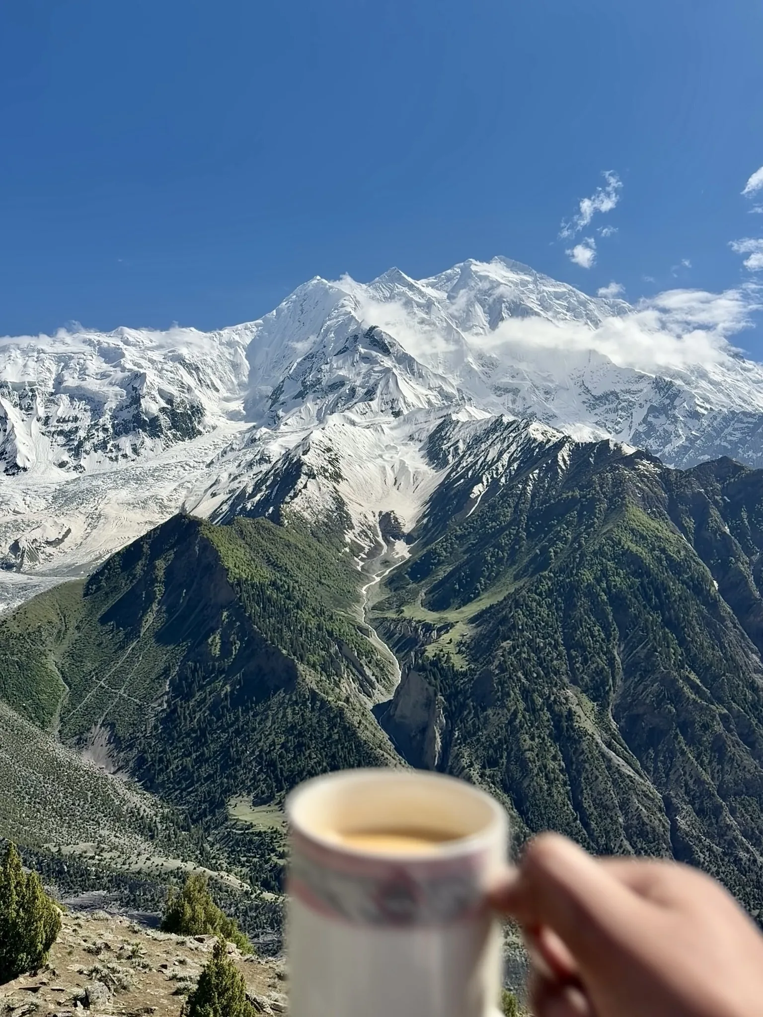
Rakaposhi is the 27th-highest mountain in the world at 7,788 metres (25,551 feet), and one of the most beautiful peaks anywhere on Earth. It stands in the Karakoram of Gilgit-Baltistan, in northern Pakistan, and is famous for a single staggering statistic: from the Hunza River to its summit it rises almost 6,000 metres in one unbroken sweep, the greatest uninterrupted slope of any mountain on the planet. A Rakaposhi expedition is a serious high-altitude climb of 35 to 45 days, hard on snow, ice and rock, and far quieter than the famous 8,000ers a valley away.
Where is Rakaposhi?
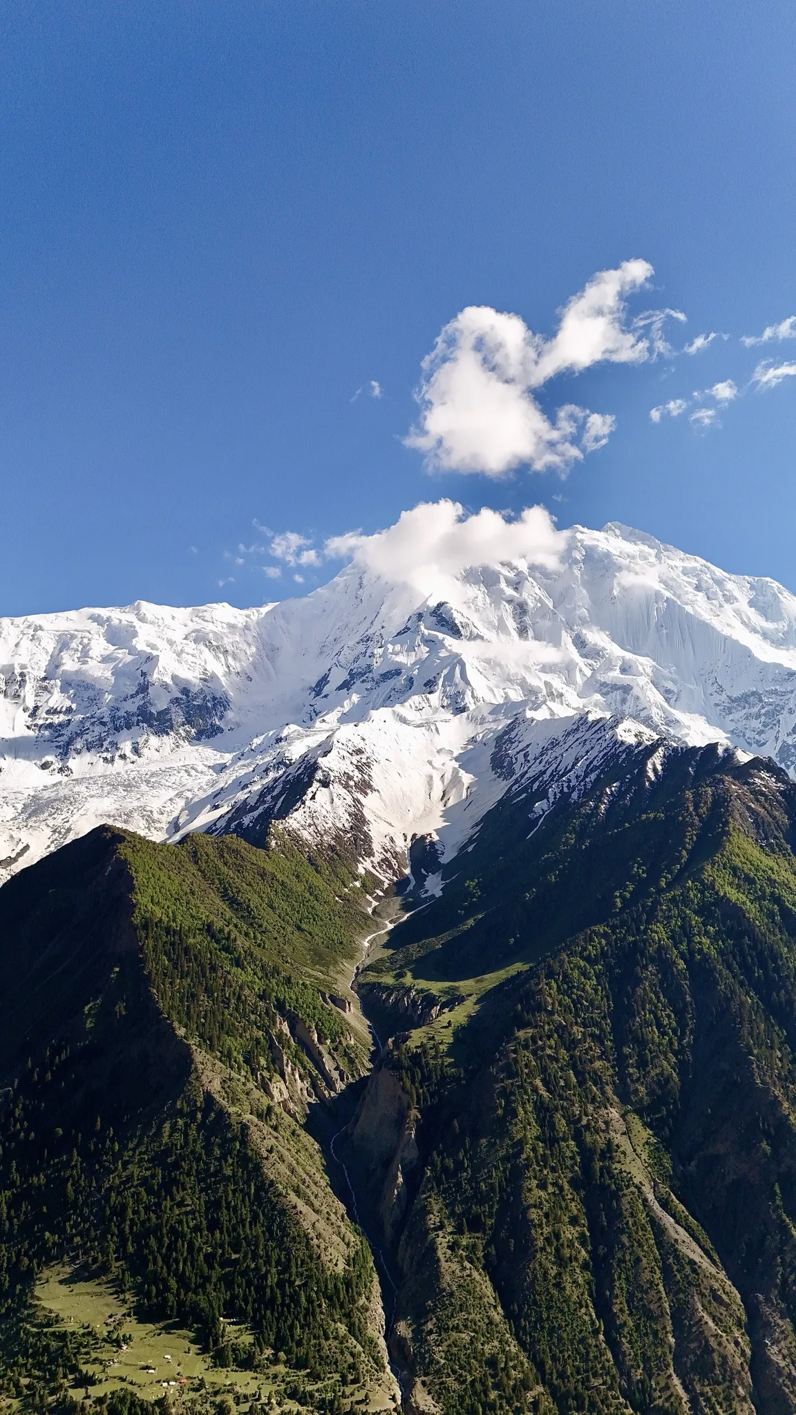
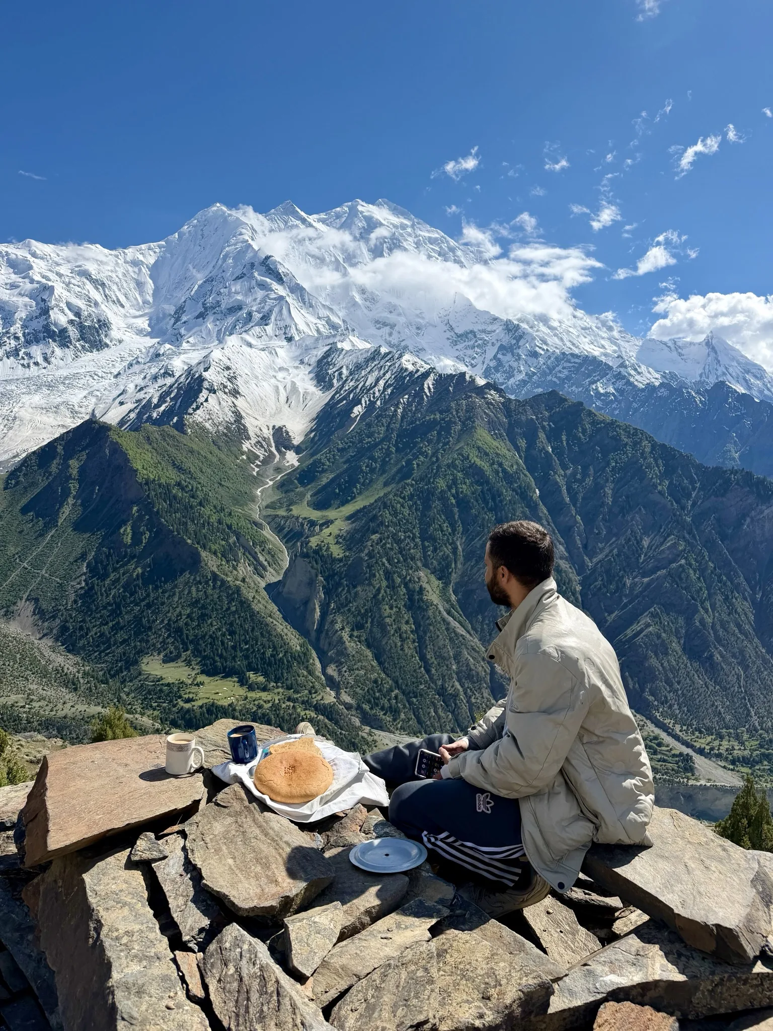
Rakaposhi lies in the Nagar district of Gilgit-Baltistan, about 100 kilometres north of Gilgit, rising between the Nagar and Bagrote valleys. Travellers on the Karakoram Highway see it for hours at a time: the mountain towers over the Hunza-Nagar valley, and the roadside Rakaposhi View Point at Ghulmet is one of the most photographed spots in Pakistan. Its name comes from the local Burushaski language and means "shining wall." The older local name, Dumani, means "Mother of Mist," for the cloud that so often wraps the summit. Rakaposhi is the high point of the Rakaposhi-Haramosh range, a western arm of the greater Karakoram.
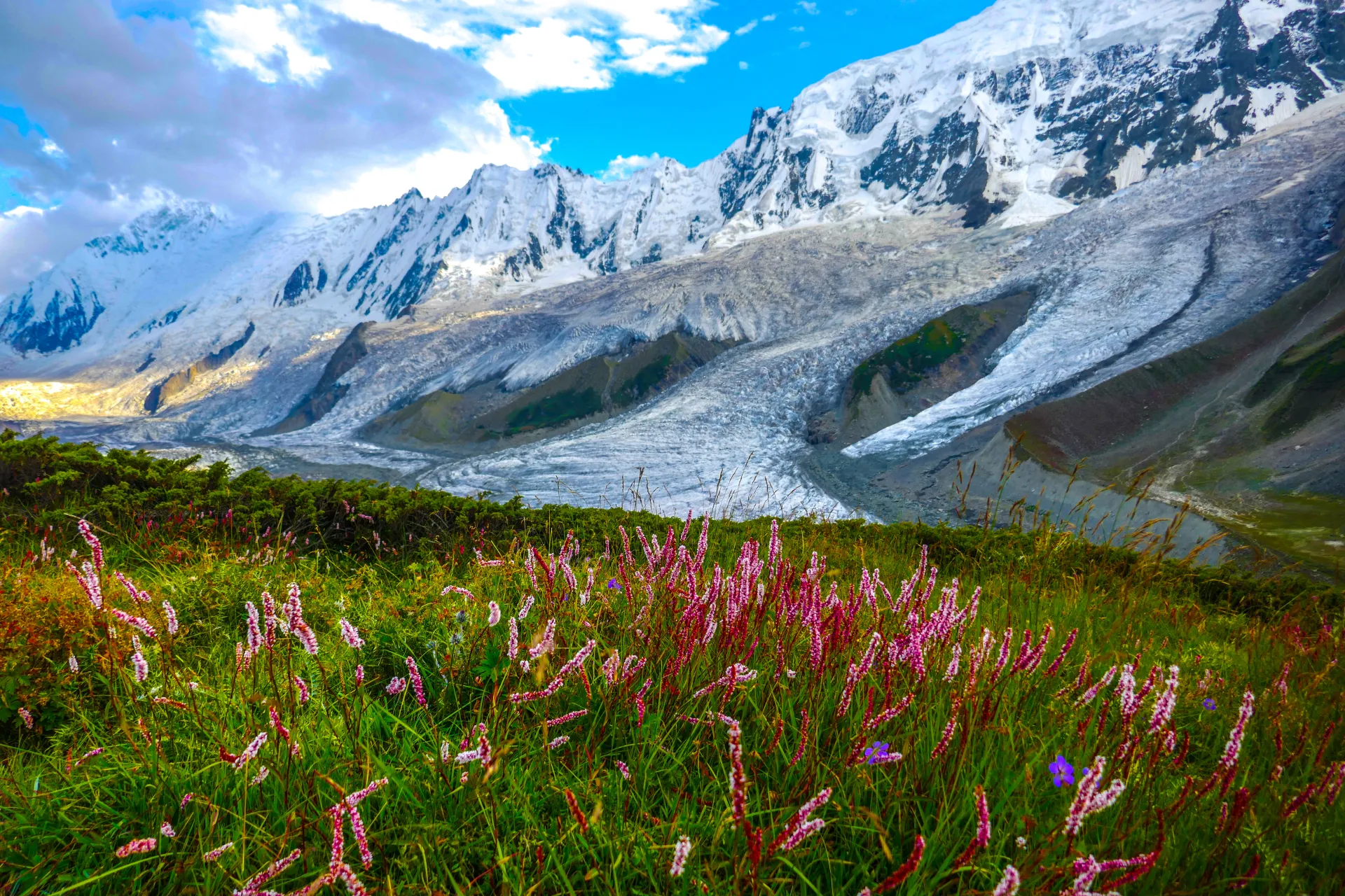
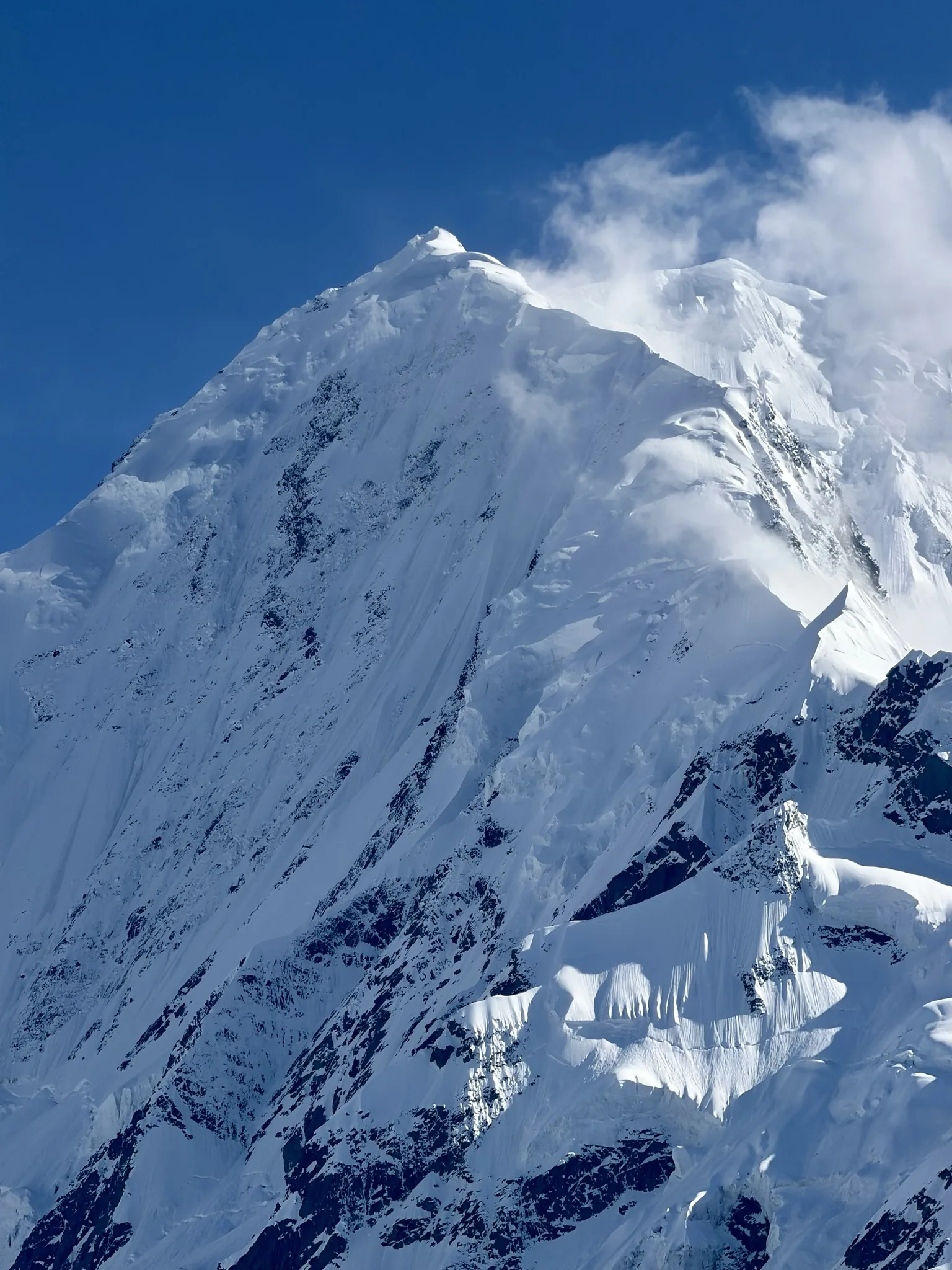
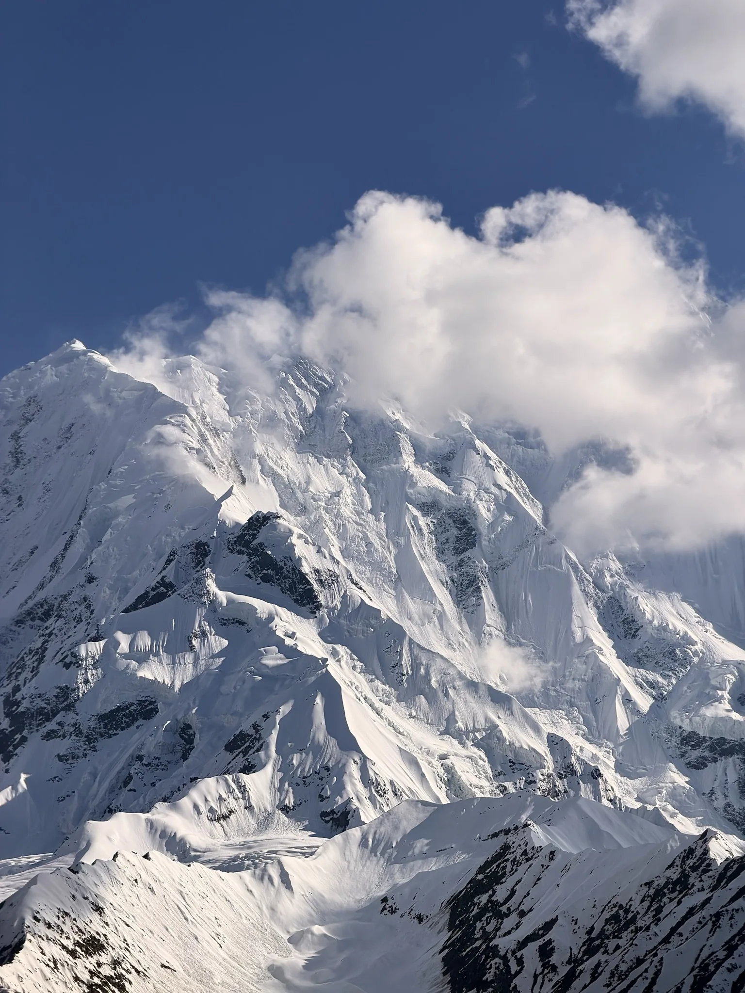
The 6,000-metre wall: why Rakaposhi is special
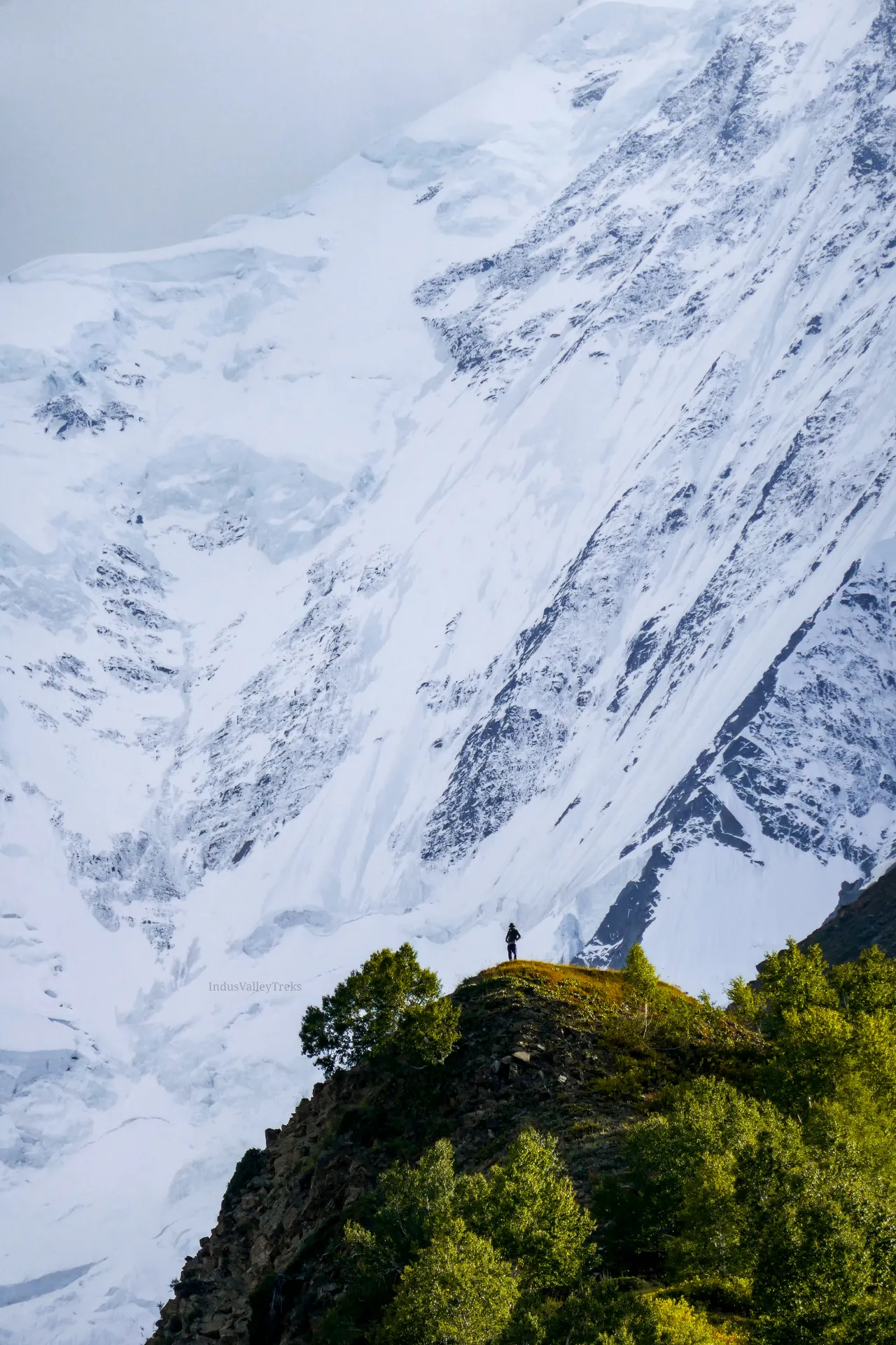
What sets Rakaposhi apart is not its height but its rise. On the north side the mountain climbs roughly 5,900 metres in only 11.2 kilometres of horizontal distance from the Hunza River, and it is often described as the only peak on Earth that drops almost 6,000 metres from summit to base without a break. Stand in the orchards of Hunza in spring and the whole mountain is in front of you at once, from apricot blossom to summit snow. That scale is what draws climbers, and it is also what makes the peak dangerous: those flanks hold enormous quantities of snow and are swept by frequent avalanches.
How hard and how dangerous is Rakaposhi?
Rakaposhi is graded an extreme expedition, with a reputation out of all proportion to its modest place on the height tables. The climbing is technically and physically demanding, with sustained snow and ice, sections of mixed rock, and long summit days at altitude. More to the point, the mountain is genuinely dangerous. Heavy Karakoram snowfall leaves its slopes loaded and avalanche-prone, and the weather can turn in a matter of hours. The summit success rate is low, and many strong, experienced teams have come home without the top. This is not a peak for a first high-altitude season, but for climbers with the right background it is one of the great prizes of the range.
The Southwest Spur: Rakaposhi's standard route
The standard line on Rakaposhi is the Southwest Spur, sometimes called the Southwest Ridge, the route of the 1958 first ascent. It is long rather than savagely technical, but it is no walk: the ridge throws up rock gendarmes and pinnacles that have to be climbed or turned, and the snow and ice steepen to around 55 degrees in places. From base camp the climb is broken into a series of camps up the spur, with the upper mountain fully exposed to wind and weather and the final day a sustained push on steep ground to the 7,788-metre summit. Fixed ropes are placed on the harder sections, and the descent follows the same line.
The approach: Jaglot, Darakush and the Kunti Glacier
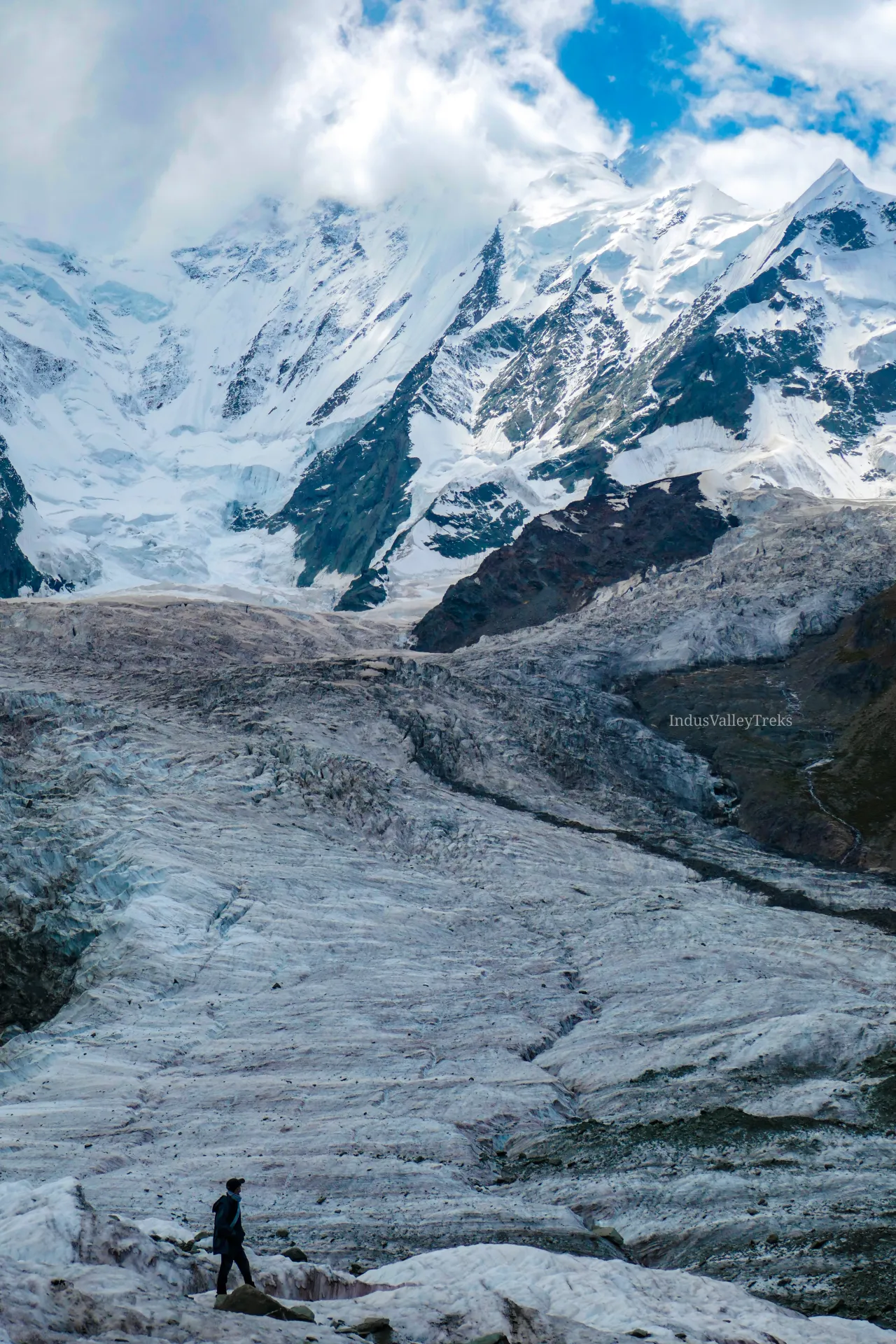
The climb is approached from the south-west side of the mountain, not the popular trekking valley to the north. From Gilgit the expedition drives up the Karakoram Highway and then by jeep to the village of Jaglot in the Nagar valley, continuing on foot through Darakush to a base camp on the Kunti Glacier beneath the southwest face. From there the route works up the spur with intermediate camps as the team acclimatises. Base camp is a green and comfortable spot by Karakoram standards, but everything above it is committing, remote terrain a long way from the nearest road or helicopter.
Best time to climb Rakaposhi
The climbing season runs through the Karakoram summer, roughly June to August, when the weather is most settled and the days are long. Even then Rakaposhi rarely gives away an easy window: teams plan for several weeks on the mountain to catch the few stable spells that allow a safe push to the top. Earlier or later in the year, deeper snow and shorter, colder days make the slopes even more avalanche-prone and the climb impractical.
Acclimatisation, camps and rotations
Like any 7,000-metre peak, Rakaposhi is climbed slowly. After the walk in to base camp, the team makes rotations up the spur, climbing to a higher camp, sleeping there, then dropping back down so the body can adjust to the thinning air. Each rotation reaches a little higher before a final rest at base camp ahead of the summit bid. Rakaposhi is low enough that many climbers attempt it without supplemental oxygen, though emergency oxygen and a strong support team belong in any well-run expedition. Confident use of crampons, ice axe, fixed ropes and ascenders on steep ground is essential.
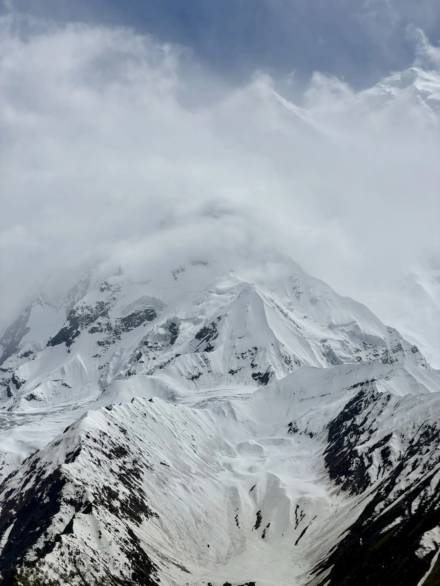
The dangers: avalanche, weather and altitude
Rakaposhi's main hazard is its snow. The same heavy precipitation that keeps the mountain so white loads its slopes and feeds the avalanches it is known for, and several stretches of the route demand good timing and judgement to cross safely. Storms build quickly and can pin a team at a high camp for days. At altitude the body weakens, decisions get harder, and most accidents on big mountains happen on the way down, when climbers are tired and the weather is closing in. A good expedition is built around conservative turnaround times, careful forecasting, and the discipline to wait, or to descend, rather than force a summit.
Permits, royalty and cost
Climbing Rakaposhi requires a Pakistan mountaineering permit and a peak royalty paid to Gilgit-Baltistan, along with a liaison officer assigned to the expedition. Because Rakaposhi sits below 8,000 metres, its royalty is only a fraction of the fees charged on K2 and the other 8,000-metre giants, part of what makes it such good value for a serious Karakoram objective. A fully supported expedition, covering permit and liaison handling, approach logistics, base camp and high camps, climbing staff and full support, typically starts from around $24,000 per climber. Pricing here is indicative; we quote each expedition individually according to team size and the level of support you want.
What it takes to climb Rakaposhi
Rakaposhi is a step up, not a starting point. We expect climbers to have solid mountaineering experience, ideally previous time at 5,000 to 6,000 metres, comfort on steep snow and ice, and the fitness to keep moving through long summit days at altitude. Just as important is the temperament the mountain rewards: patience with the weather, respect for avalanche danger, and the willingness to turn around. Months of endurance and strength training and a structured acclimatisation plan are what turn a hopeful attempt into a safe, successful climb.
Prefer the trek? Rakaposhi Base Camp via Minapin
If you want to stand beneath Rakaposhi without committing to the climb, the Rakaposhi Base Camp trek is one of the finest short treks in Pakistan. It starts from the village of Minapin in the Nagar valley, on the opposite, northern side of the mountain, and climbs through forest and meadow to Hapakun and then the Tagaphari meadow, the Rakaposhi Base Camp, at about 3,260 metres. From there you look straight up the great north face, with Diran Peak alongside and the Minapin Glacier below. It is a moderate, non-technical walk of a few days and a perfect way to see the Shining Wall up close. Ask us about pairing it with a wider Hunza itinerary.
Go With Guide Pakistan runs fully supported Rakaposhi expeditions with experienced Pakistani high-altitude guides, Karakoram Highway and jeep logistics from Gilgit, permit and liaison handling, fixed camps, and full base-camp support. Whether you want to climb the Southwest Spur or simply trek to base camp beneath the north face, our team will help you plan it.
Climbing History
1892
Early Reconnaissance
Early Reconnaissance
Martin Conway surveyed Rakaposhi's southern side during his 1892 Karakoram expedition and judged its ridges difficult and dangerous, the first serious appraisal of a possible route up the mountain.
1956
First Above 7,000m
First Above 7,000m
A British-American expedition led by Mike Banks climbed the Southwest Spur to about 7,170 metres, the first party to pass 7,000 metres on Rakaposhi and the line that would finally succeed two years later.
1958
First Ascent
First Ascent
Mike Banks and Tom Patey reached the summit on 25 June via the Southwest Spur, climbing the final stretch without supplemental oxygen and in a blizzard. Their British-Pakistan Forces expedition made the first ascent of Rakaposhi.
1979
Two New Routes
Two New Routes
Rakaposhi saw two bold new lines in a single season: a Polish-Pakistani team opened the Northwest Ridge, while a Japanese expedition from Waseda University climbed the difficult North Spur.
2019
Piolet d'Or
Piolet d'Or
Japanese alpinists Kazuya Hiraide and Kenro Nakajima climbed a new route on the south face, finishing up the southeast ridge, and were awarded the Piolet d'Or in 2020, the most celebrated ascent in Rakaposhi's modern history.
Recommended Reading
Road to Rakaposhi
by George Band (1955)
Road to Rakaposhi
by George Band (1955)
Rakaposhi
by Mike Banks (1959)
Rakaposhi
by Mike Banks (1959)
Frequently Asked Questions About the Rakaposhi Expedition
How tall is Rakaposhi, and where is it?
How tall is Rakaposhi, and where is it?
Rakaposhi is 7,788 metres (25,551 feet) high, the 27th-highest mountain in the world. It stands in the Karakoram range of Gilgit-Baltistan in northern Pakistan, between the Nagar and Bagrote valleys, about 100 km north of Gilgit and high above the Karakoram Highway.
What is the standard route up Rakaposhi?
What is the standard route up Rakaposhi?
The standard route is the Southwest Spur, also called the Southwest Ridge, the line of the 1958 first ascent. It is long rather than extremely technical, but involves rock gendarmes, steep snow and ice up to about 55 degrees, and serious avalanche exposure. It is approached from the village of Jaglot and a base camp on the Kunti Glacier.
How hard and how dangerous is Rakaposhi?
How hard and how dangerous is Rakaposhi?
Rakaposhi is an extreme climb. Its slopes are heavily prone to avalanche, the weather is volatile, and the summit success rate is low, so even experienced teams often turn back. It demands prior high-altitude experience and sound judgement, and is not suitable as a first big mountain.
How long does a Rakaposhi expedition take, and when is the best time?
How long does a Rakaposhi expedition take, and when is the best time?
A full Rakaposhi expedition runs about 35 to 45 days, including the approach, acclimatisation rotations, and waiting for a safe summit window. The best time to climb is the Karakoram summer, roughly June to August.
Do you need supplemental oxygen to climb Rakaposhi?
Do you need supplemental oxygen to climb Rakaposhi?
Not necessarily. At 7,788 metres Rakaposhi is often climbed without supplemental oxygen, though a well-run expedition still carries emergency oxygen and a strong support team. Fitness, acclimatisation, and skill on steep snow and ice matter far more.
What is the difference between the expedition and the Rakaposhi Base Camp trek?
What is the difference between the expedition and the Rakaposhi Base Camp trek?
The expedition is a 35 to 45 day climb to the 7,788 m summit via the Southwest Spur, from the south-west side of the mountain. The Rakaposhi Base Camp trek is a moderate, non-technical walk of a few days from Minapin on the north side, ending at the Tagaphari meadow at about 3,260 metres beneath the north face. The trek involves no climbing.
What's Included
Not Included
Ready for Your Next Adventure?
Join our community of explorers and discover the journey of a lifetime. Our expert team is ready to help you plan your perfect expedition.