Passu Cathedral
The iconic cathedral spires of Hunza
Last updated: · Reviewed by Javeed Iqbal, Founder
Elevation
6,106m
Difficulty
Challenging
Duration
20 to 28 Days
Best Season
Jun to Aug
Passu Cathedral (Tupopdan): a complete guide to the cones of Hunza
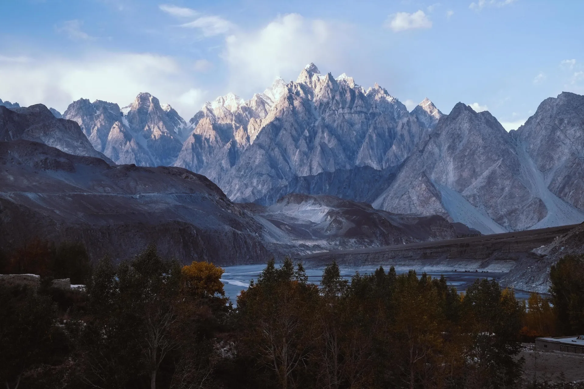
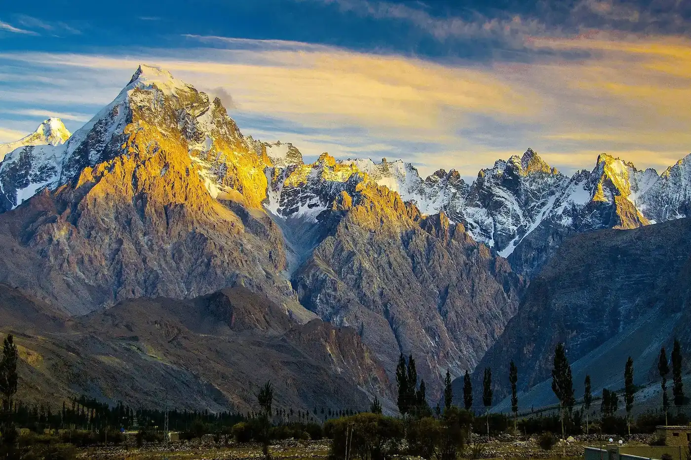
Passu Cathedral is the row of dark, knife-edged spires that almost every traveller on the Karakoram Highway stops to photograph. It rises to 6,106 metres above the village of Passu in upper Hunza, and the people who live beneath it call it Tupopdan. The peak leads two lives. It is among the most recognisable mountains in Pakistan, seen by tens of thousands of road-trippers a year, and it is a serious, rarely climbed alpine objective whose jagged summit has had only a handful of ascents. This guide covers both sides: how to see the cones at their best, and what an attempt on the mountain actually involves.
Where is Passu Cathedral?
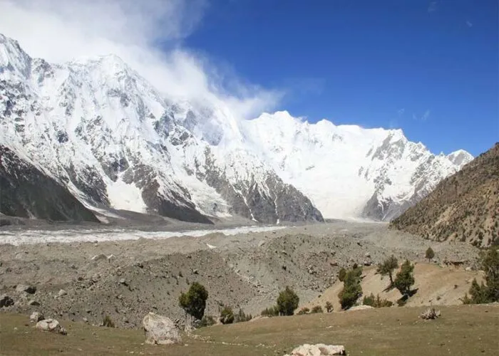
The peak stands in Gojal, the upper part of the Hunza valley in Gilgit-Baltistan, about 10 kilometres north of Passu village and roughly a three-to-four-hour drive up the Karakoram Highway from Hunza's main town of Karimabad. It belongs to the South Ghujerab Mountains, a subrange on the eastern edge of the Batura Muztagh, with the Passu and Batura glaciers spilling down close by. Its coordinates are about 36°33′N 74°56′E. What makes it so photogenic is the sheer relief: the north face rises roughly 1,700 metres in barely a kilometre and a half, and the summit stands some 3,600 metres above the Hunza River, so the spires fill the sky straight from the roadside.
Tupopdan, Passu Cones, Passu Cathedral: one mountain, three names
The local Wakhi name is Tupopdan, usually read as "sun-drenched" or "hot rock," a nod to how fast snow melts off its southern slopes through the winter. Travellers and photographers know it as the Passu Cones for the row of near-symmetrical points, or the Passu Cathedral because the outline echoes the spires and buttresses of a gothic church. All three names point to the same 6,106-metre massif. Despite a common mix-up, it is not Passu Sar (7,478 m) or Passu Diar (about 7,295 m); those are separate, higher peaks of the Batura Muztagh a little to the west.
How to see the Passu Cones
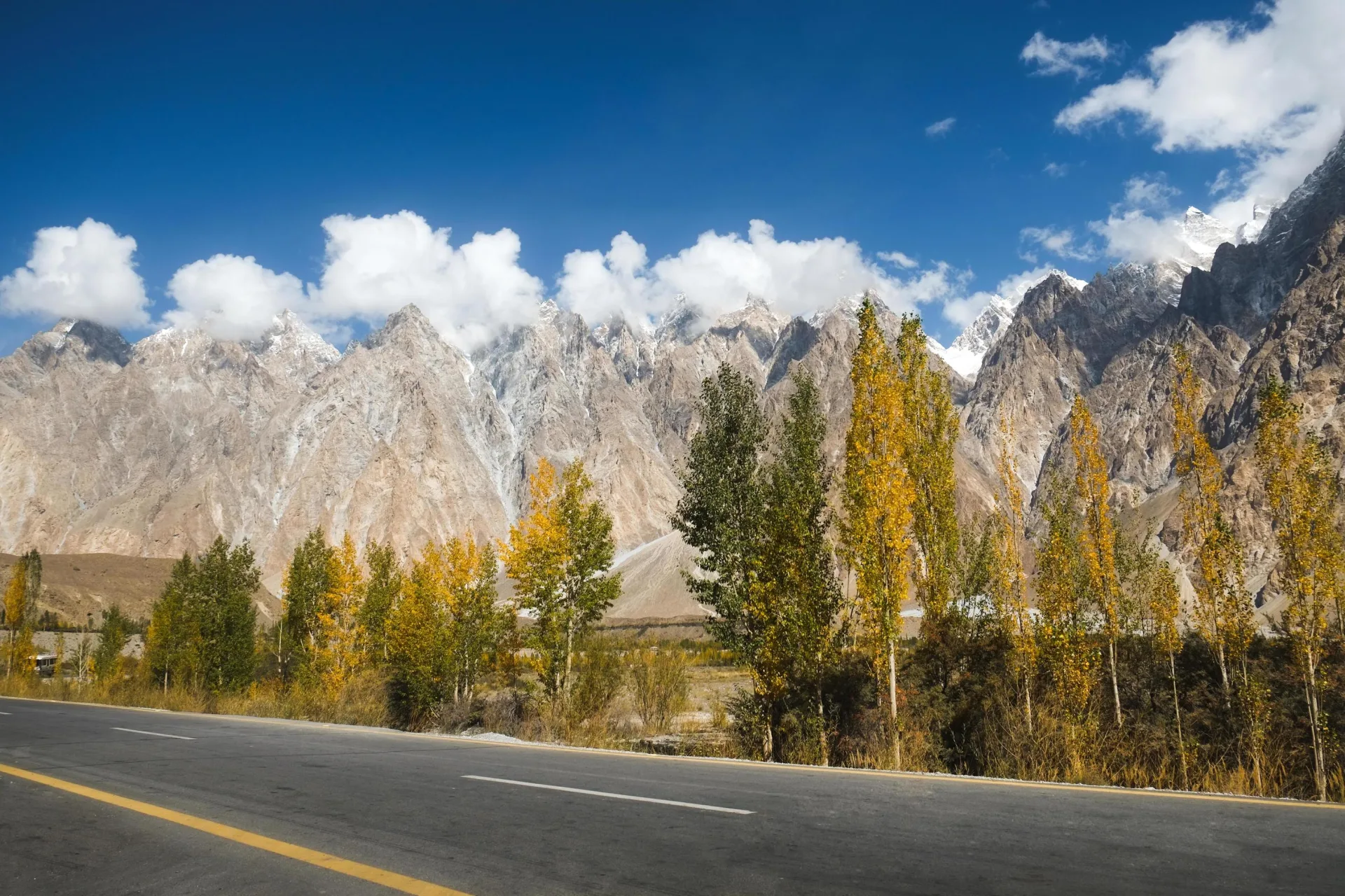
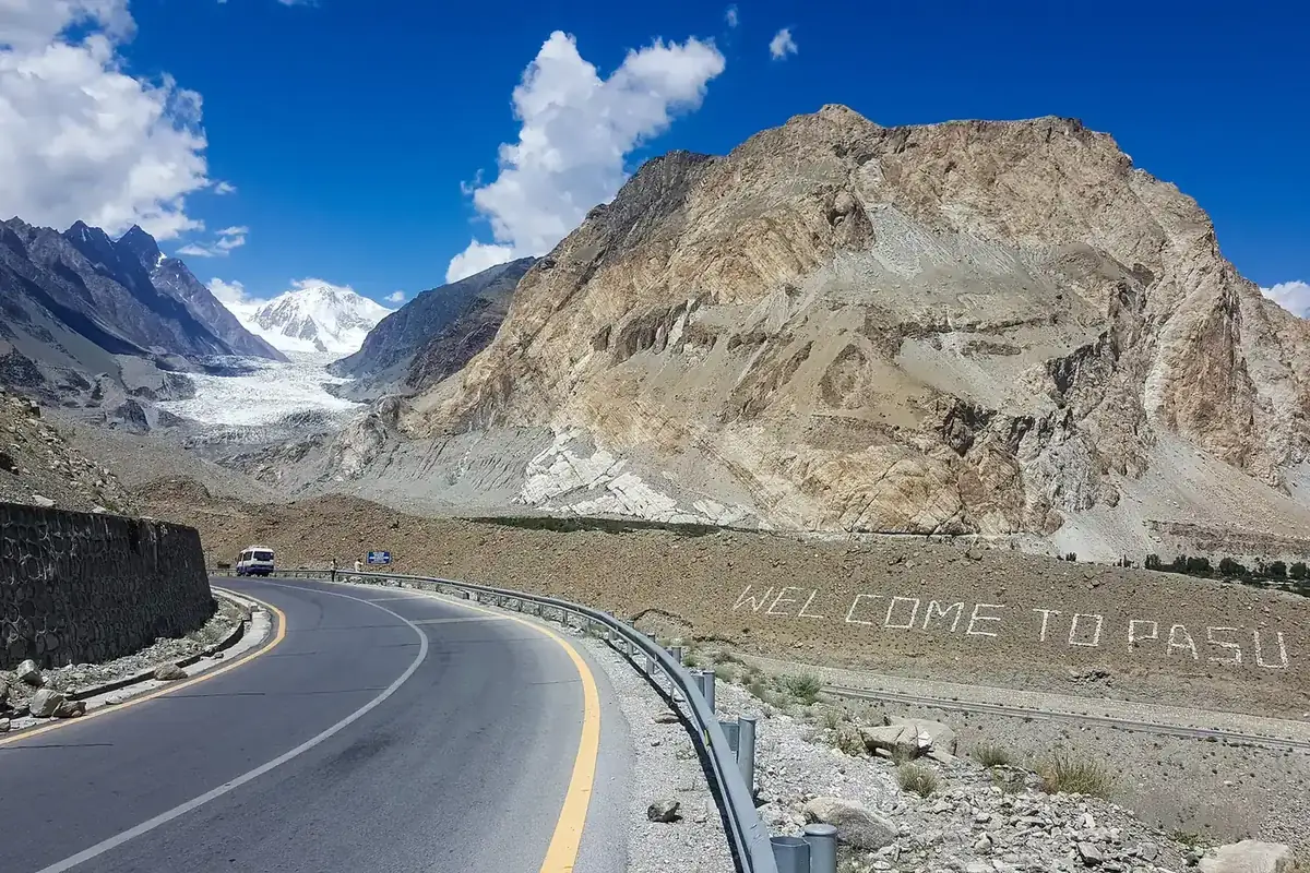
You do not need to climb anything to enjoy the cones, and most visitors come purely to look. The classic view is from the Karakoram Highway itself, where a roadside lookout just south of Passu gives the postcard angle. A short way on, the Hussaini suspension bridge, a swaying span of planks and cable over the Hunza River, frames the spires beautifully and has become a destination in its own right. Come at sunrise or sunset for the best light, when a low sun turns the dark rock gold and throws the points into sharp relief. The cones are visible year-round, though the clearest air usually arrives in autumn.
Things to do around Passu
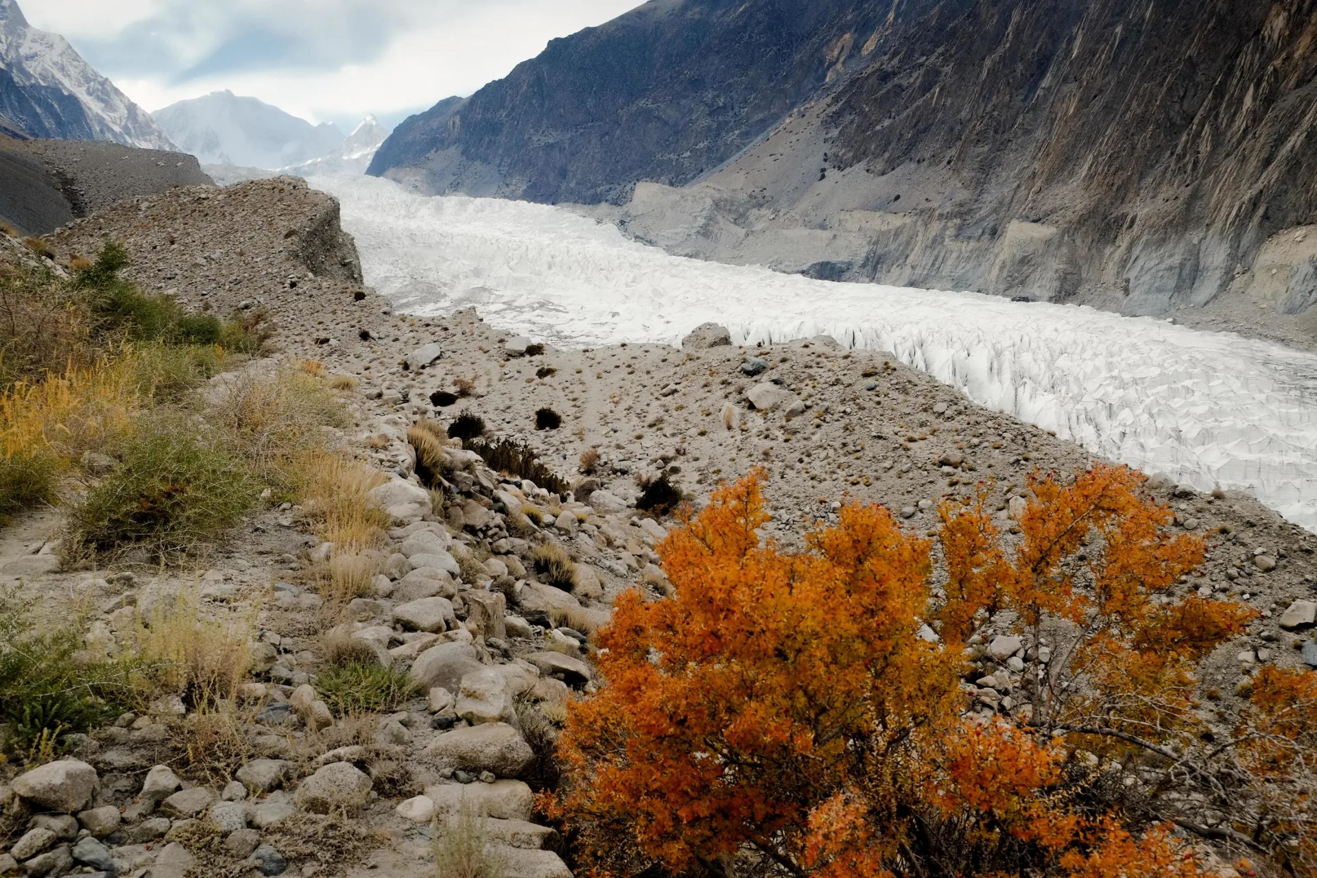
Passu makes an easy base for a day or two. The Hussaini suspension bridge and nearby Borith Lake, a brackish lake about two kilometres off the highway that draws migrating birds, are both gentle outings. Fitter visitors can walk to the snout of the Passu Glacier or climb towards Patundas meadow for a high view over the ice, while the white tongue of the Batura Glacier, one of the longest outside the polar regions, lies just up the valley. Together with the cones, it makes upper Hunza among the most scenic stretches of the entire Karakoram Highway.
How hard is it to climb, and how dangerous?
As a climb, Passu Cathedral is far harder than its modest 6,106-metre height suggests. The spires are steep mixed rock and ice with serious exposure, and there is no easy line to the top from any side. This is not a peak for a first expedition or a trekking-peak ambition. It asks for confident technical climbing, sound judgement on loose and committing ground, and the experience to turn back when conditions sour. Rockfall, unstable snow, and fast-changing weather are the main hazards. Far more people photograph Tupopdan than ever set foot on it, and that balance is unlikely to change.
The first ascent and the climbers who followed
Tupopdan was first climbed on 6 July 1987 by the British pair Andy Cave and John Stevenson, who took the Northeast Ridge. A few climbing sources credit a separate British party in the same year, a reminder of how lightly documented the peak's record is. Ascents since have been rare. The mountain never drew the traffic of a commercial objective, and among alpinists it is still better known for its looks and its difficulty than for any well-trodden route. If you are after the longer story of the Passu group, the other 6000m peaks of upper Hunza sit in the same corner of the Karakoram.
The Northeast Ridge route
The Northeast Ridge of the 1987 first ascent is still the line most associated with the peak. It offers the most logical weakness through the spires, a sustained mixed climb on rock and ice that is protected and moved on with care rather than rushed. Because so few teams attempt the mountain, there is no maintained camp chain or annual rope-fixing as there is on the big trade peaks. An attempt is a self-contained alpine undertaking, planned around the specific party and the conditions of the day rather than a fixed itinerary, which is exactly why we cost and plan any climb here individually.
Best time to visit and to climb
For sightseeing, the highway to Passu stays open for most of the year, but the comfortable window runs roughly May to October. Autumn, in September and October, gives the crispest views and the famous golden poplars down in the valley. For climbing, summer offers the most settled spell, broadly June to August, when daytime conditions are most workable on the mixed ground, though the high Karakoram can hold weather in any month.
Getting to Passu
Passu sits directly on the Karakoram Highway, which is the whole reason the cones are so accessible. Most travellers arrive by road from Gilgit, about five to six hours, or from Karimabad in central Hunza, three to four hours, often breaking the drive at Attabad Lake and Gulmit. The nearest airport is Gilgit, served by flights from Islamabad that depend heavily on mountain weather; many visitors prefer the two-day overland drive up the highway for the scenery alone.
What a climb takes: permits and cost
Climbing Passu Cathedral needs a Pakistan mountaineering permit and a peak royalty paid to Gilgit-Baltistan, with a liaison officer assigned to the team. As a 6,000-metre peak its royalty is modest next to the 8,000ers, but the logistics, technical staff, and equipment for such a committing climb are not. Costs depend entirely on team size, length, and the level of support, so the figure shown on this page is indicative and we quote each expedition individually.
Go With Guide Pakistan arranges both sides of Passu Cathedral: photography and sightseeing trips to the cones and the wider upper Hunza valley, and custom technical expeditions on the peak itself for experienced climbers. Tell us which one you are after and we will build the trip around it.
Climbing History
1980s
Early Attempts
Early Attempts
Drawn by the cathedral-like spires, early climbing parties reconnoitred the steep rock and ice of Tupopdan, probing possible lines on its dramatic faces.
1987
First Ascent
First Ascent
On 6 July 1987, the British climbers Andy Cave and John Stevenson made the first ascent of Tupopdan (Passu Cathedral) via the Northeast Ridge.
2000s
Rare Ascents
Rare Ascents
Its technical difficulty kept Tupopdan a coveted but seldom-climbed objective, repeated only occasionally by experienced alpinists.
2010s
Tourism Icon
Tourism Icon
With the Karakoram Highway and the Passu suspension bridges drawing visitors, the Passu Cones became one of Pakistan's most photographed landmarks.
Recommended Reading
High Asia: An Illustrated History of the 7,000 Metre Peaks
by Jill Neate (1989)
High Asia: An Illustrated History of the 7,000 Metre Peaks
by Jill Neate (1989)
The Karakoram: Mountains of Pakistan
by Shiro Shirahata (1990)
The Karakoram: Mountains of Pakistan
by Shiro Shirahata (1990)
Frequently Asked Questions About Passu Cathedral
How tall are the Passu Cones?
How tall are the Passu Cones?
The main summit of the Passu Cones reaches 6,106 metres, or 20,033 feet. The same peak is also called Tupopdan, its local Wakhi name, or the Passu Cathedral. It rises about 10 kilometres north of Passu village in Gojal, upper Hunza, and belongs to the South Ghujerab Mountains on the eastern edge of the Batura Muztagh. What makes it look far bigger than its height is the relief. The north face rises roughly 1,700 metres in barely a kilometre and a half, and the summit stands some 3,600 metres above the Hunza River, so the spires fill the sky straight from the Karakoram Highway. It is often confused with Passu Sar at 7,478 m, which is a separate and higher peak to the west. We run both sightseeing trips to the cones and technical expeditions on the mountain.
What does Tupopdan mean?
What does Tupopdan mean?
Tupopdan is the local Wakhi name for the Passu Cones, and it is usually translated as 'sun-drenched' or 'hot rock'. The name refers to how quickly snow melts off the mountain's southern slopes through the winter, leaving the dark rock bare while other peaks stay white. It is the name used by the people who live beneath the peak in Gojal, the upper part of the Hunza valley. Travellers and photographers tend to call it the Passu Cones, for the row of near-symmetrical points, or the Passu Cathedral, because the outline echoes the spires of a gothic church. All three names refer to the same 6,106-metre massif about 10 kilometres north of Passu village. Climbing records usually use Tupopdan, including for the first ascent by the British pair Andy Cave and John Stevenson on 6 July 1987.
Why is it called the Passu Cathedral?
Why is it called the Passu Cathedral?
It is called the Passu Cathedral because its row of steep, pointed spires looks like the towers and buttresses of a gothic cathedral. The effect is strongest from the Karakoram Highway, where the dark, knife-edged points rise straight above the road and line up almost symmetrically. The same shape gives the peak its other common name, the Passu Cones. Locally the mountain is Tupopdan, a Wakhi name meaning 'sun-drenched' or 'hot rock'. All three describe one 6,106-metre massif in upper Hunza. The outline is sharpest at sunrise or sunset, when a low sun turns the dark rock gold and throws each spire into relief. The north face adds to the drama, rising roughly 1,700 metres in barely a kilometre and a half. That light is when we time our photography stops at the roadside lookout just south of Passu.
Where are the Passu Cones and how do I see them?
Where are the Passu Cones and how do I see them?
The Passu Cones stand in Gojal, upper Hunza, about 10 kilometres north of Passu village and directly above the Karakoram Highway. You do not need to climb or trek to see them. The classic postcard view is from a roadside lookout just south of Passu. A short way on, the Hussaini suspension bridge, a swaying span of planks and cable over the Hunza River, frames the spires and has become a destination in its own right. Come at sunrise or sunset, when the low sun turns the dark rock gold. The cones are visible year-round, though the clearest air usually arrives in autumn. Passu makes an easy base for a day or two, with Borith Lake, the Passu Glacier and the Batura Glacier all close by. We arrange photography and sightseeing trips that take in these stops.
Can you climb the Passu Cones?
Can you climb the Passu Cones?
Yes, but very few people do, and it is not a peak for a first expedition. Passu Cathedral is far harder than its 6,106 metres suggests. The spires are steep mixed rock and ice with serious exposure, and there is no easy line to the top from any side. The first ascent was on 6 July 1987, when the British pair Andy Cave and John Stevenson climbed the Northeast Ridge, still the line most associated with the peak. Ascents since have been rare. There is no maintained camp chain or annual rope-fixing, so an attempt is a self-contained alpine climb planned around the party and the conditions. Rockfall, unstable snow and fast-changing weather are the main hazards. You also need a mountaineering permit, a peak royalty and a liaison officer. Most people experience the cones from the road rather than the rope.
When is the best time to visit Passu?
When is the best time to visit Passu?
For travel, the comfortable window to visit Passu runs roughly from May to October. Autumn, in September and October, gives the crispest views of the cones and the famous golden poplars down in the valley. The Karakoram Highway to Passu stays open for most of the year and the cones are visible in every season, so a winter visit is possible, just colder. For climbing Passu Cathedral itself, the most settled window is summer, broadly June to August, when daytime conditions are most workable on the mixed rock and ice. Even then the high Karakoram can hold bad weather in any month, so a climbing trip needs slack in the plan. Sightseeing and climbing therefore suit rather different months. Whichever you choose, sunrise and sunset give the best light on the spires, and we time roadside stops around them.
How do I get to Passu?
How do I get to Passu?
Passu sits directly on the Karakoram Highway, so you reach it by road. From Gilgit the drive takes about five to six hours, and from Karimabad in central Hunza it is three to four hours. Many travellers break the journey at Attabad Lake and Gulmit on the way up. The nearest airport is Gilgit, served by flights from Islamabad, but those flights depend heavily on mountain weather, so it is worth leaving some slack in your plans. Plenty of visitors skip the flight and take the two-day overland drive up the highway from Islamabad for the scenery alone. Once in Passu, the roadside lookout for the cones, the Hussaini suspension bridge and Borith Lake are all close by. For climbers, Passu village is also where the approach logistics for an attempt on the peak begin, and we arrange transport from there.
Is Passu Cathedral the same as Passu Sar?
Is Passu Cathedral the same as Passu Sar?
No, they are different mountains. Passu Cathedral, also called the Passu Cones or Tupopdan, is 6,106 metres and belongs to the South Ghujerab Mountains, on the eastern edge of the Batura Muztagh. Passu Sar at 7,478 m and Passu Diar at about 7,295 m are separate, higher peaks of the Batura Muztagh a little to the west, and they get mixed up with the cones because they share the Passu name. The cones are the peak you see from the Karakoram Highway, rising about 10 kilometres north of Passu village. The difference matters when you read climbing reports or compare expedition plans, since a 7,000 m peak is a very different objective. Passu Cathedral was first climbed in 1987 by the Northeast Ridge. If you are unsure which peak a trip or photo refers to, ask us.
What's Included
Not Included
Ready for Your Next Adventure?
Join our community of explorers and discover the journey of a lifetime. Our expert team is ready to help you plan your perfect expedition.