Koh-e-Brobar
The ideal first summit
Last updated: · Reviewed by Javeed Iqbal, Founder
Elevation
6,008m
Difficulty
Challenging
Duration
16 to 20 Days
Best Season
Jun to Sep
Koh-e-Brobar (6,008m): the 'Mount Equality' of the Ghujerab Muztagh
Koh-e-Brobar is one of the Karakoram's quiet trophies: a 6,008-metre snow peak deep in the Ghujerab Muztagh beyond Shimshal, climbed for the first time only in 2011. It carries the English name "Mount Equality," given by the team that made that first ascent, a Pakistani-led expedition built around women's mountaineering. There is no crowd here and no fixed infrastructure; reaching the foot of the mountain is a multi-day trek over a high pass into some of the emptiest country in upper Hunza. This guide covers where it is, who first climbed it, and what an ascent involves.
Where is Koh-e-Brobar?
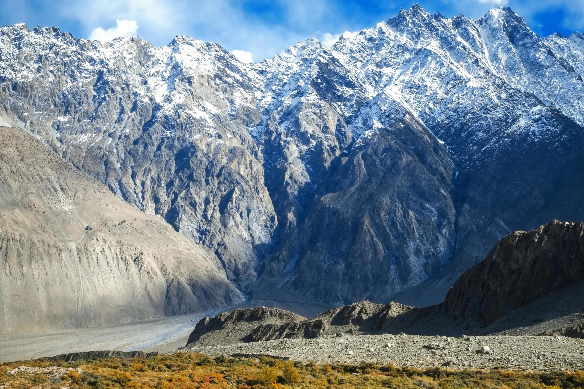
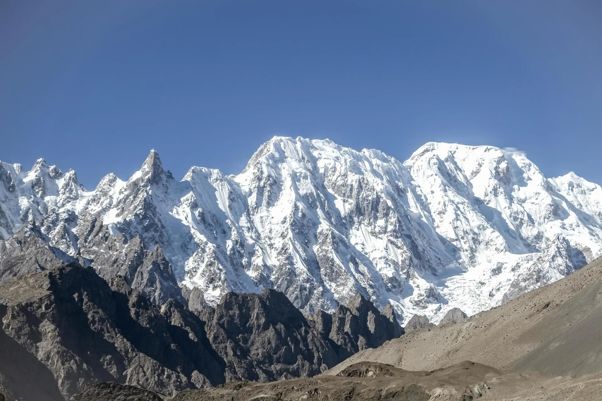
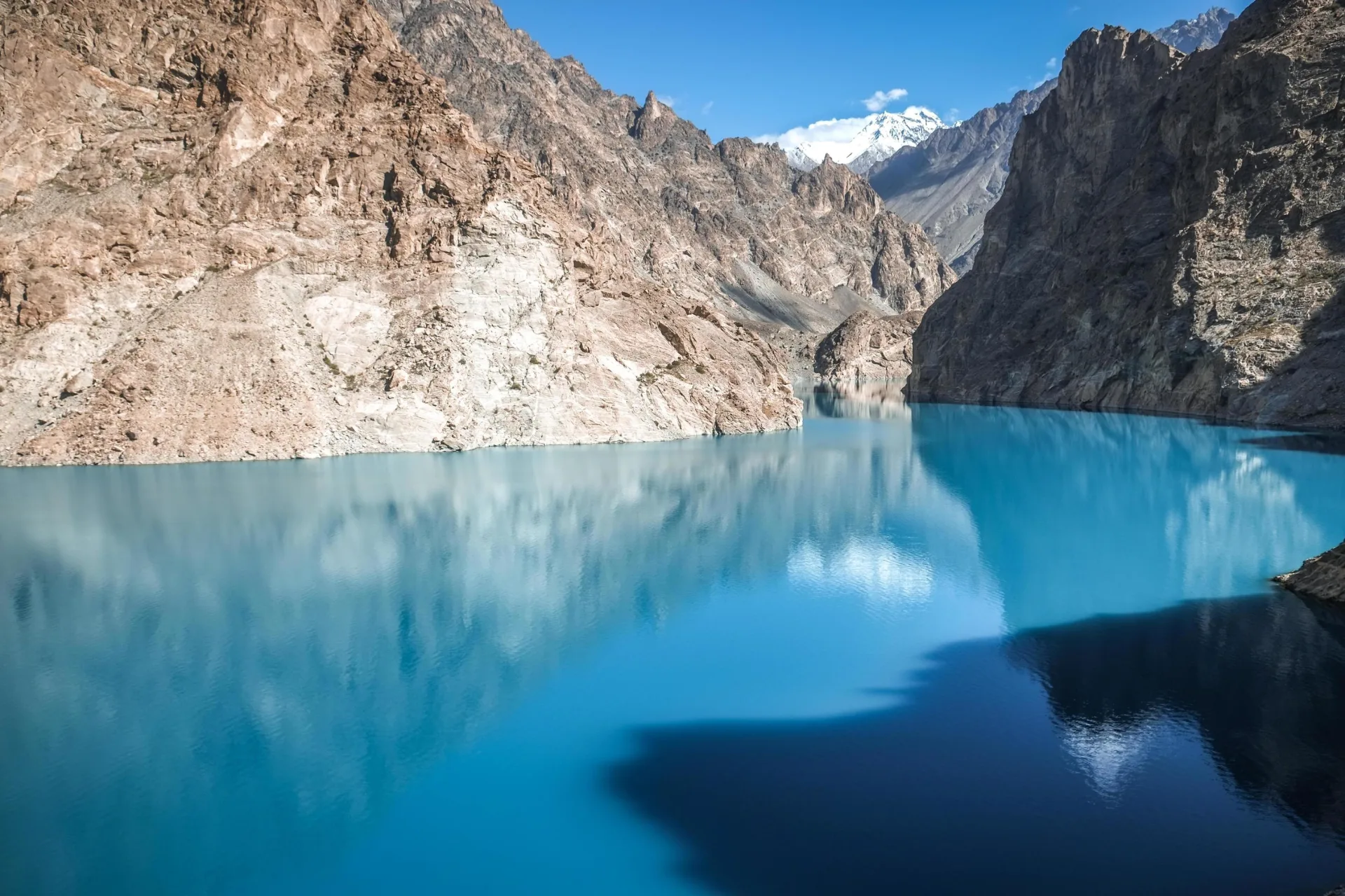
Koh-e-Brobar stands in the Ghujerab Muztagh, a remote subrange of the Karakoram in the far upper Hunza district of Gilgit-Baltistan, north of the Shimshal valley and close to the Chinese frontier. Its summit, at roughly 36°34'N 75°24'E, was measured by GPS at 6,008 metres on the first ascent, which is why it belongs in the 6,000-metre category. This is genuine wilderness, reached only on foot from Shimshal over the Boesam Pass, with no road, no village, and no other traffic on the mountain. It is a long way from Gilgit, with which the peak is sometimes wrongly associated.
The name: Mount Equality
The peak had no recorded name before 2011. The first-ascent team named it Koh-e-Brobar, which translates as "Mount Equality," to mark the purpose of their expedition: promoting equal access to the mountains for women. The name has stuck, and the peak is now known by both its local form and its English translation.
First ascent: Samina Baig and the 2011 expedition
Koh-e-Brobar was first climbed on 26 June 2011 by a seven-person international team led by the Shimshali climber Mirza Ali, alongside his sister Samina Baig, then just twenty, Arshad Karim of Shimshal, the German climbers Jens Franke and Christof Nettekoven, and Małgorzata Skowrońska of Poland, by the south-southeast ridge. Two years later Samina Baig became the first Pakistani woman to summit Everest, and Koh-e-Brobar was an early step on that path.
How hard, and how dangerous?
This is a real mountaineering objective, not a beginner's trekking peak. The climbing is not extreme, but the first-ascent party reported deep, soft snow, hidden crevasses with a few falls into them, and a final pitch up steep snow guarded by a large cornice as the crux. Add genuine remoteness, with no rescue and no other teams, and Koh-e-Brobar asks for solid glacier skills, fitness for 6,000 metres, and the self-reliance to operate far from any help.
The route and approach
Everything starts at Shimshal. From the village it is roughly a three-day trek up to the Boesam Pass at about 5,090 metres, then down into the Sok Sok-in-Dur valley to the shepherds' ground at Mandliqshaq, around 4,150 metres. Base camp sits at about 4,580 metres, with a high camp at 5,200 metres for the summit bid. The line everyone follows is the south-southeast ridge of the first ascent; with so few visits there is no fixed-rope infrastructure, so every trip is planned around current conditions.
How it climbs
From high camp the summit day works up snow slopes to the south-southeast ridge and the corniced final pitch. None of it is technical rock or steep ice in the alpine sense, but the soft snow and crevasse danger mean roped travel throughout and an early start while the surface is still frozen. It is the kind of peak where good judgement and a strong, small team matter more than raw difficulty.
Best time to climb
The window is the Karakoram summer, roughly mid-June to September, when the Shimshal pastures are open and the high snow is most stable. The first ascent was made in late June. Outside this period the Boesam Pass and the approach valleys are hard going, and the mountain sees effectively no one.
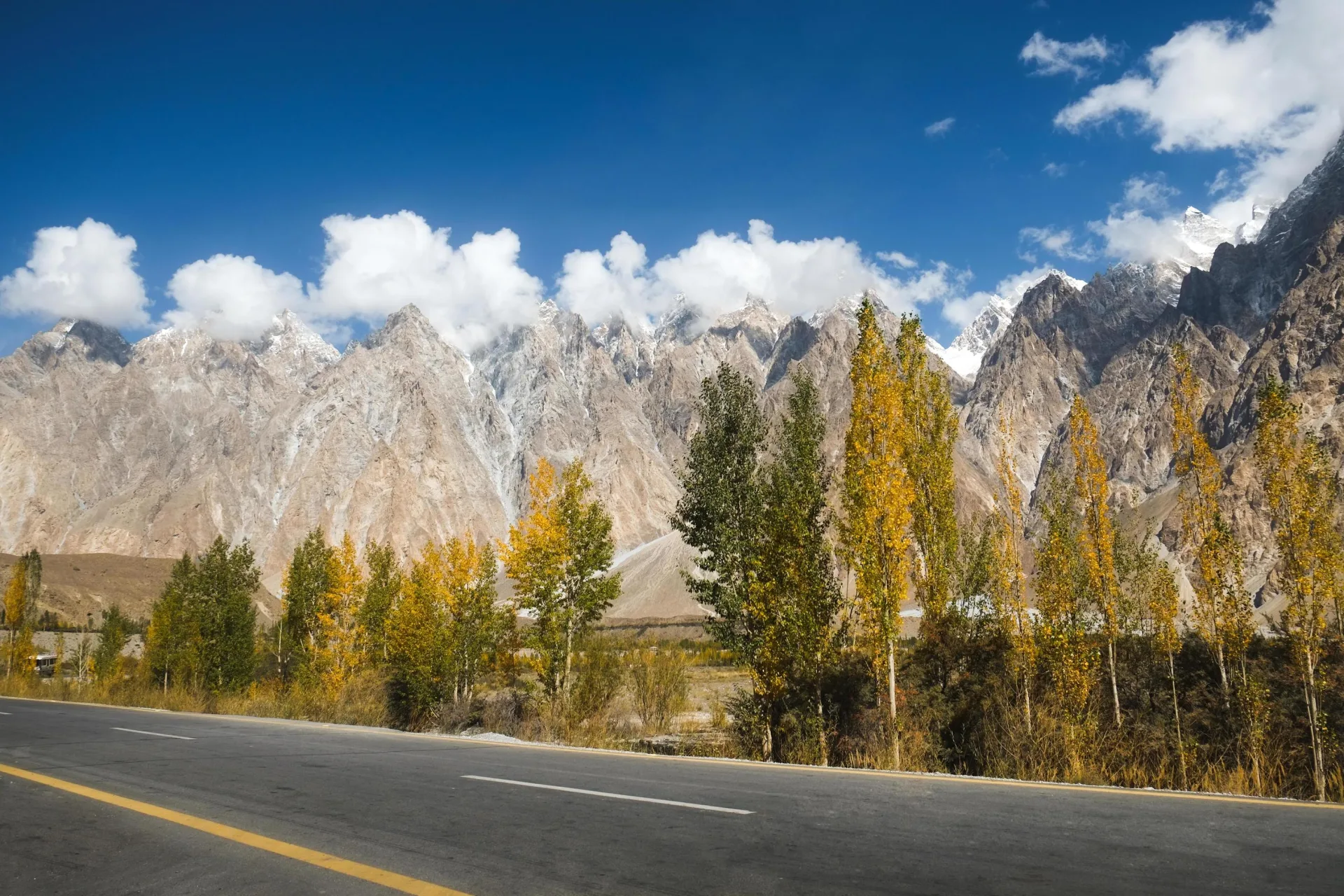
Getting to Shimshal
Like the other peaks of this corner of Hunza, the journey runs up the Karakoram Highway to Passu, then along the 56-kilometre mountain road into Shimshal, the highest village in the district. From Shimshal the rest is on foot. The whole expedition, including the drive, the trek in over the Boesam Pass, acclimatisation, the climb, and the return, is a serious multi-week undertaking, usually 16 to 20 days. The nearby Minglik Sar is the gentler first-6000er of the same valley.
Permits and cost
As a 6,000-metre peak Koh-e-Brobar is far cheaper to permit than a royalty peak, but it still involves park and trekking permits for Central Karakoram National Park, Shimshal community arrangements, and a full guided logistics package for a long trip into roadless country. Because so few teams go, every ascent is organised individually, so the figure on this page is indicative and we quote each expedition on request.
Go With Guide Pakistan organises Koh-e-Brobar with Shimshali guides from the same valley as its first ascensionists, usually as a combined Shimshal trek and climb. If you want a genuine, rarely visited 6,000-metre summit with real history behind it, tell us your experience and dates and we will build the expedition around it.
Climbing History
Pre-2011
Unnamed and unclimbed
Unnamed and unclimbed
For decades the peak in the Ghujerab Muztagh beyond Shimshal had no recorded name and no known ascent, one of many blanks on the map in this remote corner of the Karakoram.
2011
First ascent: Mount Equality
First ascent: Mount Equality
On 26 June 2011 a Pakistani-led international team summited via the south-southeast ridge and named the peak Koh-e-Brobar, "Mount Equality," for their women's-mountaineering cause.
2013
Samina Baig on Everest
Samina Baig on Everest
Samina Baig, part of that first-ascent team, became the first Pakistani woman to summit Everest, putting Shimshal's climbing talent on the world stage.
Today
A rare objective
A rare objective
Koh-e-Brobar remains seldom climbed, a remote and meaningful 6000er for those drawn to its history and its solitude.
Recommended Reading
High Asia: An Illustrated History of the 7,000 Metre Peaks
by Jill Neate (1989)
High Asia: An Illustrated History of the 7,000 Metre Peaks
by Jill Neate (1989)
Frequently Asked Questions About Koh-e-Brobar
How high is Koh-e-Brobar?
How high is Koh-e-Brobar?
Koh-e-Brobar is 6,008 metres, measured by GPS on its 2011 first ascent. It stands in the Ghujerab Muztagh beyond Shimshal, in the far upper Hunza district of Gilgit-Baltistan.
What does Koh-e-Brobar mean?
What does Koh-e-Brobar mean?
It translates as "Mount Equality." The name was given by the 2011 first-ascent team to mark their expedition's goal of promoting women's access to mountaineering.
Who first climbed Koh-e-Brobar?
Who first climbed Koh-e-Brobar?
It was first climbed on 26 June 2011 by a team led by Mirza Ali with his sister Samina Baig and Arshad Karim of Shimshal, plus German and Polish climbers, via the south-southeast ridge.
Where is Koh-e-Brobar?
Where is Koh-e-Brobar?
In the Ghujerab Muztagh, north of the Shimshal valley in upper Hunza, reached on foot from Shimshal over the Boesam Pass. It is not near Gilgit, with which it is sometimes confused.
Is Koh-e-Brobar a beginner peak?
Is Koh-e-Brobar a beginner peak?
No. It is not technically extreme, but it is a serious, remote 6000er with soft snow, crevasses, a corniced summit pitch and no rescue. You need solid glacier skills and good fitness for the altitude.
How do you get to Koh-e-Brobar?
How do you get to Koh-e-Brobar?
Drive the Karakoram Highway to Passu, take the jeep road into Shimshal, then trek about three days over the Boesam Pass (5,090m) to base camp at around 4,580m.
When is the best time to climb Koh-e-Brobar?
When is the best time to climb Koh-e-Brobar?
Mid-June to September, the Karakoram summer, when the snow is most stable and the Shimshal pastures are open. The first ascent was made in late June.
What's Included
Not Included
Ready for Your Next Adventure?
Join our community of explorers and discover the journey of a lifetime. Our expert team is ready to help you plan your perfect expedition.