Phandar Valley Travel Guide: Lake, Road & Best Time (2026)
Everything you need to drive the 165 km from Gilgit to Phandar: the lake, the trout, the road condition and what the weather actually does at 2,900 m.
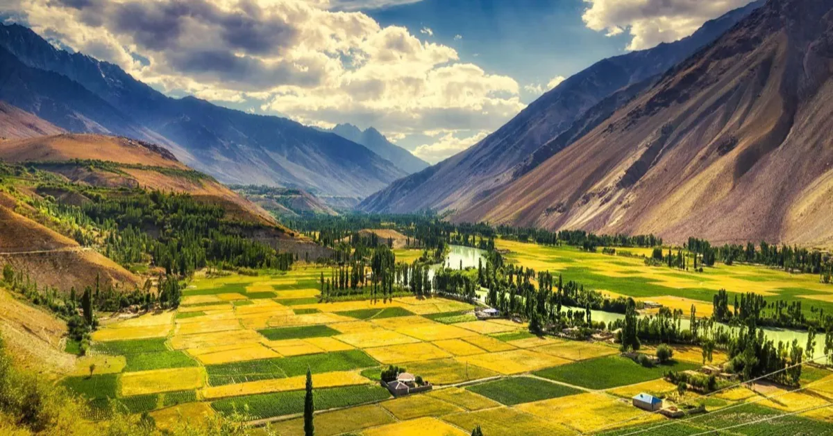
Phandar Valley is a wide, green valley in Gupis-Yasin District, Gilgit-Baltistan, about 165 km west of Gilgit on the road to Shandur Pass. It sits at roughly 2,800 to 2,900 m and is known for Phandar Lake, its brown trout, and a floor of barley terraces and poplars split by the braided Ghizer River. The drive from Gilgit takes five to seven hours, and the season runs May to October.
Most people see Phandar through a car window on the way to Shandur, which is a waste. It is the one valley in Gilgit-Baltistan that stays properly green all summer, and unlike Hunza it has almost no tourist infrastructure and almost no crowds. This guide covers what you actually need: the road, the weather, the lake, and when to come.
Where is Phandar Valley?
Phandar lies in Gupis-Yasin District, Gilgit-Baltistan, on the Gilgit to Shandur road that eventually crosses into Chitral. The coordinates are 36.169°N, 72.934°E.
Two points of confusion worth clearing up, because most guides get at least one of them wrong:
- Ghizer or Gupis-Yasin? Both, depending on when the source was written. Gupis-Yasin District was carved out of Ghizer District in 2019. Phandar is now administratively in Gupis-Yasin, but locals, maps and most travel writing still call the whole corridor the Ghizer Valley. They mean the same place.
- It is not in Khyber Pakhtunkhwa. At least one popular travel site files Phandar under KP. It is firmly in Gilgit-Baltistan; the KP border is up at Shandur, another 45 to 50 km west.
On elevation: the valley floor runs about 2,800 to 2,900 m (9,300 to 9,600 ft). If you see Phandar listed at 1,454 feet, that figure is wrong by roughly a factor of six and appears to be a mangled unit conversion that has been copied between sites.
How to reach Phandar Valley from Gilgit
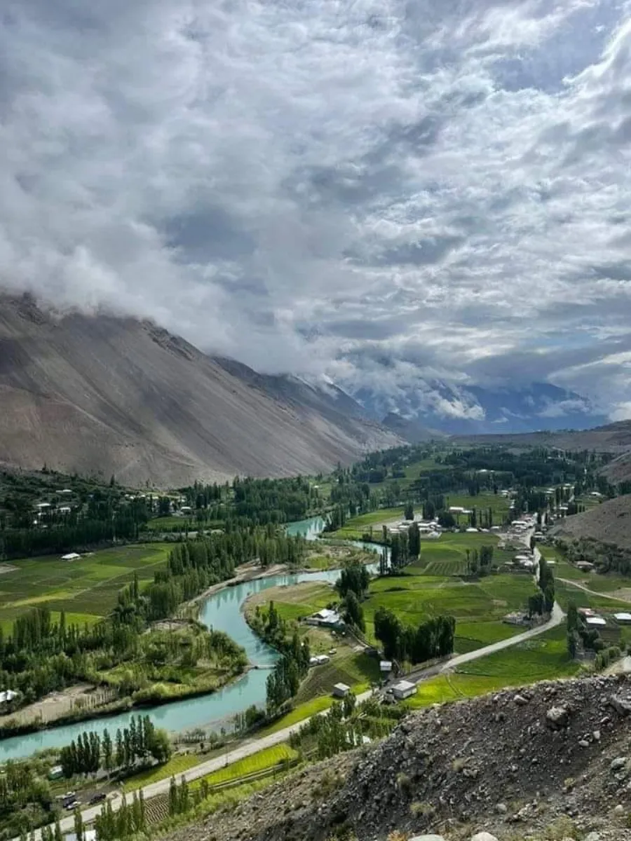
Everything starts at Gilgit. Fly Islamabad to Gilgit (about an hour, weather permitting) or drive up the Karakoram Highway over one to two days. From Gilgit the valley road heads west along the Ghizer River.
| Leg | Distance from Gilgit | Road surface | Rough driving time |
|---|---|---|---|
| Gilgit → Gahkuch (via Singal) | ~70 km | Sealed, good | 1.5 hrs |
| Gahkuch → Gupis | ~110 km | Mostly sealed | 3 to 4 hrs total |
| Gupis → Phandar (via Khalti Lake) | ~165 km | Patchy, breaks up | 5 to 7 hrs total |
| Phandar → Shandur Top | ~210 km | Rough gravel | +2 to 3 hrs |
Public transport: NATCO runs a bus from Gilgit toward Mastuj that passes Phandar, leaving around 6:00 am, plus Hiace minivans later in the morning. Tell the driver you are getting off at Phandar. It works, but it is slow and inflexible, and it will not stop at Khalti Lake for you.
Do you need a 4x4? In good summer conditions a sedan can often make it. The problem is that the section past Gupis degrades, and spring washouts and landslides are routine. We run our Phandar Valley tour in a 4x4 with a local driver for exactly that reason: not because the road is always bad, but because you cannot tell in advance which week it will be.
Phandar Valley weather, month by month
This is where most guides say "pleasant in summer" and move on. Phandar sits at nearly 2,900 m, and the numbers surprise people: July, the warmest month, averages highs of only about 17 °C, with overnight lows near 2 °C. Bring a warm layer in August. You will use it.
| Period | Daytime | Access | What it's like |
|---|---|---|---|
| Nov to Mar | Jan avg high −10 °C, low −21 °C | Shandur closed; valley road unreliable | Heavy snow, most guesthouses shut |
| April | Cold, thawing | Valley road usually opening | Washout season; brown, not yet green |
| May to June | Mild | Shandur typically opens late May | Green comes in; meltwater high |
| July and August | High ~17 °C, low ~2 °C | Fully open | Peak season, full green, most domestic visitors |
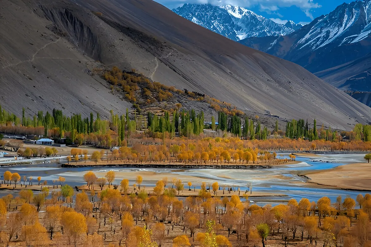
| Late Sep to Oct | High ~10 to 15 °C | Open, closing toward month end | Golden poplars, quiet, best light |
Temperature averages for Phandar; conditions vary year to year and the pass above is always the first thing to close.
When is the best time to visit Phandar?
Late September into the first half of October. The poplars along the whole valley turn gold at once, the domestic season has ended, the light is low and clean, and the road has had all summer to be repaired. July and August are warmer and fully green, but that is also when every Pakistani family road trip is on the same road.
Phandar Lake and the trout
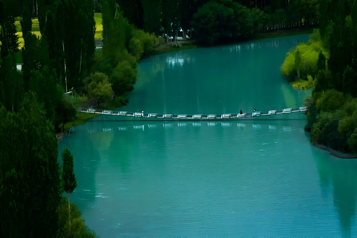
Phandar Lake, known locally as Nango Chatt, is the reason most people come. It is fed by the Ghizer River and is genuinely substantial rather than a pond:
- Length: about 900 m
- Width: about 460 m
- Surface area: roughly 40 acres (16 ha)
- Maximum depth: 44 m
The water shifts colour through the day, grey-green early and deep turquoise by mid-afternoon when the sun is high. It is shallow enough at the edges to walk the shoreline and deep enough in the middle to be properly cold.
Fishing: brown trout were introduced generations ago and the lake is one of the best-known trout waters in the region. You need a permit from the local fisheries office. It is inexpensive, enforcement is inconsistent, and you should still get one. Bring your own tackle if you care about it; what you can hire locally is basic.
The other lakes: Khalti, Handarap and Shandur
Phandar is not the only water in the valley, and the others are worth building a day around:
- Khalti Lake sits right beside the road just past Gupis, broad and shallow. It freezes hard enough in deep winter that people walk on it, and it holds trout as well. This is the easiest stop on the drive up.
- Handarap Lake is up a side valley above Phandar, higher and a good deal quieter. Reckon on half a day from Phandar.
- Shandur Lake lies on the plateau at the head of the valley, next to the polo ground at 3,720 m. Shallow, cold, and bleak in a way that grows on you.
- Khukush Lake and several smaller ones sit off the main road.
Seeing all four in one trip means a base at Phandar and a couple of long days. That is how we build the six-day Ghizer itinerary, so you are not driving the same stretch of road twice.
Where to stay in Phandar
Simple guesthouses, and that is the whole list. There is no hotel in Phandar in the sense most travellers mean, no luxury tier anywhere in the valley, and no chain anything. What you get is a clean room, home-cooked food, usually reliable hot water, and a generator that runs part of the evening.
Almost everything closes from around November to April. Book ahead in July and August, when domestic demand fills the few beds that exist, or let us do it as part of a guided trip up the valley. If you need a higher standard, the nearest is Gilgit, and you would be committing to a five-to-seven-hour drive each way.
Beyond Phandar: Shandur Pass and the polo
Phandar is the last comfortable stop before Shandur Pass at 3,720 m (12,205 ft), the high point of the Gilgit to Chitral road and home to the world's highest polo ground. The pass is snowbound and closed roughly November to May, so a crossing only works in the same window that Phandar is worth visiting.
The Shandur Polo Festival is the region's biggest event, and its dates move. It has traditionally run in early July, but in 2026 it was held from 11 to 13 June after the Khyber Pakhtunkhwa government shifted it. If the festival is why you are coming, confirm the dates before you book anything. Do not trust a blog post, including this one, on next year's schedule.
If you want the whole corridor rather than just Phandar, our Ghizer Valley tour runs Gahkuch to Shandur over six to seven days, and the Shandur Pass road trip continues over the top to Mastuj and Chitral.
At Gupis, before you reach Phandar, a bridge crosses the river and a side road runs north into Yasin. It is worth a spare day: see our Yasin Valley guide for the villages, the road to Darkot and the weather.
Practical notes
- SCOM is the only network with real coverage past Gahkuch, and it is slow. Assume you are offline above Gupis.
- Bring cash. ATMs are effectively a Gilgit and Gahkuch thing, and cards are not accepted in the valley.
- Fill up in Gilgit and top up at Gupis. Do not plan on finding fuel between Gupis and Shandur.
- There is no serious medical facility in the valley, so carry a basic kit and whatever medication you take.
- The Ghizer villages are largely Ismaili and relaxed by Pakistani standards, and women are visible in daily life. Dress modestly anyway, and ask before photographing people.
- At 2,900 m altitude sickness is uncommon. If you carry on up to Shandur at 3,720 m you will notice the difference.
If you would rather not drive it yourself, our Phandar Valley tour covers the valley over four to five days from Gilgit, with the trout permit arranged before you arrive. The longer Ghizer Valley tour takes in Khalti, Handarap and Shandur across six to seven days. For the wider regional picture, including permits and the other valleys, see our Gilgit-Baltistan travel guide.
Frequently asked questions
Where is Phandar Valley located?
Phandar Valley is in Gupis-Yasin District, Gilgit-Baltistan, about 165 km west of Gilgit on the Gilgit-Shandur road. Gupis-Yasin was split off from Ghizer District in 2019, which is why many guides still list Phandar under Ghizer, and locals and maps still call the whole corridor the Ghizer Valley. They mean the same place. It is in Gilgit-Baltistan, not Khyber Pakhtunkhwa, despite what a few travel sites say. The KP border is further on, up at Shandur Pass, another 45 to 50 km west, and the road beyond it drops to Mastuj and Chitral. The coordinates are 36.169°N, 72.934°E if you want to drop a pin. On the way up from Gilgit you pass Gahkuch and Gupis, and at Gupis a side road branches north into Yasin. Phandar itself is the last comfortable stop before the pass, which is why we use it as the base for our Ghizer trips.
How high is Phandar Valley?
The valley floor sits at roughly 2,800 to 2,900 m, about 9,300 to 9,600 feet. Several websites list Phandar at 1,454 feet, which is wrong by a factor of six and probably a botched unit conversion that has been copied from site to site. The real figure matters for packing more than for your lungs. Altitude sickness is uncommon at this height, but the nights are cold even in midsummer: July lows average around 2 °C, so bring a warm layer whatever month you travel. If you carry on west to Shandur Pass at 3,720 m (12,205 ft), you will notice the thinner air, especially walking around the polo ground. A night or two at Phandar first also leaves time for the lake and the side valleys. Handarap Lake, up a side valley above Phandar, sits higher again and makes a good half-day outing.
How do you get to Phandar Valley from Gilgit?
By road west along the Ghizer River through Gahkuch and Gupis: about 165 km, five to seven hours depending on surface and stops. The first 70 km to Gahkuch via Singal is sealed and good, roughly an hour and a half. The road stays mostly sealed as far as Gupis, then gets patchy and breaks up on the last stretch past Khalti Lake. NATCO runs a bus from Gilgit toward Mastuj that passes Phandar, leaving around 6:00 am, and Hiace minivans go later in the morning. Tell the driver you are getting off at Phandar. It works, but it is slow, inflexible and will not stop at Khalti for you. A private 4x4 with a local driver is the practical option, and it is how we run our Phandar Valley tour. Fill the tank in Gilgit and top up at Gupis, because there is no fuel between Gupis and Shandur.
What is the weather like in Phandar Valley?
Cooler than most people expect. Phandar sits at nearly 2,900 m, so July, the warmest month, averages highs near 17 °C with lows around 2 °C, and you will want a warm layer even in August. May and June are mild, with the green coming in and the meltwater high. From late September into October daytime highs drop to roughly 10 to 15 °C and the poplars turn gold. April is cold and thawing, the washout season, and the valley is still brown. From November to March it is properly winter: January averages highs near minus 10 °C and lows around minus 21 °C, with heavy snow, Shandur closed and most guesthouses shut. Conditions vary from year to year, and the pass above the valley is always the first thing to close when the weather turns. Whatever the month, pack a warm layer for the evenings.
When is the best time to visit Phandar Valley?
May to October. Within that window, our pick is late September into the first half of October. The poplars along the whole valley turn gold at once, the domestic season is over, the light is low and clean, and the road has had all summer to be repaired. July and August are the warmest months and the valley is fully green, but that is also when Pakistani family road trips fill the same road and the few guesthouse beds, so book ahead if you come then. May and June bring fresh green and high meltwater, and Shandur typically opens in late May. Outside the May to October window most guesthouses close and the road becomes unreliable, and April in particular is washout season. If you are timing a trip around the Shandur Polo Festival, check the dates first: it has traditionally run in early July, but in 2026 it was held from 11 to 13 June.
Can you fish at Phandar Lake?
Yes. Phandar Lake holds brown trout, introduced generations ago, and it is one of the best-known trout waters in Gilgit-Baltistan. A permit from the local fisheries office is required. It is inexpensive, and although enforcement is inconsistent, you should still get one. Most operators, including us, arrange it in advance, so on our Phandar Valley tour the permit is sorted before you arrive. Bring your own tackle if you care about it, because what you can hire locally is basic. The lake is about 44 m deep in the middle, so the water stays properly cold, while the shallow edges let you walk the shoreline and fish from the bank. Khalti Lake, beside the road just past Gupis, holds trout as well and is the easiest stop on the drive up. With a base at Phandar you can also visit Handarap Lake, half a day up a side valley.
How deep is Phandar Lake?
Phandar Lake reaches a maximum depth of 44 m. It is about 900 m long and 460 m wide and covers roughly 40 acres (16 ha), so it is a substantial body of water rather than a pond. It is fed by the Ghizer River and known locally as Nango Chatt. The edges are shallow enough to walk the shoreline, while the middle is deep enough to stay properly cold all summer. The colour shifts through the day, grey-green early on and deep turquoise by mid-afternoon when the sun is high, so the early afternoon is the time for photographs. A footbridge crosses the lake. It is also one of the region's best-known trout waters, and fishing needs a permit from the local fisheries office, which we arrange for guests. If you have a spare day, Khalti, Handarap and Shandur lakes are all within reach of a base at Phandar.
Is Phandar Valley safe for tourists?
Yes. Ghizer and Gupis-Yasin are among the calmest parts of Pakistan, with largely Ismaili villages and a strong hospitality tradition. The villages are relaxed by Pakistani standards and women are visible in daily life, though you should still dress modestly and ask before photographing people. The genuine risks are road conditions, weather and distance from a hospital rather than security. The road past Gupis breaks up, and spring washouts and landslides are routine. There is no serious medical facility in the valley, so carry a basic kit and any medication you take. Phones are unreliable up the valley, so tell someone your plans before you leave Gilgit. Bring cash, since ATMs are effectively limited to Gilgit and Gahkuch and cards are not accepted in the valley. We run our trips in a 4x4 with a local driver who knows which stretches are bad that week.
Do you need a 4x4 to reach Phandar?
In good summer conditions a normal car can often reach Phandar, but the stretch past Gupis breaks up and washouts appear after rain. The road is sealed and good to Gahkuch and mostly sealed as far as Gupis. After that the surface turns patchy, and every spring brings slips and washed-out sections. Our advice is a 4x4 and a driver from the area, because you cannot tell in advance which week the road will be bad, and that is why we run our Phandar Valley tour that way. Beyond Phandar the road to Shandur Top becomes rough gravel, so a 4x4 is essential if you continue toward the pass or over it to Mastuj and Chitral. Carry enough fuel for the round trip too, as the pumps run out well before the pass. Allow five to seven hours from Gilgit, longer if you stop at Khalti Lake on the way.
Is there mobile signal in Phandar?
Only patchy signal, and only on one network. SCOM is the only network with meaningful coverage in the upper Ghizer valley, past Gahkuch, and even there it is slow. Expect to be offline for stretches, and assume you have no data at all above Gupis. Do not rely on guesthouse wifi either. Guesthouses in Phandar are simple, and the generator often runs only part of the evening. In practice that means downloading offline maps and anything else you need while you are still in Gilgit, and telling people at home that you will be out of touch for a few days. It is also worth carrying enough cash for the whole stay, because you cannot count on card payments or transfers in the valley, and the last cash machines are in Gilgit and Gahkuch. On our guided trips the local driver knows the road and the stops, so a dead phone does not leave you stuck.
Ready for Your Next Adventure?
Join our community of explorers and discover the journey of a lifetime. Our expert team is ready to help you plan your perfect expedition.