Karakoram Highway: The Complete 2026/2027 Travel Guide
Everything you need to drive the world's highest paved international road: the full route and driving times, when to go, real 2026 costs, the best stops from Hunza to Khunjerab, safety, and the Pakistan-China border.
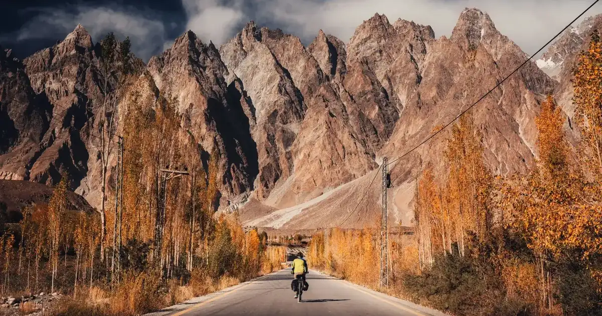
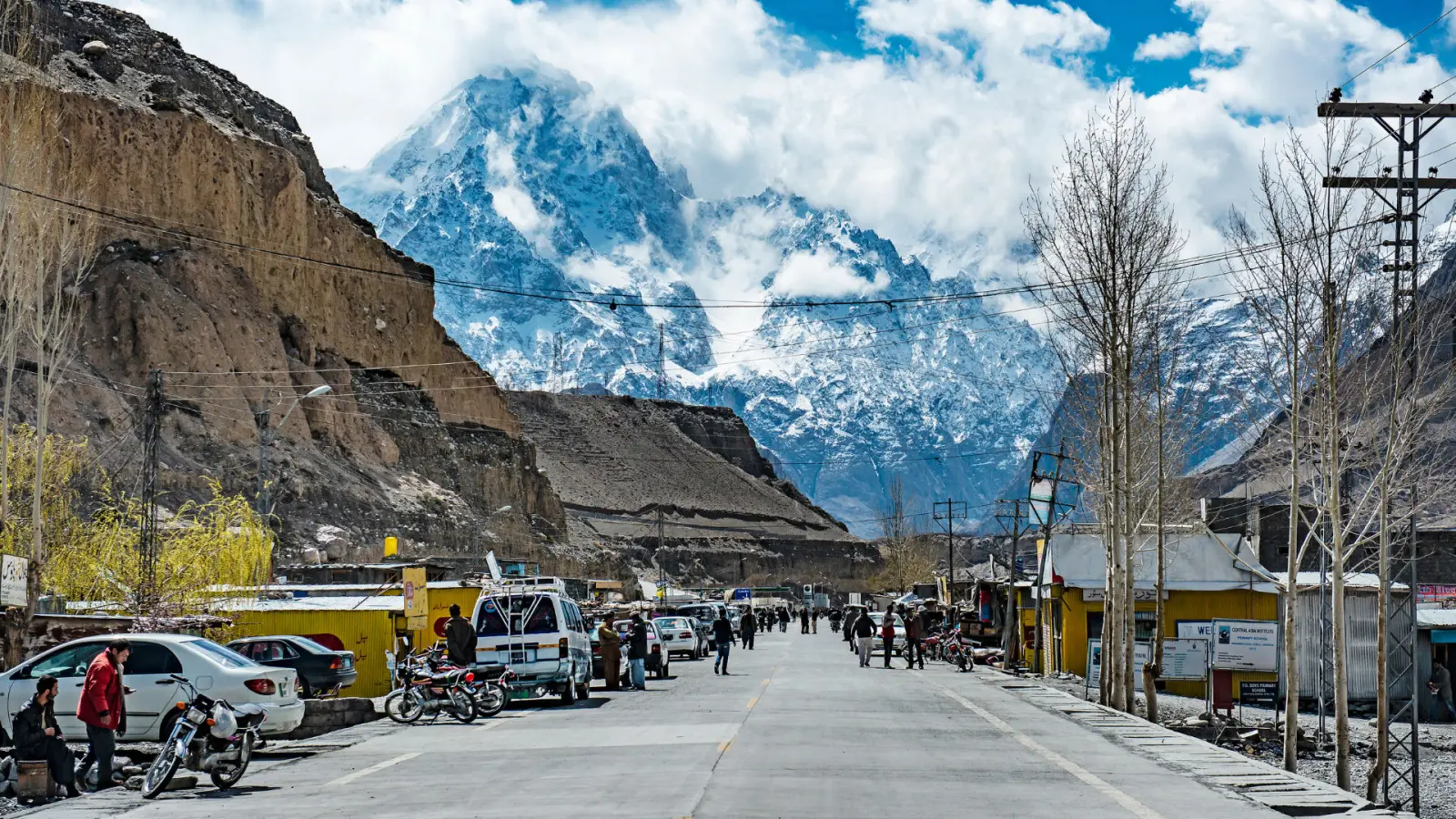
People call the Karakoram Highway a lot of things: the highest paved international road in the world, the "Eighth Wonder of the World," the friendship road between Pakistan and China. Drive it once and the labels stop mattering. What sticks is the scale of it, a two-lane ribbon threaded between 7,000 m peaks, glaciers that spill almost to the tarmac, and river gorges deep enough to swallow the daylight.
This guide is built for the traveller actually planning the trip in 2026 or 2027, not the daydreamer. You will get the real route with distances and driving times, when to go, what the drive costs, the stops worth stopping for, the honest safety picture, and how the Pakistan-China border at Khunjerab really works. We run this road on tour every season, so the numbers here come from doing it, not from a map.
What is the Karakoram Highway?
The Karakoram Highway is a 1,300 km (about 810 mile) international highway that runs from Hasan Abdal, roughly an hour northwest of Islamabad, up through Pakistan's mountain north and over the Khunjerab Pass into China, ending at Kashgar in Xinjiang. Around 806 km of it lie inside Pakistan, where it is signed as the N-35. Locals and travellers alike just call it the KKH.
It was carved out of the mountains between 1959 and 1979 by Pakistani and Chinese crews and opened to the public in 1986. It came at a brutal cost: an estimated 810 Pakistani and around 200 Chinese workers died during construction, most of them to rockfall and accidents. The road follows one of the old branches of the Silk Road, which is why you still pass caravanserai ruins, rock carvings, and Buddhist petroglyphs along the way.
The highway also cuts through the meeting point of three of the planet's greatest mountain ranges, the Karakoram, the Himalaya, and the Hindu Kush. There is a marked viewpoint near Jaglot where the three ranges converge above the Indus, and it is one of the few places on earth you can stand and see that geography with your own eyes.
The Karakoram Highway route, stop by stop
Most travellers drive the Pakistani section from Islamabad to the border and back rather than crossing into China, which needs a separate Chinese visa and a group tour. Here is how the route breaks down, with realistic 2026 driving times (mountain roads, not motorways, so plan for stops and delays).
| Section | Approx. distance | Driving time | Why it matters |
|---|---|---|---|
| Islamabad → Besham / Chilas | ~350-450 km | 8-11 hrs | Long first day; either via the Hazara Motorway and KKH, or over Babusar Pass in summer |
| Chilas → Gilgit | ~130 km | 3-4 hrs | Nanga Parbat viewpoint and the three-ranges junction |
| Gilgit → Karimabad (Hunza) | ~100 km | 2.5-3 hrs | Rakaposhi view point, gateway to central Hunza |
| Karimabad → Attabad Lake → Passu | ~55 km | 1.5-2 hrs | The turquoise lake, the Attabad tunnels, the Hussaini Suspension Bridge, the Passu Cones |
| Passu → Sost → Khunjerab Pass | ~85 km | 2.5-3 hrs | Last town, immigration post, then the 4,693 m border |
Add it up and Islamabad to the Khunjerab Pass is roughly two full days of driving each way, which is why almost everyone breaks the journey with overnights in Chilas or Gilgit on the way up. Fly Islamabad to Gilgit (about an hour, weather permitting) and you skip the longest, least scenic stretch entirely.
Hunza Valley and Karimabad
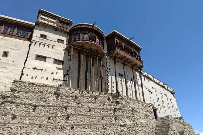
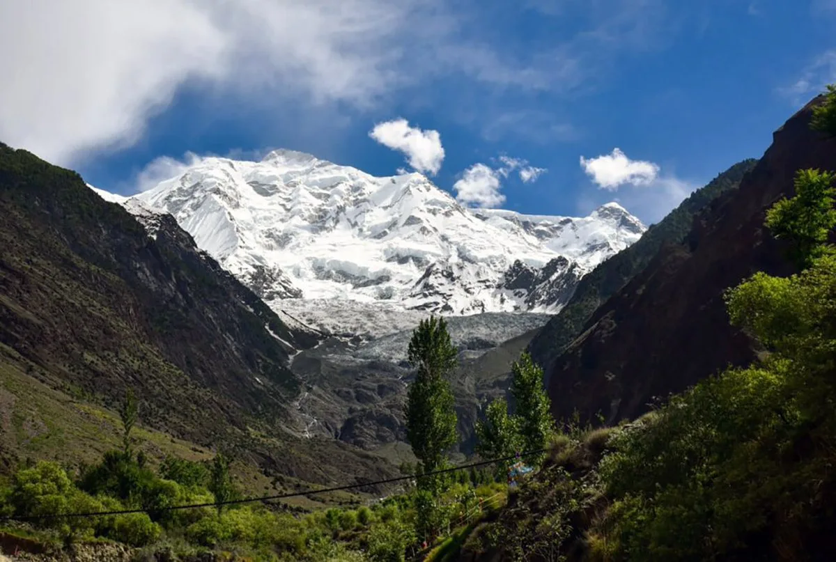
If the KKH has a heart, it is Hunza. Karimabad, the main town, sits on a terraced hillside under the 7,788 m wall of Rakaposhi, with the 700-year-old Baltit and Altit forts above the old bazaar. Most people base here for two or three nights and day-trip out. For where to stay and what to actually do, see our guide to the best places to visit in Hunza Valley.
Attabad Lake and the tunnels
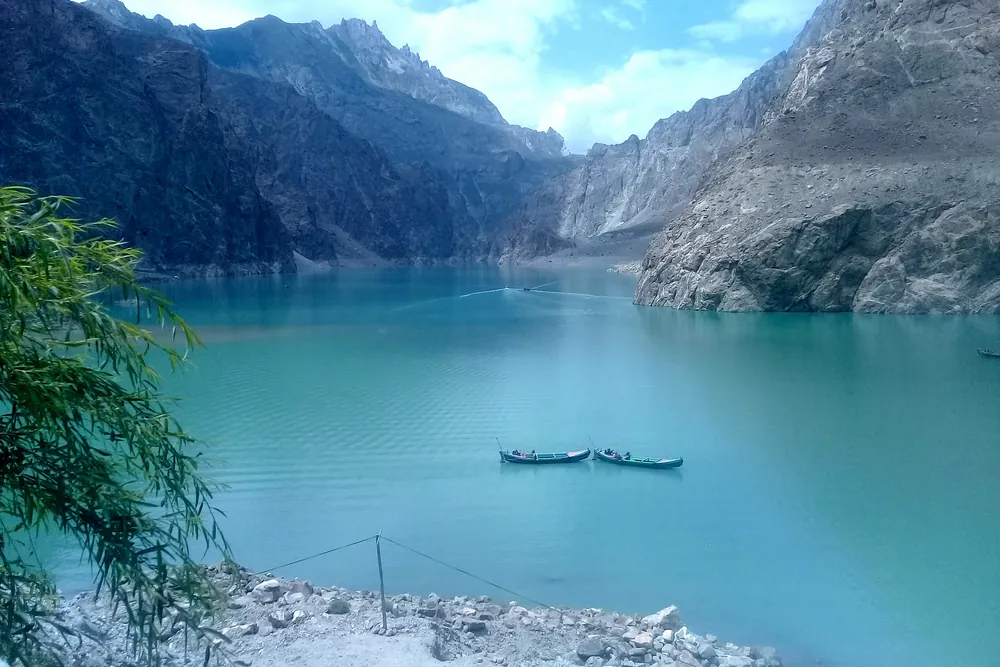
In January 2010 a massive landslide dammed the Hunza River, drowned part of the KKH, and created Attabad Lake, a startling turquoise body of water. For five years travellers crossed it by boat. Then China and Pakistan drilled the Attabad tunnels, five tunnels totalling around 24 km, which opened in September 2015 and put the road back on dry land. Today the lake is a highlight rather than an obstacle, with jetboats, zip lines, and lakeside cafés. Our full Attabad Lake guide covers the boat rides and best viewpoints.
Hussaini Suspension Bridge
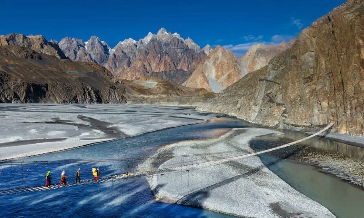
Between Gulmit and Passu, a short walk down from the KKH at Hussaini village, a footbridge of wooden planks and steel cables spans the Hunza River to Zarabad on the far bank. The Hussaini Suspension Bridge is roughly 190 m long, the planks are spaced wide enough that you watch the river rush through the gaps, and the whole thing sways with every step and every gust. It has been rebuilt after floods more than once, and the frayed remains of an older bridge still hang beside it. Locals charge a small entry fee at the top of the path. Give it an hour, go in the morning before the valley wind picks up, and turn round mid-river for the classic shot with the Passu Cones behind you.
Passu and the Cones
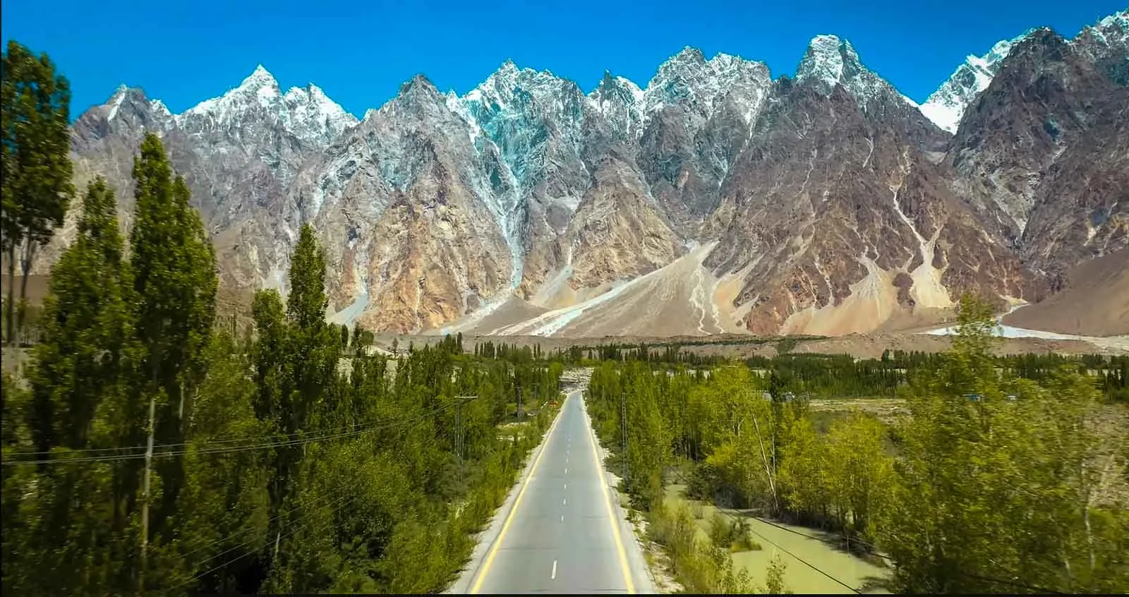
North of Attabad the road runs straight at the Passu Cones (Tupopdan), a row of impossibly sharp 6,000 m spires that are the single most photographed sight on the highway. The Passu and Batura glaciers, the swaying Hussaini suspension bridge, and the village of Gulmit are all within a short drive. Our Passu Cones guide maps out the viewpoints.
Sost and the Khunjerab Pass
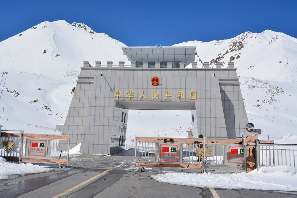
Sost is the last Pakistani town and the site of the dry port and immigration post. Beyond it the road climbs into Khunjerab National Park, home to ibex, marmots, and the occasional snow leopard, before topping out at the Khunjerab Pass (4,693 m), the actual Pakistan-China border. Even if you are not crossing into China, the run up to the border gate for a photo at the highest paved frontier on earth is a rite of passage. Take it slowly; altitude is real up here.
When is the best time to drive the Karakoram Highway?
The short version: May through October. Each window has a different character.
- April to mid-May: cherry and apricot blossom carpets Hunza. Beautiful, but the high country is still shaking off winter and the Khunjerab Pass may not be open yet.
- June to August: peak season. Everything is open, the passes are clear, and Deosai and the side valleys are accessible. Also the busiest and hottest at lower elevations.
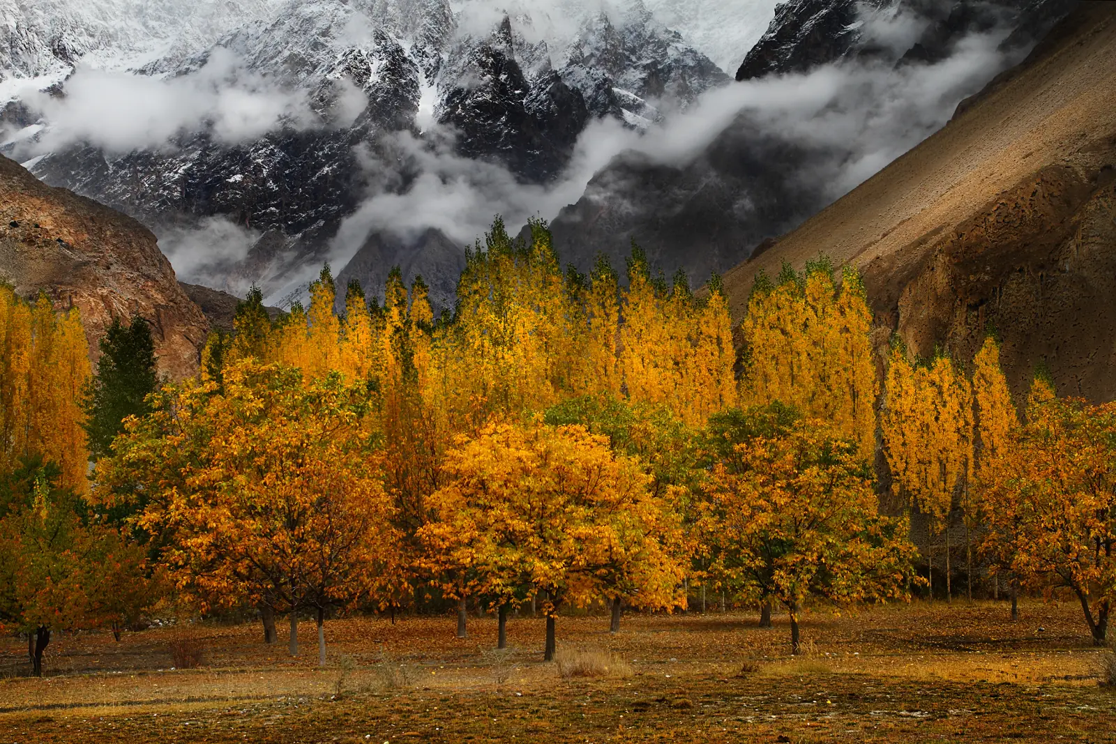
- Late September to October: our favourite. The poplars and orchards turn gold, skies are clear, and the crowds thin out. Nights get cold and the season is closing, so go early October rather than late.
- November to March: deep winter. The KKH stays open to Hunza most of the time, but snow closes the Khunjerab Pass and heavy weather can shut sections for days.
For a wider seasonal breakdown of the whole region, our Gilgit-Baltistan travel guide goes month by month.
Is the Karakoram Highway safe?
Yes, for the most part. Gilgit-Baltistan, the region the KKH runs through, is one of the safest and most welcoming parts of Pakistan, and tourism there is well established. Solo travellers and women travellers report feeling comfortable. The real risks on the KKH are not security; they are the road itself.
- Landslides and rockfall are the main hazard, especially after rain and in spring melt. Sections can close for hours or, rarely, days.
- Mountain driving means blind corners, no barriers in places, and drivers who overtake with faith. A local driver who knows the road is worth every rupee.
- Altitude hits fast near Khunjerab. Ascend gradually, drink water, and do not sleep at the pass.
- Weather can strand you. Build a buffer day into any itinerary that involves the border or a flight.
Check current conditions before you set off, keep your paperwork in order, and travel the open season rather than pushing into the shoulders. The wider safety picture for the north is covered in our Gilgit-Baltistan guide.
How much does a Karakoram Highway trip cost?
Costs vary wildly with how you travel. As a 2026 reality check, here is roughly what a week on the KKH runs per person, excluding your international flights.
| Style | Typical daily cost | What it covers |
|---|---|---|
| Backpacker / public transport | US$25-45 / day | Shared vans and buses, guesthouses, local food. Cheap but slow and rigid. |
| Private car with driver | US$70-110 / day | Your own 4x4 or sedan and a local driver, mid-range hotels. The sweet spot for most. |
| Fully guided tour | US$130-190 / day | Driver, guide, hotels, permits, and logistics handled end to end. |
Self-driving is possible but rarely worth it for a first visit: the road is demanding, fuel stops are sparse north of Gilgit, and a driver frees you to actually look up at the mountains. If you would rather have every permit, hotel, and border formality arranged, our complete Karakoram Highway road trip runs the full route from Islamabad to Khunjerab with a local guide and 4x4.
Crossing into China at Khunjerab
Actually crossing the border is a different trip from a KKH road trip, and it trips people up. The practical points for 2026:
- You need a Chinese visa arranged in advance; there is no visa on arrival at Khunjerab, and independent overland crossing is heavily restricted.
- The border is officially open from 1 April to 30 November and closed in winter, but snow makes May to October the reliable window for travellers. A 2025 agreement moved the border toward year-round trade operation, but the practical tourist window is still the warm season.
- Immigration is handled at Sost on the Pakistan side, not at the pass itself, and the border generally operates Monday to Friday.
- From the pass, onward transport takes you to Tashkurgan and then Kashgar. This leg is normally done as part of an organised tour.
If you only want to reach the border marker and turn back, that is easy and needs no Chinese visa; you can do it as a long day trip from Hunza or on our Khunjerab Pass tour. For the fine print on the crossing, the Wikivoyage Karakoram Highway page and the Khunjerab Pass entry are useful references.
Frequently asked questions
How long is the Karakoram Highway?
The KKH is about 1,300 km (810 miles) in total, from Hasan Abdal near Islamabad to Kashgar in China. Around 806 km of it lie inside Pakistan, where it is numbered the N-35. Hasan Abdal is roughly an hour northwest of Islamabad, and from there the road climbs through Pakistan's mountain north to the Khunjerab Pass at 4,693 m before crossing into Xinjiang. Most travellers only drive the Pakistani section, out to the border and back. In stages, that is about 350 to 450 km from Islamabad to Besham or Chilas, around 130 km on to Gilgit, about 100 km to Karimabad in Hunza, some 55 km past Attabad Lake to Passu, and roughly 85 km through Sost to the pass. These are mountain roads, not motorways, so Islamabad to Khunjerab takes about two full days of driving each way, and almost everyone breaks the journey with overnights in Chilas or Gilgit.
Is the Karakoram Highway open in 2026?
Yes. The Pakistani section stays open year-round to Hunza, apart from temporary closures for landslides or snow. The Khunjerab Pass border, however, is only reliably open to travellers from about May to late October, and closes under winter snow. A 2025 agreement moved the border towards year-round trade operation, but the practical window for tourists is still the warm season. In April and early May the Hunza valley is in blossom, though the pass may not be open yet. From November to March, heavy weather can shut sections of the road for days, and landslides and rockfall after rain or during the spring melt can close it for hours at a time. Before setting off, check current conditions, and build a buffer day into any plan that involves the border or a flight. We run this road on tour every season, so ask us how it is looking before you fix your dates.
How high is the Karakoram Highway?
Its highest point is the Khunjerab Pass at 4,693 m (15,397 ft), which is the highest paved international border crossing in the world. The pass marks the Pakistan-China border and sits inside Khunjerab National Park, home to ibex, marmots and the occasional snow leopard. You reach it from Passu on a section of about 85 km that takes 2.5 to 3 hours, passing Sost, the last Pakistani town and site of the immigration post. Most of the road runs far lower, threaded between 7,000 m peaks such as Rakaposhi at 7,788 m above Hunza, so the final climb to the border comes quickly and the altitude is real. Ascend gradually, drink plenty of water and do not sleep at the pass. On our tours we stage the height with nights in Hunza and Passu, spend a short time at the border gate for photographs, and then come back down to a lower night.
Who built the Karakoram Highway and why?
It was built jointly by Pakistan and China between 1959 and 1979 and opened in 1986, to create a permanent land link between the two countries along an old Silk Road route. Pakistani and Chinese crews carved it out of the mountains over twenty years, and the cost was brutal. An estimated 810 Pakistani and 200 Chinese workers died during construction, most of them to rockfall and accidents. Because the road follows one branch of the Silk Road, you still pass caravanserai ruins, rock carvings and Buddhist petroglyphs along the way. The two countries have kept working on it since. In January 2010 a landslide dammed the Hunza River, drowned part of the highway and created Attabad Lake, and for five years travellers crossed it by boat. China and Pakistan then drilled five tunnels totalling around 24 km, which opened in September 2015 and put the road back on dry land.
Do you need a permit to travel the Karakoram Highway?
No special permit is needed to drive the Pakistani section and reach the Khunjerab Pass on a standard Pakistan visa, though a small fee applies at Khunjerab National Park. Driving up to the border marker and turning back is easy and needs no Chinese visa, and you can do it as a long day trip from Hunza. Keep your paperwork in order and to hand on the way north. Actually crossing into China requires a Chinese visa arranged in advance. There is no visa on arrival at Khunjerab, and independent overland crossing is heavily restricted. Immigration is handled at Sost rather than at the pass, the border generally operates Monday to Friday, and the onward leg to Tashkurgan and Kashgar is normally done as part of an organised tour. On our Khunjerab and Karakoram Highway tours, the park fees and the formalities on the Pakistani side are arranged for you.
Can you self-drive the Karakoram Highway?
You can, but it is demanding: narrow mountain sections, landslide risk, and sparse fuel north of Gilgit. Expect blind corners, no barriers in places and drivers who overtake with faith. Landslides and rockfall after rain or during the spring melt can close sections for hours, and the altitude comes on fast near Khunjerab. Most first-time visitors are better off with a local driver or a guided tour, which is safer and lets you enjoy the scenery instead of watching the next bend. On cost, a private car or 4x4 with a local driver and mid-range hotels runs about US$70 to 110 a day per person, which is the sweet spot for most travellers. A fully guided tour, with guide, hotels, permits and logistics handled end to end, runs about US$130 to 190 a day. If you want all of that arranged, our complete Karakoram Highway road trip covers Islamabad to Khunjerab with a local guide and 4x4.
How many days do you need for the Karakoram Highway?
Plan on a minimum of 7 days for a comfortable Islamabad-to-Khunjerab return with time in Hunza. Driving from Islamabad to the pass takes about two full days each way, with overnights in Chilas or Gilgit, so anything shorter leaves you mostly in the car. Flying Islamabad to Gilgit, about an hour when the weather allows, skips the longest and least scenic stretch and frees up days at the top end. Most people base themselves in Karimabad for two or three nights and day-trip out to Attabad Lake, Passu and the Khunjerab Pass, which is a long day from Hunza. Ten days lets you add side valleys like Naltar or Shimshal without rushing the drive. Whatever the length, keep a buffer day for landslides or a cancelled flight. Our Karakoram Highway Complete tour, from Islamabad to Khunjerab, runs 9 to 11 days.
Is the Hussaini Suspension Bridge safe to cross?
Yes, for most reasonably fit visitors, as long as you take it slowly. The bridge hangs on steel cables and is kept in repair by the local community, and thousands of tourists cross it every summer. What makes it feel dangerous is the wide gaps between the wooden planks and the sway, which grows as the afternoon wind comes up the valley. Hold the side cables with both hands, watch your feet rather than the water, and cross in small groups instead of crowding the middle for photos. Children should be accompanied, and anyone nervous of heights can walk a few metres out for a picture and come back. Avoid it in strong wind, rain, or when the planks are icy in winter. The bridge is a few minutes south of Passu on the Karakoram Highway, so it fits easily into a drive to the Passu Cones or the Khunjerab Pass.
Ready for Your Next Adventure?
Join our community of explorers and discover the journey of a lifetime. Our expert team is ready to help you plan your perfect expedition.