Passu Cones: Complete Guide to Hunza's Cathedral Peaks
A licensed Karakoram operator's guide to the Passu Cones (Tupopdan): where they are, the best roadside viewpoints, when to go for golden light, and the stops worth making nearby.
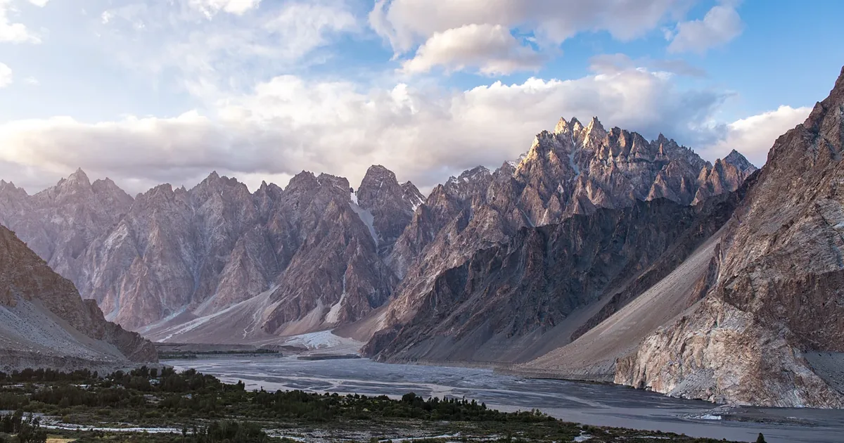
The Passu Cones are a row of near-vertical rock spires that rise straight off the Karakoram Highway in Upper Hunza, northern Pakistan. Their local name is Tupopdan, and the highest point reaches 6,106 metres (20,033 feet). You do not need to trek to reach them: the best view is from the road itself, beside Passu village in the Gojal valley.
This guide covers what the Cones actually are, where to stand for the best photo, how to get there, the season that turns the whole valley gold, and every stop worth adding on the same drive. It comes from years of running trips along this stretch of the Hunza Valley.
What are the Passu Cones (Tupopdan)?
Tupopdan means "shining wall" in the local Wakhi language, and once you watch the ridge catch the first light of morning the name makes sense. What looks like a dozen separate peaks is really one long serrated ridge, sculpted into sharp cones by ice and erosion. The tallest point stands at 6,106 m, and the whole wall runs above the west bank of the Hunza River just north of the village of Gulmit.
The shape is why travellers started calling it the Passu Cathedral or Cathedral Ridge: the spires line up like the towers of a Gothic church. Whatever you call it, this is the postcard image of Upper Hunza, and it turns up on tourism posters, magazine covers and roughly every second trip report from the region.
One quick clarification, because the names get mixed up: the Cones (Tupopdan, 6,106 m) are not the same as Passu Sar (7,478 m) or the Passu Glacier, both of which sit nearby but are separate features. When people say "Passu Cones," they mean the row of sharp rock towers you see from the highway.
Where are the Passu Cones?
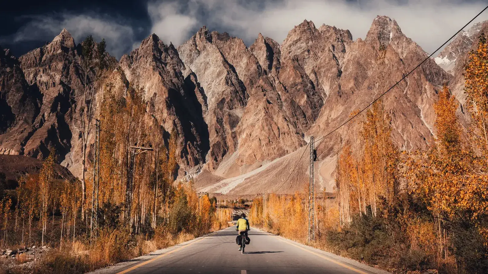
The Cones stand in Passu village, part of the Gojal (Upper Hunza) region of Gilgit-Baltistan, in Pakistan's far north. The Karakoram Highway (KKH) runs right along their base, which is what makes them so easy to reach compared with most high peaks in the range. Here is how Passu sits relative to the places most travellers start from:
- From Karimabad (central Hunza): about 55 km, a 1.5 to 2 hour drive north on the KKH, passing Attabad Lake on the way.
- From Gilgit: about 150 km, or 4 to 5 hours, with Rakaposhi viewpoint and Attabad Lake as natural stops.
- From Sost and the Khunjerab side: roughly 40 km south of Sost, so it is an easy add-on if you are heading up to the China border.
- From Islamabad: around two days by road up the full length of the KKH, usually broken with a night in Chilas or Gilgit.
How to reach the Passu Cones
Getting there is genuinely simple. The viewpoint is on a public highway, so no permit or entry ticket is needed to see the Cones themselves (the separate Khunjerab National Park fee only applies further north, past Sost). You have three realistic options:
- Private car or jeep with a driver: the most flexible way, and what most of our guests use. You can stop for photos whenever the light is good and detour to Borith Lake or the glacier on the same day.
- Public bus: NATCO and private coaches run the KKH between Gilgit, Hunza and Sost. Ask to be dropped at Passu; the ridge is right there when you step off.
- Cycling or motorbike: this section of the KKH is a bucket-list ride, and the Cones are the reward at the top of the valley.
If you would rather not arrange the logistics yourself, the Cones feature on our Hunza to Khunjerab road trip, which drives this whole stretch of the highway with stops built in.
The best Passu Cones viewpoint
There is no single "official" viewpoint, and that is part of the charm: the ridge is visible for several kilometres along the road. That said, a few spots stand out:
- The roadside pull-offs near Passu village. This is the classic head-on view, with the highway leading your eye straight into the spires. A cluster of small cafes here let you sit with a cup of tea and the full ridge in front of you.
- Just south, toward Hussaini. From here the Cones line up with the braided Hunza River in the foreground, which is the shot most photographers are after.
- Borith Lake and the Passu Glacier trail. A short detour lifts you above the road for a higher, quieter angle.
For light, aim for early morning, when the sun hits the east faces and the spires glow, or the hour before sunset. Midday is the flattest and least flattering time to shoot.
Best time to visit the Passu Cones
The short answer: May to October for reliable weather and open roads, with mid-October the standout for autumn colour. Here is how the seasons compare:
| Season | Months | What to expect | Road access |
|---|---|---|---|
| Spring | Apr–May | Blossom in the valley, cool and fresh, occasional cloud on the peaks | Open, some late-snow risk high up |
| Summer | Jun–Aug | Warmest weather, long days, greenest valley; busiest with domestic visitors | Fully open |
| Autumn | Sep–Oct | Clear skies and golden poplars; the best light and colour of the year | Fully open |
| Winter | Nov–Mar | Snow-dusted spires and near-empty roads, but very cold; some hotels closed | Occasional closures after snow |
If you can only pick one week, make it the second or third week of October. The contrast of the gold trees against the grey-brown rock is what draws photographers to Passu in the first place.
Things to do near the Passu Cones
The Cones are a viewpoint, so most people pair them with the sights strung along this part of the valley. Within a short drive you have:
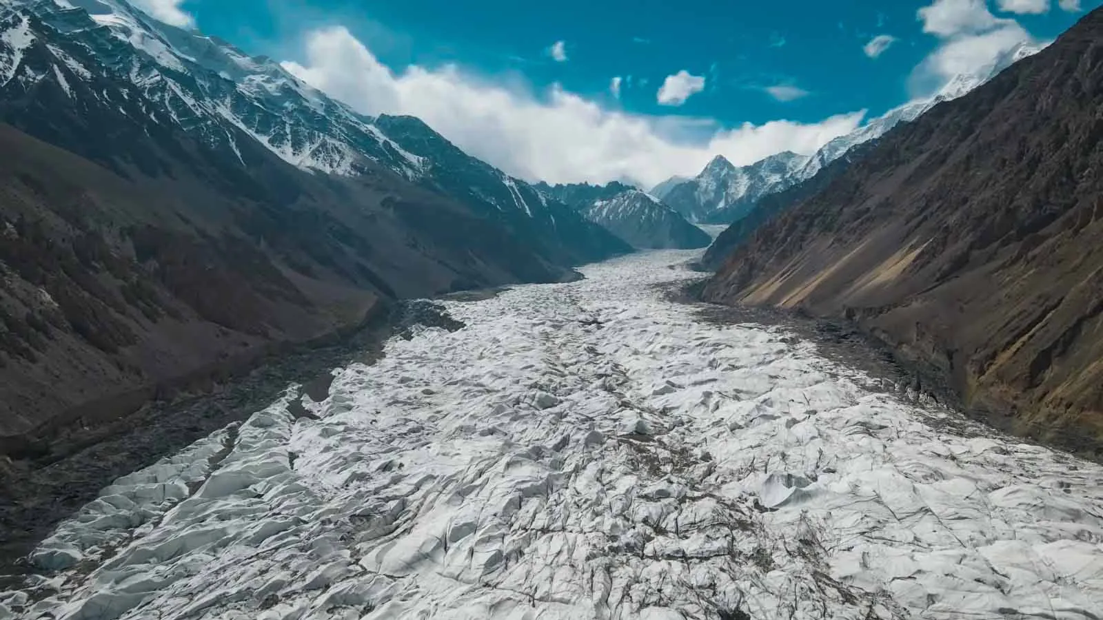
- Passu Glacier: a black-and-white river of ice reachable on a short, well-marked walk from the road.
- Hussaini Suspension Bridge: the famous, wobbly plank bridge over the Hunza River, a few kilometres south in Hussaini village.
- Borith Lake: a quiet brackish lake below the Ghulkin and Passu glaciers, good for a night's stay and easy walking.
- Batura Glacier: one of the longest glaciers outside the polar regions, with a multi-day trek for those who want more.
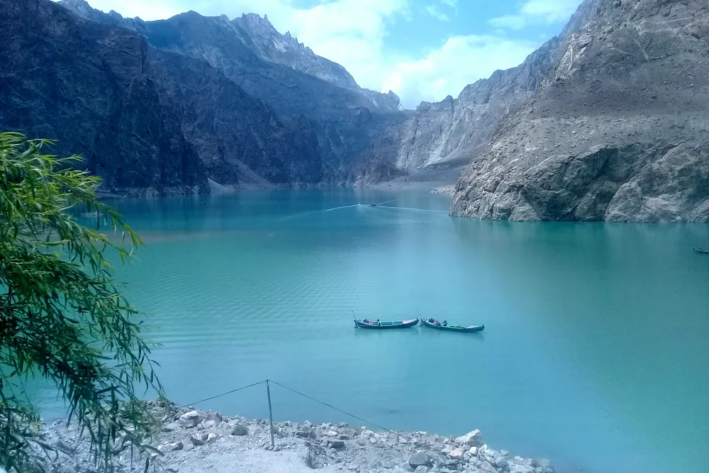
- Gulmit and Attabad Lake: the old Gojal capital and the startlingly blue lake formed by the 2010 landslide, both on the drive up.
- Khunjerab Pass: the 4,693 m China border, about 2.5 hours further north for anyone chasing the top of the KKH.
For a wider plan of the region, our roundup of the best places to visit in Hunza Valley maps out how these stops fit together, and our Hunza tour packages guide covers typical routes and costs. You can also read more on the region's geography via the Wikipedia entries for Passu village and Tupopdan.
Can you climb the Passu Cones?
For almost everyone, no, and that is fine. The Passu Cathedral (6,106 m) is a serious technical rock objective, with steep, loose spires that see very few attempts and no straightforward walking route to the top. It sits in a different league from the trekking peaks and base-camp walks in the region. If you are a climber researching an expedition rather than a viewpoint, see our Passu Cathedral expedition page. Everyone else can enjoy the ridge exactly as it was meant to be enjoyed: from a cafe chair with a camera.
Where to stay near the Passu Cones
Passu itself has a handful of simple guesthouses and small hotels, several with the Cones framed from the terrace. Many travellers instead base in Gulmit (about 20 minutes south, with more choice) or push on to Sost if they are border-bound. For a more comfortable trip, staying in Karimabad and visiting Passu as a day trip works well, since the drive up the valley is scenic in its own right.
Practical tips for visiting
- Carry cash. Card payments are rare in Gojal, and ATMs are limited north of Karimabad.
- Mobile signal is patchy. An SCOM SIM tends to work best in Upper Hunza; expect gaps between villages.
- Altitude is mild here. Passu sits around 2,500 m, so the viewpoint itself is not a problem, but pace yourself if you continue to Khunjerab at 4,693 m.
- Dress in layers. Mornings and evenings are cold even in summer once the sun drops behind the ridge.
Passu Cones: frequently asked questions
How tall are the Passu Cones?
The highest point, the peak Tupopdan, is 6,106 metres (20,033 feet). The Cones are a ridge of sharp rock spires rather than one summit, which is why they look like a row of cones or a cathedral from the road.
Do you need to hike to see the Passu Cones?
No. The main viewpoint is right beside the Karakoram Highway at Passu village, so you can see and photograph the Cones with no walking at all. Short optional hikes toward Passu Glacier or Borith Lake give you different angles.
What is the best time to visit the Passu Cones?
May to October, with mid-October the highlight when the poplars turn gold against the grey spires. Winter brings snow and the occasional road closure.
How far are the Passu Cones from Karimabad?
About 55 km north on the KKH, a 1.5 to 2 hour drive that passes Attabad Lake and the Hussaini bridge. From Gilgit it is roughly 150 km, or 4 to 5 hours.
Can you climb the Passu Cones?
The Passu Cathedral (6,106 m) is a demanding technical climb that is very rarely attempted. Nearly every visitor experiences the Cones as a viewpoint and photography stop instead.
Ready to see them for yourself? We build the Passu Cones into most of our Upper Hunza itineraries. Browse our Hunza Valley tours or tell us what you have in mind and we will plan the drive around the best light.
Ready for Your Next Adventure?
Join our community of explorers and discover the journey of a lifetime. Our expert team is ready to help you plan your perfect expedition.