Gilgit-Baltistan: The Complete Travel Guide (2026/2027)
Where it is, is it safe, the best time to go, the top places, permits, sample itineraries and costs: a first-hand operator's guide to travelling Pakistan's mountain north.
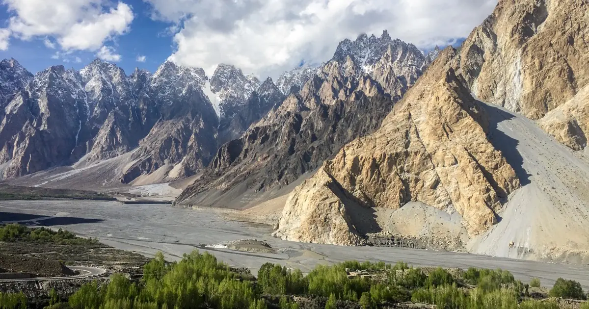
Where is Gilgit-Baltistan? Gilgit-Baltistan is the mountainous northernmost territory of Pakistan, bordering China, Afghanistan and Indian-administered Kashmir. Its capital is Gilgit, and it holds five of the world's fourteen 8,000-metre peaks, including K2. This is where the Karakoram, Himalaya and Hindu Kush ranges meet. The best time to visit is May to October, and for most travellers no special permit is needed to reach the main valleys.
If Pakistan has a headline act, this is it. Gilgit-Baltistan is the region people mean when they talk about the Karakoram Highway, Hunza's apricot blossom, the turquoise of Attabad Lake or the pyramid of K2. It is huge, high and gloriously varied, and it rewards a bit of planning. This guide pulls together the essentials, where it is, whether it is safe, when to go, the places worth your days, how to get there, the permit picture, sample itineraries and rough costs, from years of running trips across the region. Use it to shape a trip, then message us to lock in the details.
| Gilgit-Baltistan at a glance | Detail |
|---|---|
| Where | Northernmost territory of Pakistan, bordering China, Afghanistan and Kashmir |
| Capital | Gilgit |
| Area | About 72,500 km2 (roughly the size of Ireland) |
| Population | Around 1.7 million (2023 census) |
| Administration | 3 divisions and 10 districts, a self-governing territory |
| Languages | Shina, Balti, Burushaski, Wakhi and Khowar; Urdu is the lingua franca |
| Currency | Pakistani Rupee (PKR) |
| Highest peak | K2, 8,611 m, one of five eight-thousanders in the region |
| Best time to visit | May to October |
| Getting there | Fly to Gilgit or Skardu from Islamabad, or drive the Karakoram Highway |
Where is Gilgit-Baltistan?
Gilgit-Baltistan sits at the top of Pakistan, wrapped around the western Himalaya and the heart of the Karakoram. It shares borders with China (over the Khunjerab Pass), a thin strip of Afghanistan (the Wakhan Corridor), and Indian-administered Kashmir to the south-east. Near Gilgit, at a spot called the Junction Point, three of the world's great mountain ranges collide: the Karakoram, the Himalaya and the Hindu Kush.
Administratively it is a self-governing territory rather than a full province, covering about 72,500 km2 across three divisions and ten districts. The capital, Gilgit, and the Baltistan hub of Skardu are the two arrival points most travellers use. From Islamabad, Gilgit is roughly a two-day drive up the Karakoram Highway or a one-hour flight, weather permitting.
Is Gilgit-Baltistan safe to visit?
Yes. Gilgit-Baltistan is widely considered one of the safest parts of Pakistan for travellers, including solo and female travellers, and tourism here is well established. The security concerns people associate with Pakistan mostly relate to other regions; the northern valleys of Hunza, Nagar, Gojal and Baltistan are calm, welcoming and used to visitors.
The real risks up here are practical rather than personal: altitude (much of the region sits above 2,000 m, and passes climb past 4,000 m), road conditions and weather, especially landslides during the July-August monsoon and snow closures in winter. Travel in the open season, build in buffer days, and use a local driver who knows the roads. Sectarian tensions have occasionally flared around Gilgit town in the past, so most itineraries simply push straight on to the valleys.
Best time to visit Gilgit-Baltistan
For the mountains, the season runs May to October. Here is the short version:
- Spring (April to May): cherry and apricot blossom in Hunza, green lower valleys, fewer crowds. Higher passes may still be closed.
- Summer (June to August): the full season. Khunjerab and the trekking routes are open, and Deosai follows from roughly July to September, but July and August bring the monsoon to the approaches and the biggest domestic crowds.
- Autumn (late September to October): our pick. Clear skies, golden poplars and thinner crowds, with roads still open.
- Winter (November to March): the high country closes under snow. Beautiful and quiet for the adventurous, but many roads and services shut down.
For a fuller month-by-month breakdown, see our guide to the best time to visit Pakistan.
Top places to visit in Gilgit-Baltistan
You could spend a month here and not see it all. These are the regions that anchor most trips, roughly in the order travellers reach them coming up from Islamabad.
Hunza Valley
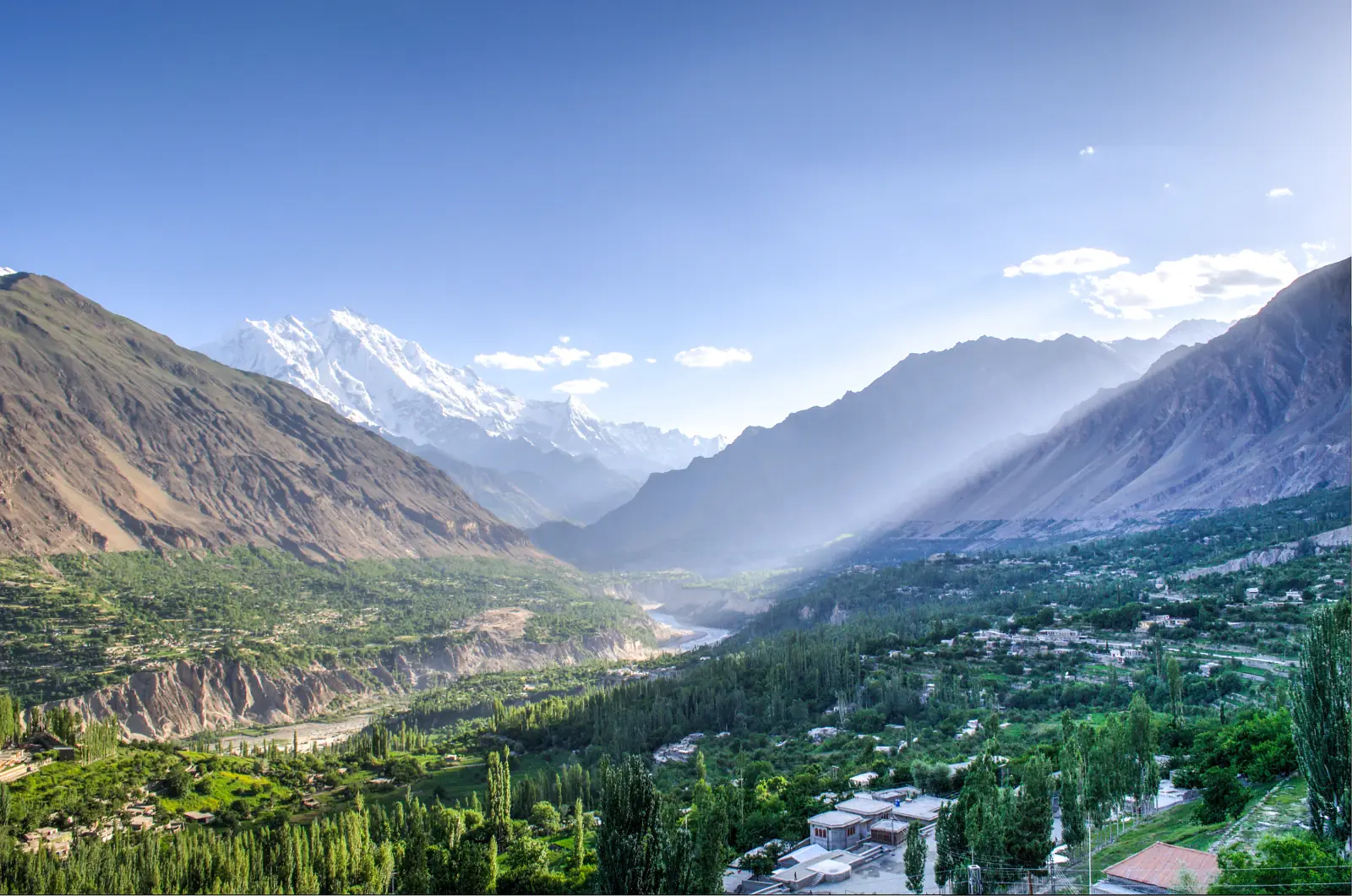
The tourist heart of the region, and for good reason. Hunza is a green, terraced valley strung along the Karakoram Highway beneath the 7,788 m wall of Rakaposhi, dotted with old stone villages, apricot orchards and the centuries-old Baltit and Altit forts above Karimabad (Altit's tower is about 1,100 years old, Baltit about 700). Nearby sit the vivid turquoise of Attabad Lake and the jagged Passu Cones. It is the easiest place to base yourself for a first trip. See our Hunza Valley tours for the full loop.
Skardu and Baltistan
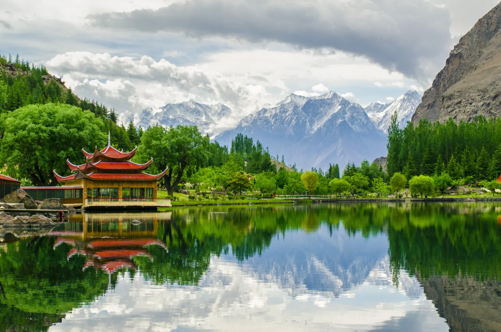
East of Gilgit, the Skardu valley is the gateway to Baltistan, a high desert of cold rivers, sand dunes and startling lakes. The postcard stop is Shangrila (Lower Kachura Lake) with its red pagoda, alongside Upper Kachura and Satpara lakes, the Katpana cold desert and Kharpocho Fort above the town. Skardu is also the launch pad for the great Karakoram treks. Browse our Skardu tours.
Deosai National Park
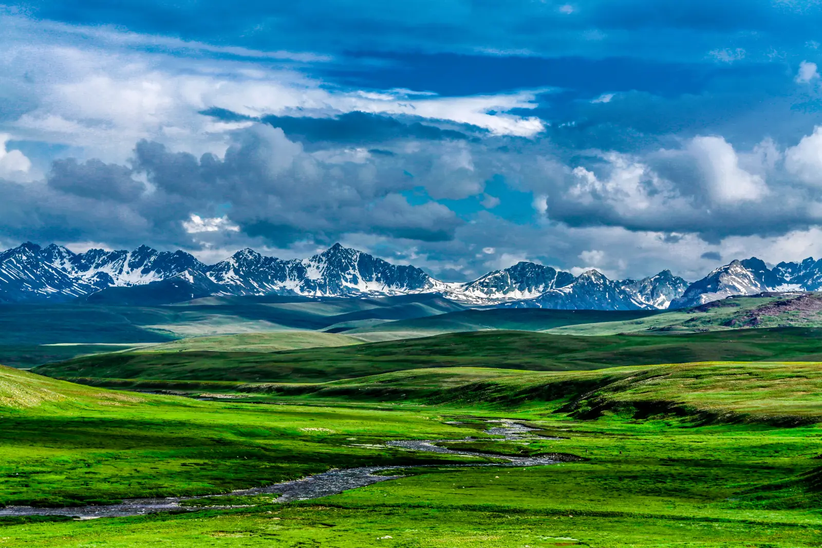
Between Skardu and Astore lies the Deosai Plateau, one of the highest plains on earth at around 4,115 m. Snowbound for most of the year, it opens for a brief summer as a rolling green wilderness of wildflowers, streams and marmots, and it is one of the last refuges of the Himalayan brown bear. It is only accessible roughly July to September. See our Deosai tours.
K2 and the Baltoro
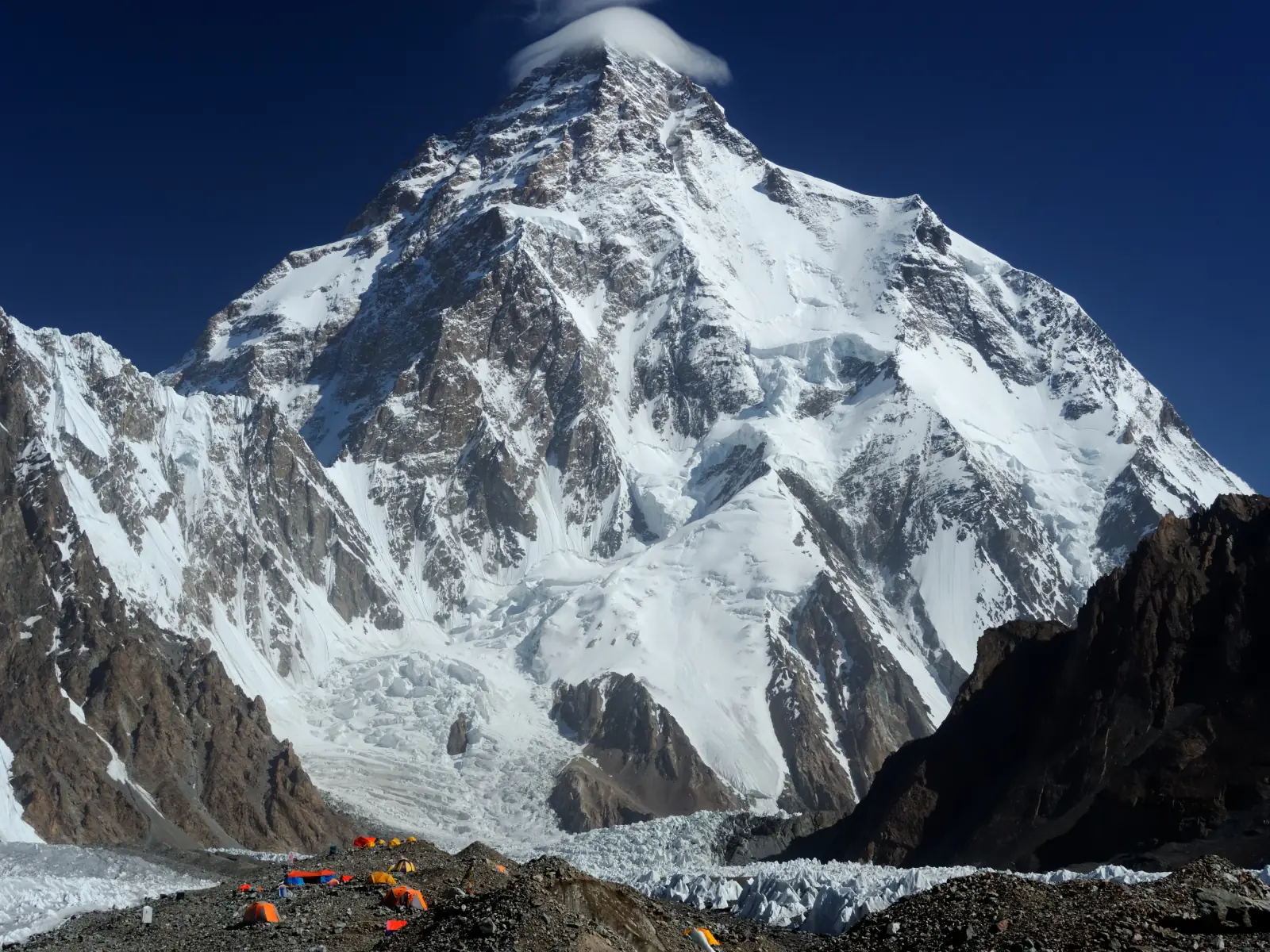
Deep in the Karakoram east of Skardu stands K2 (8,611 m), the world's second-highest and hardest mountain, reached by the legendary trek up the Baltoro Glacier to Concordia, the amphitheatre where four eight-thousanders ring the horizon. Gilgit-Baltistan holds five of the fourteen 8,000 m peaks in all, K2, Nanga Parbat, Gasherbrum I and II and Broad Peak, which is why it draws climbers from around the world each summer.
Fairy Meadows and Nanga Parbat
On the western edge of the region, above the Karakoram Highway near Chilas, the alpine meadow of Fairy Meadows sits directly beneath the Raikot Face of Nanga Parbat (8,126 m), the world's ninth-highest mountain. A jeep track and a short hike bring you to one of the most jaw-dropping campsites anywhere, open roughly May to October. It pairs naturally with a Hunza trip. See our Fairy Meadows tours.
Khunjerab Pass and the Karakoram Highway
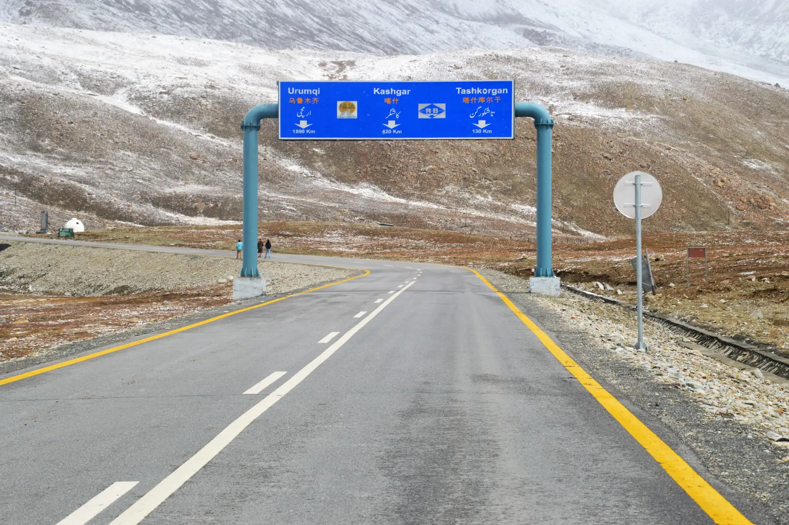
At the far north, the Karakoram Highway climbs to the Khunjerab Pass (4,693 m), the highest paved international border crossing in the world, where Pakistan meets China. The drive up through Gojal, past Attabad Lake and the Passu Cones, is one of the great road trips on earth. The pass is usually open from about April to late November. Our Gilgit-Baltistan grand tour runs the whole highway.
How to get to Gilgit-Baltistan
There are two ways in, and many trips use one each way.
- By air: PIA flies from Islamabad to both Gilgit and Skardu in about an hour. The flights are spectacular but weather-dependent and prone to cancellation, so never book them on a tight schedule.
- By road: the Karakoram Highway from Islamabad to Gilgit is roughly a two-day drive (around 600 km), usually broken with a night near Chilas or Naran. It is long but stunning, and it is how you actually see the country change from the plains to the high mountains.
Within the region, travel is by road: shared vans, public NATCO buses along the highway, or a private car with a driver, which is what most of our guests use for the flexibility to stop wherever the light is good.
Do you need a permit for Gilgit-Baltistan?
For the places most travellers want, no special permit is needed. Foreign tourists can visit Hunza, Nagar, Gojal, Skardu, Deosai and the Khunjerab Pass on a standard Pakistan visa, with your passport as the only document you carry. A few things to know:
- Khunjerab National Park charges a small entry fee near Sost on the way to the pass.
- Restricted and border zones, such as areas close to the Line of Control or certain high peaks, need a No Objection Certificate (NOC), which a licensed operator arranges in advance.
- Climbing and some treks require permits and, for higher peaks, a royalty fee and a liaison officer, all handled through your operator.
The practical upshot: for a standard Hunza-Skardu-Deosai trip you just need your visa. For expeditions or anything near a border, plan with an operator who sorts the paperwork.
Sample Gilgit-Baltistan itineraries
How long do you need? A week gets you the highlights of one area; two weeks lets you link them. Rough templates:
| Length | Route | Best for |
|---|---|---|
| 7 days | Islamabad, Hunza (Karimabad, Attabad, Passu, Khunjerab), back | First-timers, the classic north |
| 10 days | Hunza plus Skardu via Gilgit, Shangrila and the Kachura lakes | Hunza and Baltistan combined |
| 14 days | Grand tour: Hunza, Skardu, Deosai, Fairy Meadows and the full KKH | Seeing the whole region |
| 16 to 21 days | K2 base camp trek from Skardu via Askole and the Baltoro Glacier | Serious trekkers |
We build all of these around your dates and pace. The Gilgit-Baltistan grand tour is the natural starting point for a first full trip.
How much does a Gilgit-Baltistan trip cost?
Costs vary widely with style, but as a rough guide: independent budget travel runs about USD 30 to 50 a day once you are in the region, covering guesthouses, shared transport and local food. A mid-range guided trip with a private vehicle, driver and hotels typically lands around USD 120 to 200 a day. The Islamabad to Gilgit or Skardu flight is roughly USD 60 to 100 one way when it runs. Treks and expeditions are a separate calculation because of permits, porters and gear. These are ballpark figures for planning; message us for a firm quote on a specific itinerary.
Planning your Gilgit-Baltistan trip
Pick your season, decide how many days you have, and choose whether you want the easy Hunza highlights or the fuller Hunza-Skardu-Deosai loop. From there, local guides who know exactly when each valley, pass and trail is at its best can build the trip around you. Browse our Gilgit-Baltistan grand tour and our wider range of Hunza and Skardu trips, or read the Wikipedia overview of Gilgit-Baltistan and the official Gilgit-Baltistan tourism department for background, then get in touch to lock in dates.
Frequently asked questions
Where is Gilgit-Baltistan?
Gilgit-Baltistan is the northernmost territory of Pakistan, bordering China, Afghanistan and Indian-administered Kashmir. The Chinese border is crossed at the Khunjerab Pass, the Afghan frontier is the thin Wakhan Corridor, and Kashmir lies to the south-east. It covers the western Himalaya and the heart of the Karakoram, and near Gilgit, at the Junction Point, the Karakoram, Himalaya and Hindu Kush ranges meet. Administratively it is a self-governing territory rather than a full province, covering about 72,500 km2 (roughly the size of Ireland) across three divisions and ten districts, with around 1.7 million people at the 2023 census. The capital is Gilgit, and Skardu is the main hub of the Baltistan region. Those two towns are where most travellers arrive. From Islamabad, Gilgit is roughly a two-day drive up the Karakoram Highway or about an hour by air, weather permitting.
Is Gilgit-Baltistan safe to visit?
Yes. It is widely considered one of the safest parts of Pakistan for travellers, including solo and female travellers, and tourism is well established in Hunza, Skardu and the surrounding valleys. The security concerns people associate with Pakistan mostly relate to other regions, and the valleys of Hunza, Nagar, Gojal and Baltistan are calm and used to visitors. Sectarian tensions have occasionally flared around Gilgit town in the past, so most itineraries push straight on to the valleys. The main risks are practical: altitude, roads and weather. Much of the region sits above 2,000 m and passes climb past 4,000 m. The July-August monsoon brings landslides to the approach roads, and winter snow closes many routes. Travel in the open season, build in buffer days and use a local driver who knows the roads, which is how most of our guests travel.
What is the best time to visit Gilgit-Baltistan?
May to October. Within that window each season suits a different trip. Spring, April to May, brings cherry and apricot blossom to Hunza, green lower valleys and fewer crowds, although some higher passes may still be closed. Summer, June to August, is the full season, with Khunjerab and the trekking routes open and Deosai following from roughly July, but July and August also bring the monsoon to the approach roads and the biggest domestic crowds. Autumn, late September to October, is our pick: clear skies, golden poplars, thinner crowds and roads that are still open. Winter, November to March, closes much of the high country under snow; it is quiet and beautiful for the adventurous, but many roads and services shut down. Deosai has the shortest window, roughly July to September, so plan around it if the plateau matters to you. Our best time to visit Pakistan guide has the full month-by-month breakdown.
What is the capital of Gilgit-Baltistan?
The capital is Gilgit. It is one of the two arrival points most travellers use, and PIA flights land there from Islamabad when the weather allows. Just outside the town is the spot where three great mountain ranges collide. Skardu, in the Baltistan region to the east, is the other main town and the gateway to the great Karakoram treks, including the Baltoro Glacier route to K2 base camp, as well as Shangrila, the Kachura lakes and the Deosai Plateau. Gilgit is the capital of a self-governing territory of three divisions and ten districts rather than a full province. Most itineraries pass through Gilgit rather than stopping long, pushing on to Hunza or Skardu. If you are heading for the Kargah Buddha, it is carved into a cliff just outside the town.
How do you get to Gilgit-Baltistan?
By air or by road, and many trips use one each way. PIA flies from Islamabad to both Gilgit and Skardu in about an hour. The flights are spectacular but weather-dependent and prone to cancellation, so never book them on a tight schedule. When they run, a one-way ticket is roughly USD 60 to 100. By road, the Karakoram Highway from Islamabad to Gilgit is around a two-day drive of about 600 km, usually broken with a night near Chilas or Naran. It is long, but it is how you actually see the country change from the plains to the high mountains. Once you are in the region, travel is by road: shared vans, NATCO buses along the highway, or a private car with a driver. Most of our guests choose the car and driver, for the freedom to stop wherever the light is good.
Do you need a permit to visit Gilgit-Baltistan?
For the main destinations, Hunza, Nagar, Gojal, Skardu, Deosai and the Khunjerab Pass, no special permit is needed beyond a standard Pakistan visa. Your passport is the only document you carry. A small entry fee applies at Khunjerab National Park, collected near Sost on the way to the pass. Restricted and border zones, such as areas close to the Line of Control or certain high peaks, need a No Objection Certificate (NOC), which a licensed operator arranges in advance. Climbing and some treks require permits, and the higher peaks also carry a royalty fee and a liaison officer, all handled through your operator. So for a standard Hunza, Skardu and Deosai trip, your visa is enough. For expeditions or anything near a border, plan with an operator who sorts the paperwork. We sort that paperwork for our own trekking and expedition guests.
How many days do you need in Gilgit-Baltistan?
About a week covers the highlights of one area, such as Hunza. Seven days from Islamabad gets you Karimabad, Attabad Lake, Passu and the Khunjerab Pass and back, the classic route for first-timers. Ten days lets you add Skardu via Gilgit, with Shangrila and the Kachura lakes, and combine Hunza with Baltistan. Around two weeks is ideal for a grand tour of Hunza, Skardu, Deosai and Fairy Meadows along the full Karakoram Highway. Treks like K2 base camp need 16 to 21 days on their own, starting from Skardu and going via Askole and the Baltoro Glacier. Remember that Islamabad to Gilgit is about two days each way by road, and flights can be cancelled by weather, so build in buffer days. We build all of these around your dates and pace, and the Gilgit-Baltistan grand tour is the natural starting point for a first full trip.
What language is spoken in Gilgit-Baltistan?
Several. Shina, Balti, Burushaski, Wakhi and Khowar are the main regional languages, and which one you hear depends on the valley. Burushaski, a language isolate, is spoken in central Hunza around Karimabad and, in its own dialect, in Yasin. Wakhi is the language of most of Gojal and of Shimshal. Shina is spoken in lower Hunza toward Gilgit, in Astore and around Fairy Meadows and Bagrote. Balti belongs to Skardu and Baltistan, and Khowar, the language of Chitral, is heard in Yasin and toward the passes to the west. Urdu is the common language across the region and is widely understood, so it is what people from different valleys use with each other and with visitors from the rest of Pakistan. English is used in the tourism trade, and in Hunza many people speak it well. Off the main routes it thins out, which is where a local guide makes the biggest difference.
Ready for Your Next Adventure?
Join our community of explorers and discover the journey of a lifetime. Our expert team is ready to help you plan your perfect expedition.