Babusar Pass (Babusar Top): Height, Road, Weather and Best Time to Visit
How high is Babusar Pass, when does it open, and how do you drive it? A licensed operator's guide to Babusar Top, the highest point of the Kaghan Valley and the summer shortcut to Hunza.
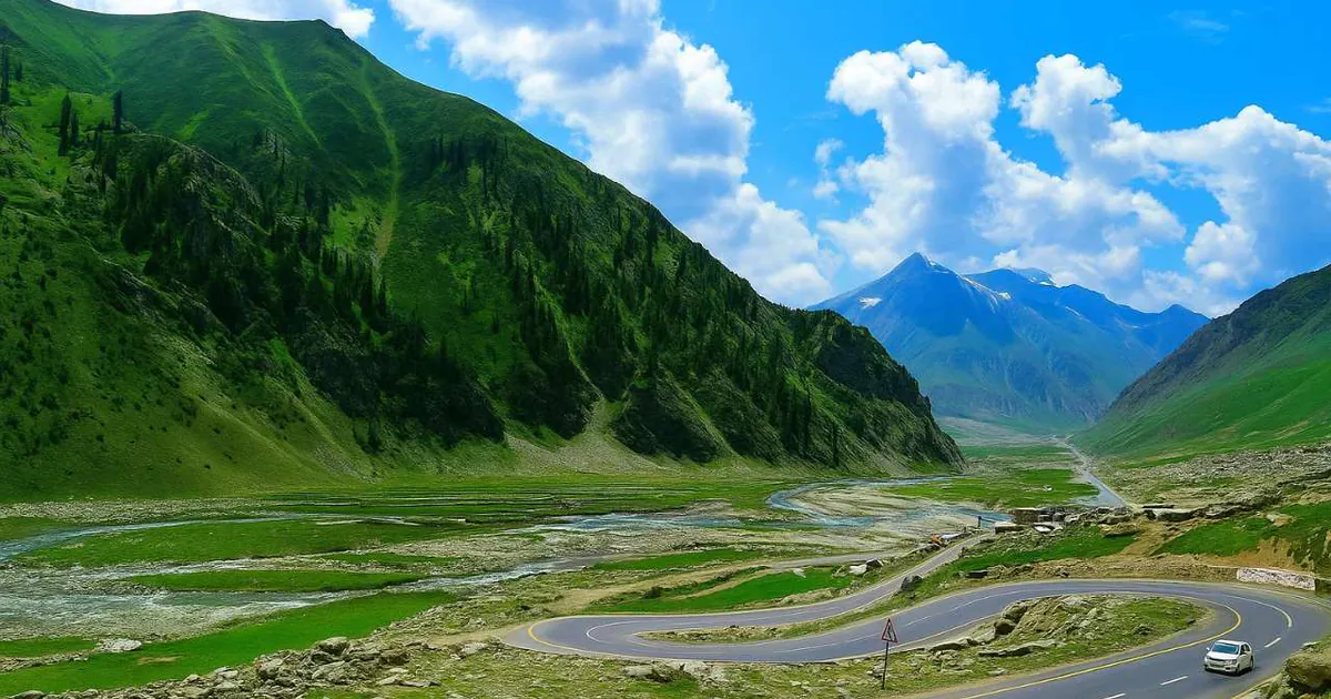
Babusar Top is the pass everyone photographs on the drive north, a bare, wind-scoured saddle where the green Kaghan Valley finally gives way to the brown mountains of Gilgit-Baltistan. It is the high point of a classic Pakistani road trip and, in summer, the fastest and most scenic way to reach Hunza. It also has a reputation for steep, tricky driving. We run tours over it every open season, so this guide gives you the real height, the opening window, the route with distances, and an honest word on safety.
What is Babusar Pass (Babusar Top)?
Babusar Pass is a high mountain pass at the northern end of the Kaghan Valley, connecting the Naran-Kaghan region of Khyber Pakhtunkhwa with Chilas in the Diamer District of Gilgit-Baltistan, where it meets the Karakoram Highway. Locals almost always call it Babusar Top. It is the highest point of the Kaghan Valley that ordinary cars can reach, which is exactly why it draws so many travellers: you can drive to over 4,000 metres on a paved road and stand in the snow in July.
| Fact | Detail |
|---|---|
| Height | 4,173 m (13,691 ft) |
| Also called | Babusar Top |
| Connects | Naran (Kaghan Valley, KPK) ↔ Chilas (Gilgit-Baltistan) |
| Region | Highest point of the Kaghan Valley reachable by car |
| Open season | Usually mid-June (sometimes late May) to late October (weather-dependent) |
| Winter | Snowbound and closed, usually November to May |
| Road | Paved but narrow, steep and winding |
| From Islamabad | ~310 km, usually driven over two days via Naran |
How high is Babusar Pass?
Babusar Top stands at 4,173 metres (13,691 feet) above sea level. That makes it noticeably higher than most passes people drive in Pakistan, and high enough that the air feels thin, the weather turns fast, and snow can linger beside the road well into summer. It is not the highest pass on the wider Karakoram Highway network, the Khunjerab Pass at the China border is higher, but Babusar is the high point of the Kaghan route and one of the highest paved passes you can simply drive up to.
When does Babusar Pass open and close?
This is the question that catches most travellers out. Babusar Top is only open in summer. Heavy snow blocks it through winter and spring, and the road is usually cleared and reopened by mid-June, sometimes as early as late May after a lighter winter, depending on how much snow fell and how fast it melts. It then stays open until the first heavy snowfall closes it again, typically by late October.
So the practical window is roughly July to September, with the shoulders of June and October being a gamble on the weather. Always check that the pass is actually open before you commit to the route, because the opening date shifts every year and the authorities can close it at short notice after snow. If Babusar is shut, the only way north to Hunza is the longer Karakoram Highway via Besham, which we cover in our Karakoram Highway guide.
Babusar Pass weather
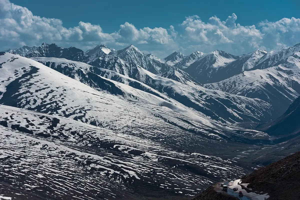
Even in the middle of summer, Babusar Top is cold. Daytime temperatures at the top are often only around 10 to 15 °C in the sun, and they drop close to or below freezing at night, with snow flurries possible at any time of year. Mornings can be icy on the road, and cloud can roll in and cut visibility within minutes. The clearest, most stable conditions are usually late morning to early afternoon, which is also the best light for the views. Bring a warm layer even if you set off from Naran in a t-shirt, because the temperature change on the climb is dramatic.
How to reach Babusar Pass
Almost everyone approaches Babusar from the south, up the Kaghan Valley. From Islamabad the drive is usually split over two days, with a night in Naran, because the mountain roads are slow and worth enjoying rather than rushing. The rough legs look like this:
| Leg | Distance | Drive time |
|---|---|---|
| Islamabad → Naran (via Mansehra, Balakot, Kaghan) | ~240 km | 8–9 hrs |
| Naran → Lulusar Lake | ~48 km | 1.5–2 hrs |
| Lulusar Lake → Babusar Top | ~25 km | ~1 hr |
| Babusar Top → Chilas (Karakoram Highway) | ~70 km | 2–2.5 hrs |
| Chilas → Hunza (Karimabad) | ~200 km | 5–6 hrs |
The road from Naran up to the top is metalled the whole way, so a normal car can make it in dry conditions, though the surface is rough in patches and a higher-clearance vehicle is more comfortable. There is no fuel at the top, so fill up in Naran or Chilas. Phone signal is patchy to non-existent over the pass. If you would rather not drive it yourself, our Babusar Pass tours run the route with a driver who knows the road and its moods.
Lulusar Lake, the highlight on the way up
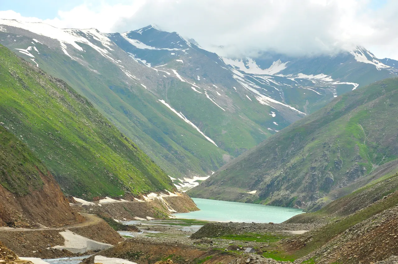
You do not have to wait for the top to get the best of this drive. About 48 km above Naran, the road runs right along the shore of Lulusar Lake, a long turquoise lake fed by snowmelt and ringed by green and snow-streaked mountains. It is the source of the Kunhar River that flows all the way back down the Kaghan Valley, and it is one of the most photographed spots in the region. Most trips stop here for half an hour, and it breaks up the climb nicely before the final push to the pass.
Is the Babusar Pass drive safe?
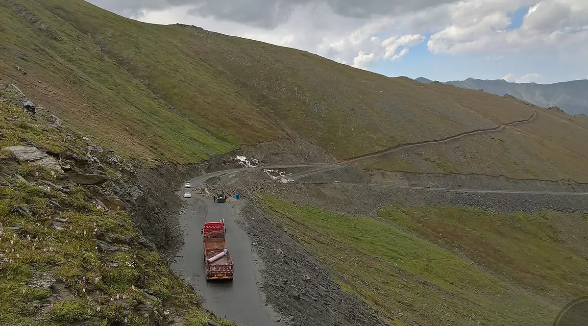
It is safe if you treat it with respect, and risky if you do not. Wikipedia describes the road as one of the most dangerous in Pakistan, and the specific danger is the long, steep descent on either side, where overheated or failing brakes cause most of the accidents. The sensible precautions are simple:
- Descend in a low gear and let engine braking do the work, rather than riding the brakes the whole way down.
- Make sure your brakes and tyres are in good condition before you start, and don't overload the vehicle.
- Start early so you cross while the weather is clear, and turn back if cloud or snow closes in.
- Take altitude seriously: some people feel light-headed at 4,000 m, so don't linger for hours and keep water handy.
- Give trucks and buses room on the blind switchbacks, and use your horn on tight corners.
None of this should put you off. Thousands of ordinary families drive it every summer. But it is a real high-mountain pass, not a motorway, and a careful driver makes all the difference.
What you'll see from the top
The top itself is a broad, treeless saddle, often dotted with parked cars, snack stalls and people throwing snowballs in July. The reward is the sweep of bare, snow-flecked peaks in every direction and, on the northern side as you drop toward Chilas, a chance on a clear day to pick out Nanga Parbat, the ninth-highest mountain on earth, standing on the horizon. The contrast is the whole point of the crossing: you climb out of the green, forested Kaghan Valley and descend into the dry, dramatic mountain desert of Gilgit-Baltistan in the space of a couple of hours.
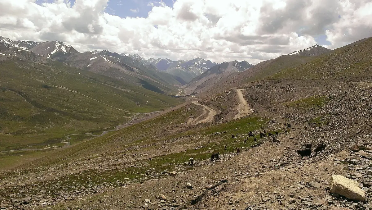
Babusar Pass: the summer shortcut to Hunza
For travellers heading to Hunza and Gilgit-Baltistan, Babusar is not just a viewpoint, it is a shortcut. In the open season it lets you drive from Islamabad to Hunza through the beautiful Kaghan Valley and join the Karakoram Highway at Chilas, which is shorter and far more scenic than the long lowland approach via Besham. That is why so many summer itineraries go up over Babusar and come back down the main KKH, or the reverse. Once the pass closes for winter, everyone routes the long way round on the KKH. If Babusar is on your way north, it pairs naturally with a Hunza Valley tour, and our guide to the best time to visit Pakistan helps you line the seasons up. Fairy Meadows and Nanga Parbat sit just up the KKH from Chilas too, covered in our how to reach Fairy Meadows guide.
Frequently asked questions
How high is Babusar Pass?
Babusar Pass, or Babusar Top, is 4,173 metres (13,691 feet) above sea level. It is the highest point of the Kaghan Valley that can be reached by car, though the Khunjerab Pass on the China border is higher. That puts it well above most passes people drive in Pakistan, and high enough that the air feels thin and snow can linger beside the road well into summer. Even in July, daytime temperatures at the top are often only around 10 to 15 °C in the sun, and close to or below freezing at night. Some people feel light-headed at 4,000 m, so don't linger for hours and keep water handy. The top is a broad, treeless saddle where the green Kaghan Valley gives way to the brown mountains of Gilgit-Baltistan. On a clear day, as you descend towards Chilas, you can pick out Nanga Parbat on the horizon.
When is Babusar Pass open?
Babusar Top is open only in summer. The road usually reopens by mid-June, sometimes as early as late May after a lighter winter, and stays open until the first heavy snowfall, which normally closes it by late October. It is snowbound and closed for the rest of the year, roughly November to May. July to September is the most dependable window, while the first weeks after opening and the end of the season are more of a gamble on the weather. Always check the current status before travelling, because the dates shift each year and the authorities can close the road at short notice after snow. If Babusar is shut, the only road north to Hunza is the longer Karakoram Highway via Besham. Even when the pass is open, snow lies beside the road well into summer and cloud can cut visibility within minutes, so plan to cross early in the day.
Where is Babusar Pass and what does it connect?
Babusar Pass sits at the northern end of the Kaghan Valley in Khyber Pakhtunkhwa and connects Naran with Chilas, in the Diamer District of Gilgit-Baltistan, where it joins the Karakoram Highway. It is the summer shortcut between the Kaghan Valley and Hunza. From the top it is about 70 km and two to two and a half hours down to Chilas, then about 200 km and five to six hours to Karimabad in Hunza. In the open season that lets you drive from Islamabad to Hunza through the Kaghan Valley, which is shorter and far more scenic than the lowland approach via Besham. That is why so many summer itineraries go up over Babusar and come back down the main KKH, or the reverse. Once the pass closes for winter, all traffic goes the long way round. Fairy Meadows and Nanga Parbat lie just up the KKH from Chilas, so they fit easily into the same route.
How do you get to Babusar Pass from Islamabad?
Drive up the Kaghan Valley via Mansehra, Balakot, Kaghan and Naran, then continue past Lulusar Lake to the top. It is about 310 km and usually split over two days with a night in Naran. Islamabad to Naran is roughly 240 km and eight to nine hours. From Naran it is about 48 km, an hour and a half to two hours, to Lulusar Lake, then about 25 km and an hour to Babusar Top. Lulusar, the turquoise lake that feeds the Kunhar River, is worth a half-hour stop on the way up. There is no fuel at the top, so fill up in Naran or Chilas, and expect phone signal to be patchy or absent over the pass. All of these distances and times are approximate and change with road and weather. If you would rather not drive yourself, our Babusar Pass tours run the route with a driver who knows the road.
Is the Babusar Pass road dangerous?
It is a demanding road, but driven with care it is manageable. The road is paved but steep, narrow and winding, and Wikipedia describes it as one of the most dangerous in Pakistan. The long descents on either side are where most accidents happen, usually from overheated or failing brakes. Descend in low gear and let engine braking do the work, make sure your brakes and tyres are sound, and don't overload the vehicle. Cross in clear weather and start early, and turn back if cloud or snow closes in. Give trucks and buses room on the blind switchbacks and use your horn on tight corners. Altitude matters too, since some people feel light-headed at 4,000 m. Thousands of ordinary families drive it every summer without trouble. With an experienced local driver it is a spectacular crossing rather than a stressful one, which is how our Babusar Pass tours run it.
Can normal cars drive to Babusar Top?
Yes. The road is metalled all the way from Naran to the top, so a normal car can make it in dry summer conditions, and thousands of families do every season. The surface is rough in places, though, and a higher-clearance vehicle is more comfortable. In rain or snow, or if the pass has just opened, a 4x4 is the safer choice. Whatever you drive, check the brakes and tyres before you set out, since the long descents put most strain on them, and don't overload the car. Fill the tank in Naran or Chilas, because there is no fuel at the top. Mornings can be icy near the summit and snow lies beside the road well into summer, so start early and cross while the weather is clear. If you are not used to mountain driving, let an experienced local driver take the wheel. Our Babusar Pass tours run with drivers who know the road.
Height and route facts drawn from Wikipedia and cross-checked with our own trips; distances and drive times are approximate and vary with road and weather. Lulusar Lake photo by irfan muhammad, CC BY-SA 3.0, via Wikimedia Commons.
Ready for Your Next Adventure?
Join our community of explorers and discover the journey of a lifetime. Our expert team is ready to help you plan your perfect expedition.