How to Reach Fairy Meadows from Islamabad, Lahore & Karachi (2026)
Every way to get to Fairy Meadows and Nanga Parbat base camp: road and air routes from Islamabad, Lahore and Karachi, the drive to Raikot Bridge, the famous jeep track and the final trek, with real distances, times and costs.
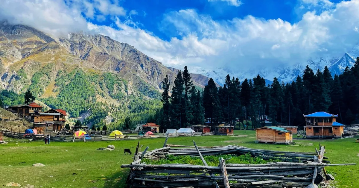
The short version: Getting to Fairy Meadows is a four-stage relay, whichever city you start from. You travel to Raikot Bridge on the Karakoram Highway, swap into a shared 4x4 jeep for the famous cliff track up to Tato village, then trek on foot for the last stretch to the meadow. From Islamabad it is a 10 to 14-hour drive to Raikot Bridge, or a 1-hour flight to Gilgit plus a 2-hour drive. From Lahore and Karachi, route through Islamabad first (Karachi realistically means flying).
Fairy Meadows sits at about 3,300 m (10,800 ft) on a shelf of alpine grassland staring straight at the 8,126 m north face of Nanga Parbat. There is no road to the meadow itself, and that is the whole point of this guide: the last leg is a jeep track people call one of the most dangerous roads in the world, followed by a trek. Knowing the sequence before you go saves a lot of confusion at Raikot Bridge.
We run this route every season, so below is exactly how to reach Fairy Meadows from each of the three big cities, with real distances, drive times, the jeep and the trek, plus the air option that cuts a brutal road day out of the trip.
The route in a nutshell
No matter where you begin, the journey funnels through the same four stages:
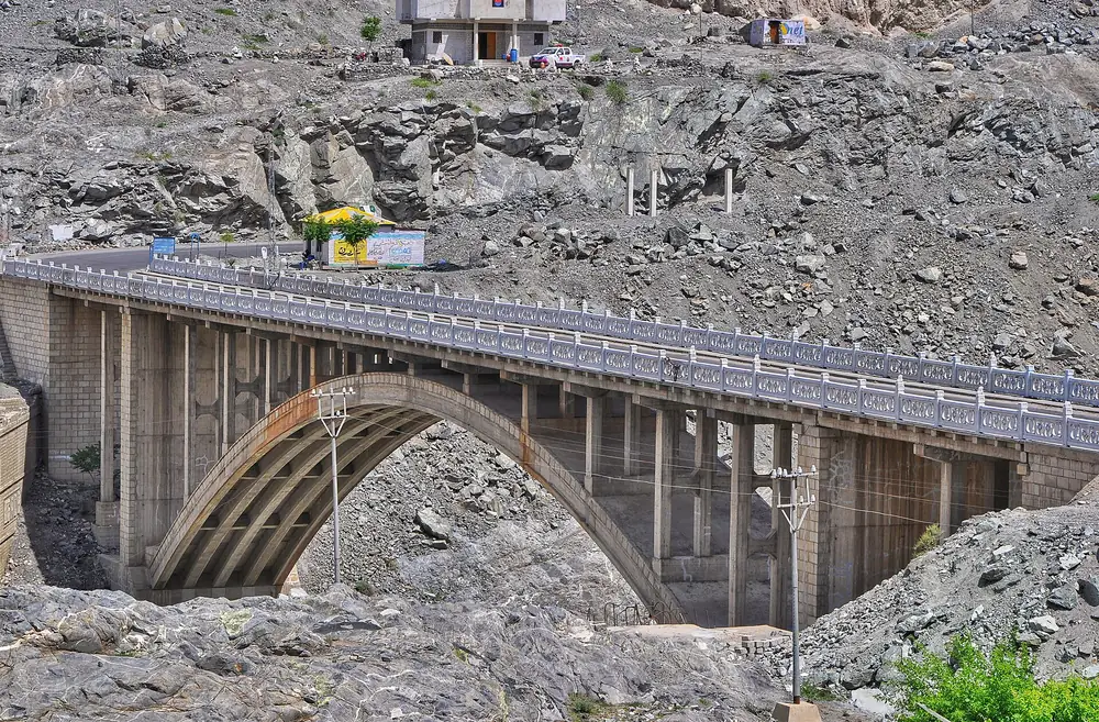
- Your city to Raikot Bridge on the Karakoram Highway (KKH), near Chilas. This is the long haul, by road or by air-plus-road.
- Raikot Bridge to Tato village by shared 4x4 jeep, roughly 10 to 15 km of narrow, unpaved cliff track (about 1 to 1.75 hours).
- Tato to Fairy Meadows on foot, about 3 to 5 km uphill (2 to 4 hours; horses and porters are available).
- Fairy Meadows onward if you continue to Nanga Parbat Base Camp, a further full-day trek.
Private cars and coaches cannot do stages 2 and 3. Everyone transfers to a local jeep at Raikot Bridge, and everyone walks the final climb.
How to reach Fairy Meadows from Islamabad
Islamabad is the real gateway. You have two ways to cover the ground to Raikot Bridge.
By road (the classic KKH drive)
It is roughly 410 to 520 km from Islamabad to Raikot Bridge, depending on the route, and a genuine 10 to 14-hour drive. Most travellers go straight up the Karakoram Highway via Mansehra, Besham and Chilas. In summer you can instead take the scenic Naran and Babusar Pass (4,173 m) route, which is beautiful but only open roughly July to September and adds time. Many people break the journey with a night in Chilas or Naran rather than driving it in one shot.
By air (the fast option)
You can fly Islamabad to Gilgit in about 1 hour 15 minutes (several flights most days, weather permitting, around US$90 to 110 one way), then drive Gilgit to Raikot Bridge, about 80 km and 2 hours. Flying removes the hardest road day, but Gilgit flights are famously weather-dependent and cancel often, so keep a spare day in your plan.
How to reach Fairy Meadows from Lahore
From Lahore, everything routes through Islamabad first. It is about 375 km on the M-2 motorway, a comfortable 4 to 5-hour drive to Islamabad, from where you continue exactly as above, by road up the KKH or by flight to Gilgit. Total road distance from Lahore to Raikot Bridge works out to roughly 780 to 900 km. If you would rather not drive the whole way, fly Lahore to Islamabad (about an hour) and connect to a Gilgit flight, or start the KKH drive from Islamabad the next morning.
How to reach Fairy Meadows from Karachi
Karachi is simply too far to drive, over 1,500 km just to Islamabad, so flying is the sensible choice. Take a Karachi to Islamabad flight (about 2 hours), then either connect onward to Gilgit and drive 2 hours to Raikot Bridge, or overnight in Islamabad and begin the KKH road trip. Booking the Karachi to Islamabad and Islamabad to Gilgit legs together, with a buffer day for weather, is the smoothest way to do it.
Distances and drive times at a glance
| From | To Raikot Bridge | Approx. time | Best way |
|---|---|---|---|
| Islamabad | 410–520 km | 10–14 hrs road / 1 hr flight + 2 hrs | Road or fly to Gilgit |
| Lahore | 780–900 km | +4–5 hrs to Islamabad, then as above | Via Islamabad |
| Karachi | ~1,900 km | Fly Karachi–Islamabad (2 hrs) first | Fly, then road/flight |
| Naran | via Babusar Pass | seasonal (Jul–Sep), scenic | Summer only |
| Chilas | ~61 km | ~1–1.5 hrs | Road |
| Gilgit | ~80 km | ~2 hrs | Road (after flight) |
Then, from Raikot Bridge, everyone faces the same last two stages: the jeep and the walk.
The Raikot Bridge jeep track: the famous bit
This is the stretch that gives Fairy Meadows its reputation. At Raikot Bridge you leave your car or coach and pile into a local shared 4x4 jeep for roughly 10 to 15 km of unpaved track carved into the cliff face, climbing hard for about 1 to 1.75 hours. It is narrow, there are no guardrails, and passing spots are tight. It is regularly listed among the world's most dangerous roads, and yes, it earns that.
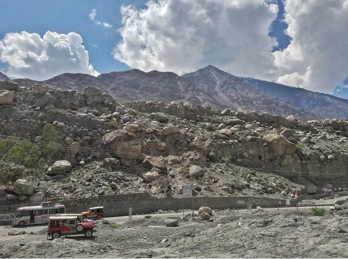
A few things that help: the jeeps are driven by experienced local drivers who know every inch of it, you pay a set fare per jeep (shared between passengers, so it is cheapest with a full vehicle), and only these registered jeeps are allowed on the track. If heights bother you, sit on the inside and keep your eyes on the mountain, not the drop. The track ends at Tato village, where the road runs out for good.
The final trek: Tato to Fairy Meadows
From Tato it is a 3 to 5 km walk uphill to Fairy Meadows, about 2 to 4 hours depending on your pace and fitness. The path is clear and steady rather than technical, climbing through pine forest before the trees open onto the meadow and Nanga Parbat fills the sky. If you would rather not carry your bag or walk the climb, horses and local porters wait at Tato for a fixed rate. Take it slowly, you are gaining altitude, and stop for the view, it only gets better.
Once you are up, our companion Fairy Meadows travel guide covers where to stay, what it costs and the onward trek to Nanga Parbat Base Camp and Beyal Camp.
Going by air: flights to Gilgit
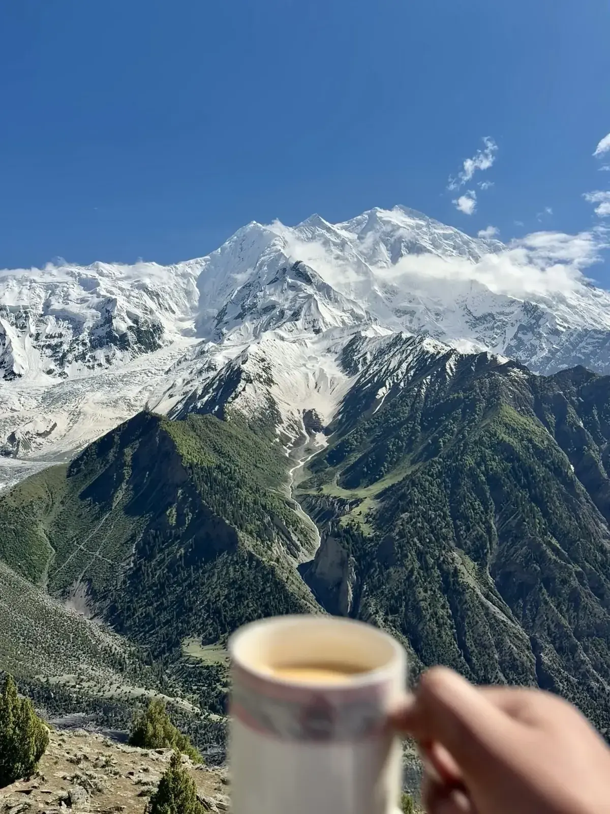
The single best way to shorten the trip is to fly the Islamabad to Gilgit leg. It turns a punishing road day into a spectacular 75-minute flight down the spine of the Karakoram, with Nanga Parbat off the wing on a clear day. From Gilgit it is a straightforward 2-hour drive south to Raikot Bridge. The catch is reliability: these flights cancel for weather more often than not in shoulder season, so never book a Gilgit flight for the same day you need to be somewhere. Build in a spare day, and have the KKH road as your backup.
Best time to make the trip
The road, the jeep track and the meadow are comfortably open from about May to October, with June to September the prime window: green meadows, clear mountain views and the Babusar route open. Spring and late autumn are quieter and beautiful but colder, and by late October snow starts closing the higher sections. The jeep track is at its trickiest right after rain. For a month-by-month view of weather and road conditions, see our guide to the best time to visit Pakistan.
Because the route mixes long KKH driving, a weather-dependent flight, a permit-checked jeep transfer and a trek, most visitors find it far less stressful to have it handled end to end. Our guided Fairy Meadows trip arranges the transport, the Raikot jeeps and the stay, and the Nanga Parbat Base Camp trek carries on from the meadow to the mountain's foot.
Common questions about reaching Fairy Meadows
How long does it take to reach Fairy Meadows from Islamabad?
Plan on a long day either way, and most people take two. By road it is about 10 to 14 hours from Islamabad to Raikot Bridge on the Karakoram Highway, roughly 410 to 520 km depending on the route. From there a shared 4x4 jeep takes roughly 1.5 hours (anywhere from 1 to 1.75 hours) up the cliff track to Tato village, and the walk from Tato to the meadow adds another 2 to 4 hours. That is too much for a single push, so most travellers break the journey with a night in Chilas or Naran. Flying Islamabad to Gilgit cuts the first leg to about 75 minutes, followed by a drive of about 80 km and 2 hours south to Raikot Bridge. Gilgit flights are weather-dependent and cancel often, though, so keep a spare day and treat the KKH road as your backup. On our guided trip we arrange the transport, the Raikot jeeps and the stay.
Is the Fairy Meadows jeep track really the most dangerous road in the world?
It is genuinely one of the scariest jeep tracks anywhere, and it is regularly listed among the world's most dangerous roads. The stretch from Raikot Bridge to Tato village runs 10 to 15 km on a narrow, unpaved road carved into the cliff face, with no guardrails and tight passing spots. The climb takes about 1 to 1.75 hours. That said, it is driven daily by experienced local drivers in registered jeeps, and serious incidents are rare when you go with them rather than trying it in your own vehicle. Only those registered jeeps are allowed on the track anyway. You pay a set fare per jeep, shared between passengers, so a full vehicle is cheapest. Nervous passengers should sit on the mountain side and keep their eyes on the rock rather than the drop. The track is at its trickiest right after rain, so expect a slower, more careful drive if it has just rained.
Can you drive your own car to Fairy Meadows?
No, only as far as Raikot Bridge on the Karakoram Highway, near Chilas. From there, private cars and coaches are not allowed on the jeep track, so everyone transfers to a local 4x4 jeep driven by an experienced local driver. Only these registered jeeps can use the 10 to 15 km cliff road up to Tato village, and the fare is set per jeep and shared between passengers. Tato is where the road runs out for good. The final stretch from Tato to the meadow is on foot (or horseback), a climb of about 3 to 5 km that takes 2 to 4 hours. Leave your vehicle at Raikot Bridge before you board. If you are driving up from Islamabad, allow 10 to 14 hours to reach the bridge, and many people stop overnight in Chilas or Naran on the way. When you travel with us, we handle the road transport and book the Raikot jeeps for you.
How far is the trek from Tato to Fairy Meadows?
About 3 to 5 km, climbing steadily uphill for 2 to 4 hours depending on your fitness. It is a walk rather than a technical trek, on a clear forest path, and horses and porters are available at Tato if you would rather ride or have your bag carried. They work for a fixed rate, so there is no haggling on the spot. The path climbs through pine forest before the trees open out onto the meadow, and Nanga Parbat's 8,126 m north face fills the view from there. Remember you are gaining height on the way to roughly 3,300 m, so set an easy pace and stop for breathers rather than racing it. Tato itself is where the jeep track from Raikot Bridge ends, so the walk starts straight after the jeep ride. If you plan to continue to Nanga Parbat Base Camp, that is a further full-day trek beyond the meadow.
Is Fairy Meadows safe to visit?
Yes. The region is welcoming and routinely visited by families and solo travellers alike. The real risks are practical rather than personal: the jeep track, the mountain weather and the altitude at 3,300 m. The jeep stretch from Raikot Bridge to Tato is a narrow cliff road with no guardrails, so go with experienced local drivers in the registered jeeps, which are the only vehicles allowed on it anyway. The track is at its trickiest right after rain. Take the climb slowly to acclimatise, as you gain a fair amount of height on the walk up from Tato. Check road and flight conditions before you set off too, because Gilgit flights cancel often in bad weather and by late October snow starts closing the higher sections. We run this route every season, and our guided trip covers the transport, the Raikot jeeps and the stay.
Ready for Your Next Adventure?
Join our community of explorers and discover the journey of a lifetime. Our expert team is ready to help you plan your perfect expedition.