The Karakoram Range: Where It Is, What's In It, and How to See It
A working guide to the world's most concentrated cluster of high peaks: where the Karakoram actually sits, the four 8,000ers inside it, its great glaciers, and where to stand to see them.
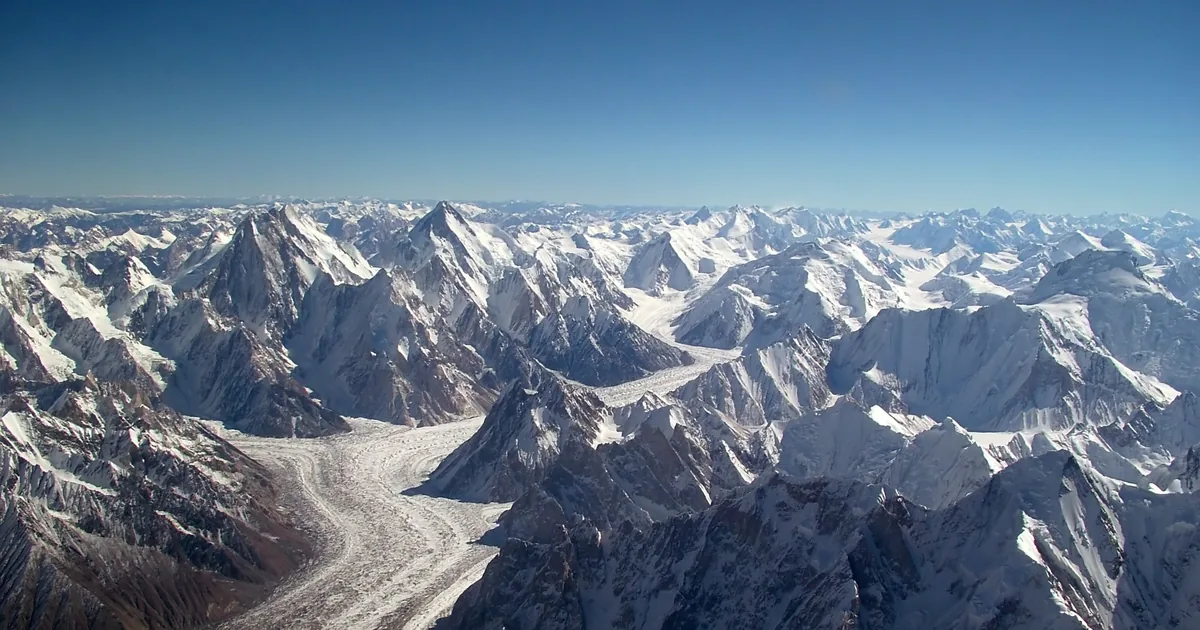
The Karakoram is a 500 km mountain range on the borders of Pakistan, China and India. It holds four of the world's fourteen 8,000-metre peaks, including K2, and more glacier ice than anywhere outside the polar regions. Almost all of the part you can actually visit, and all four of its 8,000ers, sit in Pakistan's Gilgit-Baltistan.
People come to us asking for "the Himalayas in Pakistan" and mean the Karakoram. It is a fair mistake. The two ranges touch, they look alike from a plane window, and the maps in most guidebooks blur the line between them. But they are different mountains with a different character, and if you are planning a trip it helps to know which one you are actually going to.
This is the range that holds K2. It is smaller than the Himalaya, steeper, drier, and far more heavily glaciated.
Where is the Karakoram Range?
The Karakoram runs roughly 500 km from northwest to southeast along the watershed between Central and South Asia. Its territory is split between Pakistan, China and India, with the far western tail brushing Afghanistan and Tajikistan. Five borders converge inside the range, which is part of why it stayed unmapped for so long.
The southern boundary is the useful one to remember, because it is drawn by rivers rather than by a line on a map. The Gilgit, Indus and Shyok rivers mark where the Karakoram ends and the Himalaya begins. To the west is the Hindu Kush, to the north the Pamirs, to the northeast the Kunlun.
For a traveller, though, only one answer matters: the accessible Karakoram is in Gilgit-Baltistan, northern Pakistan. Gilgit and Skardu are the two gateway towns, both reachable by air from Islamabad or by road up the Karakoram Highway. Everything in this article is within a few days of one of them.
Karakoram, Himalaya or Hindu Kush?
The confusion is worth clearing up properly, because it changes what you book.
- K2 is in the Karakoram, not the Himalaya. So are Broad Peak and both Gasherbrums.
- Nanga Parbat is Himalayan. It anchors the western end of the Himalaya and is cut off from the Karakoram by the Indus. Two of Pakistan's five 8,000ers therefore sit in different ranges. If Nanga Parbat is what you are after, our Nanga Parbat guide covers it separately.
- The Hindu Kush is further west, around Chitral, and is lower and gentler.
The practical difference: Himalayan valleys are green and monsoon-fed. The Karakoram is high desert with ice on top of it. You can be walking on bare grey scree in blazing sun with a 7,000-metre wall of snow directly above you, and that contrast is the thing people remember.
The four eight-thousanders
Fourteen mountains on Earth rise above 8,000 m. Four of them are in the Karakoram, and all four stand within about 20 km of one another at the head of a single glacier system. There is no other cluster like it anywhere.
| Peak | Height | World rank | Where it stands |
|---|---|---|---|
| K2 | 8,611 m | 2nd | Head of the Godwin-Austen Glacier |
| Gasherbrum I | 8,080 m | 11th | Upper Baltoro |
| Broad Peak | 8,051 m | 12th | Above Concordia |
| Gasherbrum II | 8,034 m | 13th | Upper Baltoro |
Beyond those four, the range carries eighteen summits above 7,500 m and something in the region of 570 named peaks. K2 alone has a shelf of nicknames: Godwin-Austen, after the surveyor who first mapped it, and the Savage Mountain, after the death rate on its slopes. The plain surveyor's label is the one that stuck.
The Trango Towers, Masherbrum and Muztagh Tower are not 8,000ers and are in some ways more striking. Trango's Nameless Tower is close to a vertical kilometre of clean granite, and climbers rate it among the hardest big-wall objectives in the world.
The glaciers: more ice than anywhere outside the poles
Somewhere between 28 and 50 percent of the Karakoram is under permanent ice, covering more than 15,000 square kilometres. Four of the longest non-polar glaciers on the planet are here, and three of them are walkable.
| Glacier | Length | Non-polar rank | Access |
|---|---|---|---|
| Siachen | 70 to 76 km | 2nd | Closed, militarised zone |
| Biafo | 67 km | 3rd | Trek, joins Hispar at Snow Lake |
| Baltoro | 63 km | 5th | The K2 base camp route |
| Batura | 57 km | 7th | Roadhead near Passu, Hunza |
Two notes on those numbers. Siachen's length depends on where you start measuring, which is why you see both 70 and 76 km quoted. And Biafo is given as 63 km in some sources and 67 km in others, depending on whether the measurement follows the longest branch.
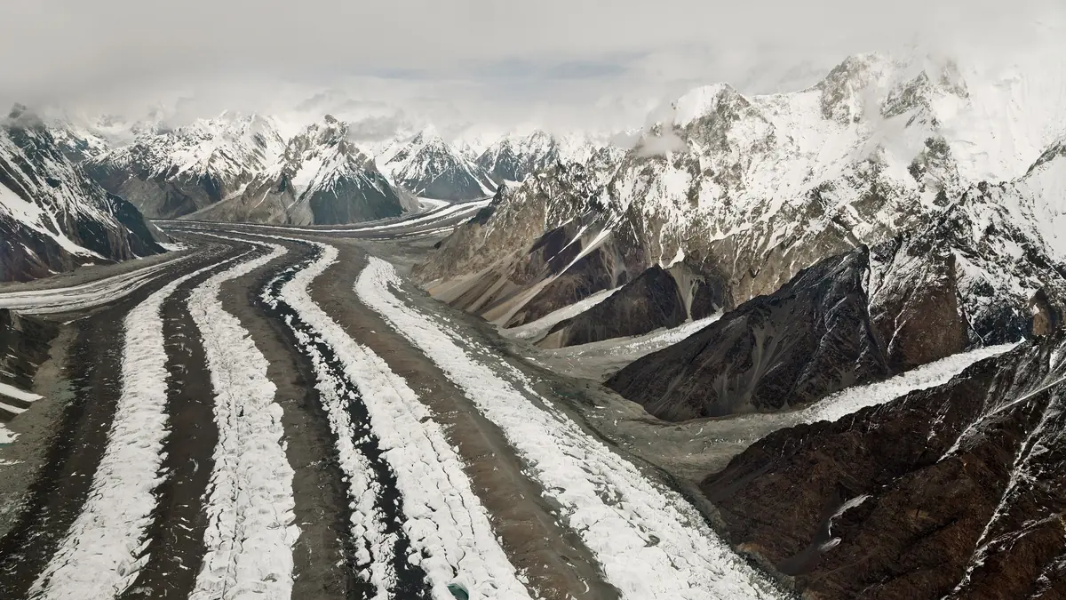
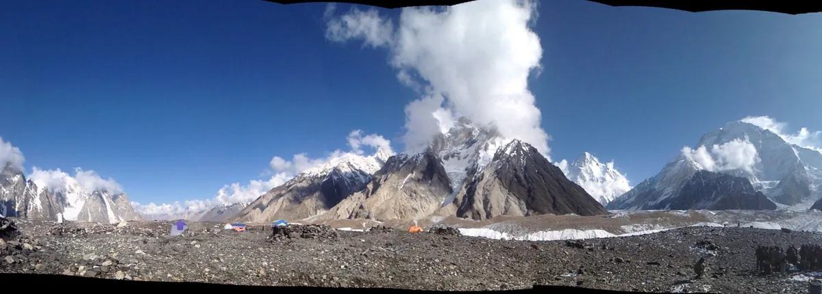
The Baltoro is the one most visitors meet. It drains into the Braldu, then the Shigar, then the Indus, and about halfway up it meets the Godwin-Austen Glacier at a wide flat junction called Concordia, at roughly 4,600 m. Four 8,000ers are visible from that one spot on a clear morning. No other viewpoint on Earth puts that many of them in one frame, which is the whole reason the Baltoro trek exists.
The Karakoram anomaly
Almost every glaciated range on Earth is losing ice. The Karakoram, or at least its central and western parts, largely is not. Glaciers here have held steady or advanced slightly while the Himalaya, the Alps and the Andes retreat. Researchers call it the Karakoram anomaly, and the leading explanations involve heavy winter snowfall from westerly systems and thick debris cover insulating the ice.
It is not a climate reprieve and the eastern Karakoram is retreating like everywhere else. But it does mean the ice you walk on today looks much as it did when the first survey parties came through, which is not something you can say about most of the world's great glaciers.
How to actually see the Karakoram
This is where most articles stop. You do not need to be a mountaineer, and you do not need three weeks. There are three tiers of access, and the first requires nothing more than a car.
From the road
The Karakoram Highway runs straight through the range, and several of the best views are roadside. Rakaposhi (7,788 m) rises almost six vertical kilometres above the highway at Ghulmet, and there is a viewpoint with a tea shop directly beneath it. The Passu Cones are visible from the tarmac in upper Hunza. Khunjerab Pass tops out at 4,693 m on the Chinese border. For a full route breakdown, our Karakoram Highway guide covers the drive stage by stage.
You can see genuine Karakoram giants this way in a week, on sealed road, sleeping in hotels. Most of our first-time visitors do exactly that.
From Skardu
Skardu is the staging town for the Baltoro side and worth days in its own right. The Shigar and Khaplu valleys have restored forts, apricot orchards and cold-desert dunes sitting under 7,000-metre walls. Flights from Islamabad take about an hour when the weather cooperates, which is the caveat every local will give you.
On foot
The Baltoro trek to Concordia and K2 base camp is the classic, and it is a serious undertaking: three weeks door to door, glacier travel, altitude to 5,000 m and above, porters and permits. Shorter options reach real Karakoram viewpoints in two to four days, and for most travellers those are the better trip.
When to go
The high Karakoram has a genuinely short window. Late June to early September is the trekking season on the Baltoro, when the passes are open and the glaciers are crossable. Outside it, snow closes the high routes.
The road-based Karakoram is far more forgiving. April to October works along the Karakoram Highway, with blossom in Hunza through late March and April and the poplars turning gold in October. Khunjerab Pass is officially open from 1 April to 30 November, but snow makes May to October the reliable window for visitors. Winter travel to Hunza is possible and increasingly popular, but the high passes are shut.
Frequently asked questions
Where is the Karakoram range located?
The Karakoram lies on the borders of Pakistan, China and India, extending about 500 km from northwest to southeast along the divide between Central and South Asia. Its southern edge is drawn by rivers: the Gilgit, Indus and Shyok mark where the Karakoram ends and the Himalaya begins. To the west lies the Hindu Kush, to the north the Pamirs and to the northeast the Kunlun. The part open to travellers is in Gilgit-Baltistan in northern Pakistan, reached from Gilgit or Skardu. Both gateway towns can be reached by air from Islamabad, weather permitting, or by road up the Karakoram Highway. Skardu is the staging town for the Baltoro Glacier and K2 base camp, while Gilgit leads north into Hunza and on to the Khunjerab Pass on the Chinese border. Everything a first-time visitor wants to see is within a few days of one of them, and we run road trips, valley tours and treks from both.
Which countries does the Karakoram span?
Pakistan, China and India, with the western end touching Afghanistan and Tajikistan. Five borders converge inside the range, which is part of the reason it stayed unmapped for so long. Pakistan holds the largest share and all four of the range's 8,000-metre peaks: K2, Gasherbrum I, Broad Peak and Gasherbrum II. It is also, in practice, where you go to see the Karakoram. The accessible part is in Gilgit-Baltistan, and the Karakoram Highway runs right through it on its way north to the Chinese border at the Khunjerab Pass, 4,693 m, beyond which lies Xinjiang. That makes the Pakistani side the easy way in for a traveller. You can stay in Hunza under Rakaposhi, fly to Skardu for the Shigar and Khaplu valleys, or walk the Baltoro towards K2. Tell us which of those appeals and how long you have, and we will map a route around it.
How many 8,000 m peaks are in the Karakoram?
Four: K2 at 8,611 m, Gasherbrum I at 8,080 m, Broad Peak at 8,051 m and Gasherbrum II at 8,034 m. They rank 2nd, 11th, 12th and 13th among the fourteen 8,000-metre peaks on Earth. All four stand within roughly 20 km of each other around the head of the Baltoro Glacier, and there is no other cluster like it anywhere. K2 rises at the head of the Godwin-Austen Glacier, Broad Peak above Concordia, and the two Gasherbrums on the upper Baltoro. Concordia, the junction of the Baltoro and Godwin-Austen glaciers at roughly 4,600 m, is the one spot where all four can be seen on a clear morning, which is the reason the Baltoro trek exists. Beyond those four, the range carries eighteen summits above 7,500 m and something like 570 named peaks. Pakistan does have a fifth 8,000er, Nanga Parbat, but it belongs to the Himalaya.
Is K2 in the Karakoram or the Himalaya?
K2 is in the Karakoram. The two ranges are separated by the Indus river system, with the Gilgit, Indus and Shyok rivers marking where one ends and the other begins. K2 stands at 8,611 m at the head of the Godwin-Austen Glacier, and Broad Peak and both Gasherbrums are Karakoram peaks too. Nanga Parbat, Pakistan's other famous giant, is Himalayan rather than Karakoram: it anchors the western end of the Himalaya and is cut off from the Karakoram by the Indus. So two of Pakistan's five 8,000ers sit in different ranges, which is why people who ask us for 'the Himalayas in Pakistan' usually mean the Karakoram. The difference matters when you book. K2 is reached from Skardu on the Baltoro trek to Concordia and base camp, roughly three weeks door to door, while Nanga Parbat is a separate trip with its own approach, covered in our Nanga Parbat guide.
What is the difference between the Karakoram and the Himalaya?
The Karakoram is shorter, higher on average, far drier and much more heavily glaciated. The Himalaya catches the monsoon and has green valleys; the Karakoram is high desert with enormous glaciers running through it. The Gilgit, Indus and Shyok rivers form the boundary. Somewhere between 28 and 50 percent of the Karakoram is under permanent ice, more than 15,000 square kilometres, and four of the longest non-polar glaciers on the planet are here. On the ground the contrast is what people remember: you can walk on bare grey scree in blazing sun with a 7,000-metre wall of snow directly above you. The ice behaves differently too. Glaciers in the central and western Karakoram have largely held steady or advanced slightly while the Himalaya's retreat, which researchers call the Karakoram anomaly. The ranges touch and look alike from a plane window, but K2 and its neighbours are Karakoram, while Nanga Parbat is Himalayan.
Can you see the Karakoram without trekking?
Yes. The Karakoram Highway runs through the range, and peaks including Rakaposhi and the Passu Cones are visible from the road. Rakaposhi, at 7,788 m, rises almost six vertical kilometres above the highway at Ghulmet, where there is a viewpoint with a tea shop directly beneath it. The Passu Cones stand beside the tarmac in upper Hunza, and the road tops out at the Khunjerab Pass, 4,693 m, on the Chinese border. A week-long road trip from Islamabad to Khunjerab Pass needs no trekking at all, on sealed road and sleeping in hotels, and most of our first-time visitors see the range exactly this way. Skardu is the other option. The Shigar and Khaplu valleys have restored forts, apricot orchards and cold-desert dunes under 7,000-metre walls, and the flight from Islamabad takes about an hour when the weather allows. For a little walking, shorter routes reach real Karakoram viewpoints in two to four days.
What does Karakoram mean?
It is a Turkic name meaning black gravel or black rock, thought to refer to the dark scree and moraine that covers much of the range below the snowline.
What is the longest glacier in the Karakoram?
The Siachen Glacier, at 70 to 76 km depending on the measurement, is the longest in the range and the second longest outside the polar regions. Both figures get quoted because its length depends on where you start measuring. It sits in a militarised zone and is closed to visitors. The Biafo comes next, given as 67 km in some sources and 63 km in others depending on whether the longest branch is followed; it is trekked and joins the Hispar Glacier at Snow Lake. The Baltoro, at 63 km, is the glacier most visitors meet, because it carries the route to Concordia and K2 base camp, and the 57 km Batura has its roadhead near Passu in Hunza. Four of the longest non-polar glaciers on the planet are in the Karakoram, and three of them can be walked. The Baltoro trekking season runs from late June to early September, when the glaciers are crossable.
Planning a trip
We run road trips, valley tours and treks through the Karakoram from Gilgit and Skardu, and we live here. If you are weighing a first visit, the Gilgit-Baltistan travel guide is the place to start, and you can tell us what you have in mind and we will map a route to it.
Ready for Your Next Adventure?
Join our community of explorers and discover the journey of a lifetime. Our expert team is ready to help you plan your perfect expedition.