Nanga Parbat Guide 2026/2027: Fairy Meadows, Base Camp Trek, Cost & Best Time
A licensed local operator's guide to the Nanga Parbat base camp trek and Fairy Meadows: itinerary, best time, cost in USD and PKR, difficulty and safety.
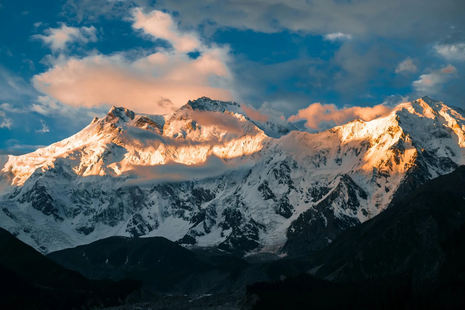
Quick facts: Peak: Nanga Parbat, 8,126 m (world's 9th highest, an eight-thousander) · Traveler base: Fairy Meadows, ~3,300 m · Nanga Parbat Base Camp (Raikot): roughly 3,900 m · Region: Diamer and Astore, Gilgit-Baltistan, Pakistan · Access: Karakoram Highway to Raikot Bridge, jeep to Tato, then a 2 to 3 hour trek · Base camp trek: about 5 days from Islamabad · Best time: June to September · Permit: none to trek, only to climb.
Nanga Parbat is the mountain that stops conversation. At 8,126 metres it is the ninth highest peak on Earth and the western anchor of the Himalaya, rising alone above the great bend of the Indus River in Pakistan's Gilgit-Baltistan. Climbers know it as the Killer Mountain. Travelers know it for Fairy Meadows, the green forest plateau that gives you one of the most jaw-dropping mountain views on the planet without a single technical step.
This is a complete guide to the Nanga Parbat base camp trek and Fairy Meadows: what the mountain is, how to reach it, a day-by-day itinerary, the best time to visit, what the trek costs in both dollars and rupees, how hard it really is, and an honest take on safety. We run these trips ourselves, so everything below is what we would tell a friend planning to go in 2026 or 2027.
Nanga Parbat and Fairy Meadows: a quick overview
Nanga Parbat sits on the border of Diamer and Astore districts, just southeast of where the Indus swings north. It is the westernmost of the fourteen eight-thousanders and the point where the Himalaya ends and the Karakoram begins across the river. The name comes from the Sanskrit for "naked mountain," a nod to the huge bare rock of its south wall, while locals call it Diamer, "the king of the mountains." Odd fact worth keeping: it is still growing by about seven millimetres a year.
Fairy Meadows is the traveler's window onto all of this. It is a meadow and pine plateau at roughly 3,300 metres, facing the Raikot side of the peak, and it is the launch point for the Nanga Parbat base camp trek. You do not climb anything here. You walk in, you settle into a cabin or a tent, and you wake up to an eight-thousander filling the sky.
Why Nanga Parbat is called the Killer Mountain
The nickname was earned the hard way. A German expedition lost ten people to a storm in 1934. In 1937 an avalanche buried an entire camp and killed sixteen more in a single night, one of the worst disasters in mountaineering history. At least thirty-one people died on Nanga Parbat before anyone reached the top.
That first ascent, on 3 July 1953, is one of the great survival stories. The Austrian Hermann Buhl pushed on alone after his partner turned back, summited at around seven in the evening without bottled oxygen, and survived a night standing on a narrow ledge in the open. He is still the only person to make the first ascent of an eight-thousander solo. In 1970 the Messner brothers climbed the giant Rupal Face and crossed the mountain to descend the far side, but Gunther died in an avalanche on the way down. Nanga Parbat was also one of the last eight-thousanders to be climbed in winter, finally in February 2016.
The three faces of Nanga Parbat: Raikot, Rupal and Diamir
Part of what makes Nanga Parbat so dramatic is that it is really three mountains depending on where you stand:
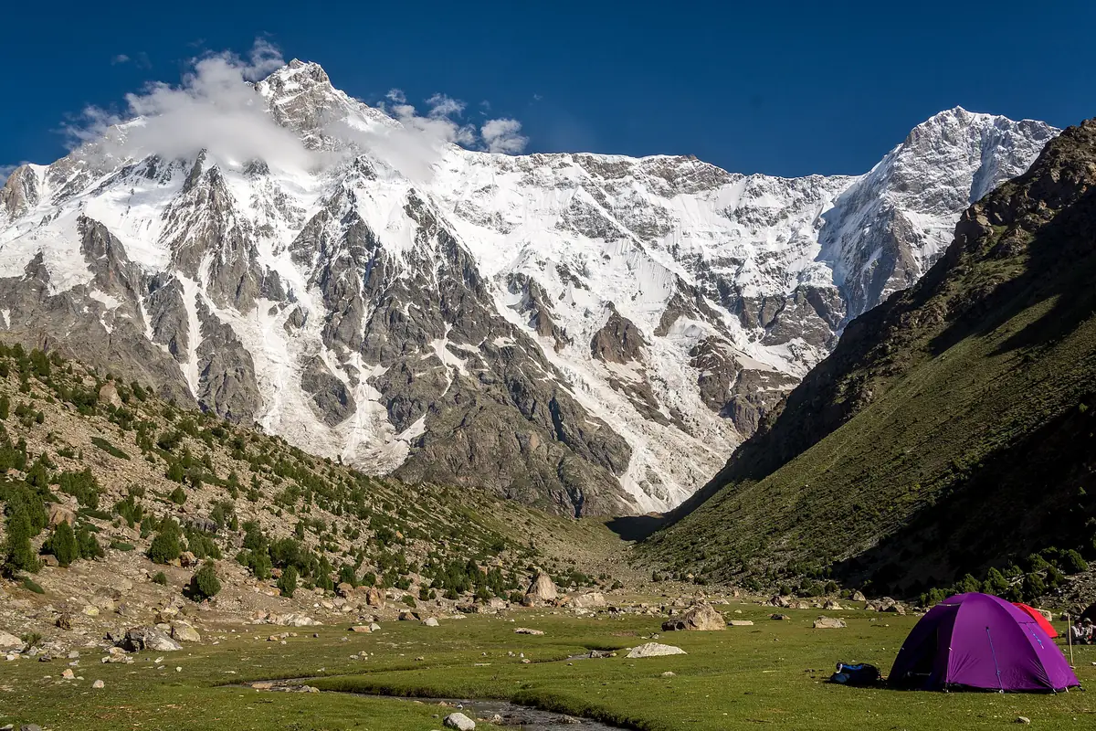
- The Raikot Face (north) climbs some 7,000 metres from the Indus over just 25 kilometres. This is the side you see from Fairy Meadows and the line of the 1953 first ascent.
- The Rupal Face (south) rises about 4,600 metres in one unbroken sweep and is widely called the highest mountain face in the world, sometimes "the Wall of the World." You reach it from the Astore and Tarashing side.
- The Diamir Face (west) holds the standard climbing route and the Diamir base camp where summit expeditions are based.
Fairy Meadows and the Nanga Parbat base camp trek
There are two realistic ways to get close to the mountain on foot, and they feel completely different.
The Raikot side: Fairy Meadows, Beyal Camp and base camp
This is the famous one. From Fairy Meadows, a well-trodden trail leads on to Beyal Camp at about 3,500 metres, then up alongside the Raikot Glacier to the Nanga Parbat Base Camp viewpoint at roughly 3,900 metres. It is beginner friendly at the meadow and moderate for the full base-camp day. Our Nanga Parbat trek is built around this Raikot route.
The Rupal side: Tarashing and Herrligkoffer base camp
Far fewer travelers see the Rupal side, which is exactly its appeal. You reach it through the Astore Valley to Tarashing at about 2,900 metres, the last road head, then trek to Herrligkoffer base camp at around 3,550 metres, a meadow on the edge of the Bazhin Glacier directly beneath that vast Rupal wall. A Rupal-side trek usually runs five to six days and gives you the single most imposing view of the mountain.
Which side should you choose?
| Raikot side (Fairy Meadows) | Rupal side (Tarashing) | |
|---|---|---|
| Face you see | Raikot (north) | Rupal (south, the world's biggest face) |
| Base | Fairy Meadows lodges and cabins | Village guesthouses and camping |
| Trek length | 2 to 5 days, easy to moderate | 5 to 6 days, moderate |
| Crowds | Popular, busy in summer | Quiet and remote |
| Best for | First-timers, families, short trips | Keen trekkers wanting solitude |
How to reach Fairy Meadows
Everything starts on the Karakoram Highway. From Islamabad you drive north through Chilas to Raikot Bridge, a long day on the road. At the bridge you swap into a local 4x4 jeep for the Raikot to Tato track, roughly 14 to 16 kilometres of narrow, unpaved road hacked into the cliffs with sheer drops and no barriers. It is often called one of the most dangerous roads in the world, only licensed local drivers are allowed on it, and the ride takes about two to two and a half hours. From Tato village at around 2,600 metres you walk the last stretch, two to three hours up through pine forest to Fairy Meadows. Horses and porters are available if you would rather not carry a pack.
Nanga Parbat base camp trek itinerary
Most travelers do the Raikot base camp trek as a five-day trip from Islamabad. Here is the classic shape of it:
| Day | Route | What happens |
|---|---|---|
| Day 1 | Islamabad to Chilas | Full day on the Karakoram Highway along the Indus, overnight in Chilas. |
| Day 2 | Chilas to Fairy Meadows | Short drive to Raikot Bridge, jeep up to Tato, then a 2 to 3 hour trek to Fairy Meadows. First view of Nanga Parbat. |
| Day 3 | Fairy Meadows to base camp | Day hike to Beyal Camp and the Nanga Parbat Base Camp viewpoint by the Raikot Glacier, then back to the meadow. |
| Day 4 | Fairy Meadows | Rest, short viewpoint walks, forest and glacier views, or an extra push toward Beyal for sunrise. |
| Day 5 | Fairy Meadows to Islamabad | Trek down to Tato, jeep to Raikot Bridge, and start the drive back down the Karakoram Highway. |
Add a night if you want a slower pace or a buffer for weather, and swap in the Rupal side if you want the quieter, longer route. We can shape the itinerary around your dates and fitness.
Nanga Parbat trek difficulty, distance and altitude
Fairy Meadows itself asks little of you beyond that forest walk in. The base-camp day is where fitness matters: a long day out, around 14 kilometres there and back over eight to ten hours, at altitudes between roughly 3,300 and 3,900 metres. There is no climbing and no exposure a nervous walker cannot handle, but you should be happy on your feet for most of a day. Anyone who hikes regularly at home, paces themselves and respects the altitude will manage the Nanga Parbat base camp trek comfortably.
Best time to visit Nanga Parbat and Fairy Meadows
The season runs from late May to early October. June to September is the sweet spot, and July and August are the warmest and most settled, with wildflowers in the meadow and the best chance of clear weather for the base-camp hike. Late May and October are quieter but colder and less predictable. From roughly November to March, Fairy Meadows lies under deep snow and the Raikot to Tato jeep road is closed, so winter is off the table for a normal visit.
Permits and registration
Good news: you do not need a climbing permit or a No Objection Certificate to trek to Fairy Meadows or the Nanga Parbat base camp. The standard tourist trek is open to travelers of all nationalities, and you simply register with the police at Raikot Bridge on the way in. A formal permit and royalty are required only if you plan to climb Nanga Parbat, which is a separate mountaineering expedition. As of 2025 the armed escorts once assigned here are generally no longer required, though rules can change, so it is worth confirming locally or letting your operator handle it.
Is the Nanga Parbat trek safe?
This is the question we hear most, usually because of one event. In June 2013, militants attacked the Diamir-side climbing base camp used by summit expeditions and killed ten foreign climbers and a Pakistani guide. It was a real tragedy and it deserves to be acknowledged. It also needs context: that attack happened at a remote high-altitude expedition camp, not on the Fairy Meadows tourist trek, and it remains the only incident of its kind in the history of Gilgit-Baltistan.
In the years since, Hunza, Skardu, Fairy Meadows and the Nanga Parbat trekking areas have become some of the most welcoming and secure parts of Pakistan for visitors, with checkpoints along the highway and tourism police in the valleys. The honest risks for a trekker here are not security. They are the jeep road, the weather and the altitude, and all three are manageable with a good local guide, a sensible pace and the right gear.
Nanga Parbat trek cost
Prices move with the season, group size and the exchange rate, so treat these as ranges rather than quotes. We show both US dollars and Pakistani rupees, since domestic and international travelers ask in different currencies:
| Item | Rough cost |
|---|---|
| Raikot Bridge to Tato 4x4 jeep | About PKR 22,500 per jeep round trip, or ~USD 12 to 15 per person shared |
| Fairy Meadows tent or basic cabin | From ~PKR 500 to ~PKR 1,000 per night |
| Premium cabin, half board | Around USD 60 per person |
| Horse or porter | Around PKR 6,000 per person with a handler |
| Guided day hike to base camp | Roughly USD 35 to 65 per person |
| Full guided 5-day trek from Islamabad | Roughly USD 300 to 480, or from about PKR 90,000 per person |
What to pack: a Nanga Parbat trek packing list
Bring proper hiking boots, warm layers for cold mornings even in July, a windproof jacket, sun protection, a refillable water bottle, a headlamp and any personal medication, including something for mild altitude discomfort. Nights at the meadow get genuinely cold. Fairy Meadows has also grown popular enough that litter and inflated pricing can be a problem, so carry your rubbish out, agree prices before you commit, and support the local families who run the cabins and lead the horses.
Nanga Parbat expedition vs base camp trek
One quick clarification, because the two get mixed up. A Nanga Parbat expedition means actually climbing the peak: a 40-day-plus mountaineering trip with permits, royalty fees, high camps and serious risk, handled through the Alpine Club of Pakistan. The Nanga Parbat base camp trek is the traveler's version: no climbing, no ropes, a few days to walk up to Fairy Meadows and the base camp viewpoint. This guide is about the trek. If you are aiming for the summit, see our Nanga Parbat expedition instead.
Plan your Nanga Parbat trip
Whether you want the classic Fairy Meadows and base camp trek on the Raikot side, the quiet grandeur of the Rupal Face, or a full expedition on the mountain itself, we can put it together with local guides who know these valleys personally. Browse our Nanga Parbat trek for the traveler route, or the Nanga Parbat expedition if you are going for the top, and message us to shape a trip around your dates, budget and pace.
Frequently asked questions
How do I reach Fairy Meadows and Nanga Parbat base camp?
From Islamabad you travel the Karakoram Highway through Chilas to Raikot Bridge, then take a local 4x4 jeep up the roughly 14 kilometre Raikot to Tato road, about two to two and a half hours. From Tato you hike two to three hours up to Fairy Meadows. The Nanga Parbat base camp viewpoint is then a full day hike beyond the meadow, past Beyal Camp.
How long is the Nanga Parbat base camp trek?
Most people do it as a five-day trip from Islamabad: a day each way on the Karakoram Highway, plus two to three nights around Fairy Meadows to acclimatise and do the base-camp day hike. The base-camp day itself is roughly 14 kilometres round trip over eight to ten hours. The quieter Rupal-side trek from Tarashing usually runs five to six days.
How much does the Nanga Parbat trek cost?
A full guided five-day trek from Islamabad runs roughly USD 300 to 480, or from about PKR 90,000 per person, depending on season, group size and comfort level. Individual costs like the Raikot jeep, cabins and guided day hikes are cheaper if you piece it together yourself, but a package covers transport, permits, lodging and guiding in one.
When is the best time to visit Nanga Parbat and Fairy Meadows?
June to September is peak season, with July and August the warmest and most reliable for the base-camp hike. Late May and October are quieter but colder. Avoid roughly November to March, when heavy snow closes the Raikot to Tato jeep road and Fairy Meadows is under deep snow.
How hard is the trek, and can beginners do it?
Fairy Meadows is easy and beginner friendly, a two to three hour forest walk from Tato. The full day hike to Nanga Parbat base camp is moderate, long but non-technical, at 3,300 to 3,900 metres. Anyone with reasonable fitness who paces themselves and acclimatises can do it, with no climbing or ropework involved.
Do I need a permit to trek to Nanga Parbat base camp?
No. Trekking to Fairy Meadows and the Raikot-side base camp needs no climbing permit or NOC and is open to all nationalities. You simply register with the police at Raikot Bridge. A permit and royalty are required only if you plan to climb Nanga Parbat, which is a full expedition. Confirm locally, as rules can change.
Is the Nanga Parbat trek safe?
Yes. For trekkers the area is considered one of the safest in Pakistan, with no reported foreign-tourist security incidents in recent years. The 2013 attack many people remember happened at the remote Diamir-side climbing base camp used by summit expeditions, not on the Fairy Meadows trek, and it remains the only incident of its kind in Gilgit-Baltistan's history. The real day-to-day considerations are the jeep road, the weather and the altitude.
What is the difference between Fairy Meadows and Nanga Parbat base camp?
Fairy Meadows, at around 3,300 metres, is the grassy forest plateau where you stay, with lodges, cabins and tents and a classic view of the mountain. The Raikot-side base camp, at roughly 3,900 metres, is higher and closer, reached by a full day hike past Beyal Camp and the Raikot Glacier. There is no accommodation there, so it is a there-and-back day trip for the best up-close views.
Ready for Your Next Adventure?
Join our community of explorers and discover the journey of a lifetime. Our expert team is ready to help you plan your perfect expedition.