Yasin Valley Travel Guide: The Road, the Weather and the Way to Darkot
How to get from Gilgit to Yasin, which villages to stop in, what the weather does each month, and the drive north to Darkot, where the explorer George Hayward was killed in 1870.
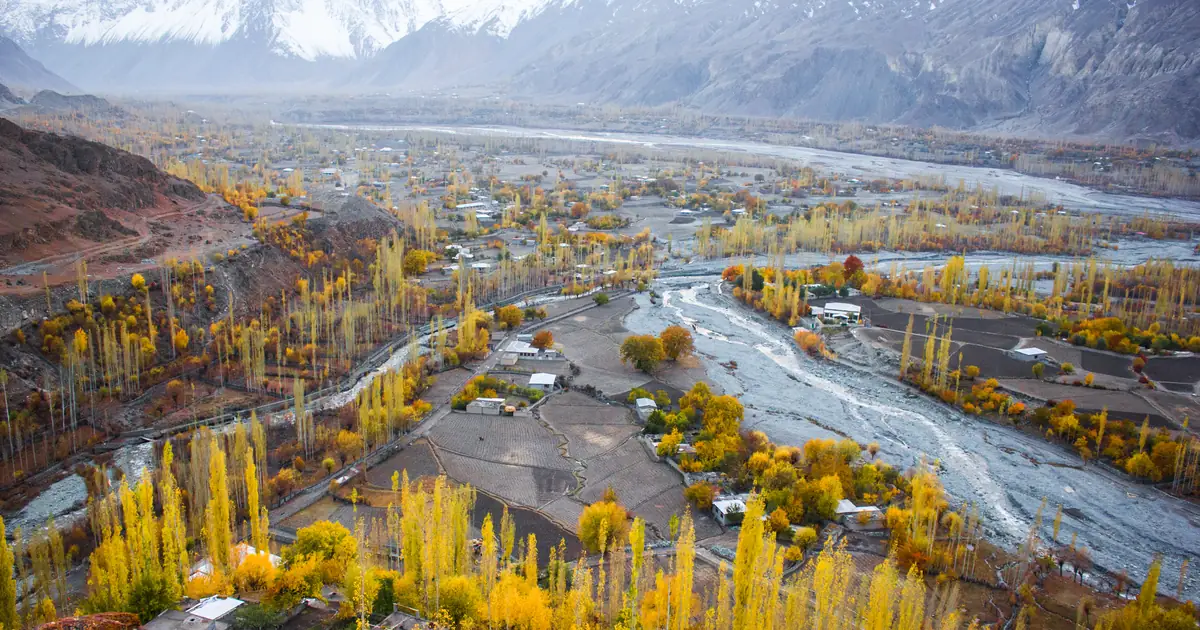
Yasin Valley is a Hindu Kush valley in Gupis-Yasin District, Gilgit-Baltistan, running north from Gupis along the Yasin River. Yasin town is about 130 km from Gilgit by road, a four to five hour drive through Gahkuch and Gupis, and sits at roughly 2,360 m. The valley road carries on another 40 km to Darkot, the last village below the Darkot Pass (4,703 m). The best time to visit is May to October.
Most people heading west from Gilgit are on their way to Phandar or Shandur, and they drive straight past the bridge at Gupis where the Yasin road turns north. That is a pity. Yasin is bigger, older and more lived-in than the lake valleys further up the Ghizer. It has a 15th-century fort, a string of side valleys that lead over high passes into Chitral and Ishkoman, the grave of Pakistan's most recent Nishan-e-Haider, and one of the stranger stories of the Great Game.
It also has very little written about it that you can actually plan with. The pages that rank for "Yasin Valley" run to a few hundred words, and the distances they give don't agree. We measured the road on map data, checked the altitudes against elevation models, and built the weather table from climate data. Where sources disagree, we say so.
Where is Yasin Valley?
Yasin is in the Hindu Kush, in the far west of Gilgit-Baltistan. The Yasin River rises under the Darkot glaciers near the Chitral border and runs south for about 60 km to join the Ghizer River at Gupis. Until 2019 the whole area was part of Ghizer District. It now sits in the new Gupis-Yasin District, though locals, road signs and most guides still say Ghizer.
Locally the valley is split into four union councils. They're also the easiest way to get your bearings:
- Yasin: the lower valley and the main bazaar, with its headquarters at Thodass. The Nazbar side valley opens to the west here.
- Sultanabad: centred on Taus, and including Sandhi and the Qurqulti side valley.
- Thoi: the long western branch, headquartered at Harp, which leads to the Thoi Pass and Chitral.
- Silgan: the upper valley, headquartered at Hundur, including Barkulti, Umalsit and Darkot.
People here speak Burushaski and Khowar. Yasin's Burushaski is its own dialect, different enough from Hunza's that speakers notice. Khowar is the language of Chitral, just over the passes to the west.
How to get to Yasin Valley from Gilgit
There is one road in. It leaves Gilgit westward along the Gilgit River, passes Gahkuch and follows the Ghizer River to Gupis. Just before Gupis town a bridge crosses the river, and the Yasin road turns north. From there it climbs gently through Yasin town, Taus and Barkulti, and on to Hundur and Darkot.
| From Gilgit to | Road distance | Altitude | Typical driving time |
|---|---|---|---|
| Gupis (Yasin turn-off) | about 109 km | 2,170 m | 2.5 to 3 hrs |
| Yasin town | about 131 km | 2,360 m | 3.5 to 4.5 hrs |
| Taus | about 136 km | 2,400 m | 4 to 5 hrs |
| Hundur | about 152 km | 2,490 m | 4.5 to 5.5 hrs |
| Darkot (road end) | about 172 km | 2,680 m | 5.5 to 7 hrs |
Distances are measured along the road on OpenStreetMap and altitudes come from SRTM elevation data. Other guides quote anywhere from 142 to 148 km to "Yasin", which fits once you notice they measure to different villages up the valley. The driving times are ours, with stops. Routing software says under three hours to Yasin, which you won't manage on a road shared with tractors, landslide repairs and livestock.
The road is paved and in fair shape as far as Gupis. North of the bridge it is narrower and patchier, and the stretch beyond Hundur to Darkot is rough in places. A car will get you to Yasin town in dry summer weather. For Darkot, or any time after rain, use a 4x4 with a local driver.
Villages worth stopping in
Yasin is a valley of villages, orchards and polo grounds, and most of the pleasure is in stopping. These are the places we'd point you to, from south to north.
Yasin town and Taus
The bazaar strung between Noh, Yasin and Taus is the valley's centre, with shops, a couple of basic hotels and the best chance of fuel or a phone signal. Yasin Fort, also called Dorkhand Fort, was begun under Shah Khushwaqt in about the 15th century and was once the largest fort in the region. It is unrestored and crumbling, and you are free to look around. We cover it with the other Ghizer forts in our guide to the forts of Gilgit-Baltistan.
Sandhi and Qurqulti
Just north of Taus, Sandhi sits on a broad fan of fields and poplars that turns gold in late October, which is where our cover photo was taken. The Asumbar Pass (about 4,400 m) starts here and crosses east to the Ishkoman valley. Qurqulti, a side valley 30 to 40 minutes from the bazaar, is the start of a walk of about two hours up to Makuli Meadows, one of the easier day hikes in the valley.
Thoi
The Thoi valley branches off to the west and climbs to around 2,700 m at Kuno, about 20 km from Taus by road. It's quieter than the main valley and leads to the Thoi Pass (about 4,500 m), an old route over to the Yarkhun valley in Chitral.
Nazbar
Nazbar opens west of Yasin town, about 8 km from Taus by road. The lower valley has forest and summer pasture. At its head, the Nazbar Pass (about 4,970 to 5,000 m) crosses to Mastuj in Chitral. It's often called one of the hardest non-glaciated passes in northern Pakistan, so treat it as a serious trek with a guide, not a day walk.
Hundur and the Lalak Jan memorial
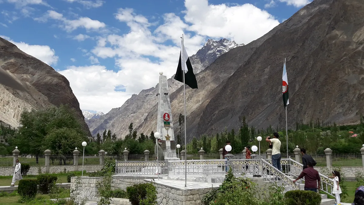
Hundur is the village most Pakistani visitors come to Yasin for. Havaldar Lalak Jan of the Northern Light Infantry was born in Yasin on 1 April 1967 and killed in the Kargil War on 7 July 1999. He was awarded the Nishan-e-Haider, Pakistan's highest military honour, and is its 11th and most recent recipient. He is buried at Hundur. The tomb sits in a small memorial garden with the flag above it, and families stop here on the way up the valley. Wikipedia's Lalak Jan article has the citation in full.
Darkot
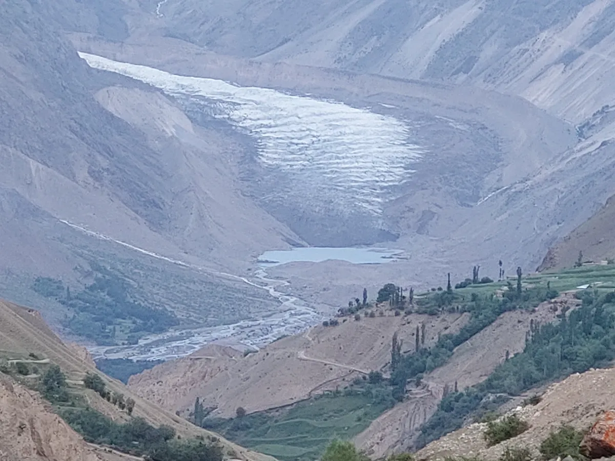
Darkot is the end of the road: a village of fields and willows at about 2,680 m, under the Darkot glacier. Above it is the Darkot Pass, which crosses into the Broghil valley of upper Chitral, close to the Wakhan Corridor. Wikipedia gives the pass as 4,703 m in one article and 4,570 m in another. The first figure matches the elevation data better. Either way, it's a glaciated crossing for experienced trekkers in high summer only.
A short history of Yasin Valley
For most of its recorded history Yasin looked west, to Chitral, not east to Gilgit. It was the seat of a small state, sometimes called Worshigum, ruled by the Khushwaqt dynasty, a branch of Chitral's ruling house. Its best-known ruler, Gohar Aman, fought the Sikhs and then the Dogras of Kashmir for control of Gilgit in the mid-19th century. In 1863, after his death, Dogra troops invaded Yasin and massacred a large part of its population.
Seven years later came the killing that put Darkot on British maps. George Hayward, an English explorer trying to reach the Pamirs, came through Yasin in July 1870. On the morning of 18 July 1870, near Darkot, he was seized and murdered. Who ordered it is still argued about. Some blamed Mir Wali, Yasin's ruler at the time, others the ruler of Chitral, and others the Maharaja of Kashmir, who had reason to want Hayward silenced. His body was carried back to Gilgit and buried there, in what became the town's old Christian cemetery. The Hayward entry on Wikipedia sets out the competing versions. The British took the valley into the Gilgit Agency in 1895.
Yasin Valley weather by month
Yasin is high, dry and continental. Summer days are hot in the sun and nights are cool. Winter is long, with snow on the valley floor from about December to February and nights well below freezing. There's no weather station in the valley, so the table below is our estimate. We took ten years of climate-model data for Yasin town (2015 to 2024) and corrected it using the Pakistan Meteorological Department's station normals for Gilgit.
| Month | Day (°C) | Night (°C) | What to expect |
|---|---|---|---|
| January | 1 | -11 | Deep cold, snow on the ground, upper road often shut |
| February | 5 | -8 | Still winter |
| March | 11 | -2 | Thaw begins. Tukhm Rezi festival |
| April | 16 | 2 | Apricot and cherry blossom |
| May | 20 | 4 | Green fields, roads opening up the valley |
| June | 27 | 7 | Warm, long days. Good for side valleys |
| July | 31 | 12 | Hottest month. Passes open |
| August | 30 | 11 | Harvest begins. Passes open |
| September | 25 | 5 | Clear, settled, fewer people |
| October | 17 | -2 | Poplars turn gold late in the month |
| November | 10 | -8 | Last of the autumn colour, cold nights |
| December | 3 | -11 | Winter sets in |
Darkot is about 300 m higher than Yasin town, so take off two or three degrees up there. Rain is scarce in summer, but a thunderstorm on the peaks can still bring a flash flood down a side stream, and those do more damage to the road than anything else.
Best time to visit Yasin Valley
- Early to mid March, for Tukhm Rezi. The name means "sowing of seeds". It's a spring festival said to be centuries old, with a ploughing procession, polo, horse games and dancing. Expect cold nights and check the dates locally, because they move with the season.
- April and May, for blossom. The orchards flower in April and the fields go green in May. The upper valley can still be muddy.
- June to September, for walking. This is when the side valleys and passes are open. July and August are the only safe window for Darkot, Thoi or Nazbar.
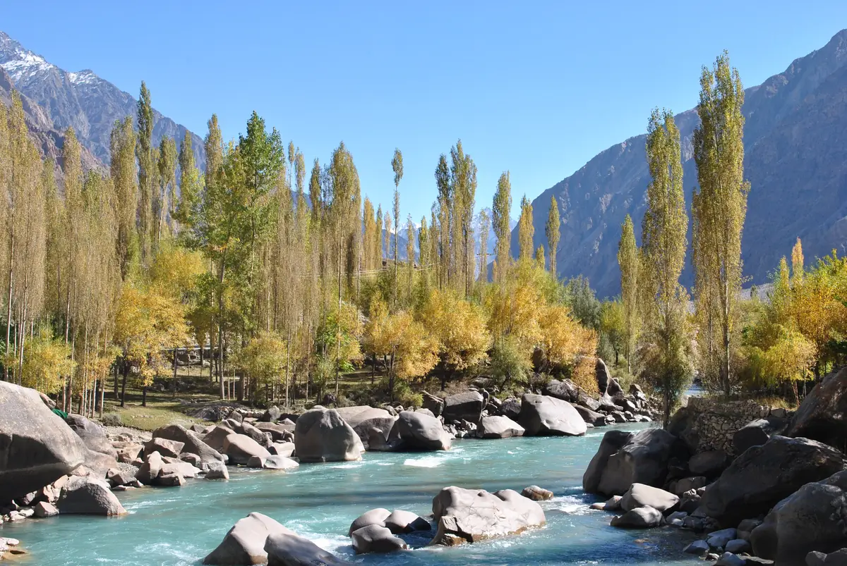
- Late October to early November, for colour. The poplars and willows turn yellow and gold across the whole valley floor, and it's the best time to photograph Sandhi and Noh.
Where to stay, and practical notes
Accommodation in Yasin is basic: a few small hotels and guesthouses around the bazaar and Taus, and homestays further up. Don't expect online booking. Many travellers base themselves at Gupis or Phandar instead and visit Yasin as a long day trip, which works for the lower valley. If you want to reach Darkot or walk anywhere, stay in the valley for at least one night.
- Signal: SCOM is the only network with meaningful coverage past Gahkuch, and it's patchy north of Gupis. Assume you'll be offline for long stretches.
- Money: bring cash from Gilgit or Gahkuch. Cards aren't accepted in the valley.
- Fuel: fill up at Gupis.
- Permits: we know of no special permit for Yasin itself, but carry your passport and visa, since you may be asked for them at checkposts on the Ghizer road. The high passes to Broghil sit close to the Afghan border, so check the current rules before planning a crossing.
- Etiquette: the valley is conservative. Dress modestly, and ask before photographing people, particularly women.
Combining Yasin with the rest of Ghizer
Yasin fits neatly into a trip west from Gilgit. The obvious pairing is the lake valley of Phandar, about 55 km further up the main road from Gupis. Our Phandar Valley travel guide covers that road, the lake and the trout. With a 4x4 you can do Gupis, Yasin and Phandar in three nights, or keep going to the Shandur plateau.
Our six-to-seven-day Ghizer Valley tour already overnights at Gupis on the way to Phandar and Shandur, so adding a day up the Yasin road to Hundur, or a night at Darkot, is easy to arrange. Tell us when you enquire. For the official picture of the region, Gilgit-Baltistan's tourism department page on Yasin is worth a look.
Common questions about Yasin Valley
Where is Yasin Valley located?
Yasin Valley is in the Hindu Kush in the far west of Gilgit-Baltistan, in northern Pakistan. It follows the Yasin River north from Gupis, where the river joins the Ghizer, for about 60 km to Darkot below the Chitral border. Administratively it has been part of Gupis-Yasin District since 2019, when that district was split off from Ghizer District, so older guides and most local people still describe it as being in Ghizer. The valley has four union councils: Yasin, Sultanabad (centred on Taus), Thoi and Silgan (centred on Hundur). Its main side valleys are Thoi, Nazbar and Qurqulti. The main town sits at roughly 36.37 N, 73.34 E, at an altitude of about 2,360 m.
How far is Yasin Valley from Gilgit?
Yasin town is about 131 km from Gilgit by road, measured on OpenStreetMap. The route runs west along the Gilgit and Ghizer rivers through Gahkuch to Gupis, which is about 109 km, then turns north across the bridge for another 22 km. Allow three and a half to four and a half hours with stops. Other guides give 142 to 148 km because they measure to villages further up the valley: Taus is about 136 km from Gilgit, Hundur about 152 km, and Darkot, where the road ends, about 172 km. The road is paved to Gupis and narrower and patchier after it. A car can manage Yasin town in dry weather, but take a 4x4 for Darkot or after rain.
What is the weather like in Yasin Valley?
Yasin is high and dry, with hot summer days, cool nights and a long, cold winter. Our estimate for Yasin town (2,360 m) is about 31 °C by day and 12 °C at night in July, the warmest month. January averages about 1 °C by day and -11 °C at night. Spring comes in April, when days reach about 16 °C and the orchards flower. October is still pleasant at around 17 °C but brings the first frosts at night. These figures come from ten years of climate-model data corrected against the Gilgit weather station, because the valley has no station of its own. Darkot, 300 m higher, runs two or three degrees cooler. Summer rain is rare, but storms on the peaks can cause flash floods on side streams.
What is Yasin Valley famous for?
Pakistanis know Yasin best as the home of Havaldar Lalak Jan, the 11th and most recent recipient of the Nishan-e-Haider, who was killed in the Kargil War in 1999 and is buried at Hundur. The valley is also known for its history as a Khushwaqt principality, for Yasin (Dorkhand) Fort, and for the murder of the explorer George Hayward near Darkot in 1870. Travellers come for the landscape: poplar-lined villages that turn gold in late October, apricot blossom in April, and side valleys leading to high passes into Chitral and Ishkoman. The Tukhm Rezi spring sowing festival in March brings polo, horse games and music. Unlike Hunza, Yasin gets very few tourists, which is much of its appeal.
Is it safe to visit Yasin Valley?
Yes. Yasin and the rest of the Ghizer corridor are among the calmest parts of Pakistan, and visitors are generally welcomed warmly. The real risks are practical ones. The road beyond Gupis is narrow and can be cut by landslides or flash floods after storms. Mobile coverage is patchy, with SCOM the only network worth relying on. The nearest proper hospital is in Gilgit, four to five hours away. Travel with a local driver who knows the road, keep a spare day in your plans, and bring cash, since there are no card payments in the valley. If you plan to cross the Darkot, Thoi or Nazbar passes, go in July or August with an experienced guide, and check the current permit position for the Broghil side before you set off.
Photos: Samikhan86, Ghazala Shah, Shakeelgilgity and BaigNasirullah via Wikimedia Commons (CC BY-SA 4.0).
Ready for Your Next Adventure?
Join our community of explorers and discover the journey of a lifetime. Our expert team is ready to help you plan your perfect expedition.