Khaltaro Valley Guide: The Jeep Road, Khun Meadows and Rakhan Gali
A quiet side valley of Haramosh, up one of the steepest jeep tracks off the Skardu road. Checked altitudes, distances, weather, permits and costs.
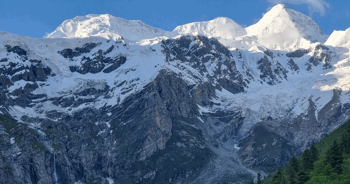
Khaltaro Valley is a quiet side valley of Haramosh in Gilgit-Baltistan, about 80 km from Gilgit. A 14 km jeep track climbs from Sassi on the Gilgit-Skardu road (about 1,400 m) to Khaltaro village at 2,577 m, which takes around two hours in a 4x4. From the village it is a three-hour walk to Khun Meadows (about 3,300 m), where Haramosh, Malubiting and Nanga Parbat are all in view. The season runs June to September.
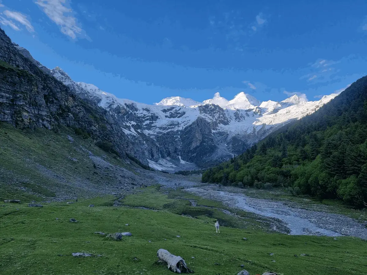
Most people driving the Gilgit-Skardu road pass the Sassi turn-off without a second look. The few who do turn off usually go to Kutwal Lake, on the other side of the Haramosh massif. Khaltaro sees a fraction of that traffic. There is no lake and no hotel, and the road is worse. What it does have is pine forest, a chain of summer settlements, seven waterfalls under a glacier, and a meadow with a panorama you can walk up to before lunch.
What you read about it online tends to fall apart when you check it. The page that ranks first gives four different distances from Gilgit. Another puts the valley's coordinates in Bagrote, 21 km away. The figures below were checked against map data, logged GPS tracks and the original trekking notes for the route, and where the sources disagree we say so.
Where is Khaltaro Valley?
Khaltaro is in Gilgit District, Gilgit-Baltistan, on the north bank of the Indus below the Haramosh range. It is one of two side valleys that people mean when they say "Haramosh Valley". The other is Kutwal, which you reach from the village of Dassu. Both leave the main road near Sassi, but they are separate valleys with separate trailheads, and at least one well-known road guide mixes them up.
The valley's stream, the Khaltaro Nala (also called Darchan Gah), runs south and meets the Indus at Sassi. Going up the valley you pass Khaltaro, Khaya, Kalijut, Darchan and Pamiri. The higher ones are summer settlements where families take their yaks, cows and goats. Humal sits on the opposite bank from Khaltaro and is where the path to Khun Meadows begins. If you want to put it on a map, the village is at roughly 35.913 N, 74.716 E.
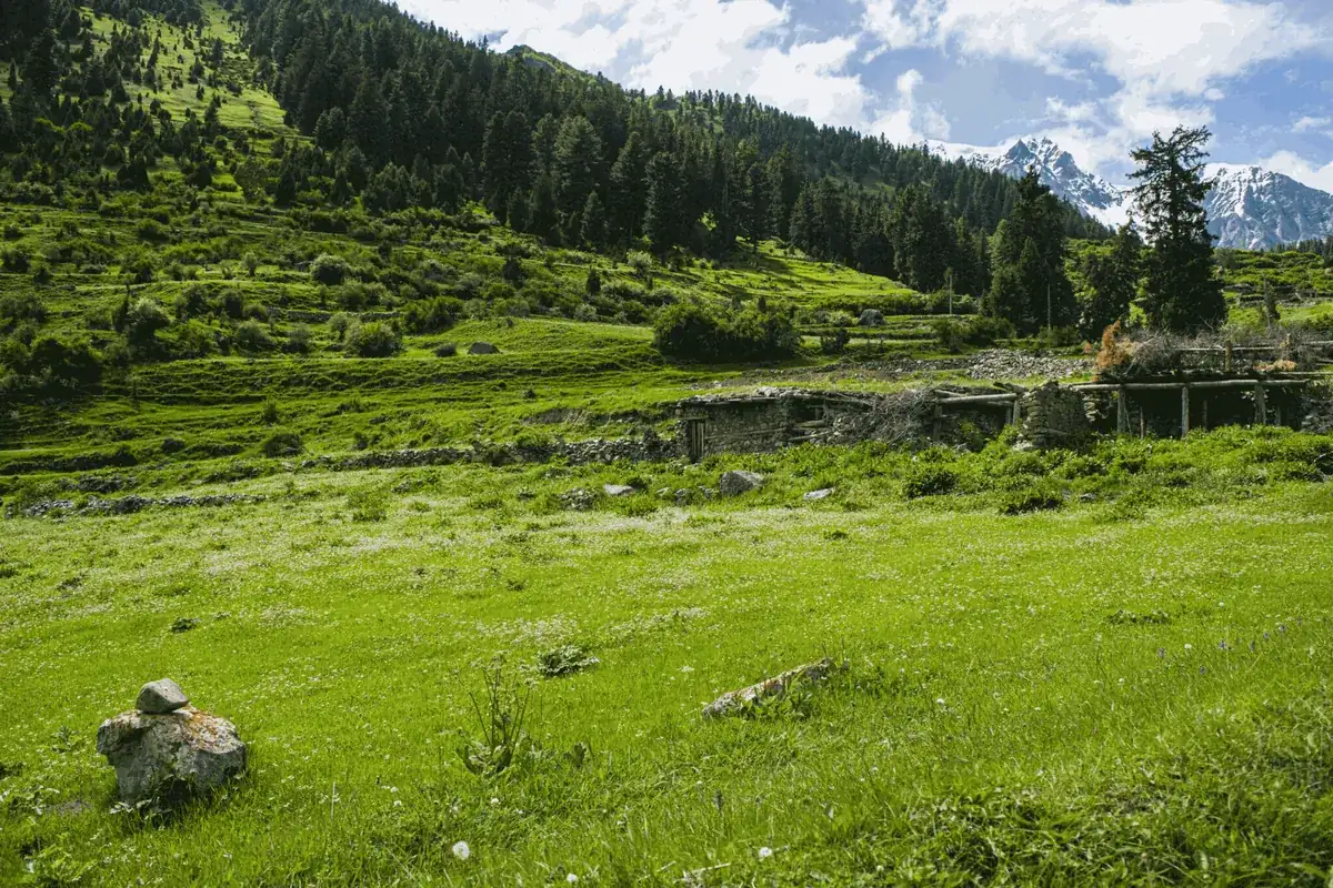
Gilgit to Sassi is about 68 km, or around two hours on the S-1, the road that leaves the Karakoram Highway near Jaglot and follows the Indus toward Skardu. From Skardu it is about 142 km to the same turn-off. Add the 14 km jeep track and Khaltaro is roughly 80 km from Gilgit by road, even though it is only 37 km away in a straight line.
The Khaltaro Valley road: Sassi to Khaltaro by jeep
The track leaves the S-1 just north of Sassi, at a signpost for Khaltaro. From there it is 14 km of unpaved single lane, gaining nearly 1,200 m. The average gradient is over 8%, and some pitches reach about 15%. There are very few places to pass another vehicle, and people who have driven both say it is narrower and more unnerving than the jeep road to Fairy Meadows.
- Time: a GPS-logged run took just under two hours. Other trip reports say up to three. It depends on the driver, the load and what the last rain did to the surface.
- Vehicle: 4x4 only. Hire a local jeep in Sassi or Gilgit. Seats are in the cab; everyone else rides on the back.
- Fare: about Rs 8,000 return was quoted in late 2025, and about US$50 one way in early 2026. Agree the pickup date for the return before the driver leaves.
- Paving: one operator writes that widening is under way. We could not find anything recent to confirm it, so plan for a jeep.
There is also the old way in on foot. A path drops from Khaltaro to Hanuchal, on the main road just west of Sassi, in three to four hours. Few people walk up it, but it makes a good exit if you would rather not ride the jeep back down.
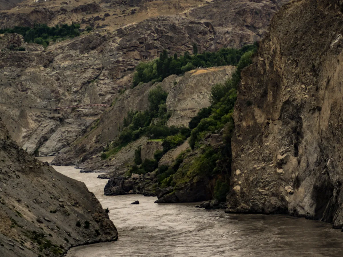
Khaltaro Valley altitudes at a glance
Published altitudes for Khaltaro vary by a few hundred metres. These are the figures that agree with GPS tracks and elevation data. Where two sources still disagree, both are given.
| Place | Altitude | Notes |
|---|---|---|
| Sassi, road junction | about 1,400 m | On the Gilgit-Skardu road (S-1) |
| Khaltaro village | 2,577 m | End of the jeep track; other sources give 2,500 to 2,600 m |
| Darchan | about 3,200 m | Summer settlement below Darchan Glacier |
| Khun Meadows | 3,200 to 3,450 m | The GPS camp is at 3,221 m; the top of the meadow is about 3,450 m |
| Pamiri | about 3,330 m | Kitchen huts; base for Rakhan Gali |
| Rakhan Gali | 4,548 m | The published figure; the only GPS track reads 4,341 m |
The peaks you can see from the valley are much higher. Haramosh is 7,409 m, Malubiting 7,458 m and Bilchar Dobani 6,143 m. On a clear day Nanga Parbat (8,126 m) shows to the south-west.
Khun Meadows: the walk and the view
Khun Meadows is the reason most people come. From Khaltaro the path crosses the stream to Humal, then climbs through pine forest to open grass. The logged GPS route is 6.9 km with about 650 m of ascent and took a little over three hours. You will see "half an hour" and "one hour" quoted online. For most walkers carrying a pack, that is wrong.
Fill every bottle at Humal. It is the last water on the way up, and there is none at Khun. If you plan to camp on the meadow, somebody has to carry water for cooking as well.
From the top of the meadow you look across to Haramosh, Malubiting and Bilchar Dobani, and back toward Nanga Parbat. Some trip reports claim Rakaposhi too. We have not seen a photo that shows it, so treat that as a maybe. One group reported phone signal at the top of Khun in 2024, which is more than you will get in most of the valley.
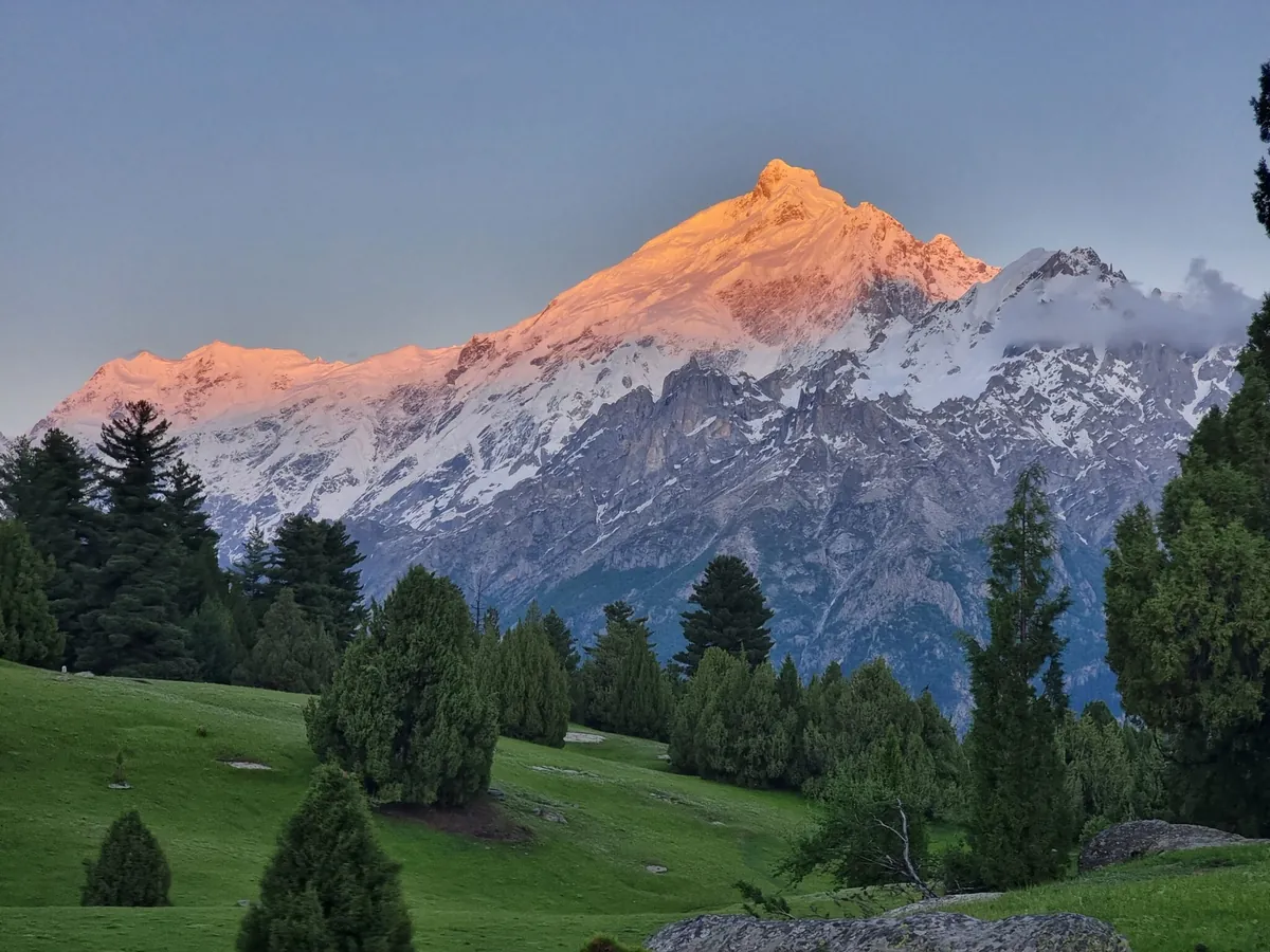
The longer loop: Khaya and the seven waterfalls
With four nights you can make a loop of the upper valley instead of going straight up and down. One well-documented version runs like this:
- Khaltaro to Khaya: 4 km, about 475 m up, 2 hours.
- Khaya to the seven waterfalls viewpoint: 6 km, about 300 m up, 3 hours. The falls come off Darchan Glacier at the head of the valley.
- Waterfalls to Khun Meadows via Humal: about 3½ hours.
- Khun back down to Khaltaro: about 2½ hours.
That is about 26 km and 11 to 13 hours of walking in total, all on good paths. The waterfalls are at their fullest in June and July and get noticeably thinner by late August.
Rakhan Gali: the pass from Khaltaro to Bagrote
Rakhan Gali is the high pass at the head of the valley. It leads over to Bagrote, the valley on the Gilgit side of the range, which means you can walk in from one side and come out on the other. It is the boundary between Bagrote and Haramosh porter territory, so expect to change porters at the pass.
This is a serious day. The standard trekking notes grade it "demanding" and give the season as mid-June to September. The Bagrote side is steep, loose scree. One party that crossed from Khaltaro took over 14 hours from base camp to the Bagrote roadhead. Very few local guides have been over it, so ask directly whether yours has.
| Stage (Bagrote to Khaltaro) | Distance | Height change |
|---|---|---|
| Chirah (2,700 m) to Gargoh | 12 km | +800 m |
| Gargoh to Agurtsab Dar (3,950 m) | 5 km | +450 m |
| Agurtsab Dar over Rakhan Gali to Darchan | 14 km | +598 m, then −1,348 m |
| Darchan to Hanuchal on the main road | 15 km | −1,600 m |
The stages come from the classic route description, reproduced on trek.pk's Rakhan Gali page. If you want to see the Bagrote end first, our Bagrote Valley trek guide covers Chirah, Gargo and the glacier.
Khaltaro Valley weather and the best time to go
There is no weather station in the valley, so the table below uses a climate model (ERA5 reanalysis, 2015 to 2024) adjusted to the village and to Khun Meadows. Treat it as a guide to what to pack. It works just as well for the rest of the Haramosh Valley at the same heights.
| Month | Khaltaro village (2,577 m) | Khun Meadows (about 3,300 m) |
|---|---|---|
| January | −1 °C by day, −7 °C at night | Under snow |
| May | 15 °C by day, 4 °C at night; the wettest month | Snow patches, cold nights |
| July | 24 °C by day, 15 °C at night | 19 °C by day, 9 °C at night |
| September | 20 °C by day, 11 °C at night | 15 °C by day, 6 °C at night |
| October | 12 °C by day, 3 °C at night | 7 °C by day, −3 °C at night |
The model shows snow at village level from October to May. Our advice is to go between mid-June and September. June and July give you full waterfalls, green grass and the warmest nights. September is cooler, and the air tends to be clearer for the view from Khun. By October the meadow drops below freezing at night, and a snowfall can close the jeep track.
Where to stay, phone signal, fuel and permits
Where to stay. There are no hotels in Khaltaro. People camp, or stay with local families by arrangement. On the main road there are two basic hotels at Shatoot, about 4 km past Sassi, and a hotel with camping near Sassi itself. In the valley the usual campsites are Khaya (water close by, but you are camping in the village, so ask first), the seven waterfalls viewpoint, and Khun Meadows, where you carry water up. Pamiri has kitchen huts used by the herders.
Phone signal. Patchy. Reports range from "nothing after Sassi" to SCOM in a few spots and a signal at the top of Khun. Tell someone your plan before you leave the main road.
Fuel and cash. Map data shows a fuel station at Sassi, but fill up in Gilgit or Jaglot anyway. There is no ATM anywhere near the valley, so bring enough cash from Gilgit for the jeep, porters and food.
Permits. Haramosh is in Gilgit-Baltistan's open zone. The official open-zone list names the Haramosh route via Dassu and Sassi, and the rules let foreigners trek open-zone routes without a trekking permit or a mandatory guide. Khaltaro is not named on its own, but we know of no separate rule for it. One site says foreigners need an NOC. We found nothing to back that up.
The people. The valley is Shina-speaking herding country. Families move their animals up to Khaya, Darchan and Pamiri for the summer, and yaks are still walked over Rakhan Gali to be sold in Gilgit. You may also meet people digging for aquamarine; the Gemstone Corporation of Pakistan found emerald here in 1985. Dress modestly and ask before you photograph anyone.
Khaltaro, Kutwal or Bagrote?
These three get compared because they share a mountain range, and Rakhan Gali connects two of them. They suit different trips.
| Khaltaro | Kutwal | Bagrote | |
|---|---|---|---|
| Start | Khaltaro, 14 km jeep track from Sassi | Dassu, about 2 hours by jeep from Sassi | Chirah, via Jalalabad near Gilgit |
| Main draw | Khun Meadows panorama, forest, seven waterfalls | Kutwal Lake and the face of Haramosh | Rakaposhi and Diran views, glaciers |
| Walk in | About 3 hours to Khun | About 18 km from Dassu via Iskere | Varies with the route |
| Crowds | Very few | The busiest of the three | Easy to reach from Gilgit |
If you want a lake and the classic Haramosh walk, go to Kutwal. Our Kutwal Lake and Haramosh Valley guide covers it in detail. If you want the same mountains with almost nobody else around, go to Khaltaro. If you have a week and strong legs, walk from Bagrote over Rakhan Gali and come out through Khaltaro.
What a Khaltaro trip costs
Khaltaro is cheap to reach once you are in Gilgit. The main costs are the jeep and the people who carry your gear.
- Jeep, Sassi to Khaltaro: about Rs 8,000 return (late 2025), or about US$50 one way (2026).
- Guide: about US$50 to 70 a day. Porters: about US$10 to 15 a day each, plus food.
- Local group trips from Gilgit: one 2023 package charged Rs 48,000 for six days, or Rs 56,000 with the Rakhan Gali crossing.
- International Rakhan Gali packages: a 12-day trip from Islamabad was about US$1,600 per person for 2026.
For time, allow three days from Gilgit for a simple trip: drive and jeep in, walk to Khun, come back. Four or five days lets you do the waterfall loop. Five or six covers the Rakhan Gali crossing to Bagrote, with an extra day for weather.
We run guided treks on the Haramosh side of the range. The easiest way to fit Khaltaro in is as an add-on to our guided Kutwal Lake trek in Haramosh, since both start from Sassi and use the same jeeps and porters. For background on the mountains, Wikipedia's pages on Haramosh Peak and the Bagrot Valley are well sourced.
Common questions
Where is Khaltaro Valley?
Khaltaro Valley is in Gilgit District, Gilgit-Baltistan, in northern Pakistan. It is a side valley of the Haramosh Valley on the north bank of the Indus, below the Haramosh range. The jeep track to it starts just north of Sassi on the Gilgit-Skardu road (S-1), about 68 km from Gilgit and 142 km from Skardu. The village itself is at roughly 35.913 N, 74.716 E and 2,577 m. Kutwal, the better-known Haramosh side valley with the lake, is reached from Dassu instead, so the two valleys have different trailheads even though they start from the same stretch of road. Above Khaltaro village the valley carries on past the summer settlements of Khaya, Darchan and Pamiri to Rakhan Gali, the pass over to Bagrote.
How do you get to Khaltaro Valley from Gilgit?
Drive from Gilgit down the Karakoram Highway to Jaglot, then take the S-1 toward Skardu along the Indus as far as Sassi. That is about 68 km and roughly two hours. Just north of Sassi a signposted jeep track turns up into the valley. It is 14 km long, unpaved and one lane wide, and it climbs from about 1,400 m to 2,577 m at Khaltaro village. A 4x4 takes around two hours, sometimes three. Local jeeps cost about Rs 8,000 return, based on a late-2025 quote. Arrange the return pickup before your driver leaves, because there is little phone signal in the valley. You can also walk out on the old path from Khaltaro down to Hanuchal on the main road, which takes three to four hours.
Can a normal car reach Khaltaro?
No. Leave an ordinary car at Sassi. The last 14 km is a steep, narrow, unpaved jeep track with gradients up to about 15% and almost nowhere to pass, and people who have driven both call it harder than the Fairy Meadows road. A small, capable 4x4 such as a Suzuki Jimny has made it, but most visitors hire a local jeep and driver in Sassi or Gilgit, which is safer and not expensive. One operator reports that the road is being widened and may be surfaced eventually. We could not find recent confirmation of that, so for now plan on a 4x4 and a driver who knows the track. After rain or early snow, ask in Sassi before you go up, because a landslide can close the track for a day or more.
How long is the walk to Khun Meadows?
Allow about three hours from Khaltaro village. The logged GPS route is 6.9 km with roughly 650 m of ascent. It crosses the stream to Humal, then climbs through pine forest to the meadow, which sits at about 3,200 to 3,450 m. Some websites say half an hour or one hour. That is far too short for most people carrying a pack. Fill all your water at Humal, because it is the last source and Khun Meadows has none. Coming down takes about two and a half hours. If you have more time, a four-night loop takes in Khaya, the seven waterfalls below Darchan Glacier and Khun. It covers about 26 km in total on good paths and is suitable for most fit walkers.
What is the best time to visit Khaltaro Valley?
Mid-June to September. In July the village sees daytime highs around 24 °C and nights around 15 °C, while Khun Meadows is about 19 °C by day and 9 °C at night. These figures come from climate model data, since there is no station in the valley. June and July are best for the waterfalls and green grass. September is cooler, and the air is often clearer for mountain views. From October, nights at Khun drop below freezing and snow can close the jeep track. The model shows snow at village level from October to May, so winter visits are not practical. If you plan to cross Rakhan Gali to Bagrote, stay within mid-June to September, when the pass is usually clear enough to cross.
Do foreigners need a permit for Khaltaro Valley?
We know of no permit requirement for Khaltaro itself. Haramosh lies in Gilgit-Baltistan's open zone, and the official list of open-zone routes names the Haramosh route via Dassu and Sassi. Under the trekking rules, foreigners can walk open-zone routes without a trekking permit and without a mandatory licensed guide. Khaltaro and Rakhan Gali are not named separately on that list, but they sit in the same area, and we have found no rule that treats them differently. One website says foreigners need an NOC. We found nothing to support that claim. You still need a valid Pakistan visa and should carry your passport on the Skardu road. A local guide is strongly recommended for Rakhan Gali, because very few people know the route.
Ready for Your Next Adventure?
Join our community of explorers and discover the journey of a lifetime. Our expert team is ready to help you plan your perfect expedition.