Bagrote Valley Trek: Gargo Meadows, Barche and Diran Base Camp
Two hours from Gilgit, three hours on foot, and you are camped under Rakaposhi and Diran. The short Karakoram trek almost nobody books.
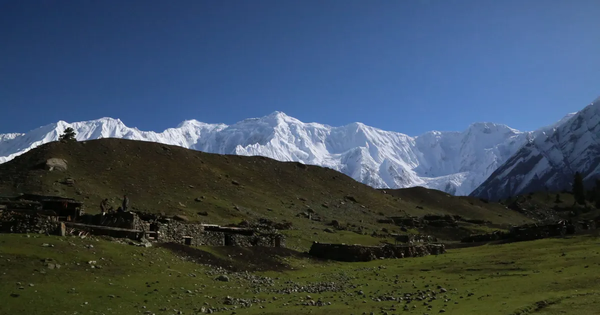
Bagrote is the valley most Gilgit visitors drive past without noticing. The turning is an unmarked side road off the Karakoram Highway, and two hours later you are standing in a meadow with Rakaposhi (7,788 m) on one side and Diran (7,266 m) straight ahead, having walked for an afternoon rather than a week.
That is the case for it. Almost every other Karakoram trek asks for a flight to Skardu, days of driving, or a serious approach walk. This one starts from a city with an airport, and you can sleep under a 7,000er the same night.
Bagrote Valley at a glance
| Detail | |
|---|---|
| Where | East of Gilgit, off the Karakoram Highway, Gilgit-Baltistan |
| Distance from Gilgit | About 38 km, two hours by jeep |
| Altitude range | 2,500 m at the villages to about 4,500 m at the glacier heads |
| Peaks around it | Rakaposhi 7,788 m, Diran 7,266 m, Miar 6,824 m, Bilchar Dobani about 6,138 m |
| Glaciers | Hinarche, Barche, Gargo, Bursil |
| Villages | Sinaker, Datuchi, Bulchi, Farfu, Chirah, Hopay, Gasunar |
| People | Around 10,000, Shina speaking |
| Season | June to September for the meadows and glaciers |
| Permit | CKNP permit for the upper treks, issued in Gilgit or Skardu |
Where Bagrote Valley is, and how to get there
The valley runs east from the Karakoram Highway a short way north of Gilgit and climbs to the foot of the Rakaposhi and Diran massifs. The road is paved at first and then becomes a jeep track. Beyond Sinaker you want a 4x4 and a driver who knows the track, which is the normal arrangement out of Gilgit.
Public transport goes as far as the lower villages and no further, on no useful timetable. Most visitors hire a jeep in Gilgit for the day or come with a guide. Give the drive two hours from town to the upper villages, longer after rain, when the side streams push gravel across the track.
The three walks: Gargo, Barche and Diran base camp
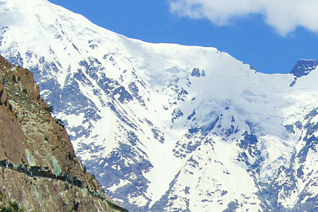
Bagrote is not one trek. It is a road head with three different walks above it, and you can do the short one in an afternoon or string them into four or five days.
| Walk | Time from the road | What you get |
|---|---|---|
| Gargo Meadows | About 3 hours up | The classic wide pasture with Diran behind it. Camping, shepherd huts, day-trip friendly |
| Barche | A day, sleep up there | Grazing grounds and the Barche glacier above Hopay. Quieter and rougher than Gargo |
| Diran base camp (4,300 m) | 2 to 3 days up | Moraine walking beside the Hinarche glacier, camp at Tagaphari 3,500 m, the south face of Diran above you |
Gargo Meadows
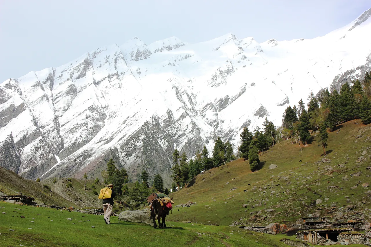
Gargo is the one in the photographs: a broad summer pasture used for grazing, with stone huts, grazing cattle, and Diran filling the head of the valley. From the upper road it is about three hours of steady uphill walking, with no technical ground and nothing exposed. Fit families manage it. Most people who only have a day in Bagrote walk to Gargo, eat there and come back down, and that already justifies the drive.
Barche
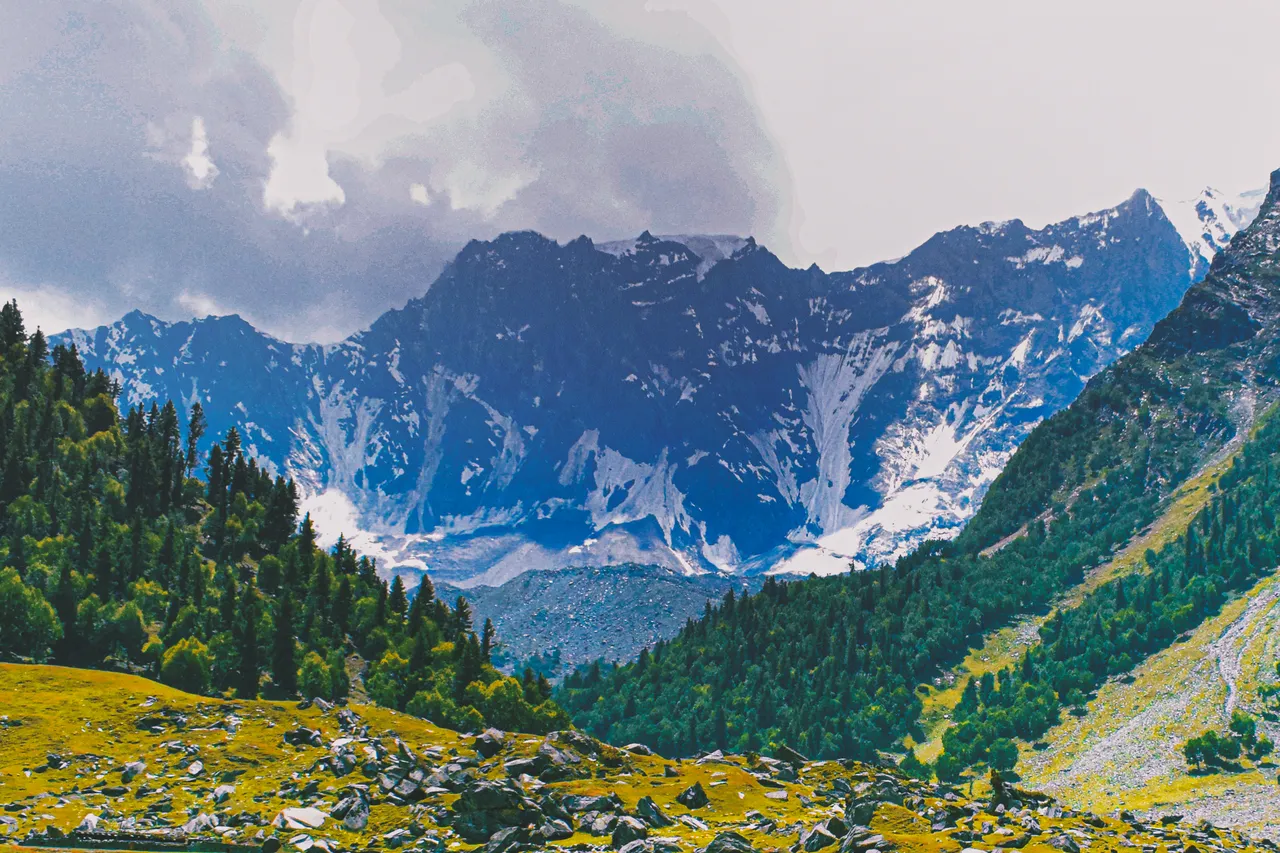
Barche sits on the other side of the upper valley, reached from Hopay, the last main village. It gives its name to one of the valley's glaciers, and the ground below the ice is summer grazing rather than a manicured viewpoint. It is a longer, rougher day than Gargo and it makes sense as an overnight rather than a there-and-back.
One honest note: you will see altitudes quoted for Barche on travel sites, and they disagree with each other. No survey figure for the meadow has been published that we can find, so we would rather say that than print a number that looks precise and is not. What is certain is that it sits between the village fields at about 2,500 m and the glacier heads near 4,500 m, and that you gain most of that on your feet.
Diran base camp
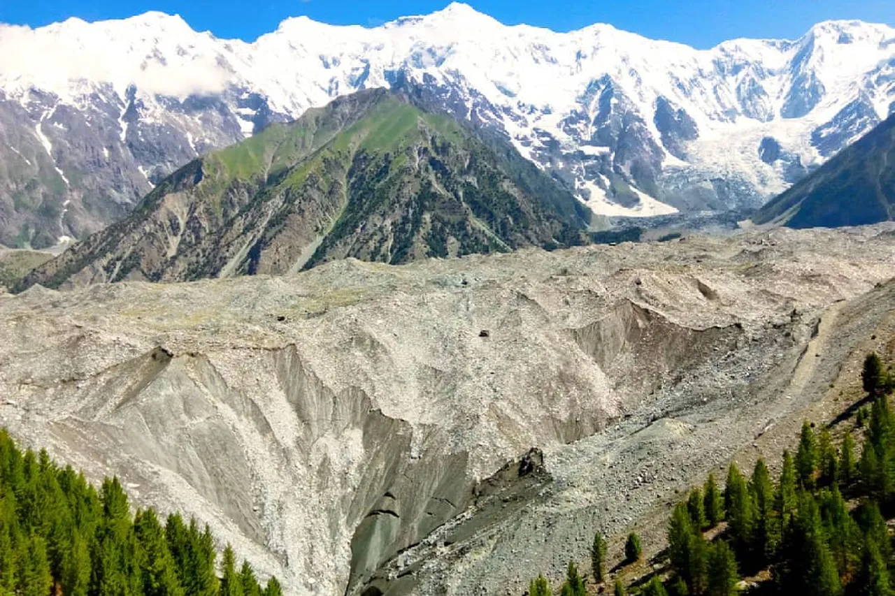
The serious option. From the road head the walk to Diran base camp at 4,300 m takes two to three days through pasture, juniper and moraine, with the usual camp at Tagaphari, about 3,500 m. The route follows the margin of the Hinarche glacier, which comes down off Diran, and there is a second line from Bulchi up the western side. Neither needs ropes or crampons in a normal summer, but glacier moraine is loose, tiring ground and the weather turns fast at 4,000 m.
Count on five to seven days for the round trip from Gilgit if base camp is the goal. Diran itself has a harder climbing history than its modest height suggests, which you can read about on our Diran expedition page.
Best time to trek in Bagrote
| Season | Conditions |
|---|---|
| April to May | Lower valley green and in blossom; the high pastures still hold snow and the top of the jeep track can be blocked |
| June to August | The trekking season. Meadows in flower, shepherd families up at the pastures, long daylight. Warm in the valley, cold at night above 3,000 m |
| September | Clearest air and the sharpest mountain views, colder nights, herders starting to come down |
| October to March | Villages accessible in good weather, upper valley effectively shut |
If you want the mountains in focus, come in September. If you want the meadows at their greenest with families and livestock up at the summer settlements, come in July.
Permits, guides and porters
The upper valley lies inside the Central Karakoram National Park, so the treks towards the glaciers and Diran base camp need a CKNP permit, arranged through the park offices in Gilgit or Skardu. No permit is needed simply to visit the villages or walk up to the pastures as a day visitor. Foreign visitors need a Pakistan tourist visa, and no separate restricted-area permission applies here the way it does on the Baltoro.
Porter loads inside the park are capped at 25 kg. For anything beyond a day walk, take a local guide. The paths are grazing routes rather than waymarked trails, they fork constantly, and in the upper valley the correct line changes with what the glacier has done since last summer.
Where to stay
Beds are limited and basic. There are homestays and simple guesthouses in Hamaran, Datuchi and Hopay, and a small hotel in the lower valley. Above the villages you are camping, which is the point. Most people run the trip out of a Gilgit hotel and carry tents for the nights at the pastures. Our Bagrote Valley trek is built that way: jeeps from Gilgit, camps at the meadows, cook and guide, and a spare day for weather.
What else is up there
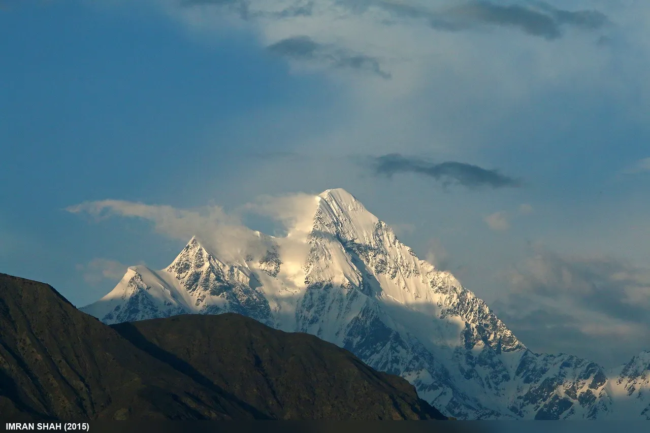
The valley is the front door to Bilchar Dobani, the sharp peak of about 6,138 m that Gilgit town sees on its skyline and that climbers call the Queen of Gilgit. Wildlife is real rather than promised: markhor on the cliff ground, lammergeier and Himalayan griffon overhead, and snow leopard on camera traps in the upper drainages. You will not see a snow leopard. Somebody's camera will.
Bagrote also pairs well with the other short trips around Gilgit. The Kargah Buddha is half an hour the other side of town, and if you want the same mountains from the Nagar side, our Rakaposhi base camp guide covers that walk.
What to bring
- Boots with grip. Grazing paths, loose moraine, stream crossings on rocks.
- A warm layer and a proper sleeping bag. Nights at the pastures are cold even in July.
- Water treatment. The streams are glacier fed and the pastures are grazed. Filter or boil.
- Cash from Gilgit. No ATMs, no card payments in the valley.
- A power bank. Village electricity is intermittent and there is none at the meadows.
- Modest clothing and some manners with cameras. Bagrote is a working farming valley, not a resort. Ask before photographing people.
Frequently asked questions
Where is Bagrote Valley?
East of Gilgit in Gilgit-Baltistan, reached by a side road off the Karakoram Highway. It is about 38 km from Gilgit city, roughly two hours by jeep, and it climbs to the foot of Rakaposhi and Diran.
How long is the trek to Gargo Meadows?
About three hours of uphill walking from the upper road, so a comfortable day trip from Gilgit if you leave early. Many people camp a night instead, which is worth it for the evening light on Diran.
How high is Diran base camp?
4,300 m, with the usual intermediate camp at Tagaphari around 3,500 m. It is two to three days up from the road head and five to seven days round trip from Gilgit.
Do you need a permit for Bagrote Valley?
Not to visit the villages or day-walk to the pastures. The upper treks run inside the Central Karakoram National Park and need a CKNP permit, arranged in Gilgit or Skardu. Foreign visitors also need a Pakistan tourist visa.
When is the best time to visit Bagrote Valley?
June to September. July gives the greenest meadows and the summer settlements in full use; September gives the clearest views of Rakaposhi and Diran with colder nights.
Is the Bagrote Valley trek difficult?
The walk to Gargo is straightforward for anyone reasonably fit, with no technical ground. Diran base camp is a different matter: long days on loose moraine, camping above 3,500 m, and real altitude at 4,300 m.
Can you drive into Bagrote Valley?
Yes, as far as the upper villages. The road is sealed at the bottom and a jeep track higher up, so beyond Sinaker you need a 4x4 with a driver who knows it. The meadows themselves are on foot.
What peaks can you see from Bagrote Valley?
Rakaposhi at 7,788 m and Diran at 7,266 m dominate the head of the valley, with Miar Peak at 6,824 m and Bilchar Dobani at about 6,138 m, the peak on Gilgit's own skyline.
Ready for Your Next Adventure?
Join our community of explorers and discover the journey of a lifetime. Our expert team is ready to help you plan your perfect expedition.