Ishkoman Valley Travel Guide: Chatorkhand, Imit, Karambar and the Passes
A quiet valley in Ghizer with a hot spring, apricot orchards and passes to Yasin, Naltar and Chitral: distances from Gilgit, villages, treks, seasons and permits.
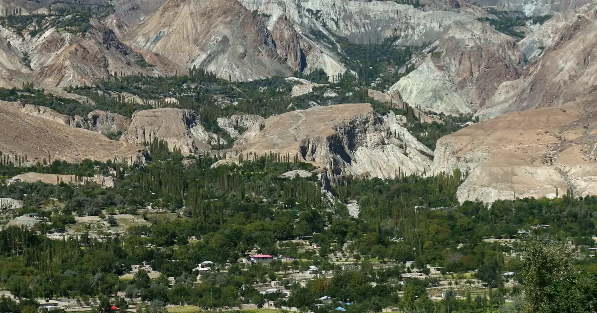
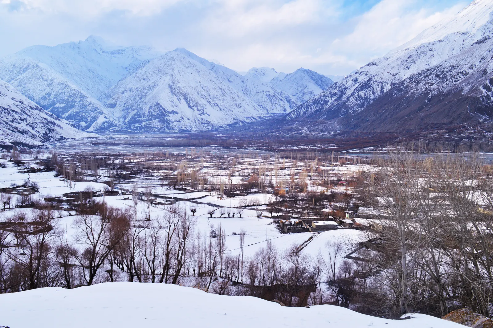
What is the Ishkoman Valley? Ishkoman is a long, quiet valley in the north of Ghizer District, Gilgit-Baltistan, running about 50 km from Gahkuch up to the Wakhan border. Its main town is Chatorkhand, the road climbs on to Imit, and from there trails lead to Karambar Lake and over passes to Yasin, Naltar, Chitral and upper Hunza. It sits between about 2,100 and 3,700 m, roughly 3.5 hours by road from Gilgit.
Most people driving the Gilgit to Chitral road pass the turn for Ishkoman at Gahkuch without a second look. That is a shame, because the valley behind it is one of the least visited and most rewarding corners of Ghizer: poplar-lined villages, apricot orchards, a hot spring at Imit, and the start of some of the best trekking routes in the Hindu Kush and Karakoram. This guide covers where Ishkoman is, how to get there, the villages in order up the valley, the treks and passes, the best time to go, and the permit question near the Afghan border.
Ishkoman Valley at a glance
| Fact | Ishkoman Valley |
|---|---|
| Location | Ishkoman tehsil, Ghizer District, Gilgit-Baltistan |
| Main town | Chatorkhand, about 2,090 m |
| Altitude of the inhabited valley | About 2,100 to 3,700 m |
| River | Ishkoman River, joined by the Karambar River just below Imit |
| Road distance from Gilgit | About 95 to 100 km to Chatorkhand, about 120 km to Imit |
| Drive time from Gilgit | About 3.5 hours to Imit |
| Best months | May to October in the valley; June to September for treks |
| Languages | Khowar, Shina and Wakhi, plus Burushaski and Gujjari |
| Nearest airport | Gilgit |
Where is Ishkoman Valley?
Ishkoman is one of the four tehsils of Ghizer District, alongside Punial, Yasin and Gupis, and its headquarters is Chatorkhand. The valley runs north to south and drains into the main river at Gahkuch, the district headquarters, where the Ishkoman River meets the Ghizer River and the two continue east as the Gilgit River.
Above Chatorkhand the valley climbs steadily to Imit, where it splits. The western branch carries on past Ishkoman village, Faizabad and Ghotolti towards the passes into Yasin. The northern branch follows the Karambar River up past Bilhanz, Badswat and Bhurt towards Karambar Lake and the watershed with Chitral. At its top end the valley touches the Wakhan Corridor of Afghanistan, which is why the upper reaches feel so remote.
Ishkoman is also a crossroads. Its passes lead west to Yasin and Darkot, east to Naltar, north-west to the Yarkhun and Broghil valleys of Upper Chitral, and north-east to Chapursan in upper Hunza. For centuries traders and herders used these routes, and trekkers use them now.
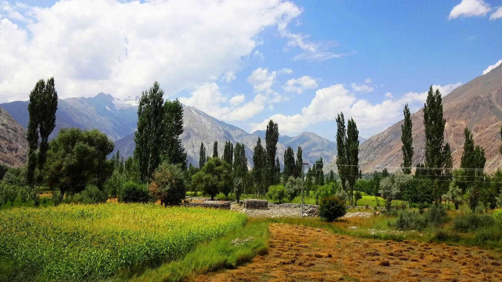
How to get to Ishkoman from Gilgit
The way in is the Gilgit to Chitral road, which follows the river west from Gilgit through Punial to Gahkuch. At Gahkuch you turn north into Ishkoman and follow the valley road up through Chatorkhand to Imit.
| Stage | Distance | Notes |
|---|---|---|
| Gilgit to Gahkuch | About 72 km | Main road west along the river, through Punial |
| Gahkuch to Chatorkhand | About 24 km | Turn north into the Ishkoman valley |
| Chatorkhand to Imit | About 25 km | Past Pakora and Barjungal to the head of the main valley |
| Gilgit to Imit, total | About 120 km | Allow about 3.5 hours with stops |
To reach Gilgit in the first place, you either fly from Islamabad, about an hour when the weather allows, or drive two days up the Karakoram Highway. Gilgit flights are often delayed or cancelled by cloud, so keep a spare day. Note that the UK Foreign Office advises against all travel on the Karakoram Highway between Mansehra and Chilas, so foreign travellers usually fly in or take the Babusar Pass road in summer. Shared vans run from Gilgit towards Gahkuch and Chatorkhand, but for the upper valley and the trailheads a private jeep with a local driver is far easier. Carry cash from Gilgit or Gahkuch, because services thin out quickly above Chatorkhand.
The villages of Ishkoman, from south to north
Ishkoman is not one village but a chain of them, each a green patch of fields and poplars against bare mountainsides. In order up the valley:
- Chatorkhand is the main town and tehsil headquarters, with a small bazaar, teahouses, schools and simple lodging for trekkers. The old ruling family of Ishkoman lived here, and the valley is the home of Syed Pir Karam Ali Shah, the religious leader who served as Governor of Gilgit-Baltistan from 2011 to 2015.
- Dain faces Chatorkhand from the opposite bank of the river.
- Pakora (Phakora), a farming village of wheat, maize, potatoes and fruit, is the trailhead for the pass treks to Naltar.
- Asumbar sits at the mouth of a side valley to the west, the start of the Asumbar Haghost trek to Yasin.
- Barjungal is a cluster of small hamlets settled by families who originally came from Hunza.
- Imit (also written Immit) is the end of the main valley road and the gateway to the upper Karambar. It is known for a hot spring with separate rooms for men and women, and for the best apricots in the valley.
Above Imit, the western branch holds Ishkoman village, which shares its name with the valley, plus Faizabad and Ghotolti, the trailhead for the Attar Pass trek. The Karambar branch holds Bilhanz, Badswat and Bhurt, the last villages before the high pastures.
Things to do in Ishkoman Valley
Soak in the Imit hot spring
The hot spring at Imit is the valley's best-known small pleasure. Locals use it for healing baths, and there are separate rooms for men and women. Combine it with a walk through Imit's orchards; in summer the apricots are the reason many Gilgit families make the drive.
Look for wildlife in Qurumbar National Park
The upper Karambar valley lies inside Qurumbar National Park, created by the Gilgit-Baltistan government in 2011 and covering about 738 km². It adjoins Broghil Valley National Park on the Chitral side. The park protects snow leopard, Himalayan ibex, brown bear and wolf, along with golden eagles, bearded vultures and snowcock. Sightings take patience and a good local guide; the park background on Wikipedia is a useful starting point.
Walk to Karambar Lake
Karambar Lake, at about 4,272 m, lies at the very head of the Karambar valley, on the boundary with Broghil in Upper Chitral. Administratively it belongs to Ishkoman. The Ishkoman approach is long and rarely used, a multi-day walk beyond the road end that needs glacier experience, and most trekkers reach the lake from the Chitral side instead. Our Karambar Lake trek guide compares both routes, the permits and the costs.
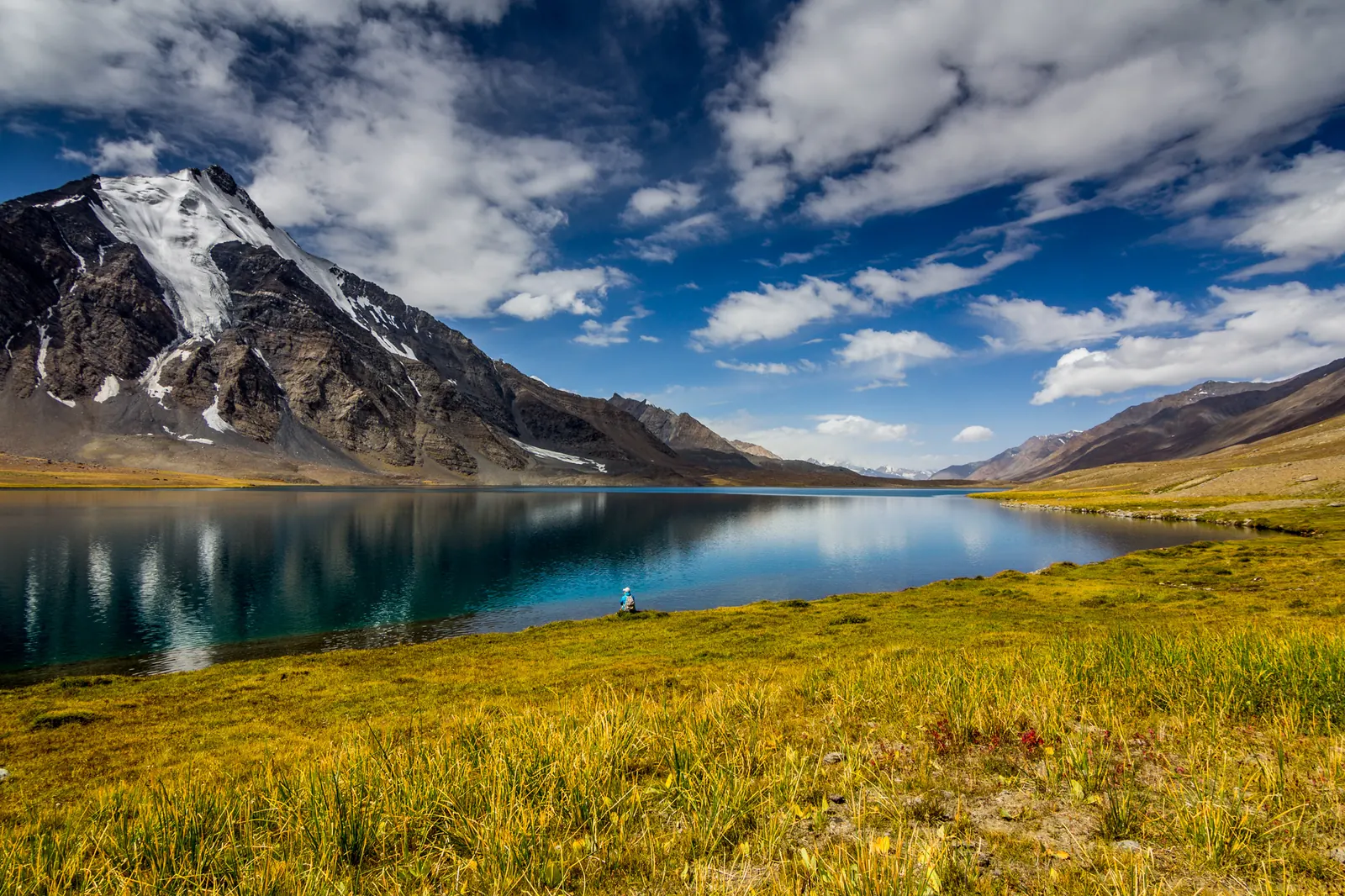
Cross a pass to Yasin, Naltar or Chapursan
Ishkoman's passes are the real draw for trekkers. Heights vary between sources, so treat these as approximate:
| Pass | Height | Links Ishkoman with |
|---|---|---|
| Asumbar Haghost | About 4,400 to 4,560 m | Yasin, from the Asumbar side valley; a non-glaciated pass, one of the easier crossings |
| Ishkoman Aghost (Punji Pass) | About 4,590 to 4,680 m | Yasin and Darkot, from the western branch |
| Attar Pass | About 4,650 m | Darkot, from Ghotolti via Attar Lake |
| Naltar Pass | About 4,200 to 4,600 m | Naltar Valley, from Pakora |
| Karambar Pass | About 4,343 m | The Yarkhun valley in Upper Chitral, beside Karambar Lake |
| Chillinji Pass | About 5,200 to 5,300 m | Chapursan in upper Hunza; a serious glacier crossing |
The Naltar crossing is the most popular, because it links two valleys that are both worth seeing; our Naltar Valley guide covers the other side. The Asumbar and Punji routes drop into Yasin, which our Yasin Valley guide covers in detail. All of them need a local guide, camping gear and a summer window.
People, languages and history
Ishkoman is one of the most linguistically mixed valleys in Gilgit-Baltistan. Khowar, Shina and Wakhi are the main languages, and you will also hear Burushaski and Gujjari, spoken by Gujjar families whose ancestors came up from Indus Kohistan. Imit and the upper villages are largely Wakhi. In recent centuries Ishkoman was a small principality under the Khushwaqt rulers linked to Chitral, and it became part of Pakistan's administration in 1972, when the princely states of Gilgit-Baltistan were abolished.
Life still follows the seasons. In summer families move livestock to the high pastures, where women run the dairy work, and yaks are used for threshing. Before winter, villages store food and fodder for the months of heavy snow. Guests are welcomed warmly, and a cup of tea in someone's courtyard is a normal part of a day here.
Best time to visit Ishkoman Valley
May to October is the season for the valley, and June to September is the window for treks and high passes, when the trails are free of snow. July and August are the warmest and greenest months, with fruit ripening in the orchards and herders up on the pastures.
Autumn is quieter and very beautiful. The poplars and orchards turn gold in autumn, usually around late October, as in neighbouring Yasin, and the skies are often clear and settled. Winter is hard: heavy snow falls, the passes close, and travel above Imit becomes difficult. If you want to go in winter, stay in the lower valley and travel with someone who knows the road.
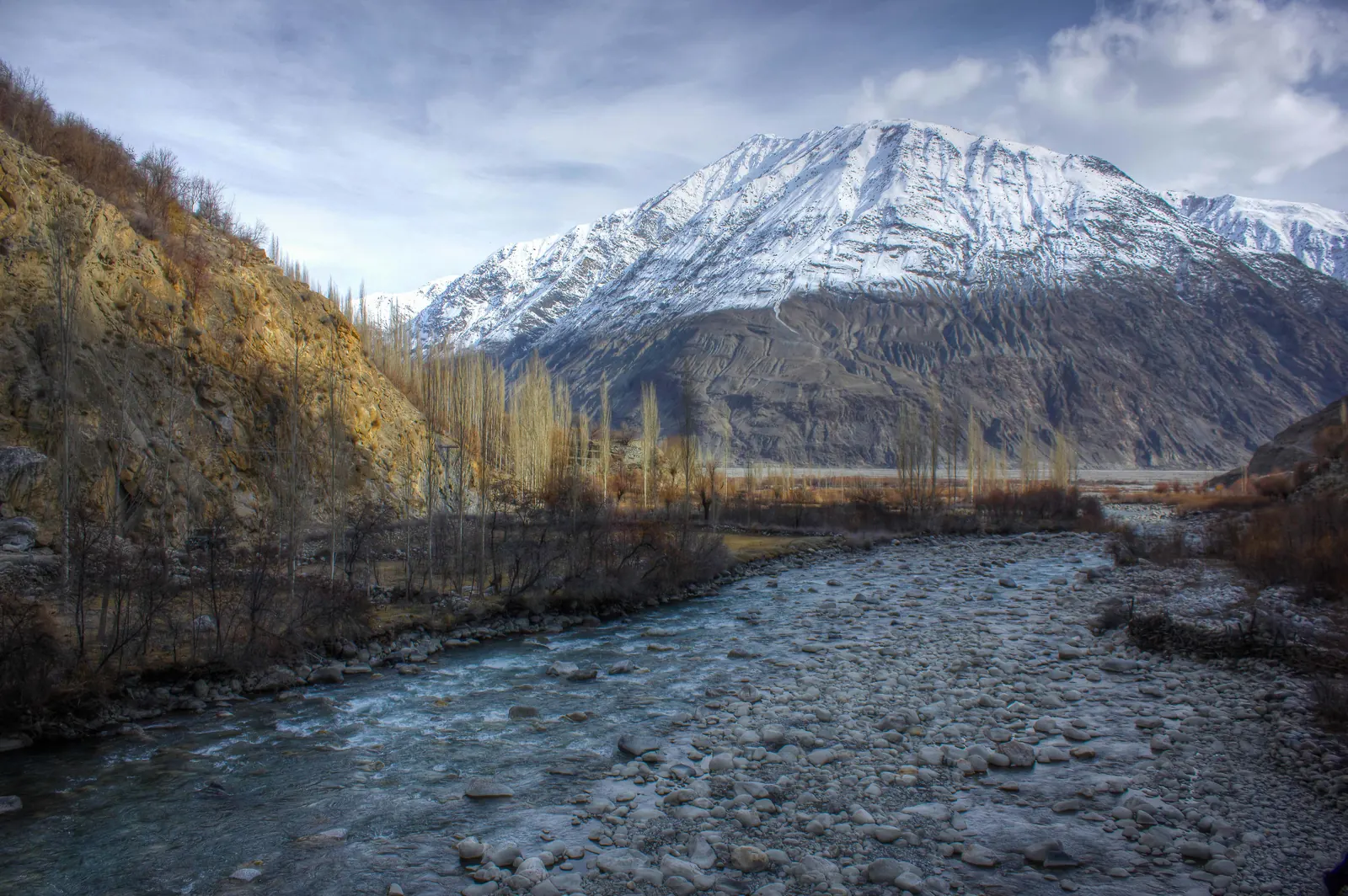
Floods and roads: what changed in 2018
In July 2018 a debris flow from the Badswat Glacier blocked the Karambar River and formed a temporary lake. More than 40 houses in Badswat and Bilhanz were submerged or swept away, and a stretch of the link road was destroyed, cutting off around ten villages upstream. Timely evacuation meant nobody died, as Pamir Times reported at the time. It is a reminder that the upper Karambar valley is glacier country: ask about the state of the road above Imit before you go, because conditions can change after heavy rain or a warm spell.
Permits and safety in Ishkoman
Foreign visitors do not need a special permit for the lower and middle valley, including Chatorkhand, Pakora and Imit, which are well away from the border. The question is the very top of the valley. Pakistan bars foreigners from a 10-mile belt along the Afghan border, except at official crossings, and the upper Karambar valley lies close to the Wakhan. Rules there can change, so check the current position with your operator or the Deputy Commissioner's office in Gahkuch before planning a trek to the head of the valley. Carry your passport and copies of your visa, because police checkposts on the Gilgit to Chitral road will ask for them.
Ghizer is calm and friendly, and the UK Foreign Office does not single it out in its warnings. The real risks are mountain ones: long drives on narrow roads, sudden weather, and remote trails where help is far away.
Where to stay in Ishkoman
Accommodation is simple. Chatorkhand has basic lodging for trekkers, and in the upper villages most visitors stay in homestays arranged locally or camp. Many travellers base themselves in Gahkuch, which has more hotels, and visit Ishkoman as a long day trip, or spend one night in Chatorkhand or Imit to see the upper valley without rushing. Bring warm layers for the evenings even in summer.
Plan your trip to Ishkoman
Ishkoman fits naturally into a wider loop of Ghizer. Our Ghizer Valley tour runs 6 to 7 days from Gilgit through Gahkuch, Gupis, Khalti Lake and Phandar to the Shandur plateau, from $1,150 per person. Every trip we run is private, so tell us if you would like to add a day or two in Ishkoman, the Imit hot spring, or a pass trek to Naltar or Yasin, and we will build it into the route.
Frequently asked questions
Where is Ishkoman Valley?
Ishkoman Valley is in the north of Ghizer District in Gilgit-Baltistan, Pakistan. It is one of the district's four tehsils, with its headquarters at Chatorkhand, and it runs north from Gahkuch, where the Ishkoman River meets the Ghizer River, for about 50 km up to Imit and beyond. Above Imit the valley splits into two branches. The western branch leads towards the passes into Yasin and Darkot, and the northern branch follows the Karambar River up to Karambar Lake on the boundary with Upper Chitral. At its far end the valley touches the Wakhan Corridor of Afghanistan. The inhabited part of the valley lies between about 2,100 and 3,700 m. Its neighbours, across high passes, are Yasin to the west, Naltar to the east, the Yarkhun and Broghil valleys of Chitral to the north-west, and Chapursan in upper Hunza to the north-east.
How far is Ishkoman from Gilgit?
Ishkoman is about 95 to 100 km by road from Gilgit to Chatorkhand, and about 120 km to Imit at the head of the main valley. The drive to Imit takes about 3.5 hours with stops. You leave Gilgit on the Gilgit to Chitral road and follow the river west through Punial for about 72 km to Gahkuch, the district headquarters. There you turn north into Ishkoman and drive about 24 km to Chatorkhand, then another 25 km or so past Pakora and Barjungal to Imit. Shared vans run from Gilgit towards Gahkuch and Chatorkhand, but for the upper valley a private jeep with a local driver is much easier, especially if you want to stop at villages or reach a trailhead. Many visitors stay in Gahkuch and treat Ishkoman as a long day trip, while others spend a night in Chatorkhand or Imit to see the upper valley properly.
What is the best time to visit Ishkoman Valley?
The best time to visit Ishkoman Valley is from May to October, and June to September is the window for treks and high passes. In those summer months the trails to Naltar, Yasin and Karambar Lake are free of snow, the herders are up on the high pastures, and the orchards are green. July and August are the warmest months, when the apricots ripen in villages such as Imit. Autumn is quieter and many travellers think it is the most beautiful season: the poplars and orchards turn gold, usually around late October, as in neighbouring Yasin, and the skies are often clear and settled. Winter is hard. Heavy snow falls, the passes close and travel above Imit becomes difficult, because villages there stock up on food and fodder before the snow arrives. If you travel in winter, stay in the lower valley around Chatorkhand and go with a driver who knows the road.
Do foreigners need a permit for Ishkoman Valley?
Foreigners do not need a special permit for the lower and middle Ishkoman Valley, including Chatorkhand, Pakora and Imit, which are well away from the border. The only real question is the very top of the valley. Pakistan bars foreign visitors from a 10-mile belt along the border with Afghanistan, except at official crossings, and the upper Karambar valley lies close to the Wakhan Corridor. The rules near the border can change, so check the current position with your tour operator or the Deputy Commissioner's office in Gahkuch before planning a trek to the head of the valley or to Karambar Lake from this side. Carry your passport and copies of your Pakistani visa at all times, because police checkposts on the Gilgit to Chitral road will ask to see them and note your details. A local guide makes these stops quick and easy.
Can you reach Karambar Lake from Ishkoman?
Yes, Karambar Lake can be reached from the Ishkoman side, but it is the harder and less used of the two routes. The lake sits at about 4,272 m at the head of the Karambar valley and belongs administratively to Ishkoman, yet most trekkers approach it from Broghil in Upper Chitral, where the walk from the road head is shorter and gentler. From Ishkoman you drive up past Imit into the Karambar branch of the valley, then walk for several days beyond the end of the road. The route involves glacier travel and needs experience, a local guide, camping gear and a summer window, usually July to September. Because the upper valley lies close to the Afghan border, also check permit rules before you go. Our Karambar Lake trek guide compares the Chitral and Ishkoman routes in detail, with distances, permits and costs.
What languages are spoken in Ishkoman?
The main languages of Ishkoman are Khowar, Shina and Wakhi, and you will also hear Burushaski and Gujjari. That mix makes it one of the most linguistically varied valleys in Gilgit-Baltistan. Khowar links the valley to Chitral, with which Ishkoman had close ties when it was a small principality under the Khushwaqt rulers. Shina is the language of much of Gilgit and the lower Ghizer valley. Wakhi is spoken in Imit and the upper villages, by families related to the Wakhi communities of upper Hunza and the Wakhan Corridor. Gujjari is spoken by Gujjar families whose ancestors moved up from Indus Kohistan, and Burushaski by families with roots in Hunza, such as those in Barjungal. Urdu is understood almost everywhere, and in Chatorkhand and Gahkuch you will usually find someone who speaks English, especially among teachers and younger people.
Is Ishkoman Valley worth visiting?
Yes, Ishkoman Valley is worth visiting if you want a quiet, authentic valley rather than a busy tourist spot. It sees a small fraction of the visitors who go to Hunza or Skardu, so the villages feel unchanged and guests are welcomed warmly. The drive up from Gahkuch passes a chain of green villages, poplars and orchards set against bare mountains, and Imit adds a hot spring and the best apricots in the valley. For trekkers, Ishkoman is a gateway: passes lead to Naltar, Yasin, Darkot, Chapursan and Karambar Lake, and Qurumbar National Park protects snow leopard, ibex and brown bear in the upper valley. The trade-offs are simple accommodation and long drives on mountain roads. It fits well into a Ghizer road trip with Gupis, Phandar and Shandur, either as a day trip from Gahkuch or with a night in Chatorkhand or Imit.
Ready for Your Next Adventure?
Join our community of explorers and discover the journey of a lifetime. Our expert team is ready to help you plan your perfect expedition.