Karambar Lake Trek: Routes, Permits, Cost
Also spelled Karomber. Both routes to Pakistan's clearest alpine lake at 4,272 m, the two NOCs you actually need, and what a trip really costs.
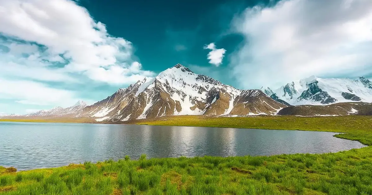
Karambar Lake sits at 4,272 m (14,016 ft) on the boundary between Broghil in Upper Chitral and the head of the Ishkoman valley in Gilgit-Baltistan. Reaching it takes three days of driving from Islamabad to the end of the jeep road, then roughly 20 to 25 km on foot, which most groups split over two days in each direction. The walking season is short, late June to mid-September. And despite what half the guides online tell you, the Chitral approach does need paperwork: two separate NOCs, not none.
What is Karambar Lake? A glacier-fed alpine lake at 4,272 m inside Qurumbar National Park, on the Chitral and Ghizer boundary in far northern Pakistan. It runs 3.9 km long and 2 km across at its widest, with a maximum depth of 55 m. Its water is the clearest ever recorded in a Pakistani lake, a Secchi disc reading of 13.75 m.
The numbers everyone copies, and what the record actually says
Almost every page about this lake repeats the same handful of figures, and several of them are wrong. They have been copied from site to site for a decade. Here is what the published record says, so you can plan against real numbers.
| Commonly repeated | What the record says |
|---|---|
| 14,121 ft | 14,016 ft. The lake is 4,272 m, and 4,272 m converts to 14,016 ft. The higher figure is a conversion error that spread |
| 31st highest lake in the world | 33rd, on the standard listing |
| Second highest lake in Pakistan | Not correct as stated. It is the second largest lake in northern Pakistan by surface area at 2.632 km², after Attabad. Plenty of Pakistani lakes sit higher, including Rush Lake at 4,694 m |
| No permit needed | Two NOCs on the Chitral approach, and checkposts that enforce them |
| Nothing said about the water | The genuinely remarkable fact: 13.75 m Secchi clarity, the highest value in the literature on Pakistani lakes |
That last line is the reason the lake photographs the way it does. You can stand on the shore and watch stones on the bed a long way out. It is also one of the highest biologically active lakes anywhere, which is what put it inside a national park in 2011.
Where it is, and which side you come from
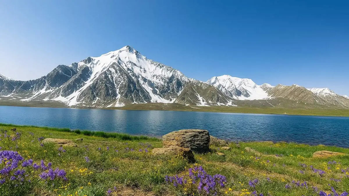
The lake lies at the top of a broad, flat-floored valley that drains two ways. Administratively it belongs to Ishkoman in Ghizer District, Gilgit-Baltistan, but the pasture immediately west of it is Broghil, in Upper Chitral, Khyber Pakhtunkhwa. The ridge to the north is the Afghan border, and the Wakhan Corridor runs parallel on the far side. That border is the reason for the paperwork.
The two routes, compared
There are two ways in that a fit trekker can realistically use. They are not equivalent, and choosing the wrong one for your group is the most common planning mistake on this trip.
| Broghil (Chitral side) | Ishkoman (Gilgit-Baltistan side) | |
|---|---|---|
| Road head | Lashkargaz or Ishkarwaz, about 3,300 m | Imit, up the Ishkoman valley from Gahkuch |
| On foot, one way | 20 to 25 km | Substantially longer, reported up to 65 km |
| Days walking, return | 3 to 4 | 6 to 8 |
| Terrain | Gentle gradient on pasture and moraine | Glacier travel and river crossings |
| Suits | First timers at altitude, families with teenagers | Experienced parties with glacier skills |
| Paperwork | Two NOCs from Chitral | GB side checks, no Chitral NOC |
The Broghil approach
This is the one to take unless you have a specific reason not to. You drive Chitral to Mastuj, then up the Yarkhun valley on a rough jeep track to Lashkargaz, the last settlement with anything resembling a road. From there the walking is long rather than steep. The valley floor is wide, the gradient is kind, and the altitude gain from road head to lake is under 1,000 m spread over two days.
The jeep track is the weak link. When the Yarkhun river runs high in July, the crossings near Kishmanja become impassable and vehicles stop short, which adds a day of walking at each end. Ask about river levels before you commit to a tight schedule.
The Ishkoman approach
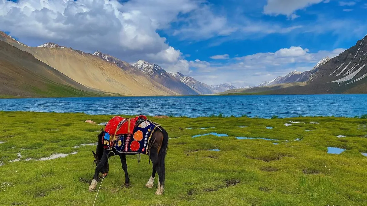
From the Gilgit-Baltistan side you drive up from Gahkuch through Chatorkhand to Imit, then walk the length of the upper Ishkoman valley. It is a serious undertaking: longer, less travelled, with glacier ground and unbridged water. Sources disagree on the distance, which tells you how few people do it. There is also an expedition-grade variant that crosses the Chilinji Pass at roughly 5,290 m from Chapursan in Upper Hunza, which is a mountaineering objective rather than a trek.
If you want the Ghizer valley without the commitment, the road itself is the reward. Our Ghizer Valley tour runs from Gilgit through Gahkuch and Gupis to Phandar and the Shandur plateau, which is the same river system one valley down.
Permits: the two NOCs, and why they matter
This is where the competing guides will get you into trouble. Several of the top-ranking pages state flatly that no permit is required. On the Chitral approach that is wrong, and finding out at a checkpost after three days of driving is an expensive way to learn it.
For the Broghil route you need two No Objection Certificates:
- One from the Deputy Commissioner's office in Chitral
- One from Chitral Scouts headquarters at Mastuj. In practice the Scouts issue theirs once you hold the DC letter
Both are checked. There is an ID check at Ishkarwaz and the Gilgit-Baltistan Scouts verify the paperwork again at the post on the far side. Two things worth knowing: the NOCs cover the lake only, not the passes, and even with correct documents parties have been turned back beyond Yarkhun Lasht when the border situation tightens. Allow several days for processing and have a backup plan. If you are travelling on a foreign passport, apply well before you leave Islamabad.
Day by day on the Broghil route
- Islamabad to Chitral. Long driving day over Lowari Tunnel, or fly if the Chitral flight is operating
- Chitral to Mastuj. Paperwork collected here. Roughly 5 hours on a rough road
- Mastuj to Lashkargaz. The Yarkhun jeep track, 7 to 9 hours depending on the river. Sleep at about 3,300 m
- Lashkargaz to a camp on the valley floor. A gentle first walking day that gets you sleeping higher
- Camp to Karambar Lake. The long day, 8 to 10 hours for most groups. Camp at the lake
- A full day at the lake. Worth building in. Dawn light on the peak above the north shore is the reason to be here
- Walk out to Lashkargaz
- Drive to Mastuj, then Chitral
- Chitral to Islamabad
Nine days works if nothing goes wrong. Build in a spare day, because on this route something usually does. Landslides on the Yarkhun track and weather at the lake are both routine.
What it costs
Most pages about Karambar Lake give no numbers at all. Here is what the components actually cost in the 2026 season. Rates move with fuel prices and the exchange rate, so treat these as planning figures rather than a quote.
| Item | Typical 2026 rate | Notes |
|---|---|---|
| 4x4 jeep, Chitral to Lashkargaz return | PKR 60,000 to 90,000 | Per vehicle including driver and fuel. Seats 4 with kit |
| Porter | PKR 2,500 to 3,500 per stage | Loads capped at 25 kg. Pack in units of 10 kg or under |
| Horse or donkey | PKR 3,000 to 4,500 per day | Cheaper than porters for group kit where the ground allows |
| Guide | PKR 6,000 to 10,000 per day | Non-negotiable on this route, even for strong parties |
| Cook and camp staff | PKR 4,000 to 6,000 per day | There is nothing to buy past Lashkargaz |
| NOC processing | No official fee | Budget 2 to 3 days of someone's time in Chitral |
| Full guided trip, per person | USD 1,200 to 1,800 | 9 to 11 days from Islamabad, group of 4 to 6, all in |
The single biggest variable is group size. A pair of trekkers pays for the same jeep and the same guide as a group of six.
Best time to go, and what the weather does
The window is late June to mid-September, and it is narrower than that sounds.
- In late June there is still snow on the approach and the rivers are running high, but you will have the place almost to yourself
- July turns the pasture green and brings the Wakhi families up with their herds. It is also when the river crossings are at their worst
- Early to mid August is the sweet spot. The ground has settled, the jeep track is reliable and the nights are as warm as they get
- September gives you the clearest air of the year for photography, but nights at the lake drop hard and the season shuts fast
At 4,272 m, expect daytime temperatures in the low teens Celsius in high summer and nights at or below freezing in any month. Weather at the lake changes fast because the valley funnels wind off the Afghan border ridge. Carry a bag rated well below what the daytime suggests.
Altitude, fitness and what the walking feels like
The Broghil route is graded easy to moderate on terrain, which is not the same as being an easy trek. The difficulty here is altitude and distance. You sleep at 3,300 m from day three, walk a 20 km day at over 4,000 m, and if someone gets into trouble there is no quick way down.
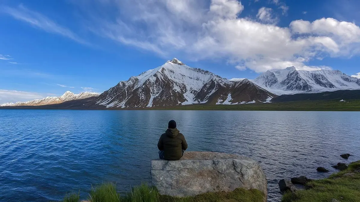
Sensible precautions: take the extra night at Lashkargaz rather than pushing through, carry acetazolamide and know how to use it, and agree in advance what the group does if one person cannot go on. Evacuation means walking, or a horse if you are lucky. Anyone who has done a Karakoram trek in the 4,000 m range, something like the Shimshal Pamir trek, will find the demands familiar.
What to bring
The kit mistake we see most often is a sleeping bag chosen for the daytime temperature. Bring one rated to minus 10C or lower. Wind is the reason to carry a proper four season tent, not rain, because it comes off the border ridge in the small hours and does not let up.
- Split your load into units of 10 kg or under so porters and horses can take them
- Buy all food in Chitral or Mastuj. Lashkargaz has a small guesthouse and almost nothing else
- Treat your water. The lake itself is clean, but the streams below it run through grazing ground
- Bring rupees in cash. The last ATM is in Chitral and nobody on this route takes a card
- Download offline maps and carry a satellite messenger. Phone signal stops in the mid-Yarkhun
The wildlife, and why the park exists
Qurumbar National Park was declared in 2011 and covers the lake and the catchment around it. It is snow leopard country, along with Marco Polo sheep on the Afghan side of the watershed and ibex on the slopes above the pasture. Sightings are rare and mostly tracks rather than animals, but the herders will tell you where the leopard has been that week. We run dedicated snow leopard trips in winter, which is when there is any real chance of seeing one.
Frequently asked questions
Is Karambar Lake the highest lake in Pakistan?
No, and the claim that it is second highest is not right either. Karambar is 4,272 m. Rush Lake in Nagar is 4,694 m, and several others sit higher still. What Karambar genuinely holds is the record for water clarity, a Secchi reading of 13.75 m, the highest ever measured in a Pakistani lake, and it is the second largest lake in northern Pakistan by surface area at 2.632 km², after Attabad. On the standard listing it is the 33rd highest lake in the world, not the 31st that is often quoted. The height is also widely given as 14,121 ft, which is a conversion error: 4,272 m is 14,016 ft. The lake runs 3.9 km long and 2 km across at its widest, with a maximum depth of 55 m, and it is one of the highest biologically active lakes anywhere. That is why it sits inside a national park, declared in 2011.
Do you need a permit for Karambar Lake?
On the Chitral and Broghil approach, yes. You need two NOCs, one from the Deputy Commissioner in Chitral and one from Chitral Scouts headquarters at Mastuj. In practice the Scouts issue theirs once you hold the DC letter. Both are checked at posts on the way in, with an ID check at Ishkarwaz and the Gilgit-Baltistan Scouts verifying the paperwork again on the far side. They cover the lake only and not the surrounding passes, and parties have been turned back beyond Yarkhun Lasht even with correct paperwork when the border situation tightens. There is no official fee, but processing takes several days, so apply well before you leave Islamabad and keep a backup plan. Pages that tell you no permit is required are describing the Gilgit-Baltistan side, or are simply out of date. The Ishkoman route has its own checks on the Gilgit-Baltistan side and needs no Chitral NOC.
Karambar or Karomber, which spelling is correct?
Both refer to the same lake. Karambar is the more common transliteration and the one used in scientific literature, while the national park itself is officially named Qurumbar National Park. Karomber, Karumbar and Kurumbar all appear in Pakistani travel writing. Search for either and you will find the same place.
How difficult is the Karambar Lake trek?
Moderate on the Broghil route. There is no technical ground and no rope work, but you walk 20 to 25 km each way at over 4,000 m and camp at 4,272 m. Anyone hill-fit who can manage consecutive 8 hour days will cope. The Ishkoman route is a different proposition and needs glacier experience. On terrain alone the Broghil approach is gentle: the valley floor is wide and the gradient kind, with under 1,000 m of height gain from the road head at Lashkargaz to the lake, spread over two days. The difficulty is altitude and distance. You sleep at about 3,300 m from day three, the long day to the lake takes 8 to 10 hours for most groups, and if someone gets into trouble there is no quick way down. Take the extra night at Lashkargaz, carry acetazolamide and know how to use it, and agree in advance what the group does if one person cannot go on.
Can you drive to Karambar Lake?
No, the last stretch is on foot or horseback. The jeep track ends at Lashkargaz or Ishkarwaz in Broghil, at about 3,300 m, and everything past that is on foot or horseback. In a high-water July the vehicles stop even earlier, near Kishmanja, which adds a day of walking at each end. The approach runs from Chitral to Mastuj, then up the Yarkhun valley, and that jeep track alone takes 7 to 9 hours depending on the river. A 4x4 with driver from Chitral to Lashkargaz and back costs in the region of PKR 60,000 to 90,000 per vehicle in 2026, and it seats four with kit. From the road head it is roughly 20 to 25 km to the lake, which most groups split over two days. Horses carry group loads here more cheaply than porters. Ask about river levels and landslides before you commit to a tight schedule.
How cold does it get at the lake?
Cold enough to need a sleeping bag rated to minus 10C or lower. Nights at the lake fall to freezing or below in every month of the trekking season, and colder in September. Daytime highs in July and August sit in the low teens Celsius. The wind off the border ridge is the part people underestimate. The valley funnels it off the Afghan frontier, it tends to arrive in the small hours and it does not let up, which is why a proper four-season tent matters more here than rain gear. Weather at the lake changes fast, so carry warm layers on the walk in even when the morning is bright. Early to mid August usually gives the mildest nights of the season. September brings the clearest air for photography, but nights drop hard and the season shuts quickly. The kit mistake we see most is a bag chosen for the daytime temperature.
Planning a trip
The nine day version of this trip works. The eleven day version, with two spare days for the road and a full rest day at the lake, is the one worth doing. If Broghil is too far for the time you have, the same road system lower down gives you a great deal for much less commitment, which is what our Phandar valley guide covers. For the full range of routes we run across the Karakoram and Hindu Kush, start with our trekking pages.
Sources for the figures in this guide: Karambar Lake and Broghil Valley National Park on Wikipedia, plus our own trip records from the Yarkhun and Broghil routes.
Ready for Your Next Adventure?
Join our community of explorers and discover the journey of a lifetime. Our expert team is ready to help you plan your perfect expedition.