Mountain Ranges in Pakistan: All 15 Ranges, Their Highest Peaks and How to Visit
From K2 and the Karakoram to the Salt Range and the Kirthar: where each range is, its highest peak, what you can do there and when to go.
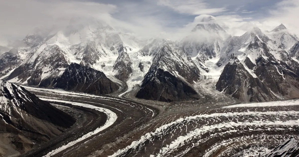
Most people picture Pakistan's mountains as one wall of ice in the far north. In fact the country is ranges almost all the way down: glaciated giants in Gilgit-Baltistan, forested hills around Islamabad, a long fold of salt and fossils across Punjab, and bare desert ranges in Balochistan that run nearly to the Arabian Sea.
This guide covers all fifteen, north to south: where each one is, its highest point, what a traveller can actually do there, and when to go. We run trips in the northern ranges every season, and the practical notes come from that.
Pakistan's mountain ranges at a glance
| Range | Where | Highest point in Pakistan | Best season |
|---|---|---|---|
| Karakoram | Gilgit-Baltistan | K2, 8,611 m | Jun to Sep |
| Great Himalaya | Diamer, Astore, Skardu | Nanga Parbat, 8,126 m | Jun to Sep |
| Hindu Kush | Chitral, Khyber Pakhtunkhwa | Tirich Mir, 7,708 m | Jun to Sep |
| Hindu Raj | Ghizer, Yasin, upper Chitral | Koyo Zom, 6,872 m | Jul to Sep |
| Pamir (southern edge) | Broghil, Chapursan, Karambar | No named Pakistani summit | Jul to Sep |
| Lesser Himalaya / Pir Panjal | Azad Kashmir, Murree, Galyat | Sarwali, 6,326 m (Neelum) | Most of the year |
| Spin Ghar (Safed Koh) | Kurram, Khyber (Afghan border) | Sikaram, 4,755 m | Restricted |
| Margalla Hills | Islamabad | Tilla Charouni, 1,604 m | Oct to Apr |
| Salt Range | Jhelum, Chakwal, Khushab | Sakesar, 1,522 m | Oct to Mar |
| Sulaiman Mountains | Balochistan, Punjab, KP border | Takht-e-Sulaiman, about 3,400 to 3,500 m | Spring and autumn |
| Central Brahui (Zarghun) | Quetta, Ziarat | Zarghun, 3,578 m | Spring and autumn |
| Toba Kakar | Pishin, Zhob | Unsurveyed; Khojak Pass 2,290 m | Spring and autumn |
| Kirthar | Sindh-Balochistan border | Zardak, about 2,260 m | Oct to Mar |
| Makran Coast Range | Gwadar, Lasbela | About 1,500 m | Nov to Mar |
| Chagai Hills and Ras Koh | Chagai, Kharan | Malik Naru, 2,412 m (Chagai) | Restricted |
Where the three great ranges meet
About 45 km south-east of Gilgit, near Juglot on the Karakoram Highway, the Karakoram, the Himalaya and the Hindu Kush come together, close to where the Gilgit River joins the Indus. A roadside viewpoint marks the junction, and on a clear day you can look towards Rakaposhi in the Karakoram, Nanga Parbat in the Himalaya and the Hindu Kush hills to the west. Tourism signs call it the only place on Earth where three such ranges meet, which is hard to prove, but it is a fine stop on any drive up the KKH.
The northern giants
1. The Karakoram
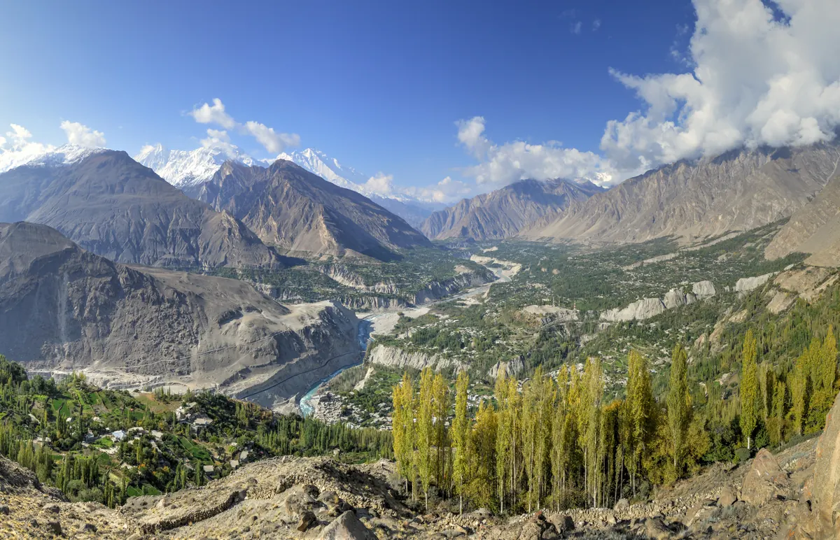
The Karakoram runs about 500 km across Gilgit-Baltistan along the border with China, and it is the most heavily glaciated mountain range outside the polar regions. It holds K2 (8,611 m), the world's second-highest mountain, and four of Pakistan's five 8,000ers stand around the Baltoro Glacier within about 20 km of each other.
Its sub-ranges carry their own giants: the Baltoro Muztagh (K2, the Gasherbrums, Broad Peak), the Hispar Muztagh (Distaghil Sar, 7,885 m), the Batura Muztagh (Batura I, 7,795 m), the Masherbrum range (Masherbrum, 7,821 m) and the Rakaposhi-Haramosh range (Rakaposhi, 7,788 m). Three of the five longest glaciers outside the poles are here: Siachen (76 km, held by India since 1984), Biafo (67 km) and Baltoro (63 km).
Visit for: the K2 Base Camp trek to Concordia, Snow Lake and the Biafo-Hispar traverse, Hunza and Nagar, the Batura Glacier, and the Karakoram Highway to Khunjerab Pass at 4,693 m. Our full Karakoram guide goes deeper. Season: June to September.
2. The Great Himalaya
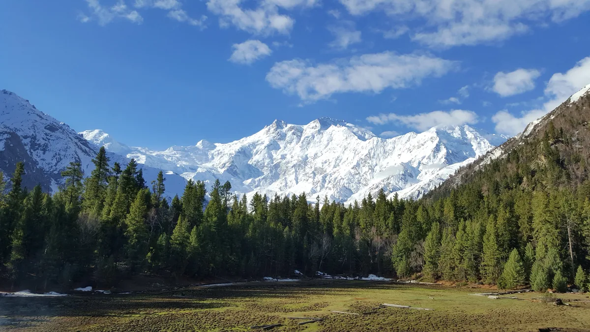
Yes, the Himalaya does reach Pakistan. Its western end is Nanga Parbat (8,126 m), the ninth-highest mountain on Earth, which rises almost 7,000 m from the Indus in about 25 km. Its south side, the Rupal Face, is one of the biggest mountain walls anywhere. Hermann Buhl made the first ascent alone in 1953.
The Pakistani Himalaya also takes in the Deosai Plains, a high plateau averaging 4,114 m that is home to Himalayan brown bears and is snowbound for most of the year, plus the Astore valley and the Neelum valley in Azad Kashmir.
Visit for: Fairy Meadows and the Nanga Parbat viewpoints, the Rupal valley, and Deosai. See our Nanga Parbat guide for the treks. Season: June to September.
3. The Hindu Kush
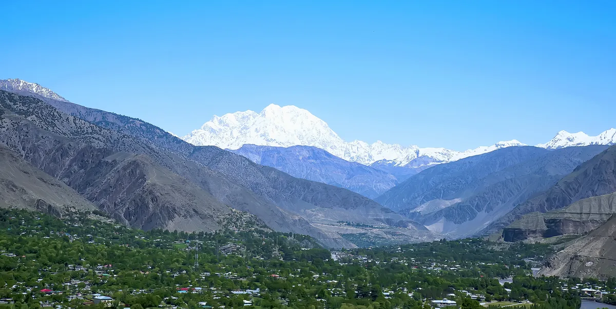
The Hindu Kush runs about 800 km from central Afghanistan into Pakistan's Chitral district. Its highest point is Tirich Mir (7,708 m), which towers over Chitral town and was first climbed by a Norwegian-British team in 1950. Noshaq (7,492 m) on the Afghan border, Istor-o-Nal (7,403 m) and Saraghrar (7,338 m) follow. The range is still rising and earthquake-prone, and it divides the Indus basin from the Amu Darya.
Visit for: Chitral, the Kalash valleys, the Tirich Mir viewpoints and the Lowari tunnel road in. Season: June to September in the high country; Kalash festivals fall in May, August and December.
4. The Hindu Raj
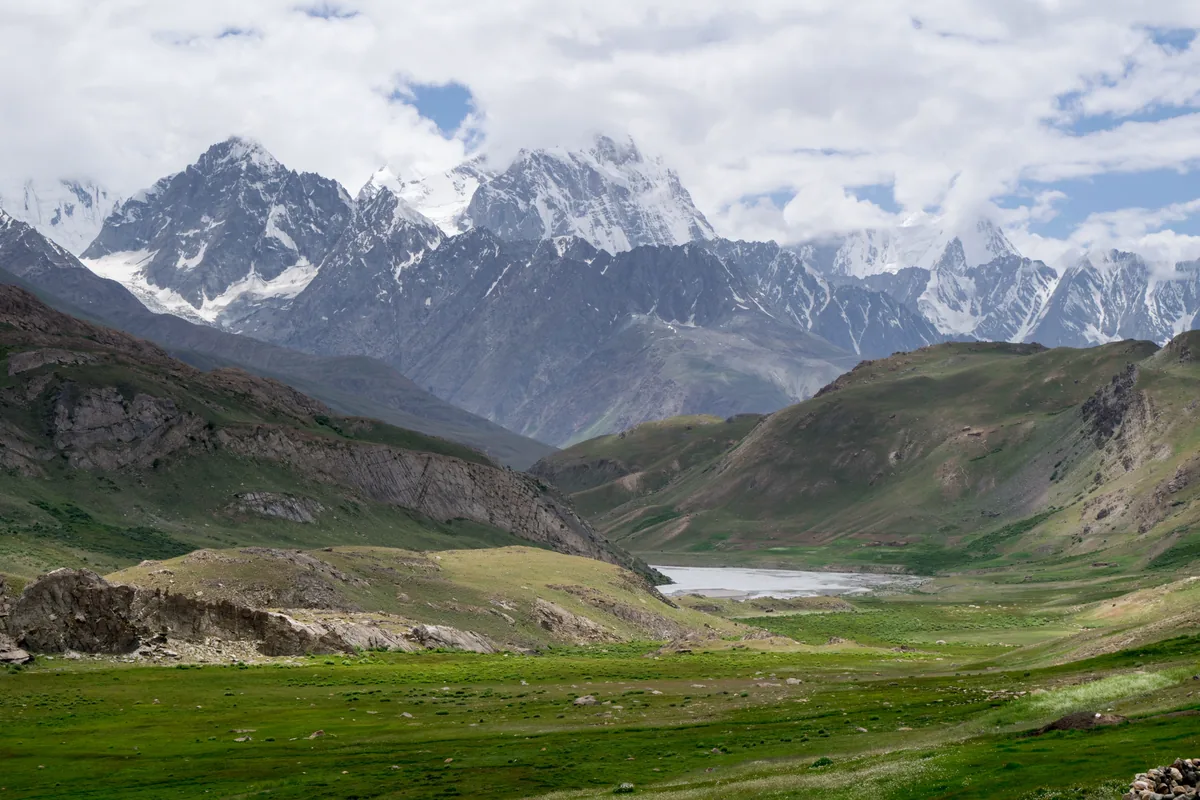
Between Chitral and Gilgit lies the Hindu Raj, often counted as part of the Hindu Kush system. Its highest summit is Koyo Zom (6,872 m), with Thui I (6,662 m) and Buni Zom (6,551 m) nearby. This is the country of the Ghizer, Yasin and Ishkoman valleys, trout lakes, and the high meadow of Shandur, home of the world's highest polo ground.
Visit for: the Shandur Pass road between Gilgit and Chitral, Phander Lake, and the Thui and Asumbar pass treks. Season: July to September.
5. The Pamir edge
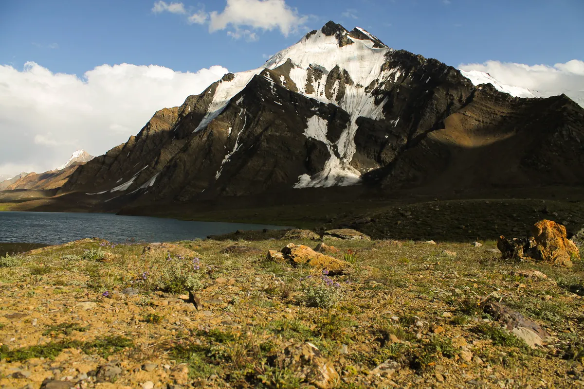
Pakistan only touches the southern edge of the Pamirs, across Afghanistan's narrow Wakhan corridor. You feel it in the far north, in Broghil, Chapursan and the Karambar area: wide, high valleys, yak herds and Wakhi villages that look more like Central Asia than South Asia. No Pakistani summit is formally classed as a Pamir peak.
Visit for: Broghil and Karambar Lake, Chapursan in upper Hunza, and Shimshal's high pastures. Season: July to September.
The Lesser Himalaya and the hills near Islamabad
6. Pir Panjal, Murree and the Galyat
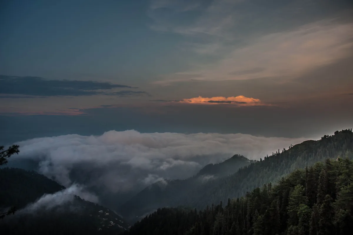
The Lesser Himalaya, led by the Pir Panjal range, reaches into Azad Kashmir and the green ridges north of Islamabad. Azad Kashmir's highest point is Sarwali (6,326 m) in the Neelum valley, while Punjab's is Kashmir Point in Murree (2,291 m). The Galyat hill stations sit on these ridges, and Miranjani (about 2,990 m) and Mushkpuri (about 2,800 m) are the classic day hikes.
Visit for: Murree, Nathia Gali, the Pipeline Track, and the Neelum valley. Season: almost year-round, with snow from December to February.
7. The Margalla Hills
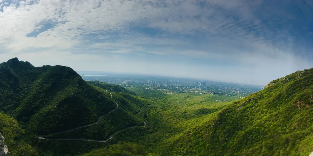
The Margalla Hills form Islamabad's northern skyline, the last foothills of the Himalaya. They are a national park of limestone ridges and forest, topped by Tilla Charouni (1,604 m), with more than 400 bird species and marked trails that start inside the city.
Visit for: Trails 3 and 5, Daman-e-Koh and Pir Sohawa. Season: October to April; summer afternoons are hot.
The western and southern ranges
8. Spin Ghar (Safed Koh)
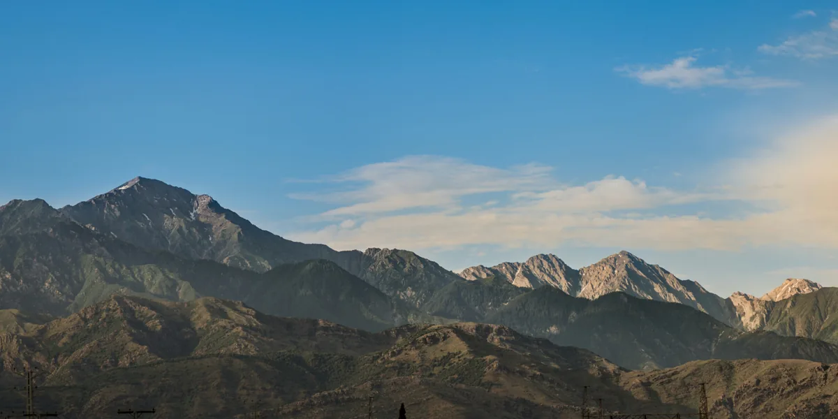
Spin Ghar, the "White Mountain", runs about 160 km along the Afghan border near Parachinar and the Khyber Pass, which crosses one of its spurs. Its highest point is Sikaram (4,755 m). Most of the range lies in security-sensitive tribal districts, so it is seen from a distance rather than trekked.
9. The Salt Range
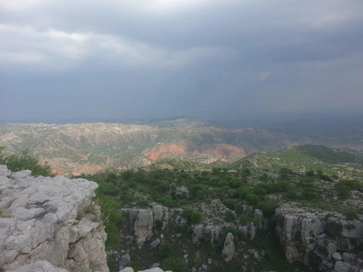
The Salt Range runs about 300 km across northern Punjab, between the Jhelum and the Indus. Its highest point is Sakesar (1,522 m). The range is a geologist's textbook: thick layers of rock salt, and fossil-bearing rocks more than 500 million years old. It holds the Khewra Salt Mine, one of the oldest and largest salt mines in the world.
Visit for: Khewra, Kallar Kahar lake, the Katas Raj temples and the Punjab urial. Season: October to March.
10. The Sulaiman Mountains
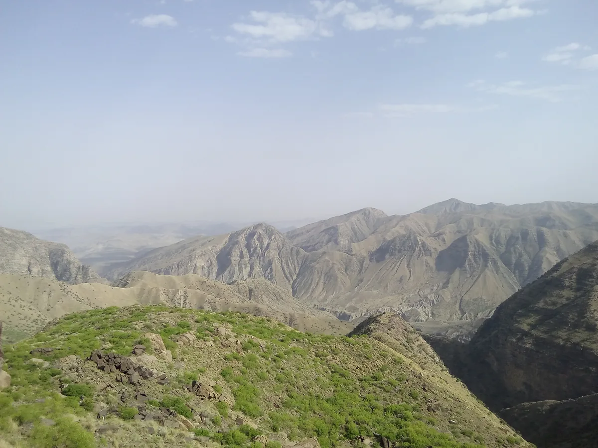
The Sulaiman Mountains run about 450 km south from the Gomal Pass, where Khyber Pakhtunkhwa, Balochistan and Punjab meet. The famous summit is Takht-e-Sulaiman, "Solomon's Throne", at roughly 3,400 to 3,500 m (sources disagree on the exact figure). The hill station of Fort Munro sits in the range at about 1,920 m, the coolest escape from the Punjab plains.
11. The Central Brahui Range (Zarghun)
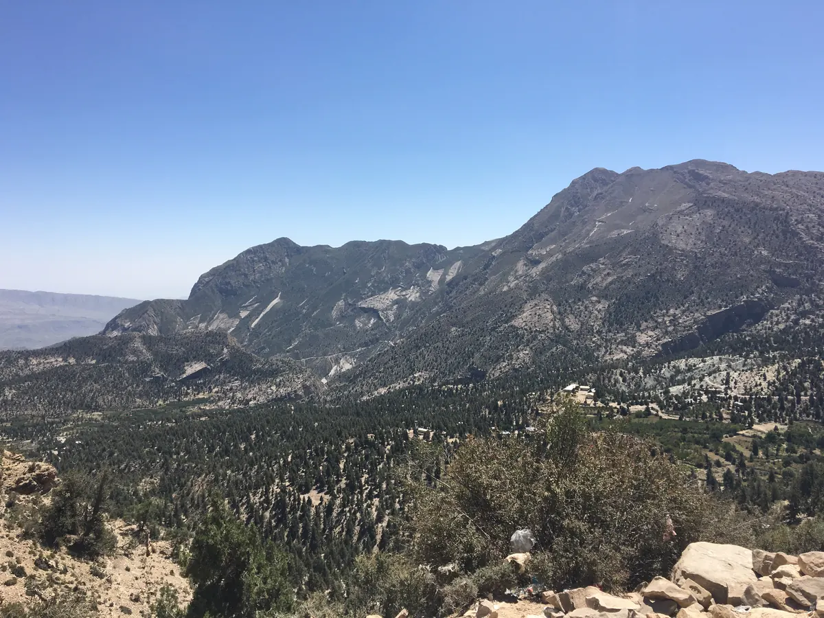
North of Quetta stands Zarghun (3,578 m), the highest point in Balochistan, in the Central Brahui Range. Nearby, the hills around Ziarat carry one of the oldest juniper forests in the world, with Khilafat Hill at about 3,475 m.
12. Toba Kakar
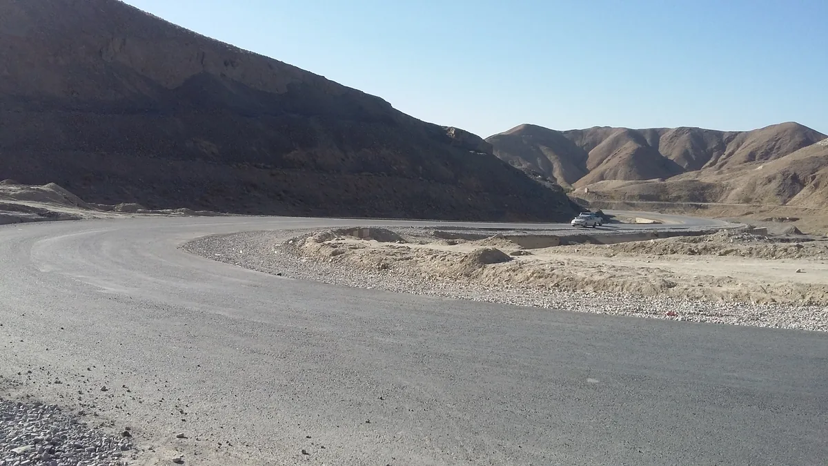
Toba Kakar runs along the Afghan border north of Quetta. Its best-known feature is the Khojak Pass (2,290 m), crossed by the old railway to Chaman through a tunnel opened in 1891. It is one of the few parts of Balochistan with juniper and wild pistachio. Its highest point has never been reliably surveyed.
13. The Kirthar Range
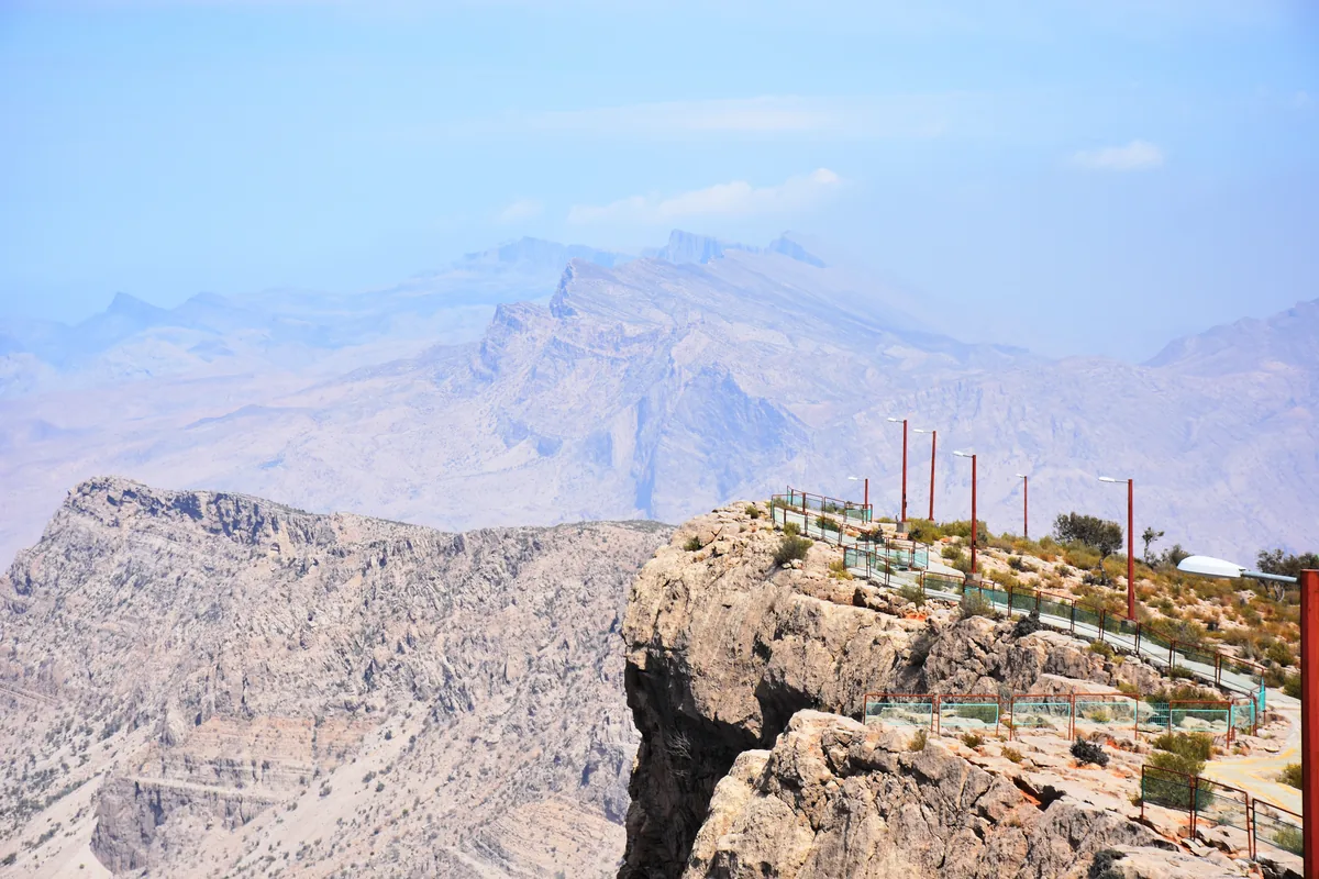
The Kirthar runs about 300 km along the Sindh-Balochistan border, from the Mula River down to Cape Monze near Karachi. Its highest point is Zardak, about 2,260 m. Sindh's hill station, Gorakh Hill (1,734 m), sits on the range, and Kirthar National Park protects ibex, urial and the Taung tombs.
Visit for: Gorakh Hill and Kirthar National Park. Season: October to March.
14. The Makran Coast Range
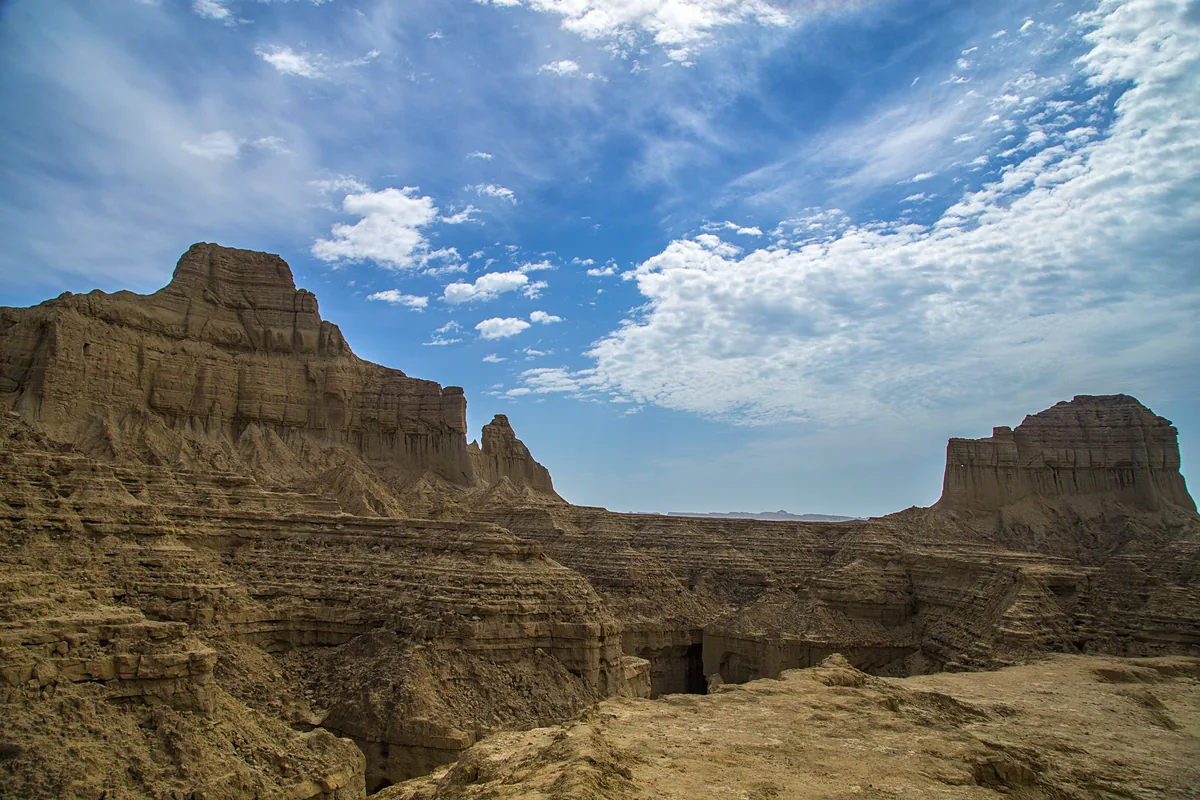
Along Balochistan's coast, the Makran ranges rise to about 1,500 m in bare, wind-carved mudstone. The Makran Coastal Highway cuts through them in Hingol National Park, Pakistan's largest, past the rock formations known as the Princess of Hope and the Balochistan Sphinx.
Visit for: the Coastal Highway from Karachi to Gwadar. Season: November to March.
15. The Chagai Hills and Ras Koh
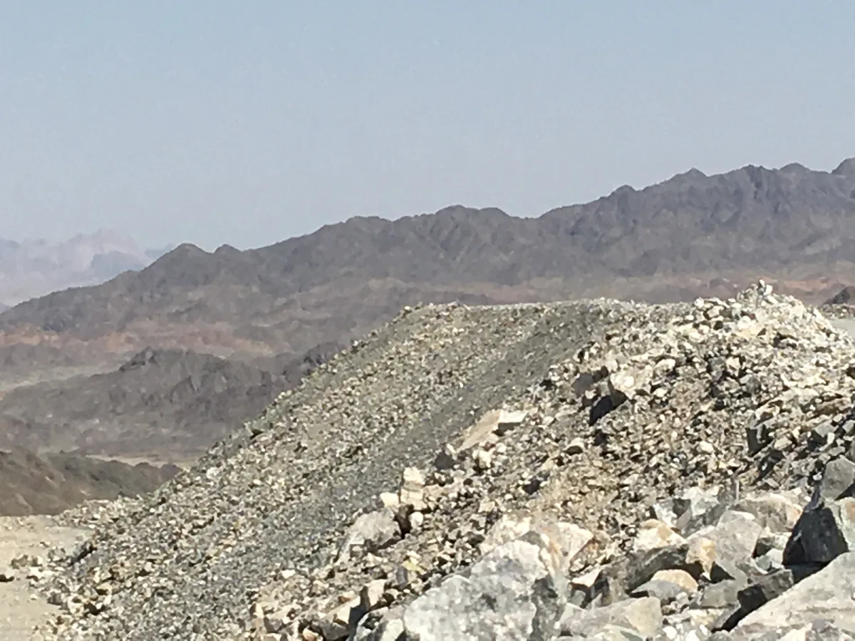
In the far west, the Chagai Hills reach 2,412 m at Malik Naru and include Koh-i-Sultan, Pakistan's youngest volcano. To the south-east, the granite Ras Koh range is where Pakistan carried out its nuclear tests in May 1998. Both areas are remote, very dry and largely restricted.
The highest mountains in Pakistan
Pakistan holds 5 of the 14 peaks above 8,000 m and more than 100 above 7,000 m (Wikipedia counts 108; the number depends on how a separate summit is defined). The ten highest are all in the Karakoram and the Himalaya:
| Peak | Height | Range |
|---|---|---|
| K2 | 8,611 m | Karakoram |
| Nanga Parbat | 8,126 m | Himalaya |
| Gasherbrum I | 8,080 m | Karakoram |
| Broad Peak | 8,051 m | Karakoram |
| Gasherbrum II | 8,035 m | Karakoram |
| Gasherbrum III | 7,952 m | Karakoram |
| Gasherbrum IV | 7,925 m | Karakoram |
| Distaghil Sar | 7,885 m | Karakoram |
| Kunyang Chhish | 7,852 m | Karakoram |
| Masherbrum | 7,821 m | Karakoram |
Outside those two ranges, the highest is Tirich Mir (7,708 m) in the Hindu Kush. For climbing them, see our 8,000 m expeditions in Pakistan, and for walking among them, our trekking guide. The Wikipedia list of Pakistan's ranges is a useful reference for the smaller hill systems.
Frequently asked questions
How many mountain ranges are there in Pakistan?
Pakistan has about 15 named mountain ranges, though the exact number depends on how sub-ranges and hill systems are counted. The northern giants are the Karakoram, the Great Himalaya, the Hindu Kush, the Hindu Raj and the southern edge of the Pamirs. Below them are the Lesser Himalaya with the Pir Panjal, Murree and the Galyat, the Margalla Hills around Islamabad, and Spin Ghar on the Afghan border. Across Punjab runs the Salt Range. In Balochistan and Sindh you find the Sulaiman Mountains, the Central Brahui Range with Zarghun, Toba Kakar, the Kirthar Range, the Makran Coast Range, and the Chagai Hills and Ras Koh in the far west. Some lists also add small hill groups such as the Kirana Hills. For travellers, the northern five matter most, because they hold the treks, the 8,000 m peaks and the famous valleys.
What is the highest mountain in Pakistan?
K2, at 8,611 m, is the highest mountain in Pakistan and the second-highest in the world after Everest. It stands in the Baltoro Muztagh section of the Karakoram, on the border between Gilgit-Baltistan and China's Xinjiang region. K2 is famous for being far harder and more dangerous to climb than Everest, and no one reached its summit in winter until 2021. Most visitors see it on the K2 Base Camp trek, which takes about a week each way from Askole up the Baltoro Glacier to Concordia at about 4,600 m, where K2 fills the head of the valley. The second-highest mountain entirely in Pakistan is Nanga Parbat (8,126 m) in the Himalaya. Pakistan's other three 8,000 m peaks, Gasherbrum I, Broad Peak and Gasherbrum II, all stand within sight of K2 around the Baltoro.
Does Pakistan have the Himalayas?
Yes. The Himalaya runs about 2,400 km from Pakistan to Arunachal Pradesh, and its western anchor is Nanga Parbat (8,126 m) in Pakistan's Gilgit-Baltistan region. The Pakistani Himalaya includes the Nanga Parbat massif, Fairy Meadows, the Rupal and Astore valleys, the Deosai Plains and, in Azad Kashmir, the Neelum valley. The Lesser Himalaya, including the Pir Panjal range, also extends into Pakistan, carrying the green ridges of Murree and the Galyat, and the Margalla Hills above Islamabad are its last foothills. Many people assume Pakistan's big mountains are all Himalayan, but K2 and most of the country's highest peaks are actually in the Karakoram, a separate range to the north. The two are divided by the Indus River, and they meet the Hindu Kush near Juglot on the Karakoram Highway.
Where do the Karakoram, Himalaya and Hindu Kush meet?
The three ranges meet near Juglot, about 45 km south-east of Gilgit on the Karakoram Highway, close to where the Gilgit River flows into the Indus. A roadside viewpoint marks the spot, and Gilgit-Baltistan tourism promotes it as the only place on Earth where three such great ranges come together, a claim that is hard to prove but makes a good photo stop. On a clear day you can see towards Rakaposhi in the Karakoram to the north, Nanga Parbat in the Himalaya to the south-east, and the Hindu Kush hills to the west. The viewpoint is on the main road between Islamabad and Hunza, so almost every trip to Gilgit, Hunza or Skardu by road passes it. Allow ten or fifteen minutes; there are boards that point out which range is which.
Which mountain range separates Pakistan and Afghanistan?
Several ranges line the Pakistan-Afghanistan border rather than one. In the north, the Hindu Kush forms much of the frontier along Chitral, with Noshaq (7,492 m) standing right on the border. Further south, Spin Ghar, also called Safed Koh, runs along the border near Parachinar and the Khyber Pass, which crosses one of its spurs, and its highest point is Sikaram (4,755 m). Below that the Sulaiman Mountains and Toba Kakar run near the frontier in Balochistan, with the Khojak Pass on the old railway route to Chaman. In the far north, Afghanistan's narrow Wakhan corridor separates Pakistan from Tajikistan, and across it rise the Pamirs. Much of the southern border country is security-sensitive, so the Hindu Kush around Chitral is the part most visitors actually see.
When is the best time to visit Pakistan's mountains?
It depends on which mountains. The northern ranges, the Karakoram, Himalaya, Hindu Kush and Hindu Raj, are a summer destination: June to September for treks, high passes and places like Deosai and Shandur, which are snowbound for the rest of the year. The valleys of Hunza, Skardu and Chitral are also lovely in spring for blossom and in October for autumn colour, when the high routes start to close. The southern ranges work the other way round. The Salt Range, the Margalla Hills, the Kirthar and the Makran coast are best from October to March, because summer there is fiercely hot. The hill stations of Murree, the Galyat and Fort Munro are popular summer escapes from the plains, and Murree and the Galyat get snow from December to February.
Ready for Your Next Adventure?
Join our community of explorers and discover the journey of a lifetime. Our expert team is ready to help you plan your perfect expedition.