Kilik and Mintaka Pass Trek: Misgar to the Silk Road Passes
Two old caravan passes on the China border, reached on foot from the last village in upper Hunza. Every stage, every camp altitude, and the one rule Misgar insists on.
The Kilik and Mintaka Pass trek is a 6 to 8 day walk from Misgar (3,075 m) in upper Hunza to two old Silk Road passes on the China border: Kilik Pass (4,827 m) and Mintaka Pass (4,709 m). It is an open-zone trek with no trekking permit, the trails are wide and grassy, and the season is June to September. The village sets one firm rule: a man from Misgar walks with you, and nobody steps over the border.
For about a thousand years, these two passes were how caravans got from Kashgar and the Tarim basin down into Hunza. Then the Karakoram Highway went over Khunjerab instead, the valleys north of Misgar were closed to foreigners, and the route dropped out of the guidebooks. It reopened in 1999. Very few people have walked it since.
That is why most of what you will find online is thin. The trek listings that rank for it give a day count and a price and not much else. No camp altitudes, no stage distances, and in two cases a "maximum altitude" of 4,027 m for a trek whose lower pass sits nearly 700 m higher than that. This guide puts the real numbers in one place.
Where Kilik and Mintaka are
Both passes sit on the Pakistan and China border at the very top of Gojal, the upper part of Hunza. The trailhead is Misgar, a village of about 1,200 people at 3,075 m. Unusually for Gojal, where most villages speak Wakhi, Misgar speaks Burushaski. It was settled in the 1840s by families from four Hunza clans.
You reach it on the Misgar Link Road, 16 km of unmetalled road that leaves the Karakoram Highway about 15 minutes north of Afiyatabad, the new town at Sost. Seven kilometres beyond the village, about 20 minutes by jeep, the track ends at Kalam Darchi, the old border post known locally as KD. From there you walk.
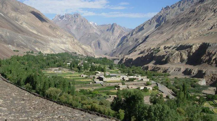
Above Kalam Darchi the valley splits three ways. The Kilik and Mintaka valleys both lead to China. The third, Dilisang, runs west toward Afghanistan's Wakhan Corridor and is not part of this trek. The two passes are about 18 km apart in a straight line, and one camp, Murkushi, serves both.
| Kilik Pass | Mintaka Pass | |
|---|---|---|
| Altitude | 4,827 m (15,837 ft) | 4,709 m (15,449 ft); the trekking guides give 4,726 m |
| Range | Usually placed in the Pamir | Karakoram |
| Other side | Taghdumbash Pamir, Xinjiang | Mintaka valley toward Tashkurgan, Xinjiang |
| Camp before the pass | Sad Buldi, 4,244 m | Gul Khwaja Uween, 4,169 m |
| Side trip from camp | 4 to 4½ hours, about 11 km | 4 to 4½ hours, about 7.5 km |
One correction worth making. Kilik is sometimes described as the pass "to Afghanistan". It is not. Its far side is Chinese territory. The confusion is understandable, because the Wakhjir Pass, where China meets the Afghan Wakhan, lies only about 17 km to the west.
The route, stage by stage
The trek is an out-and-back from Murkushi. You walk up to Murkushi, go up one valley to its pass and come back, then go up the other. Nothing here is technical, and it is the same trail both ways, so the day count depends on whether you give each pass its own day.
| Day | Stage | Distance | Time | Sleep at |
|---|---|---|---|---|
| 1 | Misgar (Kalam Darchi) to Murkushi | 21 km | 6 to 7 hrs | Murkushi, 3,659 m |
| 2 | Murkushi to Sad Buldi | 11.7 km | about 4½ hrs | Sad Buldi, 4,244 m |
| 3 | Side trip to Kilik Pass (4,827 m) | about 11 km | 4 to 4½ hrs | Sad Buldi, 4,244 m |
| 4 | Sad Buldi back to Murkushi | 11.7 km | 3 to 3½ hrs | Murkushi, 3,659 m |
| 5 | Murkushi to Gul Khwaja Uween | 11.5 km | about 4 hrs | Gul Khwaja Uween, 4,169 m |
| 6 | Side trip to Mintaka Pass (4,709 m) | about 7.5 km | 4 to 4½ hrs | Gul Khwaja Uween, 4,169 m |
| 7 | Gul Khwaja Uween back to Murkushi | 11.5 km | about 3½ hrs | Murkushi, 3,659 m |
| 8 | Murkushi to Misgar | 21 km | about 5 hrs | Misgar or drive out |
Leave out the two pass days and the walking between camps adds up to 88.4 km over six days. That six-day version tags each pass on the way through. Most groups take the eight-day version. With the drive up the Karakoram Highway and a couple of nights in Hunza to adjust to the altitude, that becomes the 15-day trip operators sell from Islamabad.
Day 1 is the long one. The path follows the river up from Kalam Darchi through Khan Wali and Arbab-e-Bul (both about 3,205 m) and climbs roughly 580 m to Murkushi, where the Kilik and Mintaka streams meet. Murkushi is grassy, has water, and is where you will sleep three of your nights.
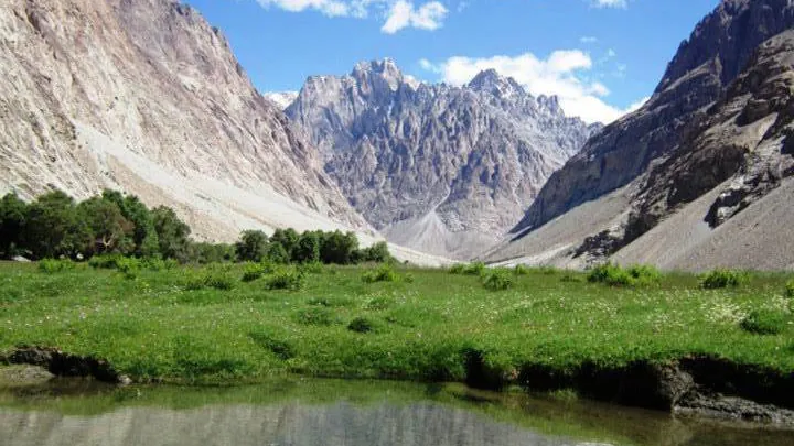
Up the Kilik valley, above Murkushi, the ground opens onto Shireen Maidan, a Pamir-style plain flat enough that it holds a polo ground. Sad Buldi sits higher up, and there are petroglyphs of riders, hunting scenes and ibex on rocks near the camp. If Sad Buldi is taken, Haaq across the river is the alternative camp. From Sad Buldi to the Kilik saddle is a climb of about 580 m.
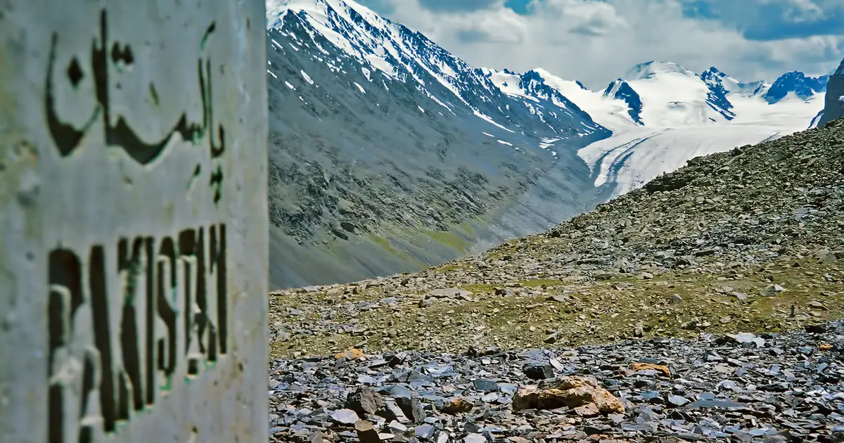
In the Mintaka valley the last camp is Gul Khwaja Uween. Near it you will pass roofless stone shelters and gun positions the Pakistan Army built along this valley. This is still a guarded frontier. The final climb to Mintaka crosses scree and broken slate to a concrete boundary pillar with "Pakistan" painted on it, and the view beyond opens onto glaciers.
How hard is it?
The trail is easy. The altitude is not. So the listings that call this "one of northern Pakistan's easiest treks" are only half right.
The paths are 1 to 3 m wide and easy to follow. There is no glacier to cross, no rope and no river you have to wade. Water and grassy camps turn up all the way. A fit walker who has done a few days in the hills at home will not find the ground difficult.
What catches people out is how fast you gain height. You start at 3,075 m, sleep at 3,659 m on night one and 4,244 m on night two, then top out at 4,827 m on day three. That is more than a vertical kilometre of sleeping altitude in 48 hours. It is why a good itinerary spends at least two nights in Hunza before driving to Misgar. A night in Karimabad at about 2,438 m, then another higher in Gojal, makes the difference between enjoying Sad Buldi and lying awake there with a headache.
The standard trekking guide to the route rates it moderate, which is fair. It is easier than the Shimshal Pamir trek across the valley, which crosses a pass above 4,700 m with far rougher ground, and harder than any day hike in Hunza.
Permits, porters and the village's rules
Permits. Kilik and Mintaka are an open-zone trek. You do not need a trekking permit or a liaison officer, only a valid Pakistan visa and your passport for the checkposts on the Karakoram Highway. Some operator listings add a Central Karakoram National Park fee. That park covers the Baltoro and Hispar glaciers, far to the south, not Misgar, so ask what any extra fee is actually for.
The village's rule. When the valleys reopened, Misgar's elders set one condition: no foreigner visits the pass areas without a man from the village. They mean it. The villagers know where the border runs on the ground, and Chinese border guards patrol the far side. They will arrest anyone who crosses into China, deliberately or by walking twenty metres too far for a photograph. Stay on the Pakistan side of the pillar.
Porters and pack animals. Misgar runs a stage system, agreed by the village in July 2000, which sets flat wages per stage including food and equipment allowances. Donkeys do most of the carrying, and one donkey takes two porter loads. Yaks are available, but in summer they stay above Murkushi. Misgar porters do not use metal-frame carriers, so pack your duffel to be lashed to an animal rather than carried on a frame.
Photography. Don't photograph army positions or people in uniform, and ask before photographing anyone in the village.
Best time to go
The season is June to September, and every source agrees on it. Snow closes the upper valleys outside it, and the herders who graze the pastures around Murkushi move up only for the summer.
Within that window, July and August give the warmest nights at Sad Buldi and the greenest grass. September is colder at camp, and the valleys empty out as the herders start to move down. Plan for frost at the high camps in any month, and for sun strong enough to burn you in an hour at 4,800 m.
Wildlife is a real part of it. Marmots are everywhere on the grass. Marco Polo sheep range across the high country, and brown bear, wolf and snow leopard signs have all been found near Mintaka. You are unlikely to see the predators, but you may well find their tracks.
Why the Karakoram Highway skipped Mintaka
The name Mintaka means "a thousand ibex" in Kyrgyz. For most of recorded history it and Kilik were the shortest way from the Tarim basin into northern India. Rock inscriptions at the Sacred Rock of Hunza name Saka and Pahlava rulers, and historians think one of them, Maues, came this way in the first century BCE on his way to take Taxila. Over time Kilik took over as the main caravan route, as ice built up on the Mintaka side.
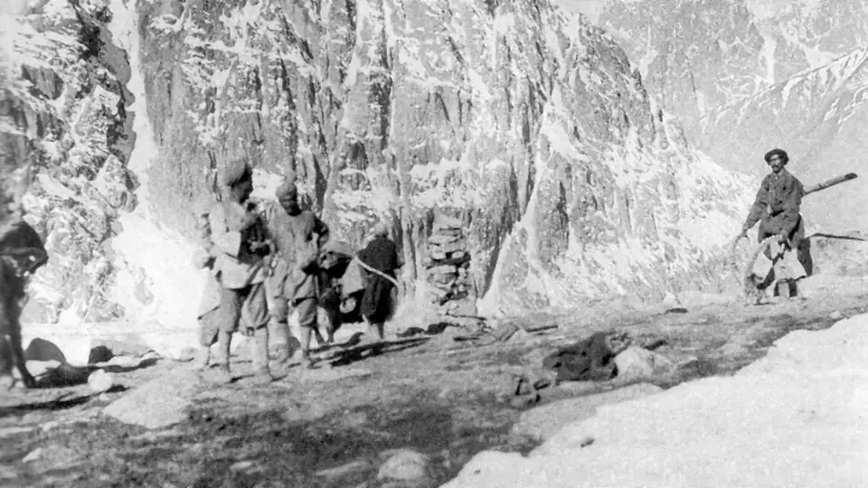
In the 1890s the passes became a line in the Great Game. Britain took control of Misgar in 1892 and built outposts here, judging the passes easy to hold against a Russian advance. The fort at Kalam Darchi, also called Qalandarchi, went up in the 1930s to watch traffic from China and the Soviet side. Our guide to the forts of Gilgit-Baltistan covers its history in more detail. After 1947 the valleys were closed to outsiders.
When Pakistan and China planned the Karakoram Highway in 1966, Pakistan's first choice was the Mintaka route. China argued for Khunjerab, further east, on the grounds that Mintaka was too exposed to air strikes. China won the argument, and the highway went over Khunjerab. That decision is the reason Mintaka and Kilik are quiet pastures today rather than a border crossing. If you want to see where the traffic went instead, the Khunjerab Pass tour drives to the 4,693 m border gate from the same stretch of highway.
What it costs and how to plan it
One published 15-day group package for 2026 and 2027 is priced at USD 2,000 per person from Islamabad, and that is a fair guide to the market. A price like that usually covers domestic transport, hotels in Gilgit and Hunza, tents, meals on the trek, a guide and porters. It does not cover international flights, your visa, insurance or a single tent. The things that move the price are group size, whether you fly or drive to Gilgit, and how many acclimatisation nights you build in.
The Gilgit to Gilgit part of the trip looks like this. Gilgit to Karimabad is about 100 km and 2½ to 3 hours on the highway. Karimabad to Passu is another 55 km past Attabad Lake. From Passu it is a short run to Sost and the Misgar turn-off. Two nights on that stretch are your acclimatisation, so don't treat them as time to cut.
If you are putting a trip together, our trekking team can set it up with a Misgar guide, porters and the acclimatisation days built in. Kilik and Mintaka pair naturally with a few days in central Hunza, or with Khunjerab, since you are already at the top of the highway.
For background reading, Wikipedia's entries on the Mintaka Pass and the Kilik Pass are well sourced on the history.
Common questions
Where is the Mintaka Pass, and which range is it in?
The Mintaka Pass is on the border between Pakistan and China, at the top of the Hunza valley in Gilgit-Baltistan. On the Pakistan side it is reached from the village of Misgar in upper Gojal, a two-day walk up the Mintaka valley. On the Chinese side it drops toward Tashkurgan in Xinjiang. It lies in the Karakoram range. Kilik, its neighbour about 18 km to the west, is usually placed in the Pamir, so the trek sits where the two ranges meet. Before the Karakoram Highway was built over the Khunjerab Pass further east, Mintaka and Kilik were the main caravan routes between Hunza and Kashgar. Mintaka was Pakistan's first choice for the highway in 1966, but China preferred Khunjerab, and the Mintaka valley has been quiet grazing ground ever since.
How high are the Kilik and Mintaka passes?
Kilik Pass is 4,827 m, or 15,837 ft, and on this route everyone agrees on that figure. Mintaka Pass is given as 4,709 m (15,449 ft) on Wikipedia and in most references, while the standard trekking guide to the route gives 4,726 m. The sources differ by 17 m. Either way, both passes are well above 4,500 m. The highest camp is Sad Buldi at 4,244 m, below Kilik, and Gul Khwaja Uween at 4,169 m serves Mintaka. You start walking at about 3,075 m in Misgar. Be wary of trek listings that give a "maximum altitude" of 4,027 m for this route. That figure is lower than either pass and lower than the camps you sleep in, so it is not a number to plan your acclimatisation around.
Do you need a permit for the Kilik and Mintaka Pass trek?
No trekking permit and no liaison officer are needed, because Kilik and Mintaka fall in Pakistan's open zone. What you do need is a valid Pakistan visa, your passport, and copies of both for the police and army checkposts on the Karakoram Highway. Misgar adds a condition of its own. Since the valleys reopened to foreigners in 1999, the village has required that no foreigner visits the pass areas without a man from Misgar, and in practice your guide or one of your porters fills that role. Some operators add government fees to their price, including a Central Karakoram National Park fee. That park covers the Baltoro and Hispar region far to the south and does not include Misgar, so it is reasonable to ask what any listed fee is for before you pay it.
How many days does the Kilik and Mintaka trek take?
The walking itself takes six to eight days. The six-day version covers 88.4 km between camps and visits each pass on the way through. The eight-day version, which most groups choose, gives Kilik and Mintaka a full day each from the camps below them. Either way, Murkushi at 3,659 m is the hub, and you sleep there three times. Most operators sell the trip as 15 days from Islamabad. That adds the flight or two-day drive to Gilgit, two nights in Hunza to adjust to the altitude, the drive to Misgar and back, and a spare day for weather or cancelled flights. It is possible to squeeze it shorter, but the acclimatisation nights are the ones that make the high camps comfortable, so they are the worst place to save time.
Is the Kilik and Mintaka Pass trek difficult?
The ground is easy but the altitude is not, which makes it a moderate trek overall. The paths are 1 to 3 m wide and clearly marked, with no glacier crossings, no ropes and no rivers you have to wade. There are springs and grassy campsites the whole way, which is why it has a reputation as one of the gentlest treks in northern Pakistan. The difficulty is the height gain. You go from 3,075 m to sleeping at 4,244 m in two days, then climb to 4,827 m on the third. Anyone reasonably fit can manage the walking. Where people struggle is when they arrive in Misgar straight from Islamabad without acclimatising. With two nights in Hunza first and the eight-day pace, most walkers who hike regularly at home will be fine.
Can you cross into China over the Mintaka or Kilik Pass?
No. Neither pass is an open border crossing. The only road crossing between Pakistan and China is the Khunjerab Pass on the Karakoram Highway, with immigration at Sost. On this trek you walk to the Pakistan side of the boundary pillar and turn back. Chinese border guards patrol the far side of both passes, and they will arrest anyone who crosses, whether on purpose or by wandering a few metres over for a better photograph. The Chinese side of the Mintaka valley is closed to visitors, except for local residents and herders. This is also part of why Misgar insists on a villager walking with every group, since he knows exactly where the line runs on open ground where nothing marks it except a single concrete pillar.
When is the best time to trek to Kilik and Mintaka?
June to September is the season, and every source on the route agrees on it. Outside those months snow closes the upper valleys, and the herders who use the pastures around Murkushi have moved down. July and August bring the warmest nights at Sad Buldi and the greenest grass on Shireen Maidan, which makes them the most comfortable months to camp above 4,000 m. September is colder at night, and the pastures empty as the herders begin to move down, so the valleys are at their quietest. Whatever month you pick, expect frost at the higher camps and strong sun at the passes. Pack a warm sleeping bag and high-factor sun cream, and wear a hat even on cool days.
How do you get to Misgar?
From Islamabad you either fly to Gilgit, about an hour when the weather allows, or drive the Karakoram Highway in two days. From Gilgit, Karimabad in central Hunza is about 100 km and 2½ to 3 hours north. From there you continue past Attabad Lake and Passu toward Sost. About 15 minutes north of Afiyatabad, the new town at Sost, the 16 km Misgar Link Road branches off the highway and runs to the village. It is not metalled, so allow extra time. Public wagons run up the highway from Gilgit, and jeeps can be hired locally for the last 7 km from Misgar to Kalam Darchi, where the walking starts. On an organised trek all of this is arranged for you, including stops in Hunza on the way up to acclimatise.
Ready for Your Next Adventure?
Join our community of explorers and discover the journey of a lifetime. Our expert team is ready to help you plan your perfect expedition.