Spantik Base Camp Trek: Arandu, the Chogolungma Glacier and Golden Peak
Three days up one of the Karakoram's longest glaciers to the foot of a 7,027 m peak. The route, the real altitudes, the season and what it costs.
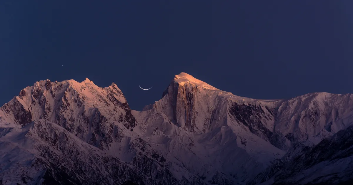
Spantik is the 7,000er people climb before they try an 8,000er. Its base camp is the destination for everyone else: a trek up one of the longest glaciers in the Karakoram, to a camp that most guidebooks barely mention, below a mountain that turns gold at sunrise.
You need no climbing skills to get there. You do need to be comfortable with three long days on moraine and ice, a week of camping and real altitude. This guide covers the route stage by stage, the altitudes that published sources disagree on, the season, permits, cost and the two passes you can add from Arandu.
Spantik base camp trek at a glance
| Fact | Spantik Base Camp trek |
|---|---|
| Start and end | Arandu, Basha valley, Shigar District (jeep from Skardu, 5 to 7 hours) |
| Base camp altitude | About 4,350 m (sources range from 4,160 to 4,374 m) |
| Trek days | 3 days in, 2 days out, plus a rest day at base camp |
| Distance | Roughly 40 km each way on the glacier and its moraine |
| Total trip | 12 to 14 days from Islamabad |
| Difficulty | Strenuous, non-technical; crevassed glacier on day 3 |
| Best months | July and August, with late June and early September possible |
| Permits | Pakistan tourist visa plus Gilgit-Baltistan trekking and park fees |
| Accommodation | Tents only; no lodges or teahouses beyond Arandu |
Where is Spantik, and why the base camp is worth the walk
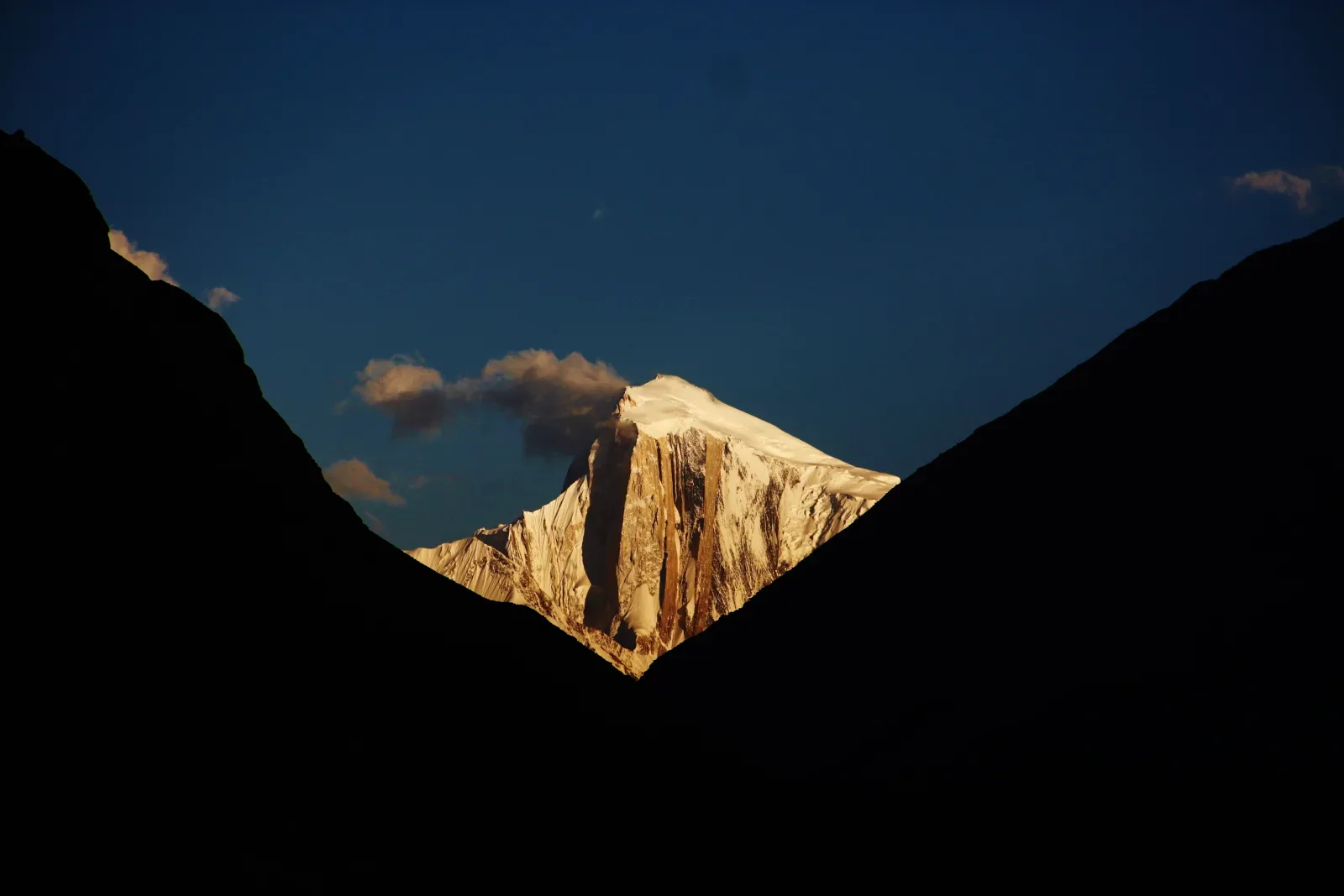
Spantik stands at 7,027 m in the Spantik-Sosbun range of the central Karakoram, in Shigar District of Gilgit-Baltistan. On the Hunza side it is known by its Burushaski name, Ganesh Chish, which also means Golden Peak. The name comes from a band of pale marble on its northwest face, the Golden Pillar, that catches the first sun and glows.
The mountain was first climbed in 1955 by a German expedition led by Karl Kramer, up the southeast ridge from the Chogolungma Glacier. That same ridge is still the normal route, and the base camp at its foot is where this trek ends. In 1987 the British alpinists Mick Fowler and Victor Saunders climbed the Golden Pillar itself from the Nagar side, one of the famous alpine ascents in the range. If you are curious about the climb rather than the walk, our Spantik expedition guide covers the camps, the ridge and the summit day.
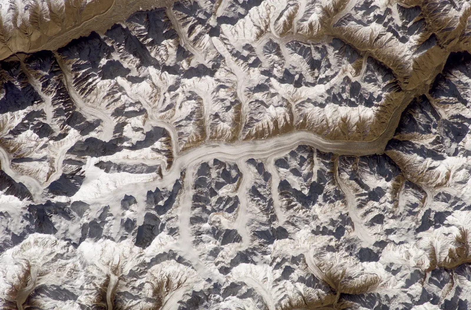
For a trekker the draw is the glacier. The Chogolungma runs for roughly 45 to 50 km from the Haramosh and Malubiting massif down to the fields of Arandu, and the walk to Spantik follows most of its upper half. It is wild, empty country. There are no teahouses, no huts and, outside the short climbing season, often no other parties on the ice at all.
Getting to Arandu, the trailhead
Every Spantik trip starts in Skardu, the hub of the central Karakoram. Most people fly in from Islamabad, a dramatic hour along the Indus gorge when the weather lets the flight go. The road alternative via the Karakoram Highway and Chilas takes the best part of two days. If you are routing in from Hunza, our guide to Skardu covers the town and what to do on the spare day.
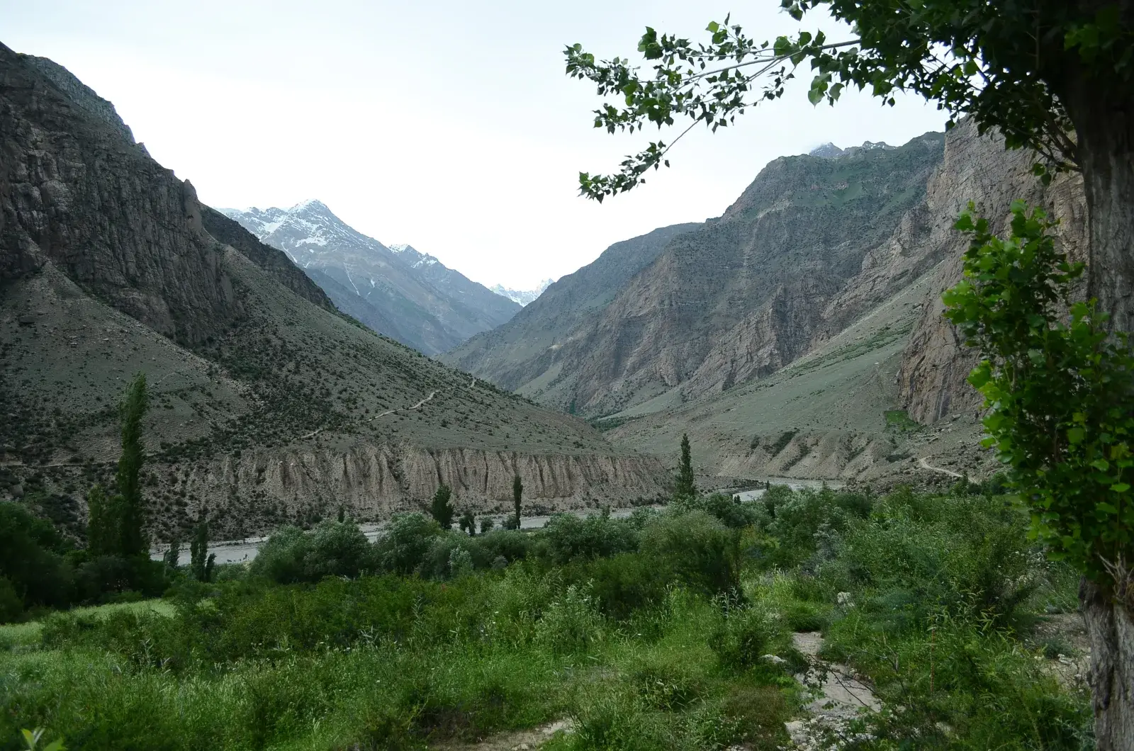
From Skardu a jeep runs north through Shigar, then turns up the Basha valley through villages such as Tisar, Chutran, Dogoro and Bisil. Allow five to seven hours to Arandu, longer after rain. The upper road is a rough jeep track.
Arandu is the last village, and it sits right against the snout of the Chogolungma. Published altitudes for it range from 2,720 m to 3,300 m, which tells you how carelessly these figures get copied; about 2,800 to 2,900 m is the realistic range. The glacier is so close that in February 2017 a surge pushed ice towards the houses and at least 14 families had to move. This is where porters are hired and loads are weighed, so expect a busy afternoon at the campsite before the walk begins.
The route, stage by stage
The walk in takes three days, staying mostly on the north side of the glacier in the ablation valley between the moraine and the mountainside. Camp names vary between operators, which is one reason itineraries look so different online. The table uses the names our porters use.
| Day | Stage | Camp altitude | Walking time | What to expect |
|---|---|---|---|---|
| 1 | Arandu to Chogo Brangsa | about 3,350 m | 5 to 6 hours | Past the snout, then along the grassy ablation valley on the north bank |
| 2 | Chogo Brangsa to Bolocho | about 3,800 m | 6 to 8 hours | The long day: two side glaciers to cross, then a camp with clean water |
| 3 | Bolocho to Spantik Base Camp | about 4,350 m | 5 to 7 hours | Bare, crevassed glacier ice, then a steep rocky climb to a grassy shelf |
| 4 | Rest and explore at base camp | about 4,350 m | Optional walks | Views of Spantik's southeast ridge and the glacier junction |
| 5 | Base camp to Chogo Brangsa | about 3,350 m | 7 to 9 hours | Long, mostly downhill; some groups stop at Bolocho instead |
| 6 | Chogo Brangsa to Arandu, jeep to Skardu | about 2,300 m | 4 to 6 hours walking | Out by lunch, then the drive back down the Basha valley |
Day 1: Arandu to Chogo Brangsa
The trail leaves the village, climbs past the dirty grey snout of the glacier and settles into the ablation valley on its north side. This is the gentlest day, with grass and wildflowers underfoot and the ice on your right. You may see this camp written as Chogo Balansa; other operators camp a little lower at a site they call Tsas Chumic or Manfi Khoro.
Day 2: Chogo Brangsa to Bolocho
This is the long one, six to eight hours. You cross two side glaciers that flow in from the north, each a scramble on and off loose moraine. Bolocho, at about 3,800 m, is a small camp with space for around ten tents and a clean stream, which is a real luxury on a glacier walk.
Day 3: Bolocho to Spantik Base Camp
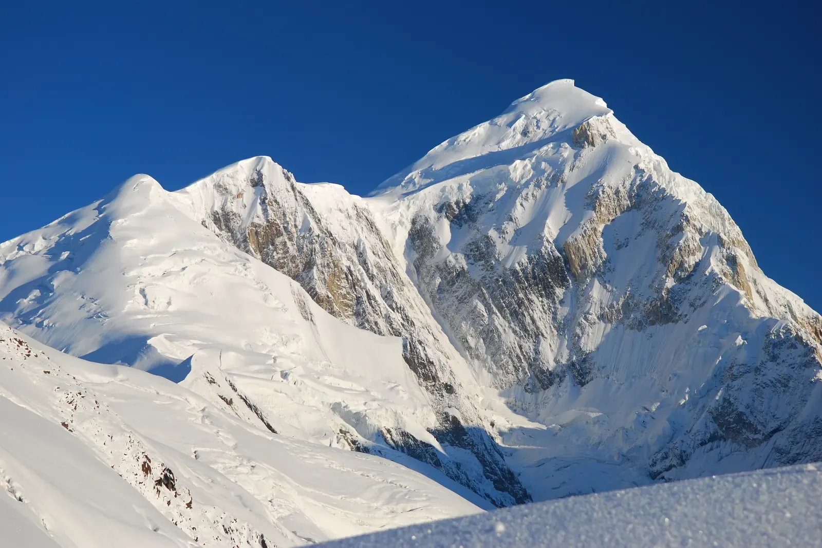
The last day takes you onto the glacier proper. Much of it is bare ice with open crevasses, and the line your guide picks changes from year to year. The final hour is a steep, rocky climb off the ice to a grassy shelf above the junction of the Chogolungma and a side glacier. That shelf is Spantik Base Camp. The southeast ridge rises straight above it, and the climbers' route up to Camp 1 starts here.
How high is Spantik Base Camp? Sources disagree
Search for the base camp altitude and you will find almost every number between 4,100 and 5,000 m. We went through the published figures so you don't have to.
| Source type | Altitude given |
|---|---|
| One Pakistani operator's fixed departure | 4,160 m |
| A climbing marketplace listing, and our own older page | about 4,200 m |
| A UK operator's day-by-day itinerary and a 1989 American Alpine Journal report | about 4,300 m |
| Two UK expedition operators and a Pakistani trekking operator | 4,340 to 4,360 m |
| A 1979 American Alpine Journal report | 14,350 ft (about 4,374 m) |
| One trekking listing | 5,000 m (wrong) |
Most of the careful sources land between 4,300 and 4,370 m, so we use about 4,350 m. The gap matters more than it looks. From Arandu at around 2,850 m, you gain about 1,500 m in three days, which is at the edge of what most acclimatisation guidance recommends. It is why our itinerary keeps a rest day at base camp rather than turning straight round.
How hard is the Spantik Base Camp trek?
It is non-technical but strenuous. You won't need ropes, crampons or climbing skills to reach base camp in a normal summer, but this is not a trail walk. Expect:
- Five to eight hours a day on loose moraine, boulder fields and, on day 3, bare glacier ice.
- Crevasses. The upper glacier is heavily crevassed, and one recent account counts about 35 km of crevassed ice on the approach. A guide who knows this year's line is not optional.
- Altitude. Base camp at about 4,350 m is high enough for headaches and poor sleep on the first night. Walk slowly, drink a lot and say something if you feel worse, not better.
- Cold. Days on the ice can be hot and glaring, but nights at base camp drop below freezing even in July.
If you have done a multi-day trek above 4,000 m before, such as the Annapurna Circuit, Kilimanjaro or a hut-to-hut route in the Alps, you have the right base. If not, train for long days with a pack and some uphill every week for two months beforehand.
Best time for the Spantik Base Camp trek
July and August are the reliable months. The snow has gone from the moraine, the side streams are crossable in the morning, and the climbing teams at base camp mean there are people about if something goes wrong.
- Late June to early July can work, but recent seasons have brought heavy snow and wind in June, and one UK expedition found fresh snow at base camp on 6 July. We don't schedule trekking departures before the first week of July.
- Mid-July to mid-August is the sweet spot: long days, the best chance of clear mornings and full camps lower down.
- Late August to mid-September brings crisper air and fewer people, at the cost of colder nights and shorter days. Bad spells of a week are possible in mid-August.
- October to May: the upper Basha valley and the glacier are effectively closed to trekkers.
Build at least one spare day into any plan for the Skardu flight, which is cancelled whenever the cloud is low.
Permits, visa and rules
The Spantik Base Camp trek is not on the list of routes that need Pakistan's dedicated trekking visa, so most nationalities trek on a standard tourist visa. Our Pakistan tourist visa guide explains the online application. Climbing Spantik itself is a different matter: the peak needs a mountaineering visa and a royalty, which our expedition page covers.
On the ground, the Gilgit-Baltistan government charges a trekking permit fee, and the Central Karakoram National Park charges a trekker's environment fee. The permit has been around US$150 a head and the park fee US$100 to US$190, depending on how the zone is classed. Both are handled in Skardu and can take a day of paperwork, which is another reason for a buffer day there. Fees have changed several times in recent years, so we confirm the current amounts and the zone status when you book, and they are included in our price.
Independent trekking on the glacier is not realistic. You need a licensed operator for the permit, a guide for the route and porters from Arandu for the loads, who carry a maximum of 25 kg each under park rules.
What does the Spantik Base Camp trek cost?
Very few operators sell this as a trek rather than as part of a climb, so published prices are scarce. One Pakistani operator lists a 16-day trek from Islamabad at about US$2,100. Full Spantik climbing expeditions are another league: US$3,800 to US$5,000 from local operators, and £7,650 to £8,900 from UK companies.
Our own Spantik Base Camp trek runs 13 days from Islamabad, from US$1,850 per person. That covers the Skardu flights, hotels in Islamabad and Skardu, jeeps to and from Arandu, all permits and park fees, a guide, a cook, porters, tents and all meals on the trek. Insurance with helicopter rescue cover, international flights and tips are extra.
Budget separately for insurance that names helicopter evacuation up to 6,000 m. Rescue flights in Gilgit-Baltistan are flown by Askari Aviation and need a guarantee arranged in advance. A single mission can run to US$20,000 or more.
Extending the trip from Arandu
Arandu is a trailhead for more than one big walk, and a few people combine them:
- Nushik La (about 4,977 m) climbs from Arandu up the Kero Lungma glacier and drops onto the Hispar Glacier on the Nagar side. It is a serious glacier crossing, and very few groups attempt it each year.
- Haramosh La crosses from the upper Chogolungma to Kutwal Lake in the Haramosh valley. It is technical, with a long fixed-rope descent, and is for experienced parties only. Our Kutwal Lake and Haramosh Valley guide covers the far side.
- Laila Peak (6,985 m), the Haramosh valley peak of that name, is approached up the same glacier system. Don't confuse it with the better-known 6,096 m Laila Peak in the Hushe valley.
What to pack
- A four-season sleeping bag rated to at least -10 °C, plus a warm down jacket for evenings.
- Stiff, broken-in trekking boots with good grip for moraine and wet rock. Light gaiters help on the ice.
- Trekking poles, glacier sunglasses (category 4) and a sun hat. The glare off the ice on day 3 is fierce.
- A headtorch, a water filter or purification tablets, and a two-litre bottle.
- A basic first-aid kit with blister care and any altitude medication your doctor has prescribed.
- Cash in rupees from Skardu. There are no ATMs or card machines beyond Shigar, and no mobile signal on the glacier, so your guide will carry a satellite phone.
Is there a base camp on the north side?
Yes, but it isn't a trekking route. The Golden Pillar climbers approach from Hopar in Nagar, up the Barpu Glacier, to a base camp at a place called Suja Bassa, around 4,000 m. You see Spantik's golden northwest face from the Hunza and Nagar valleys, which is why "Golden Peak Hunza" is such a common search. Nobody sells the northern approach as a trek, and the southern route from Arandu is the one this guide and our tour follow.
Frequently asked questions
How many days is the Spantik Base Camp trek?
The walking itself takes five to six days: three days in from Arandu to base camp, a rest day there, and two days back out. Add the travel and the whole trip is 12 to 14 days from Islamabad. That allows a day to fly to Skardu, a day in Skardu for permits and acclimatisation, a long jeep day each way between Skardu and Arandu, and at least one buffer day for the Skardu flight, which is often cancelled when the cloud is low. Our standard itinerary is 13 days. Shaving days off is possible on paper but unwise, because the altitude gain from Arandu at about 2,850 m to base camp at about 4,350 m is already brisk. If you have more time, a second rest day at base camp or a night at Shigar Fort on the way back is a far better use of it than rushing.
How high is Spantik Base Camp?
Spantik Base Camp is at about 4,350 m, on a grassy shelf above the Chogolungma Glacier. Published figures vary widely, from 4,160 m on one operator's listing to 14,350 ft, about 4,374 m, in a 1979 American Alpine Journal report, and even a clearly wrong 5,000 m on one trekking page. Most careful sources, including two UK expedition operators and a 2019 expedition report, put it between 4,300 and 4,370 m, which is why we use about 4,350 m. The trailhead at Arandu sits at roughly 2,800 to 2,900 m, so you climb about 1,500 m over three days of walking. That is a brisk rate of ascent. It is the main reason we keep a full rest day at base camp, walk slowly on the glacier and check how everyone is sleeping and eating each evening before moving higher.
Is the Spantik Base Camp trek difficult?
It is strenuous but not technical. You don't need ropes, crampons or any climbing experience to reach base camp in a normal summer, but the walking is hard. The days run five to eight hours over loose moraine and boulder fields, and the third day crosses bare, crevassed glacier ice, where a guide who knows this year's line is essential. Base camp at about 4,350 m is high enough to cause headaches and poor sleep, and nights there drop below freezing even in July. Fit walkers who have done a multi-day trek above 4,000 m will cope well. If this would be your first high trek, train for two months beforehand with long days carrying a pack and regular uphill walking. We tell every group in the pre-trip briefing which days are the hard ones, and the second day to Bolocho is the longest.
When is the best time to trek to Spantik Base Camp?
July and August are the best months for the Spantik Base Camp trek. By then the snow has cleared from the moraine, the side streams are crossable in the morning, and climbing teams are at base camp. Mid-July to mid-August gives the most reliable weather, although a bad week in mid-August is possible. Late June can work, but recent seasons have brought heavy snow and wind in June, and one UK expedition found fresh snow at base camp on 6 July. That is why we don't schedule treks before the first week of July. Late August to mid-September is quieter, with crisp air and colder nights. From October to May the upper Basha valley is effectively closed to trekkers. In any month, allow at least one spare day for the Islamabad to Skardu flight, which is cancelled whenever the cloud is low.
Do you need a permit for the Spantik Base Camp trek?
Yes, though not a special visa. The Spantik Base Camp trek is not on the list of routes that require Pakistan's trekking visa, so most nationalities can trek on a standard tourist visa. On the ground you need a Gilgit-Baltistan trekking permit, which has been around US$150 per person, and a Central Karakoram National Park environment fee, which has been between US$100 and US$190 depending on how the zone is classed. Both are issued in Skardu and can take a day of paperwork. Fees and zone classifications have changed several times in recent years, so a licensed operator should confirm the current figures when you book. Climbing Spantik itself is different and needs a mountaineering visa and a peak royalty. On our trek, all permits and park fees are arranged for you and included in the price, and the paperwork happens on the spare day in Skardu.
How much does the Spantik Base Camp trek cost?
Our 13-day Spantik Base Camp trek from Islamabad costs from US$1,850 per person. The price includes the Islamabad to Skardu flights, hotels in Islamabad and Skardu, jeeps to and from Arandu, the Gilgit-Baltistan trekking permit and park fees, a guide, a cook, porters, tents and all meals on the trek. International flights, travel insurance and tips are not included. For comparison, another Pakistani operator lists a 16-day version at about US$2,100, and full Spantik climbing expeditions cost from about US$3,800 with local operators to nearly £9,000 with UK companies. Budget separately for insurance that covers helicopter evacuation up to 6,000 m, because rescue flights in Gilgit-Baltistan need a guarantee arranged in advance and a single mission can cost US$20,000 or more. Prices vary with group size and dates, so ask us for an exact quote.
Ready for Your Next Adventure?
Join our community of explorers and discover the journey of a lifetime. Our expert team is ready to help you plan your perfect expedition.