Biafo Hispar Trek: Snow Lake and Hispar La
About 100 km of ice from Askole to Hispar village, over Snow Lake and a 5,150 m pass: the stages, the permit position, the short summer window and what it costs.
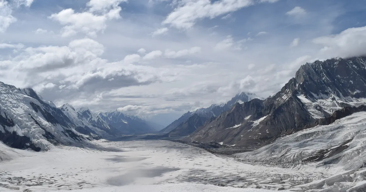
What is the Biafo Hispar trek? It is a glacier traverse across the Karakoram of northern Pakistan. You walk up the Biafo Glacier from Askole in Baltistan, cross the high snow basin of Snow Lake, go over the Hispar La at about 5,130 to 5,150 m, and walk down the Hispar Glacier to Hispar village in Nagar. It takes 12 to 14 days on foot, covers roughly 100 km of ice, and is only reliably crossed in July and August.
Most treks in Pakistan go in and come back the same way. This one doesn't. You start in Baltistan and finish in Nagar, on the Hunza side of the range, and for about two weeks in between there is no road, no village and no shop. Everything you eat and sleep in is carried by porters. People who have done both usually call it harder than the K2 Base Camp trek, and they are right.
This guide covers the route stage by stage, how hard it really is, when to go, the permit position (which a lot of pages get wrong) and what it costs.
What the Biafo Hispar traverse actually is
Two glaciers start at the same pass and flow in opposite directions. The Biafo runs south-east from the Hispar La down to the Braldu valley near Askole. The Hispar runs west from the same col down to the Hispar valley in Nagar. Walk up one and down the other and you have crossed the Karakoram watershed on ice.
Wikipedia gives the Biafo Glacier as 67 km long (its Hispar Pass article says 63 km) and the Hispar as 49 km. Together they are usually described as the longest glacier system outside the polar regions. You will see the total quoted as 100, 116 or 120 km. It depends on whether you count from the snout of the Biafo or from Askole, and how you measure the curve of the ice. For planning, think of it as roughly 100 km of glacier and a bit more on foot.
Snow Lake, called Lukpe Lawo in Balti, is not a lake. It is a wide, almost flat basin of snow and firn at the head of the Biafo, at around 4,800 m (Wikipedia gives 4,877 m, or 16,000 ft). The British explorer Martin Conway named it in 1892 and called the view "the finest view of mountains" he had ever seen. William and Fanny Bullock Workman followed in 1899. It is still one of the emptiest places in the Karakoram: Wikipedia estimates about 200 visitors a year.
The route, stage by stage
This is the itinerary we run, with typical walking times. Altitudes are rounded. Published figures for the same camps differ by 20 to 50 m between sources, so treat them as a guide rather than survey points.
| Day | Stage | Camp altitude | Walking time |
|---|---|---|---|
| 1 | Askole to Namla | about 3,570 m | 6 to 7 hrs |
| 2 | Namla to Mango | about 3,715 m | 5 to 6 hrs |
| 3 | Mango to Baintha | about 4,040 m | 5 to 6 hrs |
| 4 | Rest day at Baintha | about 4,040 m | short walk |
| 5 | Baintha to Marpogoro | about 4,300 m | 5 to 6 hrs |
| 6 | Marpogoro to Karpogoro | about 4,680 m | 5 to 6 hrs |
| 7 | Across Snow Lake to Hispar La base camp | about 4,590 m | 5 to 6 hrs |
| 8 | Over the Hispar La | about 5,130 to 5,150 m | 5 to 6 hrs |
| 9 | Down to Khani Basa | about 4,500 m | about 5 hrs |
| 10 | Khani Basa to Yutmaru | about 4,150 m | 6 to 7 hrs |
| 11 | Yutmaru to Shigam Baris | about 4,170 m | 6 to 7 hrs |
| 12 | Shigam Baris to Bitanmal | about 3,760 m | about 6 hrs |
| 13 | Bitanmal to Hispar village | about 2,300 m | 6 to 8 hrs |
The Biafo side
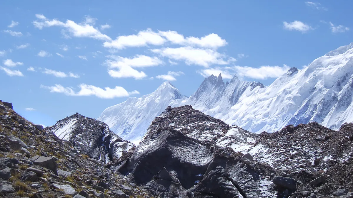
From Askole (about 3,015 m, the last village and the same roadhead as the K2 trek) the path follows the Braldu to Namla and Mango before you step onto the Biafo. The first days are rough moraine: grey rubble over ice, hard on the ankles and slow going. Baintha is the last patch of grass on the whole route and the standard rest day, right under the granite of Baintha Brakk, the Ogre (7,285 m). Above Karpogoro the moraine thins out, the crevasses start, and the team ropes up.
Snow Lake and the Hispar La
Snow Lake is the crux, although it is almost flat. It is so wide and so uniform that in cloud there is no horizon, no landmark and nothing to steer by. A whiteout here stops a team dead, which is why the weather window matters so much and why you want a guide who has crossed it before. From base camp the Hispar La is a long, cold pass day, roped the whole way, with an early start to get over while the snow is still firm. The high point is quoted as 5,128 m on most maps and 5,151 m in most trekking itineraries. From the top you look west down the Hispar towards Kunyang Chhish, Pumari Chhish and Distaghil Sar.
The Hispar side
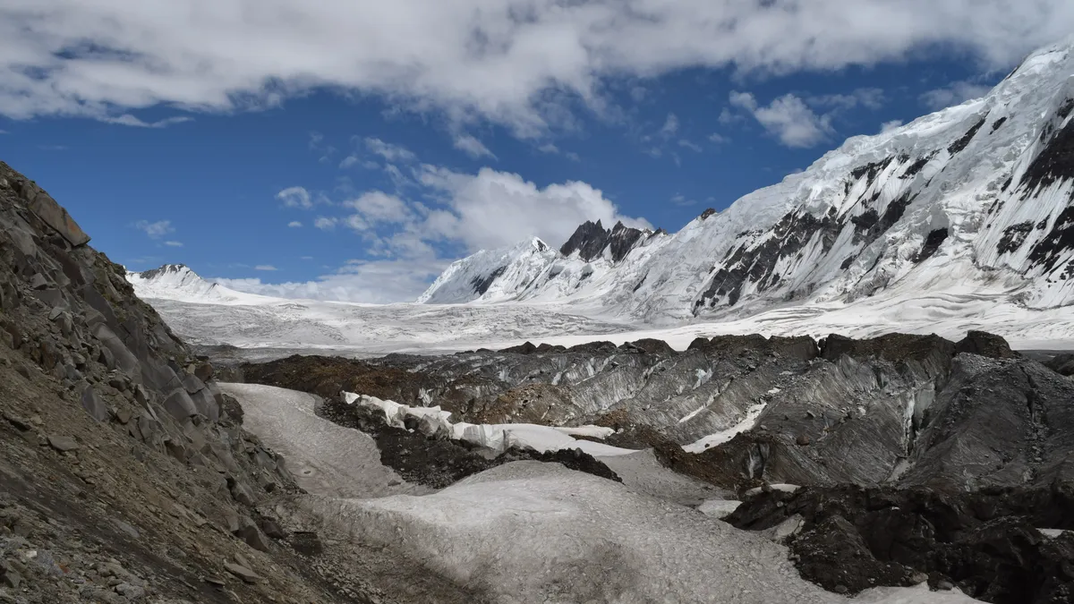
The descent feels longer than the climb. It is four days of moraine, with side glaciers coming in from the north and meltwater streams cutting across your line, so progress is slower than the map suggests. The ice finally gives way to meadow above Bitanmal, and the last day drops more than 1,400 m to Hispar village, the first houses you have seen in about two weeks.
How hard is the Snow Lake trek?
It is the hardest trek we sell. There are no climbing moves, so it is "non-technical" in the mountaineering sense, but that word undersells it. What makes it hard:
- Days of roped glacier travel. From Karpogoro to well down the Hispar you move on a rope over snow that hides crevasses. You need to be comfortable in crampons and a harness.
- Sustained altitude. You sleep at or above 4,500 m for several nights running, with the pass above 5,100 m.
- No way out. Once you are on Snow Lake there is no road, village or easy escape in either direction. Evacuation is slow and depends on weather.
- Long days on bad ground. Moraine is tiring in a way a trail is not, and most days are 5 to 7 hours of it.
For kit you need crampons that fit your boots, a harness with slings and karabiners, a helmet and an ice axe, on top of normal high-altitude trekking gear. We ask for previous trekking experience above 4,500 m and basic rope skills before we take a booking. If you have not done a big Karakoram trek yet, the K2 Base Camp trek is the better first step: it goes as high, but you can turn round and walk out the way you came. The Gondogoro La is higher at 5,585 m and uses fixed ropes, but spends far fewer days on open glacier.
Best time to go
July and August, and in practice only then. You need the winter snow to have settled enough that Snow Lake is walkable, but the snow bridges over the crevasses still intact, and the weather calm enough to risk the open basin and the pass. That combination only lines up in high summer. Go earlier and the snowpack is deep and soft; go later and the bridges start to collapse and autumn storms arrive.
Even in midsummer, nights near the pass drop to around minus 10°C, snow can fall on any day, and the sun off the snow is fierce. We build spare days into the trip for exactly this reason. Sitting out a storm at Baintha or below the pass is normal. Pushing across Snow Lake in a whiteout is the mistake this route punishes.
Permits, park fees and guides
This is where a lot of pages disagree, so here is the position as the Ministry of Tourism lists it. The classic route, Askole, Biafo, Snow Lake, Hispar La, Hispar, Nagar, is in the open zone. That means no trekking permit is needed for it. Two variants that start the same way are different: going over the Lukpe La (Lukpo La) to Shimshal, or over the Sim La to the Panmah Glacier, puts you in the restricted zone, which needs a trekking permit arranged through a registered operator.
The Biafo lies inside Central Karakoram National Park, so the park's entry fee still applies. The amount is set by the Gilgit-Baltistan government and changes from year to year, so check it for your season rather than trusting an old figure.
On paper, open-zone rules don't force you to take a guide. On the ice they do. Nobody sensible crosses Snow Lake without someone who knows where the snow bridges hold, and a porter team that is used to moving on a rope. Porters also need to be insured and paid at the regulated rates, which is far easier through an operator.
What it costs
Our fully supported Snow Lake and Hispar La trek is from USD 3,800 per person. That includes the park fees and any permits, a licensed guide and assistant guides, the full porter team for a glacier traverse, all camping gear including a mess tent, all meals on the trek, and transport from Islamabad to Skardu and Askole and back from Hispar. International flights, travel insurance, personal spending and tips are extra.
The whole trip runs 18 to 22 days from Islamabad. The trekking itself is 13 or 14 days; the rest is travel, a day in Skardu to sort kit, and spare days for weather. On a route this committing, those spare days are what make a safe crossing possible.
Getting to the start, and home again
You fly from Islamabad to Skardu, or drive the Karakoram Highway if the flight is cancelled, which happens often in bad weather. From Skardu a jeep takes about 6 to 7 hours up the Shigar and Braldu valleys to Askole. Because this is a traverse, you finish somewhere else entirely: from Hispar village a jeep runs down the Hispar and Nagar valleys to Karimabad in Hunza in about 4 hours. From there it is the Karakoram Highway to Gilgit and a flight or drive back to Islamabad.
Common questions about the Biafo Hispar trek
How long is the Biafo Hispar trek?
The walking takes 12 to 14 days from Askole to Hispar village, including one rest day at Baintha to acclimatise. Add travel from Islamabad to Skardu and Askole at the start, the jeep out through Nagar and Hunza at the end, a day in Skardu to check kit, and two or three spare days for weather, and the whole trip is 18 to 22 days. In distance it is roughly 100 km of glacier: the Biafo is 63 to 67 km long depending on the source and the Hispar about 49 km. Sources quote the total anywhere from 100 to 120 km, depending on where they start counting. Almost all of it is on ice or moraine, so daily distances are short and progress is slow. Most days are 5 to 7 hours of walking, and the pass day can be longer if the snow is soft.
How high is the Hispar La?
The Hispar La is the highest point of the trek. Most maps and Wikipedia give it as 5,128 m (16,824 ft), while most trekking itineraries, including ours, quote 5,151 m. The difference comes from different surveys and GPS readings on a broad, snow-covered col, and it makes no practical difference: plan for a pass of about 5,150 m. You cross it from a base camp near 4,590 m on the Snow Lake side, so the climb on the day is around 550 m, all of it roped on snow. The hard part is less the height gain than the length of the day, the cold start and the crevassed ground on both sides. Good acclimatisation beforehand matters more than fitness on the day, which is why the itinerary includes a rest day at Baintha and several nights above 4,500 m first.
Do I need a permit for the Snow Lake trek?
For the classic route over the Hispar La, no trekking permit is needed: the Ministry of Tourism lists Askole, Biafo, Snow Lake, Hispar La, Hispar and Nagar as an open-zone trek. The Biafo is inside Central Karakoram National Park, though, so you pay the park's entry fee, which the Gilgit-Baltistan government sets each year. If you want to leave Snow Lake by a different pass, the rules change. The Lukpe La route to Shimshal and the Sim La route to the Panmah Glacier are both in the restricted zone and need a trekking permit arranged through a registered operator. Rules and fees are revised often, so check the current position before you book. On our trip we arrange the park fee and any permits for you, and they are included in the price.
Can a beginner do the Biafo Hispar trek?
No, and we don't take first-timers on it. The trek has no climbing moves, but you spend days roped together on crevassed glacier, several nights above 4,500 m and a long day over a pass above 5,100 m, with no road or village to retreat to once you are on Snow Lake. You need to have trekked above 4,500 m before, be comfortable walking in crampons and moving on a rope, and be fit enough for 5 to 7 hours a day on rough moraine for two weeks. If that does not describe you yet, start with the K2 Base Camp trek or a shorter trek in Hunza or Nagar, then come back. Most of the people who cross Snow Lake with us have done at least one big Karakoram or Himalayan trek first.
Is Snow Lake a real lake?
No. Snow Lake, or Lukpe Lawo in Balti, is a huge basin of snow and firn at the head of the Biafo Glacier, at around 4,800 m, where several tributary glaciers meet. From the surrounding ridges the flat white surface looks like a frozen lake, which is where Martin Conway's 1892 name came from. There is no open water, and underneath the snow is glacier ice that the Wikipedia article on the Biafo describes as up to 1,600 m thick. The basin is roughly 16 km across, ringed by granite spires including the Ogre group, and it is the most remote part of the traverse. Crossing it is the day when weather matters most, because in cloud the surface gives you no sense of direction at all.
Photos: Yousaf Feroz Gill, BlackZero_007 and Vasiq Eqbal via Wikimedia Commons (CC BY-SA 4.0 and CC BY 2.0).
Ready for Your Next Adventure?
Join our community of explorers and discover the journey of a lifetime. Our expert team is ready to help you plan your perfect expedition.