Kacheli Lake Trek from Minapin, Nagar
A glacial lake at 3,970 m, two hours above the meadow where every Rakaposhi group turns around. The route, the altitudes, the season and what the climb actually costs you.
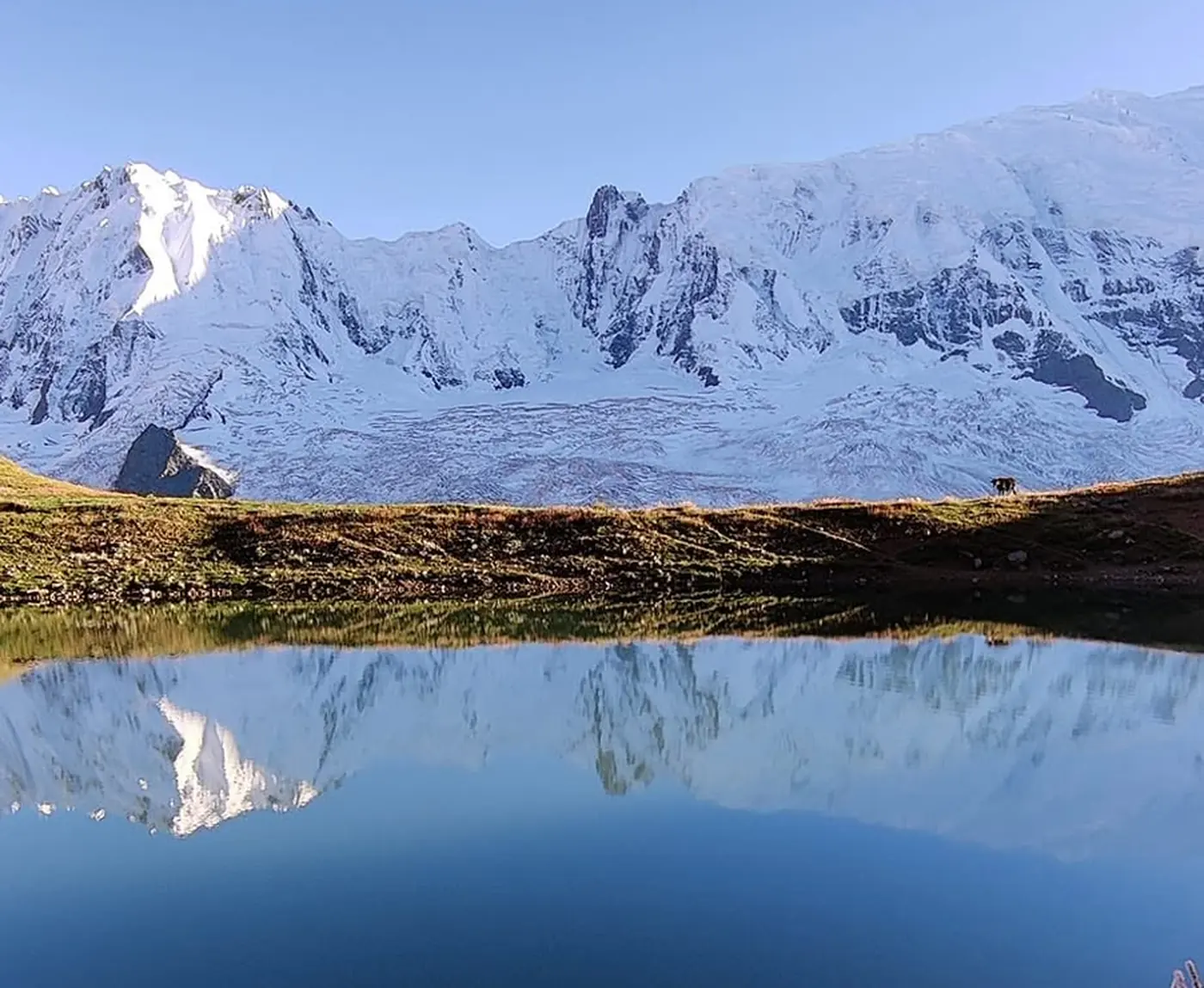
Thousands of people walk up from Minapin every summer. They climb through the forest, past the shepherd huts at Hapakun, out onto the open pasture at Tagaphari, and they stand there with Rakaposhi filling the sky in front of them and the Minapin Glacier grinding away below. Then they photograph it, sleep a night, and walk back down.
Almost nobody keeps going. Above that meadow, another four hundred and seventy metres up a steep shoulder, there is a lake that most Rakaposhi trekkers never learn about while they are standing two hours below it.
Where Kacheli Lake is, and how high
Kacheli sits in Kacheli Meadows on the Miacher side of the Minapin valley, in Nagar District. The recorded surface elevation is 3,970 m, about 13,020 feet. You will occasionally see 3,800 m quoted on trek listings; that figure appears to describe the meadow rather than the water, and 3,970 m is the only number with a source behind it.
Put against the rest of the route, the shape of the walk becomes obvious.
| Point on the route | Altitude | Walking time from the last stop |
|---|---|---|
| Minapin village (trailhead) | ~2,000 m | — |
| Hapakun shepherd huts | ~2,800 m | 2 to 3 hours |
| Tagaphari (Rakaposhi Base Camp) | ~3,300 to 3,500 m | 3 to 4 hours |
| Kacheli Lake | ~3,970 m | about 2 hours, steep |
Which makes the lake a half-day out and back from a camp people are already sleeping at, on a trek they have already committed to. The reason it gets missed is that the standard Rakaposhi itinerary does not include it, and the climb from the meadow is steep enough that nobody does it by accident.
The route from Minapin
Minapin to Hapakun
The trail leaves the last houses in Minapin at about 2,000 m and climbs through pine and birch forest. Two to three hours brings you to Hapakun, a cluster of stone shepherd huts at around 2,800 m, which is the usual rest stop and a reasonable place to camp if you are taking the walk in slowly. It is a real climb and it is relentless, but there is nothing technical about it.
Hapakun to Tagaphari
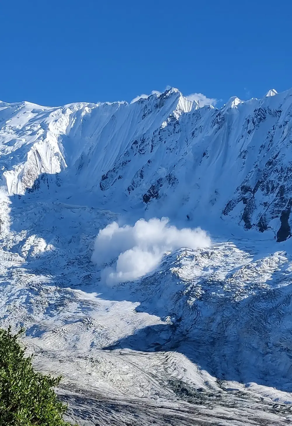
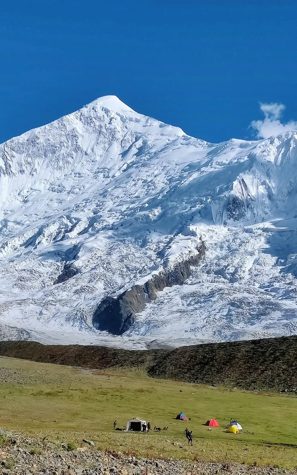
Above Hapakun the gradient eases. The trail crosses open pasture and moraine for three to four hours to reach Tagaphari, the meadow at roughly 3,300 to 3,500 m that everyone means when they say Rakaposhi Base Camp. Rakaposhi rises straight ahead at 7,788 m, Diran Peak stands across the glacier at 7,266 m, and the Minapin Glacier fills the valley floor below the tents.
Tagaphari to Kacheli Lake
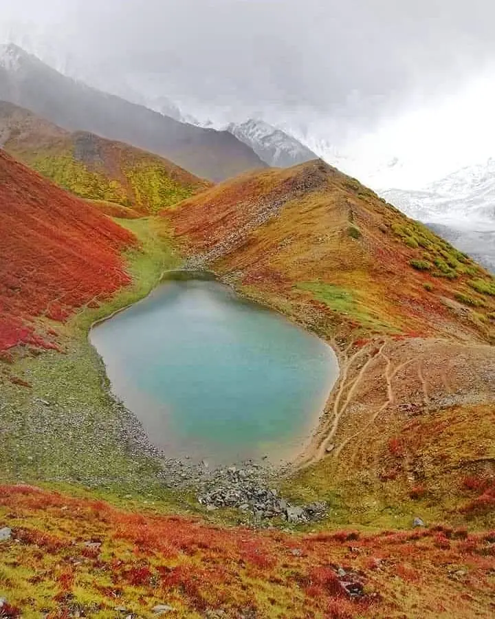
This is the part that gets skipped. From the base camp meadow the route climbs steeply up the shoulder on the Diran side, gaining roughly 470 m to reach the lake at 3,970 m. Reports put it at one and a half to two hours going up, and about half that coming back down, which is the usual arithmetic for a steep out and back.
Take the morning for it. Cloud builds over the Karakoram through the afternoon here exactly as it does everywhere else in the range, and a lake photographed in flat grey cloud is a poor reward for a 470 m climb.
How hard is the Kacheli Lake trek?
Moderate, with one caveat. There is no technical ground, no rope work and no glacier crossing on the way to the lake itself. What there is: about 1,300 to 1,500 m of ascent from Minapin to the base camp, then another 470 m on top of that, and a first day through forest that is sustained and hot.
The honest fitness test is whether you can climb for five or six hours with a daypack and then get up and do more the next morning. Porters carry the camp and the food, so you are not hauling weight, but nobody carries your legs up the hill.
The altitude profile is a sane one: you sleep at 3,500 m and day-trip to 3,970 m. The risk, as ever in Gilgit-Baltistan, is the speed of the approach: fly or drive up the valley and start walking the next morning and you are asking a lot of a body that was at 500 m in Islamabad two days ago. Give it a night in Hunza or Nagar first.
When to go, and what the weather does
May to October is the trekking window, and July and August are the most settled. The wider Minapin valley is worth visiting from April through November, but the upper meadows hold snow later and lose it earlier than the village suggests.
- Late June and July is when Hapakun and Tagaphari fill with wildflowers, and the meadows are at their best.
- September brings the crispest, clearest air of the year and the sharpest views of Rakaposhi and Diran, at the cost of colder nights.
- October still works, but the first snows can arrive on the upper shelf without much warning, and the lake sits high enough to be affected first.
Nights at the base camp drop close to freezing even in midsummer, and Kacheli is another 470 m above that. A sleeping bag rated below zero is not optional kit here.
Getting to Minapin
Minapin village sits just off the Karakoram Highway in the Nagar Valley, about 75 to 80 km from Gilgit, and it is under an hour off the highway itself. From Gilgit the drive is straightforward. From Karimabad in Hunza it is closer still, which is why most people fold this trek into a Hunza trip rather than travelling for it specifically.
Gilgit is reachable by a one-hour flight from Islamabad, spectacular and frequently cancelled for weather, or by road up the KKH. There are guest houses and camping sites in Minapin and in neighbouring Pissan, so you can arrive the evening before and start walking early.
Guides, porters and what it costs
Porters are hired through the numberdar at Minapin, the village headman, at rates fixed between the local administration and the village. That system is worth using rather than negotiating individually, because it is what keeps the rates fair at both ends.
You do not strictly need a guide to reach Tagaphari; the Minapin trail is well trodden and hard to lose in daylight. The climb to Kacheli is a different proposition, because it leaves the main trail, gains height quickly and puts you on ground where nobody else is walking that day. Going up there with someone from Minapin or Nagar who knows the shoulder is the sensible call.
Our own Kacheli Lake trek from Minapin runs as a supported trip with guides from the Nagar Valley, a porter team, camping gear and all meals, built around a base camp night so the lake is walked in the morning rather than squeezed in. If you would rather do the classic route without the extra climb, the Rakaposhi Base Camp trek guide covers the itinerary and costs in full.
Is it worth the extra two hours?
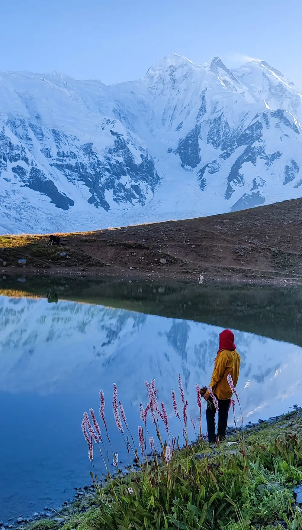
If you have come this far, yes, with one condition: do it on a clear morning. The lake itself is small. What you are climbing for is the position, a quiet shelf of water at just under 4,000 m with two seven-thousanders on display and the glacier below, and no one else on it.
If the weather is poor, stay at Tagaphari and enjoy the base camp. The lake will keep. It has managed fine without the foot traffic so far.
For a comparable short lake trek elsewhere in Gilgit-Baltistan, Kutwal Lake in the Haramosh Valley works on a similar timescale under a very different mountain.
Frequently asked questions
How high is Kacheli Lake?
Kacheli Lake sits at 3,970 m, about 13,020 feet, in Kacheli Meadows in the Minapin valley of Nagar District. Some trek listings quote 3,800 m, which appears to refer to the surrounding meadow rather than the lake, and 3,970 m is the only figure with a source behind it. To put that in context, the trail starts in Minapin village at about 2,000 m, passes the Hapakun shepherd huts at around 2,800 m and reaches Rakaposhi Base Camp at Tagaphari, roughly 3,300 to 3,500 m. The lake is about 470 m above that meadow. Because you sleep at base camp and only day-trip up to the water, the altitude profile is a sensible one. Just under 4,000 m is still real height, though, and you will feel the steep final shoulder in your breathing.
How long is the trek to Kacheli Lake?
Three to four days from Minapin village, including the climb to Rakaposhi Base Camp at Tagaphari and the out and back to the lake. From Minapin the trail climbs through pine and birch forest to the Hapakun shepherd huts in two to three hours, then crosses open pasture and moraine for three to four hours to Tagaphari. Some groups camp at Hapakun to take the walk in more slowly. The lake section itself is about two hours up from the base camp meadow and roughly an hour back down; reports give one and a half to two hours for the climb. Do it in the morning, because cloud builds over the Karakoram through the afternoon. Our own Kacheli Lake trek is built around a base camp night so the lake is walked early rather than squeezed in at the end of a long day.
Where is Kacheli Lake?
Kacheli Lake is in Kacheli Meadows on the Miacher side of the Minapin valley, in Nagar District, Gilgit-Baltistan. It lies on a shelf above Rakaposhi Base Camp at Tagaphari, on the Diran side of the Minapin Glacier system, roughly two hours of steep walking beyond the meadow where most trekking groups stop. From the base camp you have Rakaposhi at 7,788 m rising ahead and Diran at 7,266 m across the glacier. The lake sits in a shallow bowl, so you cannot see it until the last few minutes of the climb. Minapin village, the trailhead, is just off the Karakoram Highway in the Nagar Valley, about 75 to 80 km from Gilgit. Karimabad in Hunza is closer still, which is why most people add this trek to a Hunza trip rather than travelling for it on its own.
Do you need a permit for the Kacheli Lake trek?
No. Nagar and the Minapin valley are in the open zone, so an ordinary Pakistani tourist visa is enough, and no No Objection Certificate or trekking permit is required in advance. There is no permit fee to budget for either. What you do arrange locally is porters. They are hired through the numberdar, the village headman at Minapin, at rates fixed between the local administration and the village, and that system is worth using rather than negotiating individually because it keeps rates fair at both ends. You do not strictly need a guide to reach Tagaphari, as the trail is well trodden and hard to lose in daylight. The climb to Kacheli is different: it leaves the main trail, gains height quickly and puts you on ground where nobody else is walking that day, so going with someone from Minapin or Nagar who knows the shoulder is the sensible call.
What is the best time to trek to Kacheli Lake?
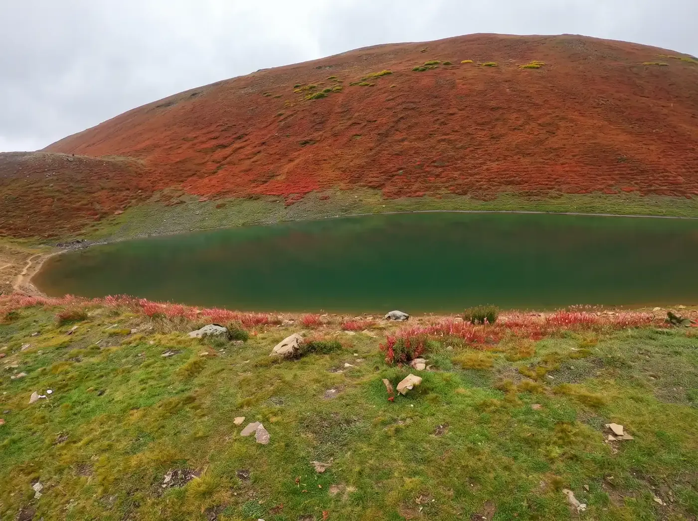
May to October is the trekking window, with July and August the most settled for weather. Late June and July are best for wildflowers, when Hapakun and Tagaphari fill with colour. September brings the crispest, clearest air of the year and the sharpest views of Rakaposhi and Diran, at the cost of colder nights. October still works, but the first snows can reach the upper shelf without much warning, and the lake sits high enough to be affected first. The wider Minapin valley is worth visiting from April through November, but the upper meadows hold snow later and lose it earlier than the village suggests. Nights at base camp drop close to freezing even in midsummer, and the lake is another 470 m higher, so pack a sleeping bag rated below zero whatever the month. Late in the season the ground around the lake turns rust red.
Can you visit Kacheli Lake on the Rakaposhi Base Camp trek?
Yes, and that is the usual way to do it. The lake is a steep out and back from the same base camp meadow at Tagaphari, so it adds roughly half a day to a standard Rakaposhi itinerary rather than needing a separate trip. The climb gains about 470 m up the shoulder on the Diran side. Most groups miss it simply because the standard Rakaposhi itinerary does not include it, and the climb is steep enough that nobody wanders up by accident. It is worth the effort on a clear morning, for a quiet shelf of water just under 4,000 m with two seven-thousanders on show and the glacier below. If the weather is poor, stay at base camp and enjoy the meadow instead. Our Kacheli Lake trek includes the base camp night needed to fit the lake in, and the Rakaposhi Base Camp guide covers the classic route without it.
How do you get to Minapin?
Minapin is just off the Karakoram Highway in the Nagar Valley, about 75 to 80 km from Gilgit and under an hour from the highway itself. From Gilgit the drive is straightforward, and from Karimabad in Hunza it is closer still, which is why most people fold this trek into a Hunza trip. Gilgit connects to Islamabad by a one-hour flight, spectacular but frequently cancelled for weather, or by road up the KKH. There are guest houses and camping sites in Minapin and neighbouring Pissan, so you can arrive the evening before and start walking early. We suggest a night in Hunza or Nagar before you set off. Flying or driving up the valley and starting the next morning asks a lot of a body that was at 500 m in Islamabad two days earlier, and the first day of the trek is a sustained climb.
Ready for Your Next Adventure?
Join our community of explorers and discover the journey of a lifetime. Our expert team is ready to help you plan your perfect expedition.