Nanga Parbat Base Camp Trek
Up the Rupal valley to the foot of the highest mountain wall on Earth
Duration
14-16 Days
Difficulty
Strenuous
Group Size
4-12 Trekkers
Best Season
Jun-Sep
About This Tour
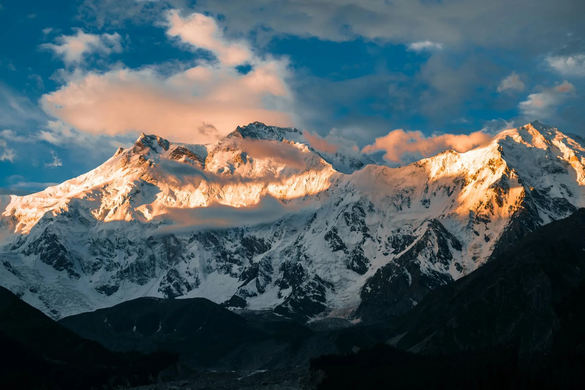
This trek walks up the Rupal valley on the south side of Nanga Parbat to the base camp beneath the mountain's south wall. Nanga Parbat is 8,126 metres, the ninth-highest mountain on Earth and the westernmost of the 8,000-metre peaks, and unlike its neighbours it stands in the Himalaya rather than the Karakoram, in Astore and Diamer district. From the trailhead village of Tarashing at about 2,900 metres, the route climbs to the Rupal base camp at roughly 3,500 to 3,600 metres, with the Latbo glacial lake and a shepherd settlement below the wall.
The hook is the Rupal Face itself. It rises about 4,600 vertical metres from its base to the summit and is widely regarded as the highest mountain wall on Earth. Standing at base camp with that face filling the sky is the reason people make this trip. The walk in passes through Gujar and Shina-speaking shepherd country, pine and birch, and meadows that fill with wildflowers in summer, with the south side of the mountain growing the whole way up the valley.
Be honest about what this is. The Rupal base camp trek is moderate: a few trekking days, a round trip of roughly 26 to 30 kilometres, real but manageable altitude, and no technical ground. It is what most so-called Nanga Parbat base camp trips actually deliver, and it suits fit walkers without mountaineering experience. The serious variant, the full circuit over the Mazeno La, is a different animal entirely and is described further down; it is not the default and not for everyone.
We run the Rupal trek with a licensed guide, porters and full camp support, and pace it for comfortable acclimatisation rather than a rush to the wall. The trip is built around the base camp and the Rupal Face, with time to explore and take in the view rather than tick it and turn. The marketed length is 14 to 16 days including travel from Islamabad and contingency, and the price is USD 2,600 per person.
The Rupal Valley Route
Access is by road from Islamabad up the Karakoram Highway to Chilas, then by jeep into Astore and on to Tarashing at about 2,900 metres, the last village and the trailhead. The drive alone is a day of dramatic mountain road, with the first views of Nanga Parbat from the highway.
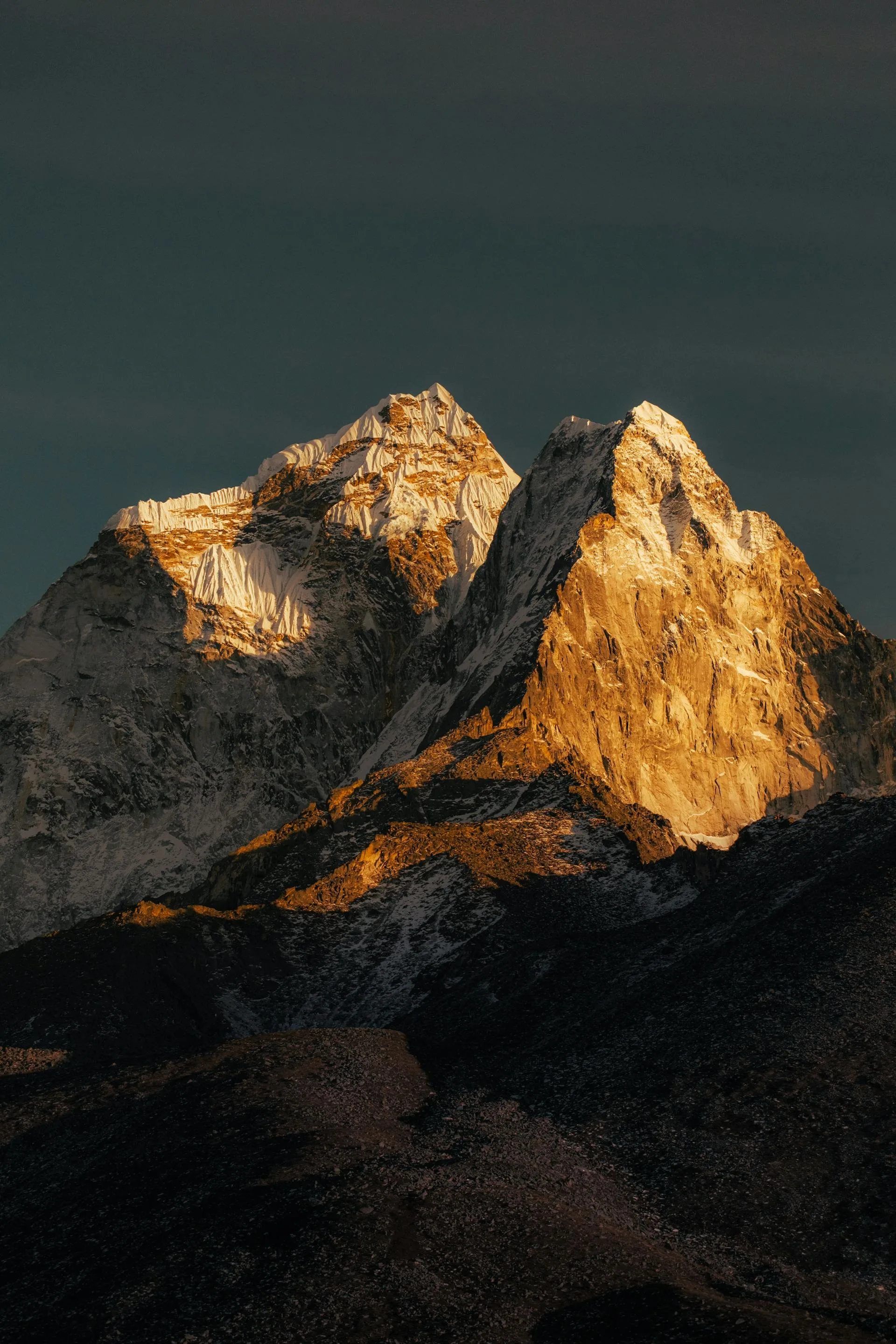
From Tarashing the trek climbs the Rupal valley through shepherd pastures and forest to the Rupal base camp at roughly 3,500 to 3,600 metres, sometimes called the Herrligkoffer or Latobah base camp, set below the south wall with the Latbo lake and a grazing settlement nearby. A rest and exploration day here lets you acclimatise and walk to higher viewpoints for the full sweep of the Rupal Face and its glaciers before retracing the valley to Tarashing.
For experienced parties we can extend the trip west toward the Mazeno La. That crossing is commonly quoted around 5,377 metres, with Wikipedia giving the ridge pass at about 5,358 metres and some operators saying 5,399 to 5,400 metres, so the figure is genuinely uncertain. It involves glacier ascent and a steep descent needing fixed-rope rappels, it is comparable in seriousness to Gondogoro La, and guides report that most trekking parties fail to cross it. We treat it as a serious mountaineering variant for fit, experienced trekkers, not part of the standard base camp trek.
How Hard Is the Rupal Trek?
The base camp trek is moderate and suits fit walkers without prior high-altitude experience, though some helps. The trekking days are short by Karakoram standards, the altitude tops out around 3,600 metres at base camp, and there is no technical ground. The main things to manage are the daily ascent, mountain weather, and a few river crossings in the valley.
The Mazeno La circuit is a completely different proposition. It is a long, remote, multi-week route with glacier travel, fixed-rope rappels on the descent and real objective hazard, and it should only be attempted by experienced trekkers with basic mountaineering skill. If you are weighing the two, the base camp trek is the trip the vast majority of people want and the one we recommend by default.
Day-by-Day Itinerary
1Islamabad to Chilas
Islamabad to Chilas
2Chilas to Tarashing (2,900m)
Chilas to Tarashing (2,900m)
3Acclimatise and explore Tarashing
Acclimatise and explore Tarashing
4Tarashing to Rupal Base Camp (3,600m)
Tarashing to Rupal Base Camp (3,600m)
5Rupal Base Camp exploration
Rupal Base Camp exploration
6Rupal Face viewpoint day
Rupal Face viewpoint day
7Rupal Base Camp to Tarashing
Rupal Base Camp to Tarashing
8Tarashing rest and culture day
Tarashing rest and culture day
9Tarashing to Astore valley
Tarashing to Astore valley
10Astore exploration
Astore exploration
11Astore to Chilas
Astore to Chilas
12Buffer and contingency day
Buffer and contingency day
13Chilas toward Islamabad
Chilas toward Islamabad
14Return to Islamabad
Return to Islamabad
Best Time to Trek the Rupal Valley
July to September is the season. By July the valley pastures are green and the snow has cleared from the lower route, and the weather is at its most settled through the high summer. Earlier in the year snow lingers on the approach, and by late September the nights at base camp turn cold and the first storms arrive.
Mountain weather on the south side of Nanga Parbat can change fast, and a cloudy spell can hide the Rupal Face for a day at a time. We build a little slack into the schedule so a poor day does not cost you the view, and an extra night at base camp often buys the clear morning that makes the trip.
Permits and Logistics
Nanga Parbat sits in the Himalaya, not the Karakoram, so there is no CKNP trekking permit for the Rupal valley. It is open zone, with local and community fees and a guide standard, all of which we arrange. This matters because some itineraries wrongly file Nanga Parbat under Karakoram permit rules; the Rupal trek does not carry the restricted-zone regime of the Baltoro.
The trip runs Islamabad to Chilas to Astore to Tarashing by road and jeep, then on foot up the valley and back the same way. From Tarashing there is no resupply, so we carry what the camp needs with the porter team. If you would rather see Nanga Parbat from the north without the full valley trek, Fairy Meadows on the Rakhiot side is the short and easy alternative, while the Rupal base camp is the close-up of the great wall.
Why Book With Us
We are a Gilgit-Baltistan operator who runs the Rupal valley with local guides and shepherd-country porters who know the south side of Nanga Parbat. We frame the trip honestly: a moderate base camp walk to the foot of the Rupal Face, paced for proper acclimatisation, with the Mazeno La offered only as a serious variant to those ready for it rather than slipped into a standard itinerary. The guide, porters, camp support, transport and the local fees are all included in the price.
What's Included
Not Included
Frequently Asked Questions
How hard is the Nanga Parbat base camp trek?
How hard is the Nanga Parbat base camp trek?
What is the altitude of Nanga Parbat base camp?
What is the altitude of Nanga Parbat base camp?
Is the Rupal Face really the highest mountain wall in the world?
Is the Rupal Face really the highest mountain wall in the world?
How far is the trek?
How far is the trek?
When is the best time to trek?
When is the best time to trek?
Do I need a permit for the Nanga Parbat trek?
Do I need a permit for the Nanga Parbat trek?
What is the Mazeno La circuit and should I do it?
What is the Mazeno La circuit and should I do it?
Is it better than Fairy Meadows?
Is it better than Fairy Meadows?
Ready for Your Next Adventure?
Join our community of explorers and discover the journey of a lifetime. Our expert team is ready to help you plan your perfect expedition.